- Chelan, Washington
-
-
- See Chelan for other uses.
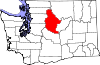
Chelan, Washington — City — Location of Chelan, Washington
Coordinates: 47°50′34″N 120°1′17″W / 47.84278°N 120.02139°WCoordinates: 47°50′34″N 120°1′17″W / 47.84278°N 120.02139°W Country United States State Washington County Chelan Area - Total 3.9 sq mi (10.0 km2) - Land 3.8 sq mi (9.8 km2) - Water 0.1 sq mi (0.3 km2) Elevation 1,129 ft (344 m) Population (2010) - Total 3,890 - Density 933.9/sq mi (360.6/km2) Time zone Pacific (PST) (UTC-8) - Summer (DST) PDT (UTC-7) ZIP code 98816 Area code 509 FIPS code 53-11615[1] GNIS feature ID 1530831[2] Website www.cityofchelan.com Chelan (
 /ʃəˈlæn/ US dict: shə·lăn′) is a city in Chelan County, Washington, United States. The population was 3,890 at the 2010 census. It sits on the southeast tip of Lake Chelan, where the lake flows into the Chelan River.
Chelan is part of the Wenatchee–East Wenatchee Metropolitan Statistical Area.
Contents
History
During a period of unrest between settlers and Native Americans in the 1870s, Lt. Colonel Henry Clay Merriam of the United States Army established Camp Chelan at the foot of Lake Chelan to control and safeguard the Indian population on the Moses Columbia Reservation. His family was with him for the 1880 Federal Census. The lake was largely non-accessible because of its sheer cliffs on most sides so a makeshift road was built from the fort to the Columbia River where a courier and mail service from Walla Walla were established. The fort only remained for about a year and was abandoned in October 1880 when the troops relocated to Fort Spokane.
The first European settlers in the area were William Sanders and Henry Dumpke, who arrived in 1886. After traversing several cliffs and streams and losing their horse, they safely arrived at the foot of the lake and were welcomed by the natives who encouraged them to stake claims. The presence of these settlers paved the way for more settlers to move to the valley. In 1888, L.H. Woodin of Minneapolis arrived in the valley and paddled up the lake in a skiff. Impressed by the area, Woodin constructed a sawmill at the foot of the lake. Chelan's main street is named for Woodin. At the same time, local ranchers were beginning to discover that orchards could be planted without the need of irrigation.
The town was platted and lots sold quickly. A post office was established in 1890. A school was built in 1892 followed by the first resort hotel, taking advantage of the area's natural beauty. Following the Panic of 1893, hard times began in earnest but never affected Chelan completely. The first bank was established in 1893. Chelan was officially incorporated on May 7, 1902. In 1903, the city gained electric lights and water service via nearby Donaldson Springs. A permanent town hall was constructed in 1904 (but was destroyed by fire in 1927). The town continues to grow as an agricultural center and resort community which helps it thrive to this day.
Geography
Chelan is located at 47°50′34″N 120°1′17″W / 47.84278°N 120.02139°W (47.842858, -120.021312).[3]
According to the United States Census Bureau, the city has a total area of 3.9 square miles (10.0 km²), of which, 3.8 square miles (9.8 km²) of it is land and 0.1 square miles (0.3 km²) of it (2.84%) is water.
Demographics
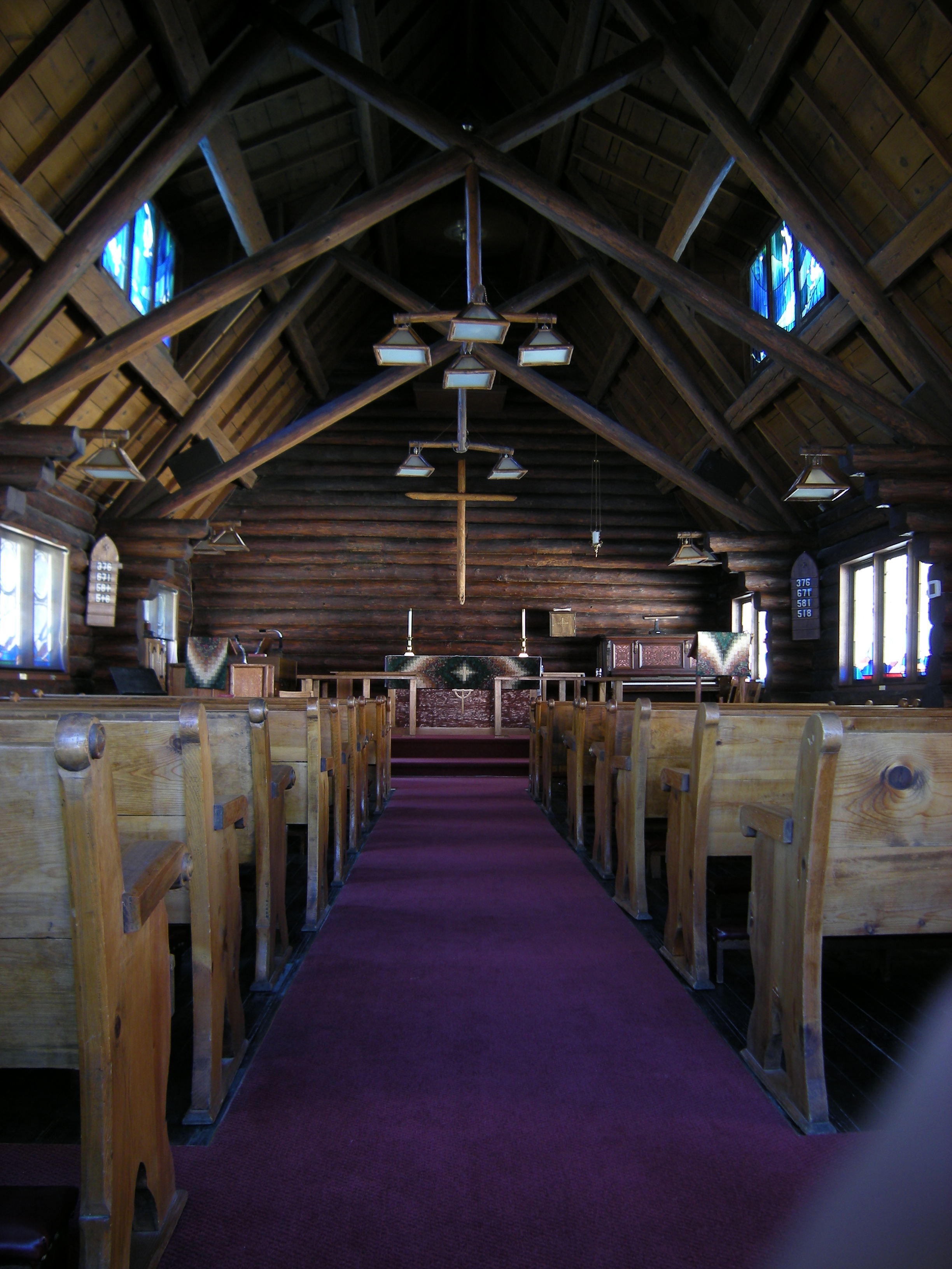
 St. Andrews Episcopal Church, an 1890s log church on Woodin Avenue in downtown Chelan, is listed on the National Register of Historic Places (NRHP).
As of the census[1] of 2000, there were 3,522 people, 1,471 households, and 939 families residing in the city. The population density was 933.9 people per square mile (360.7/km²). There were 2,058 housing units at an average density of 545.7 per square mile (210.8/km²). The racial makeup of the city was 85.69% White, 0.11% African American, 1.53% Native American, 0.48% Asian, 0.11% Pacific Islander, 9.23% from other races, and 2.84% from two or more races. Hispanic or Latino of any race were 14.45% of the population.
There were 1,471 households out of which 29.6% had children under the age of 18 living with them, 49.8% were married couples living together, 10.1% had a female householder with no husband present, and 36.1% were non-families. 30.5% of all households were made up of individuals and 14.8% had someone living alone who was 65 years of age or older. The average household size was 2.35 and the average family size was 2.93.
In the city the age distribution of the population shows 25.3% under the age of 18, 6.2% from 18 to 24, 24.6% from 25 to 44, 25.7% from 45 to 64, and 18.2% who were 65 years of age or older. The median age was 41 years. For every 100 females there were 92.8 males. For every 100 females age 18 and over, there were 88.4 males.
The median income for a household in the city was $28,047, and the median income for a family was $33,662. Males had a median income of $31,900 versus $21,397 for females. The per capita income for the city was $16,511. About 17.3% of families and 20.9% of the population were below the poverty line, including 31.3% of those under age 18 and 12.5% of those age 65 or over.
Sister cities
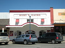 The Ruby Theater on Woodin Avenue, built 1914 and showing movies ever since, is also listed on the NRHP.
Chelan has one sister city, according to [1] and [2]:
 Tojo, Hyōgo, Japan
Gallery
-
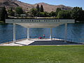
Riverwalk Pavilion
-
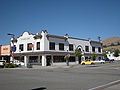
R. W. Little Building
-

Campbell’s
References
- ^ a b "American FactFinder". United States Census Bureau. http://factfinder.census.gov. Retrieved 2008-01-31.
- ^ "US Board on Geographic Names". United States Geological Survey. 2007-10-25. http://geonames.usgs.gov. Retrieved 2008-01-31.
- ^ "US Gazetteer files: 2010, 2000, and 1990". United States Census Bureau. 2011-02-12. http://www.census.gov/geo/www/gazetteer/gazette.html. Retrieved 2011-04-23.
- Hull, Lindley M. (editor)A History of Central Washington: Including the Famous Wenatchee, Entiat, Chelan and the Columbia Valleys, with an Indexed Eighty Scenic Historical Illustrations. Spokane, Washington: Shaw & Borden Company, 1929. Print.
External links
Municipalities and communities of Chelan County, Washington Cities Cashmere | Chelan | Entiat | Leavenworth | Wenatchee
CDPs Unincorporated
communitiesAppleyard | Ardenvoir | Blewett | Chelan Falls | Chiwaukum | Chumstick | Dryden | Grant Road Addition | Holden Village | Kenroy | Lakeside | Lucerne | Malaga | Manson | Merritt | Mission Square | Monitor | Pearcot | Peshastin | Plain | Stehekin | Telma | Wenatchee Heights | Winton
Indian reservation Footnotes ‡This populated place also has portions in an adjacent county or counties
Categories:- Populated places in Chelan County, Washington
- Cities in Washington (state)
- Wenatchee – East Wenatchee metropolitan area
-


Wikimedia Foundation. 2010.