- Deming, Washington
-
Deming, Washington — CDP — Location of Deming, Washington
Coordinates: 48°49′47″N 122°13′47″W / 48.82972°N 122.22972°WCoordinates: 48°49′47″N 122°13′47″W / 48.82972°N 122.22972°W Country United States State Washington County Whatcom Area – Total 5.4 sq mi (13.9 km2) – Land 5.2 sq mi (13.6 km2) – Water 0.1 sq mi (0.3 km2) Elevation 220 ft (67 m) Population (2010) – Total 353 – Density 40.1/sq mi (15.5/km2) Time zone Pacific (PST) (UTC-8) – Summer (DST) PDT (UTC-7) ZIP code 98244 Area code 360 FIPS code 53-17495[1] GNIS feature ID 1518670[2] Deming is a census-designated place (CDP) in Whatcom County, Washington, United States. Named for its first postmaster, George Deming,[3] its population was 353 at the 2010 census.
Contents
Geography
Deming is located at 48°49′47″N 122°13′47″W / 48.82972°N 122.22972°W (48.829802, -122.229832).[4]
According to the United States Census Bureau, the CDP has a total area of 5.4 square miles (13.9 km²), of which, 5.2 square miles (13.5 km²) of it is land and 0.1 square miles (0.3 km²) of it (2.24%) is water.
Demographics
As of the census[1] of 2000, there were 210 people, 73 households, and 54 families residing in the CDP. The population density was 40.1 people per square mile (15.5/km²). There were 80 housing units at an average density of 15.3/sq mi (5.9/km²). The racial makeup of the CDP was 92.86% White, 1.43% African American, 3.81% Native American, 1.43% from other races, and 0.48% from two or more races. Hispanic or Latino of any race were 2.86% of the population.
There were 73 households out of which 34.2% had children under the age of 18 living with them, 58.9% were married couples living together, 9.6% had a female householder with no husband present, and 26.0% were non-families. 19.2% of all households were made up of individuals and 4.1% had someone living alone who was 65 years of age or older. The average household size was 2.88 and the average family size was 3.15.
In the CDP the age distribution of the population shows 30.5% under the age of 18, 8.6% from 18 to 24, 28.6% from 25 to 44, 23.3% from 45 to 64, and 9.0% who were 65 years of age or older. The median age was 35 years. For every 100 females there were 112.1 males. For every 100 females age 18 and over, there were 111.6 males.
The median income for a household in the CDP was $52,292, and the median income for a family was $58,194. Males had a median income of $27,292 versus $24,750 for females. The per capita income for the CDP was $18,165. None of the population or families were below the poverty line.
See also
- North Fork Brewery and Beer Shrine
References
- ^ a b "American FactFinder". United States Census Bureau. http://factfinder.census.gov. Retrieved 2008-01-31.
- ^ "US Board on Geographic Names". United States Geological Survey. 2007-10-25. http://geonames.usgs.gov. Retrieved 2008-01-31.
- ^ Majors, Harry M. (1975). Exploring Washington. Van Winkle Publishing Co. p. 20. ISBN 9780918664006. http://books.google.com/books?id=CoWrPQAACAAJ.
- ^ "US Gazetteer files: 2010, 2000, and 1990". United States Census Bureau. 2011-02-12. http://www.census.gov/geo/www/gazetteer/gazette.html. Retrieved 2011-04-23.
External links
Municipalities and communities of Whatcom County, Washington Cities 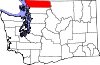
CDPs Acme | Birch Bay | Custer | Deming | Geneva | Glacier | Kendall | Maple Falls | Marietta-Alderwood | Peaceful Valley | Sudden Valley
Unincorporated
communitiesFairhaven | Laurel | Lummi Island | Maple Beach | Newhalem | Point Roberts
Ghost town Categories:- Census-designated places in Washington (state)
- Populated places in Whatcom County, Washington


Wikimedia Foundation. 2010.