- Maple Falls, Washington
-
Maple Falls, Washington — CDP — Location of Maple Falls, Washington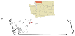
Coordinates: 48°55′35″N 122°4′43″W / 48.92639°N 122.07861°WCoordinates: 48°55′35″N 122°4′43″W / 48.92639°N 122.07861°W Country United States State Washington County Whatcom Area - Total 3.0 sq mi (7.8 km2) - Land 3.0 sq mi (7.8 km2) - Water 0.0 sq mi (0.0 km2) Elevation 646 ft (197 m) Population (2010) - Total 324 - Density 91.7/sq mi (35.4/km2) Time zone Pacific (PST) (UTC-8) - Summer (DST) PDT (UTC-7) ZIP code 98266 Area code 360 FIPS code 53-43010[1] GNIS feature ID 1522693[2] Maple Falls is a census-designated place (CDP) in Whatcom County, Washington, United States. The population was 324 at the 2010 census.
Contents
Geography
Maple Falls is located at 48°55′35″N 122°4′43″W / 48.92639°N 122.07861°W (48.926267, -122.078699),[3] on the Mount Baker Highway east of Bellingham, three miles east of a junction at Kendall, with State Route 547, which connects over a low pass on the northeast flank of Sumas Mountain to Sumas and the border crossing with Abbotsford, British Columbia.
According to the United States Census Bureau, the CDP has a total area of 3.0 square miles (7.8 km²), all of it land.
History
Among the first settlers of Maple Falls was Herbert Everant Leavitt, a native of Melbourne, Quebec, Canada.[4] After leaving Canada, Leavitt spent time in Truckee, California, where he worked as a carpenter before setting out for Columbia Township in Washington state. In 1888 Leavitt took up a homestead in Whatcom County where present-day Maple Falls is located. Leavitt packed his supplies in from Bellingham some 30 miles to his new farm. In subsequent years, besides farming, Leavitt operated a blacksmith shop at Maple Falls, was the proprietor of a Bellingham restaurant, and ran two hotels, in addition to serving as county constable for some 24 years.[5] In addition my Great X3 Grandfather Anton Warner and Great X3 Uncle Joe Warner came to the Columbia Valley on Christmas day in 1887 settling "The Warner Homestead" thats still in our family to day. Luckily it was a mild Winter and they lived in a lean to cabin. At the time there was only one trail leading out from Maple Falls to Deming then called Hollingsworth. So they came with the clothes on there back a few cooking utensils, flour, salt, bacon and a little food they carried in sacks the trail was to rough and narrow for a horse.. There were only a few settlers here at around the same time. Among those who were in Maple Falls were the Caulkins and a little later Mr. Max Koehler, The Zenders, and Mr.Ed Harvie. At this time there wasnt any cleared land only large Fir and Cedar trees. Most of the settlers of our community homesteaded there places. My Great X3 Grandfather Anton built a log cabin on his homestead the windows and stove had to be packed in, the trail was to narrow for a horse at the time, so anyone who knows the area knows that really does show how tough the men and women who began our little community were back then. One year during a storm a tree fell on the cabin and it was demolished. So he did the only thing there was to do and thats built a new larger cabin. As more and more people came into the small town of Maple Falls schools became a necessity. money was scarce back then so different settlers offered their cabins for school. Joe Warner worked out most of the year and was also a bachelor, his cabin was not in use a great deal at the time. This cabin which still stands on my families property on Silver Lake Rd. in Maple Falls on the now Tony Warner Farm was a 2 room log cabin. The Kitchen was used as a school. The classroom had log walls, one window and a hewn plank floor. They didnt have desks only hewed handmade benches and a table. The teachers then were paid a whopping $15.00 a month and boarded with the parents of the school children. This cabin served as a school house for many years.
Demographics
As of the census[1] of 2000, there were 277 people, 109 households, and 70 families residing in the CDP. The population density was 91.7 people per square mile (35.4/km²). There were 128 housing units at an average density of 42.4/sq mi (16.4/km²). The racial makeup of the CDP was 90.61% White, 2.53% Native American, and 6.86% from two or more races. Hispanic or Latino of any race were 0.36% of the population.
There were 109 households out of which 30.3% had children under the age of 18 living with them, 53.2% were married couples living together, 6.4% had a female householder with no husband present, and 34.9% were non-families. 22.9% of all households were made up of individuals and 3.7% had someone living alone who was 65 years of age or older. The average household size was 2.54 and the average family size was 3.04.
In the CDP the age distribution of the population shows 27.4% under the age of 18, 3.6% from 18 to 24, 32.5% from 25 to 44, 25.6% from 45 to 64, and 10.8% who were 65 years of age or older. The median age was 36 years. For every 100 females there were 125.2 males. For every 100 females age 18 and over, there were 128.4 males.
The median income for a household in the CDP was $41,250, and the median income for a family was $56,477. Males had a median income of $40,250 versus $17,125 for females. The per capita income for the CDP was $24,216. None of the families and 3.5% of the population were living below the poverty line.
See also
References
- ^ a b "American FactFinder". United States Census Bureau. http://factfinder.census.gov. Retrieved 2008-01-31.
- ^ "US Board on Geographic Names". United States Geological Survey. 2007-10-25. http://geonames.usgs.gov. Retrieved 2008-01-31.
- ^ "US Gazetteer files: 2010, 2000, and 1990". United States Census Bureau. 2011-02-12. http://www.census.gov/geo/www/gazetteer/gazette.html. Retrieved 2011-04-23.
- ^ Leavitt was a descendant of Moses Leavitt of Exeter, New Hampshire, whose descendant Dudley Leavitt subsequently removed from New Hampton, New Hampshire to Quebec.
- ^ History of Whatcom County, Vol. II, Lottie Roeder Roth, 1926, pp. 659–660, genealogytrails.com
Municipalities and communities of Whatcom County, Washington County seat: Bellingham Cities 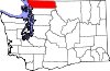
CDPs Acme | Birch Bay | Custer | Deming | Geneva | Glacier | Kendall | Maple Falls | Marietta-Alderwood | Peaceful Valley | Sudden Valley
Unincorporated
communitiesFairhaven | Laurel | Lummi Island | Maple Beach | Newhalem | Point Roberts
Ghost town Categories:- Census-designated places in Washington (state)
- Populated places in Whatcom County, Washington


Wikimedia Foundation. 2010.