- Winchester Mountain Lookout
Infobox_nrhp | name =Winchester Mountain Lookout
nrhp_type =
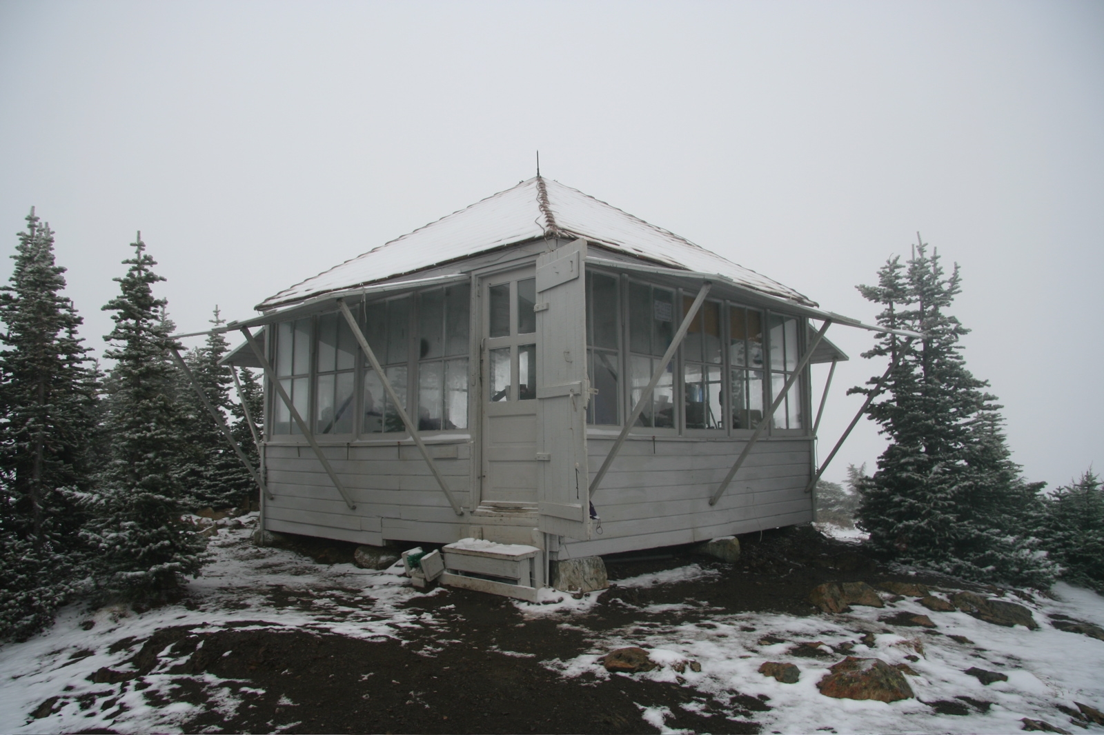
caption = Winchester Lookout (from the southwest)
location= Mt Baker Ranger District,Sedro-Woolley, Washington
lat_degrees = 48
lat_minutes = 57
lat_seconds = 25
lat_direction = N
long_degrees = 121
long_minutes = 38
long_seconds = 31
long_direction = W
locmapin = Washington
area =
built =1935
architect= Unknown
architecture= No Style Listed
added = July 14, 1987
governing_body = United States Forest Service
mpsub=USDA Forest Service Fire Lookouts on Mt. Baker--Snoqualmie National Forest TR
refnum=87001188cite web|url=http://www.nr.nps.gov/|title=National Register Information System|date=2008-04-15|work=National Register of Historic Places|publisher=National Park Service] The historical Winchester Lookout, located in the North Cascades in theU.S. state ofWashington , provides views of the NorthernPicket Range ,Mount Baker ,Mount Shuksan and Canadian peaks. The steep snowfields usually require an ice-axe well into July. The Twin Lakes road may not be passable to the trailhead which will add 2 more miles to the hike. Volunteers from the Mount Baker Club maintain the lookout with 2 work parties per year. [ [http://www.MountBakerClub.org Mount Baker Club] ]The lookout is open to the public for day or overnight use on a first-come first-served basis. Fires are not permitted at all.
History
This L-4 cab fire lookout was built in
1935 and staffed until1966 . The lookout was slated for demolition when in 1982 the Mount Baker Club, led by Gary Haufle, worked out a deal with the Forest Service to restore the lookout. The Forest Service provided the materials and the club provided all of the labor.National Register
The lookout was added to the
National Register of Historic Places onJuly 14 ,1987 . [ [http://www.nationalregisterofhistoricplaces.com/WA/Whatcom/state2.html Whatcom County listings] at [http://www.nationalregisterofhistoricplaces.com National Register of Historic Places] ]Winchester Mountain Lookout (added 1987 - Structure - #87001188):Mt. Baker Wilderness Area overlooking the north fork of Nooksack River and west fork of Silesia Creek, Sedro Wooley:Historic Significance: Event, Architecture/Engineering:Area of Significance: Architecture, Conservation, Politics/Government:Period of Significance: 1925-1949:Owner: Federal:Historic Function: Government:Historic Sub-function: Fire Station:Current Function: Government:Current Sub-function: Fire Station:Mt. Baker-Snoqualmie National Forest 15 miles northeast of Mt. Baker
Whatcom County, Washington Elevation 6521'Visiting
The lookout is generally inaccessible from early October until mid summer due to snow. If you plan to spend the night in the lookout be aware that it may be occupied when you arrive. There are areas outside the lookout to pitch a tent, or sleep under the stars with no tent. There are 3 cots in the lookout for overnighters and even more can sleep on the floor.
Propane is available at the top, provided by the club. A snowfield that lasts late into the summer is behind the lookout and provides the water. Boil all water.The Trail
The trailhead for trail #685 to the top of Winchester Mountain is located between the two Twin Lakes. The steep trail, with a 1300 foot elevation gain, starts in beautiful tall treed forest with fantastic
wildflower filled clearings and climbs high into the rough windswept and delicate alpine. There are two very narrow sections of trail with long drops that require sure footing are not for the faint of heart. The trail is 2.1 miles one-way and rated "more difficult" by the U.S. Forest Service. [ [http://www.fs.fed.us/r6/mbs/recreation/activities/trails/mbrd/mbrd_0685.htm Winchester Mountain Trail #685 Mt. Baker-Snoqualmie National Forest] ]The lookout is located within the
Mount Baker Wilderness area. Wilderness area regulations restrict group size to no more than 12 persons. [ [http://www.fs.fed.us/r6/mbs/recreation/special/wilderness/wilderness_regs.shtml Mt. Baker-Snoqualmie National Forest Wilderness Regulations] ]The Road
The trailhead is accessed by the Twin Lakes Road (Forest Service #3065 in the North Fork Nooksack area) off of the Mt Baker Highway. The first 4.5 miles to the Tomyhoi Lake/Yellow Aster Butte trailhead is well maintained. The remaining 2 miles of road is not maintained and can only be driven at about 5-15mph by
4x4 vehicles with high clearance. The unmaintained portion of road is often washed out in the early part of the season and is only fixed up by the miners at the Lone Jack Mine, provided they decide to operate the mine that year based on the price of gold.References
External links
* [http://www.topoquest.com/map.asp?z=10&n=5423506&e=599335&s=25&size=m&datum=nad83&layer=DRG25 TopoQuest Map]
* [http://www.firelookout.com/wa/winchester.jpgDavid Inscho's Photo of Winchester in the winter]
* [http://www.mountbakerclub.org/winchesterHike.htm Mount Baker Club photos of Winchester Lookout]
* [http://www.firetower.org National Historic Lookout Register]
Wikimedia Foundation. 2010.