- National Register of Historic Places listings in Orleans Parish, Louisiana
-
 Location of Orleans Parish in Louisiana
This is a list of the National Register of Historic Places listings in Orleans Parish, Louisiana.
This is intended to be a complete list of the properties and districts on the National Register of Historic Places in Orleans Parish, Louisiana, United States. The locations of National Register properties and districts for which the latitude and longitude coordinates are included below, may be seen in a Google map.[1]
There are 142 properties and districts listed on the National Register in the parish, including 25 National Historic Landmarks. Because Orleans Parish is consolidated with New Orleans, properties are listed by ward rather than by city or town.
-
- This National Park Service list is complete through NPS recent listings posted November 10, 2011.[2]
Current listings
[3] Landmark name[4] Image Date listed Location Ward Summary 1 Aldrich-Genella House 
October 8, 1980 4801 St. Charles Ave.
29°55′35″N 90°6′24″W / 29.92639°N 90.10667°W2 Algiers Point 
August 1, 1978 Bounded by the Mississippi River, Slidell St., and Atlantic Ave.
29°57′5″N 90°3′2″W / 29.95139°N 90.05056°W
Boundary increase (listed March 17, 2011): Roughly bounded by Slidell, Brooklyn, Atlantic, Newton, and Homer Sts.3 American Chicle Company Building 
September 18, 1998 8311 Fig St.
29°57′43″N 90°7′3″W / 29.96194°N 90.1175°W4 Arabella Station 
January 4, 1996 5600 Magazine St.
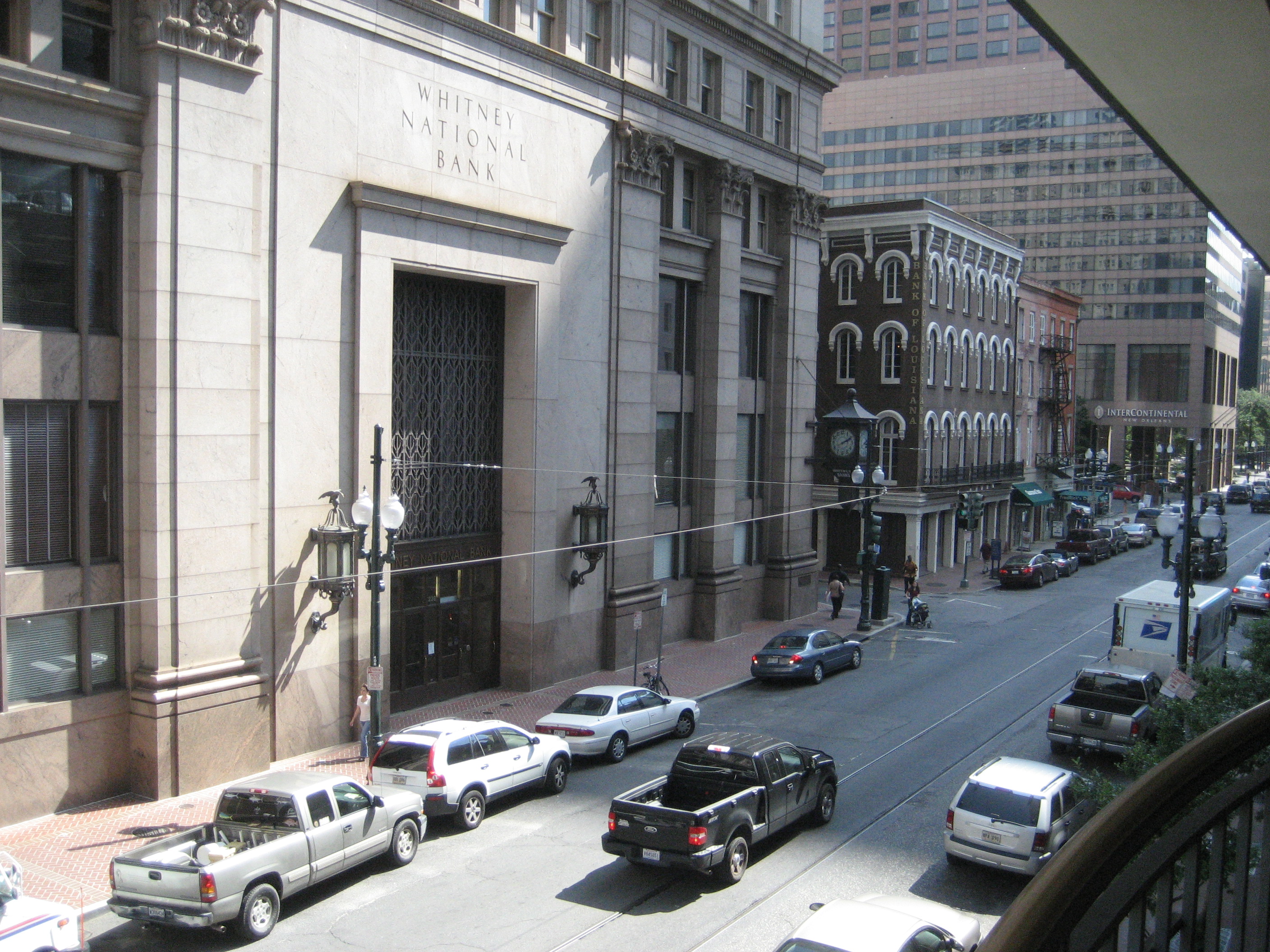
29°55′14″N 90°7′3″W / 29.92056°N 90.1175°W5 Bank of Louisiana 
June 19, 1973 334 Royal St.
29°57′21″N 90°4′0″W / 29.95583°N 90.066667°W6 Gen. Beauregard Equestrian Statue 
February 18, 1999 Junction of Esplanade Ave. and Wisner Boulevard
29°59′2″N 90°5′23″W / 29.98389°N 90.08972°W7 Big Oak-Little Oak Islands July 14, 1971 Within marshes along the shoreline of Lake Pontchartrain, northeast of central New Orleans
30°4′28″N 89°53′49″W / 30.07444°N 89.89694°W[5]8 Blue Plate Building 
October 16, 2008 1315 S. Jefferson Davis Parkway
29°57′26.8″N 90°6′19.8″W / 29.957444°N 90.1055°W9 Bohn Motor Company Automobile Dealership 
February 1, 2011 2700 South Broad
29°57′3″N 90°5′59″W / 29.95083°N 90.09972°W10 Broadmoor Historic District 
June 13, 2003 Roughly bounded by South Broad/Fountainebleau, Milan, S. Claiborne, and Octavia; also roughly bounded by Walmsley, S. White, Eden, and S. Jefferson Davis Parkway
29°56′48″N 90°6′22″W / 29.94667°N 90.10611°WSecond set of boundaries represents a boundary increase of September 13, 2007 11 Buildings at 445-447-449 South Rampart 
August 30, 2007 445-447-449 S. Rampart
29°57′2″N 90°4′30″W / 29.95056°N 90.075°W12 Bullitt-Longenecker House 
October 1, 1981 3627 Carondelet St.
29°55′42″N 90°5′42″W / 29.92833°N 90.095°W13 Bywater Historic District 
January 23, 1986 Roughly bounded by N. Claiborne Ave. and Urquhart St., Kentucky St., the Mississippi River, and Montegut and Press Sts.
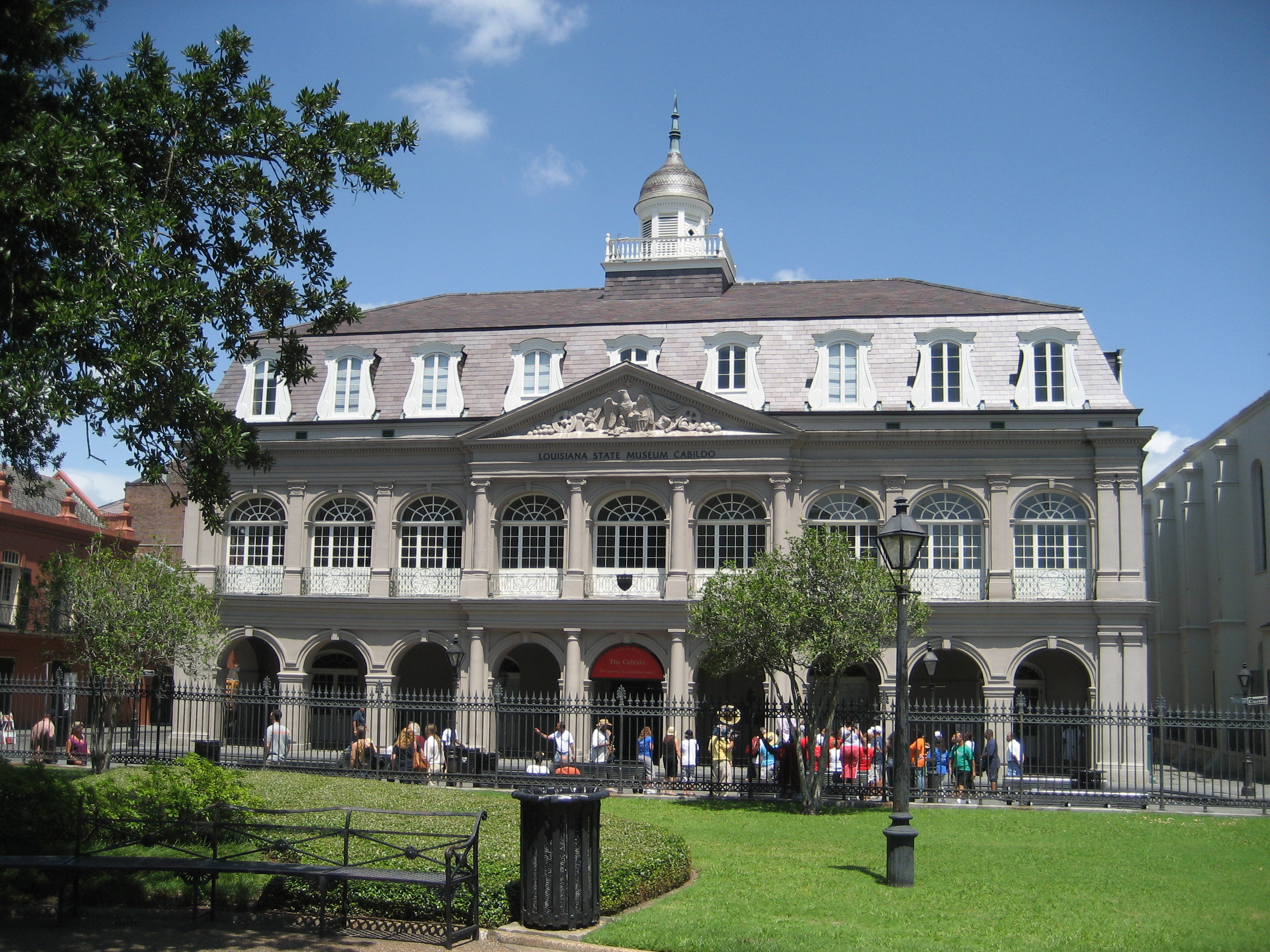
29°58′0″N 90°2′17″W / 29.966667°N 90.03806°W14 The Cabildo 
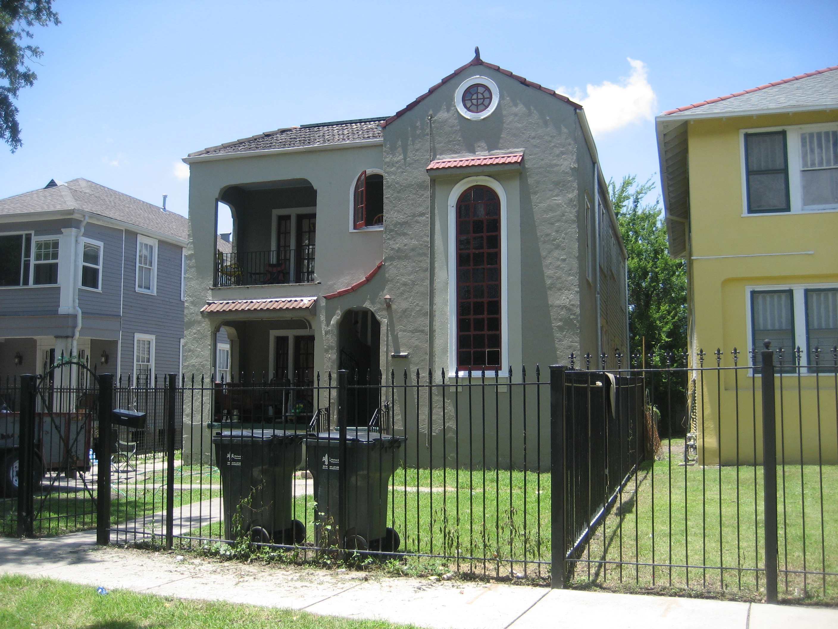
October 15, 1966 701 Chartres St.
29°57′26″N 90°3′51″W / 29.95722°N 90.06417°WA building on Jackson Square 15 George Washington Cable House 
October 15, 1966 1313 8th St.
29°55′35″N 90°5′14″W / 29.92639°N 90.08722°WGarden District cottage home of author George Washington Cable. 16 Canal Station 
February 4, 1993 2819 Canal St.
29°58′16″N 90°5′34″W / 29.97111°N 90.09278°W17 Carrollton Historic District 
November 2, 1987 Roughly bounded by Lowerline St., the Mississippi River, Monticello Ave., and Earhart Boulevard; also roughly bounded by Claiborne, National Octavia, Grape, and Lowerline
29°57′8″N 90°7′38″W / 29.95222°N 90.12722°WSecond set of boundaries represents a boundary increase of September 6, 2007 18 Carver Theater 
August 20, 1998 2101 Orleans Ave.
29°58′0″N 90°4′36″W / 29.966667°N 90.07667°W19 Central City Historic District 
July 9, 1982 Roughly bounded by Pontchartrain Expressway and Louisiana, St. Charles, and Claiborne Aves.
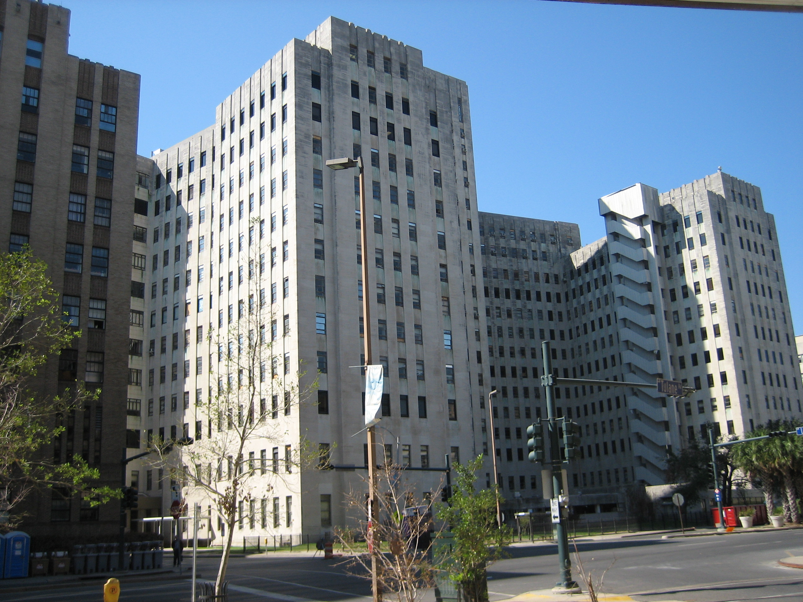
29°56′20″N 90°5′10″W / 29.93889°N 90.08611°W20 Charity Hospital of New Orleans 
January 24, 2011 1532 Tulane Ave.
29°57′19″N 90°4′41″W / 29.95528°N 90.07806°W21 Confederate Memorial Hall 
June 11, 1975 929 Camp St.
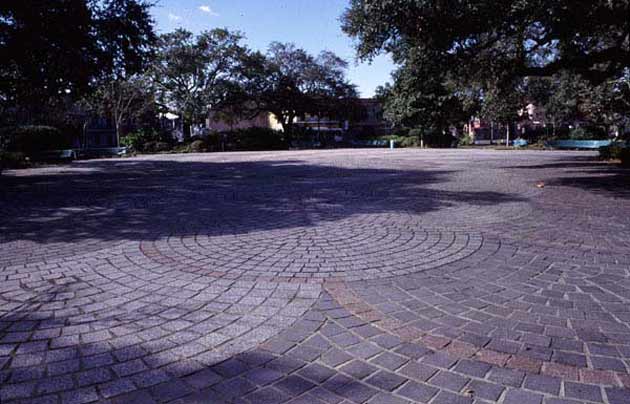
29°56′36″N 90°4′53″W / 29.94333°N 90.08139°W22 Congo Square 
January 28, 1993 Junction of Rampart and St. Peter Sts.
29°57′39″N 90°4′6″W / 29.96083°N 90.06833°W23 Criminal Courts Building 
January 12, 1984 2700 Tulane Ave.
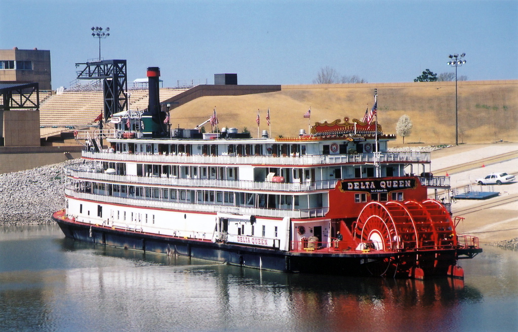
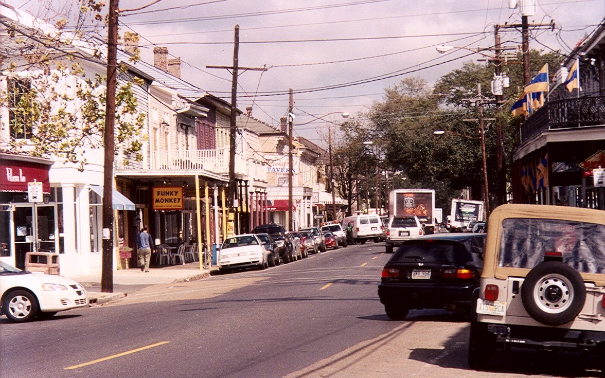
29°57′41″N 90°5′37″W / 29.96139°N 90.09361°W24 DELTA QUEEN (Steamboat) 
June 15, 1970 30 Robin St. Wharf
29°56′3″N 90°3′39″W / 29.93417°N 90.06083°W25 DELUGE 
June 30, 1989 Mississippi River north of Canal St. Algiers Ferry
29°57′20″N 90°3′18″W / 29.95556°N 90.055°W26 Dillard University 
April 10, 2003 2601 Gentilly Boulevard
29°59′50″N 90°3′56″W / 29.99722°N 90.06556°W27 James H. Dillard House 
December 2, 1974 571 Audubon St.
29°56′7″N 90°7′34″W / 29.93528°N 90.12611°W28 Eagle Saloon Building 
October 16, 2002 401-403 South Rampart
29°57′5″N 90°4′30″W / 29.95139°N 90.075°W29 Esplanade Ridge Historic District 
June 30, 1980 U.S. Route 90
29°58′34″N 90°4′42″W / 29.97611°N 90.07833°W30 Factors Row and Thiberge Buildings 
April 4, 1983 401-405 Carondelet and 802-830 Perdido St.
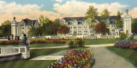
29°57′2″N 90°4′19″W / 29.95056°N 90.07194°W31 Faubourg Marigny 
December 31, 1974 Roughly bounded by the Mississippi River, Esplanade Ave., Marias St., and Montegut St.
29°57′55″N 90°3′20″W / 29.96528°N 90.05556°W32 Federal Fibre Mills Building 
March 24, 1983 1101 S. Peters St.
29°56′25″N 90°3′58″W / 29.94028°N 90.06611°W33 Flint-Goodridge Hospital of Dillard University 
January 13, 1989 Louisiana Ave. and LaSalle St.
29°56′10″N 90°5′41″W / 29.93611°N 90.09472°W34 Fort Macomb 
October 11, 1978 East of central New Orleans at Chef Menteur Pass on U.S. Route 90
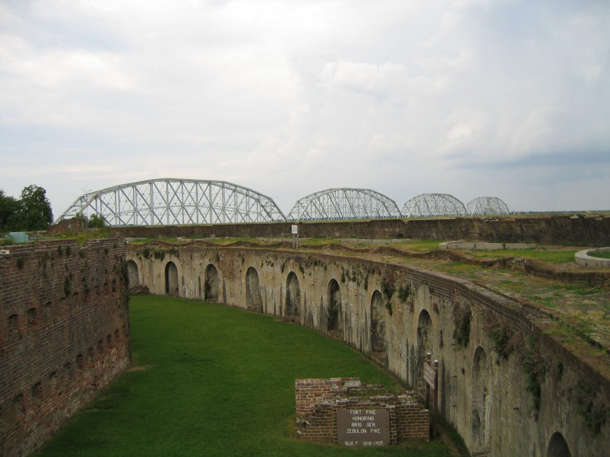
30°3′51″N 89°48′15″W / 30.06417°N 89.80417°W35 Fort Pike 
August 14, 1972 North of central New Orleans off U.S. Route 90, E.
30°9′58″N 89°44′13″W / 30.16611°N 89.73694°W36 Fort St. John 
February 11, 1983 Bayou St. John off Robert E. Lee Boulevard
30°1′20″N 90°5′0″W / 30.02222°N 90.083333°WAlso known as "Old Spanish Fort" 37 Fourth Church of Christ, Scientist 
July 19, 2002 134 Polk Ave.
30°0′5″N 90°6′51″W / 30.00139°N 90.11417°W38 William Frantz Elementary School 
June 8, 2005 3811 N. Galvez St.
29°58′35″N 90°1′59″W / 29.97639°N 90.03306°W39 French Market-Old Vegetable Market 
March 29, 1972 1000 Decatur St.
29°57′33″N 90°3′37″W / 29.95917°N 90.06028°W40 Gallier Hall 
May 30, 1974 545 St. Charles Ave.
29°56′47″N 90°4′17″W / 29.94639°N 90.07139°W41 Gallier House 
February 15, 1974 1132 Royal St.
29°57′41″N 90°3′41″W / 29.96139°N 90.06139°W42 Garden District 
June 21, 1971 Bounded by Carondelet, Josephine, and Magazine Sts., and Louisiana Ave.
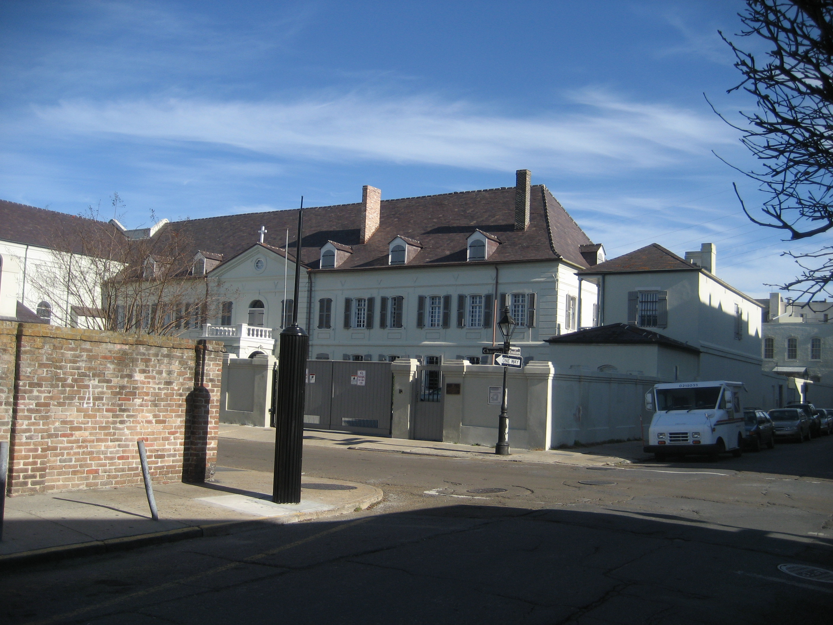
29°55′45″N 90°5′2″W / 29.92917°N 90.08389°W43 Mary Louise Kennedy Genella House 
November 10, 1982 5022-5028 Prytania St.
29°55′28″N 90°6′34″W / 29.92444°N 90.10944°W44 General Laundry Building 
December 27, 1974 2512 St. Peter St.
29°58′5″N 90°4′53″W / 29.96806°N 90.08139°W45 Gentilly Terrace Historic District 
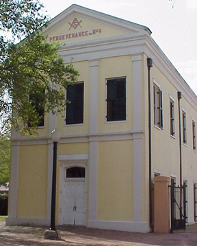
November 18, 1999 Roughly bounded by Spain, Mirabeau, Eastern, and Gentilly Boulevard
30°0′18″N 90°3′5″W / 30.005°N 90.05139°W46 Nicholas Girod House 
April 15, 1970 500 Chartres St.
29°57′21″N 90°3′54″W / 29.95583°N 90.065°WAlso known as "The Napoleon House" 47 Grant-Black House 
July 26, 1979 3932 St. Charles Ave.
29°55′35″N 90°5′50″W / 29.92639°N 90.09722°W48 Greenville Hall 
August 29, 1977 7214 St. Charles Ave.
29°56′13″N 90°7′39″W / 29.93694°N 90.1275°WFormerly part of Dominican College campus, now part of Loyola University New Orleans 49 Hart House June 7, 1984 2108 Palmer Ave.
29°56′13″N 90°7′6″W / 29.93694°N 90.11833°W50 Lafcadio Hearn House 
April 26, 2006 1565-67 Cleveland Ave.
29°57′34″N 90°4′39″W / 29.95944°N 90.0775°W51 Hennen Building 
July 31, 1986 203 Carondelet
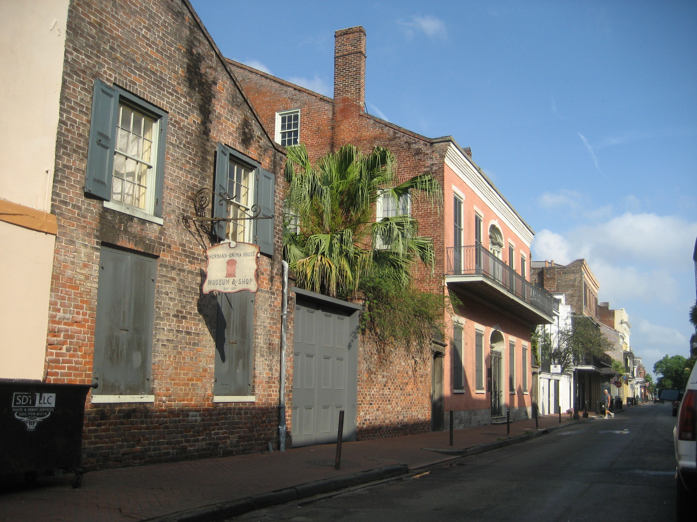
29°57′9″N 90°4′17″W / 29.9525°N 90.07139°W52 Hermann-Grima House 
August 19, 1971 818-820 St. Louis St.
29°57′26″N 90°4′4″W / 29.95722°N 90.06778°W53 Simon Hernsheim House 
June 24, 1982 3811 St. Charles Ave.
29°55′38″N 90°5′46″W / 29.92722°N 90.09611°WNow houses the Columns Hotel 54 Holy Cross Historic District 
July 31, 1986 Roughly bounded by Burgundy and Dauphine Sts., Delery St., the Mississippi River, and the Industrial Canal
29°57′26″N 90°1′8″W / 29.95722°N 90.01889°W55 Howard Memorial Library 
March 22, 1991 615 Howard Ave.
29°56′34″N 90°4′17″W / 29.94278°N 90.07139°W56 Irish Channel Area Architectural District 
September 29, 1976 Roughly bounded by Jackson Ave., Aline and Magazine Sts., and the Mississippi River
29°55′20″N 90°4′51″W / 29.92222°N 90.08083°W57 Iroquois Theater 
January 14, 2003 413-415 S. Rampart St.
29°57′9″N 90°4′30″W / 29.9525°N 90.075°W58 Isaacs-Williams Mansion 
October 21, 1976 5120 St. Charles Ave.
29°55′35″N 90°6′38″W / 29.92639°N 90.11056°WMilton Latter Memorial Library 59 Jackson Barracks 
November 7, 1976 6400 St. Claude Ave.
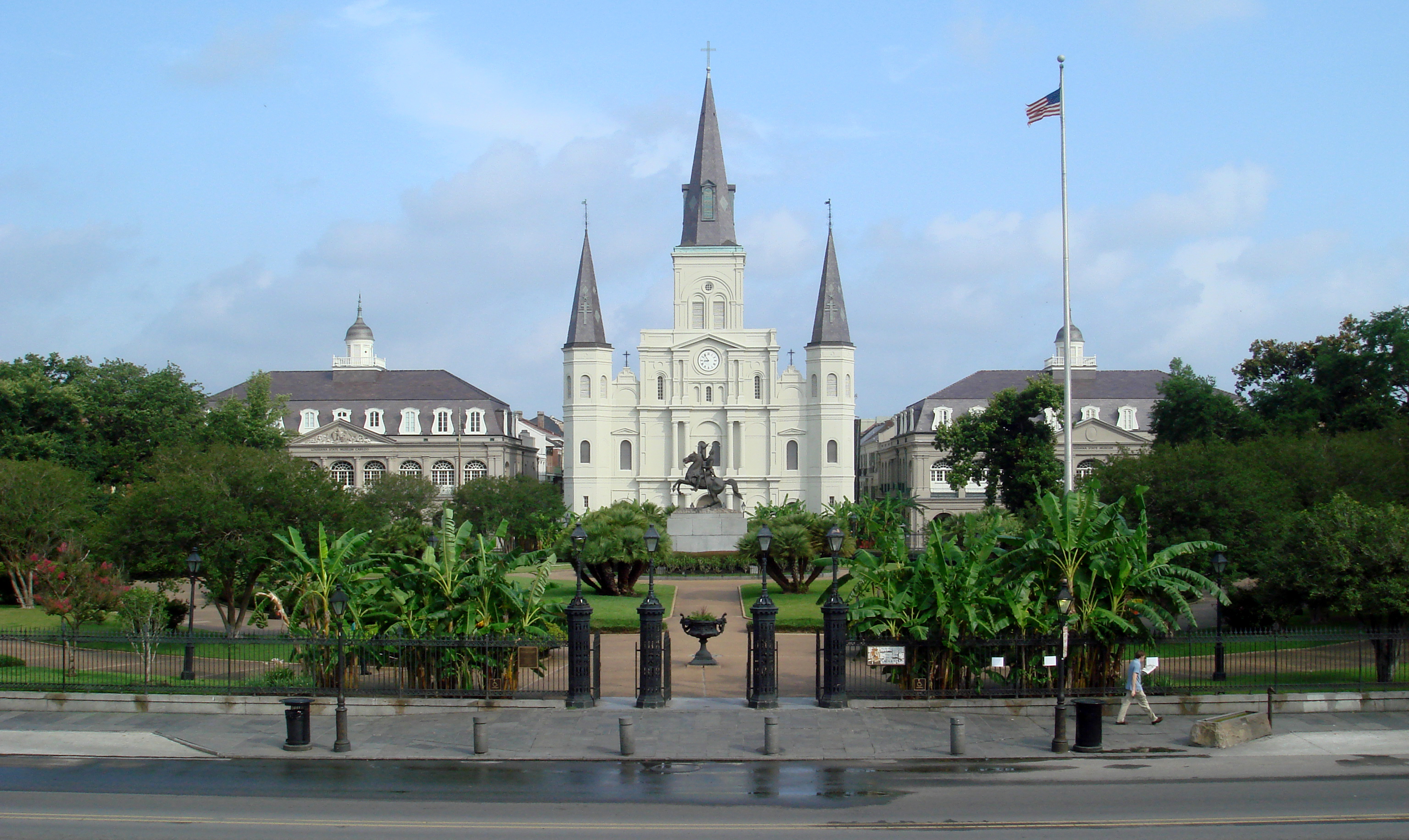
29°57′4″N 90°0′37″W / 29.95111°N 90.01028°W60 Jackson Square 
October 15, 1966 Bounded by Decatur, St. Peter, St. Ann, and Chartres Sts.
29°57′26″N 90°3′47″W / 29.95722°N 90.06306°W61 Julia Street Row 
March 28, 1977 602-646 Julia St.
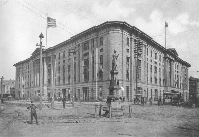
29°56′43″N 90°4′16″W / 29.94528°N 90.07111°W62 Jung Hotel 
September 27, 1982 1500 Canal St.
29°57′25″N 90°4′34″W / 29.95694°N 90.07611°W63 Karnofsky Tailor Shop-House 
October 16, 2002 427-431 S. Rampart St.
29°57′2″N 90°4′30″W / 29.95056°N 90.075°W64 Lafayette Cemetery No. 1 
February 1, 1972 1400 Washington Ave.
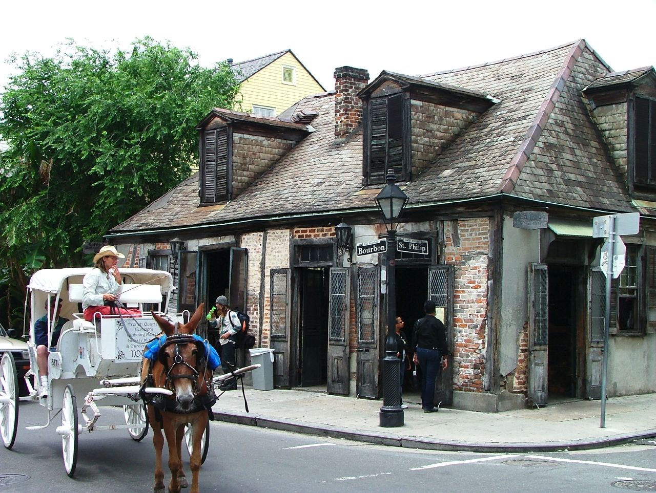
29°55′43″N 90°5′7″W / 29.92861°N 90.08528°W65 Lafitte's Blacksmith Shop 
April 15, 1970 941 Bourbon St.
29°57′39″N 90°3′50″W / 29.96083°N 90.06389°W66 LeBeuf Plantation House July 29, 1993 101 Carmick, US Naval Support Activity
29°56′56″N 90°1′50″W / 29.94889°N 90.03056°W67 LeCarpentier-Beauregard-Keyes House 
November 20, 1975 1113 Chartres St.
29°57′39″N 90°3′40″W / 29.96083°N 90.06111°W68 Robert E. Lee Monument 
March 19, 1991 Lee Cir., in the 900-1000 blocks of St. Charles Ave.
29°56′35″N 90°4′20″W / 29.94306°N 90.07222°W69 Leeds Iron Foundry 
January 11, 1976 923 Tchoupitoulas St.
29°56′33″N 90°4′5″W / 29.9425°N 90.06806°W70 Huey P. Long Mansion June 9, 1980 14 Audubon Boulevard
29°56′35″N 90°7′11″W / 29.94306°N 90.11972°W71 Longue Vue House and Gardens 
September 20, 1991 7 Bamboo Rd.
29°58′36″N 90°7′23″W / 29.97667°N 90.12306°W72 Louisiana State Bank Building 
May 4, 1983 403-409 Royal St.
29°57′20″N 90°4′1″W / 29.95556°N 90.06694°W73 Lowe-Forman House 
June 29, 1982 5301 Camp St.
29°55′18″N 90°6′47″W / 29.92167°N 90.11306°W74 Lower Garden District 
September 7, 1972 Roughly bounded by St. Charles Ave., Jackson St., the Mississippi River, and Annunciation and Race Sts.; also roughly the southern side of St. Charles Ave. between U.S. Route 90 and Josephine St. and two parcels on the southern side of Annunciation St.
29°55′55″N 90°4′15″W / 29.93194°N 90.07083°WSecond set of boundaries represents a boundary increase of July 26, 1990 75 Macheca Building 
January 6, 1983 828 Canal St.
29°57′14″N 90°4′15″W / 29.95389°N 90.07083°W76 Madame John's Legacy 
April 15, 1970 632 Dumaine St.
29°57′32″N 90°3′46″W / 29.95889°N 90.06278°W77 Magnolia Street Housing Project 
August 27, 1999 Roughly bounded by Washington Ave., La Salle St., Louisiana Ave., and Magnolia St.
29°56′16″N 90°5′34″W / 29.93778°N 90.09278°W78 Maylie's Restaurant 
June 3, 1998 1007-09 Poydras St.
29°57′2″N 90°4′28″W / 29.95056°N 90.07444°W79 McDonogh School No. 6 October 5, 1982 4849 Chestnut St.
29°55′22″N 90°6′27″W / 29.92278°N 90.1075°W80 Merieult House 
May 5, 1972 533 Royal St.
29°57′24″N 90°3′57″W / 29.95667°N 90.06583°W81 Metairie Cemetery 
December 6, 1991 Junction of Interstate 10 and Metairie Rd.
29°58′54″N 90°7′5″W / 29.98167°N 90.11806°W82 Mid-City Historic District 
December 10, 1993 Roughly bounded by Derbigny St., Conti St., City Park Ave., and Interstate 10
29°58′8″N 90°5′45″W / 29.96889°N 90.09583°W83 Napoleon Street Branch Library 
January 12, 1979 Napoleon St.
29°55′16″N 90°6′4″W / 29.92111°N 90.10111°W84 National American Bank Building 
May 15, 1986 200 Carondelet
29°57′8″N 90°4′14″W / 29.95222°N 90.07056°W85 New Marigny Historic District 
September 30, 1994 Roughly bounded by St. Claude, St. Bernard, Tonti, and St. Ferdinand Sts. and Interstate 10
29°58′27″N 90°3′17″W / 29.97417°N 90.05472°W86 New Orleans City Park Carousel and Pavilion 
February 13, 1986 City Park, off City Park Ave.
29°59′15″N 90°5′57″W / 29.9875°N 90.09917°W87 New Orleans Cotton Exchange Building 
December 22, 1977 231 Carondelet St.
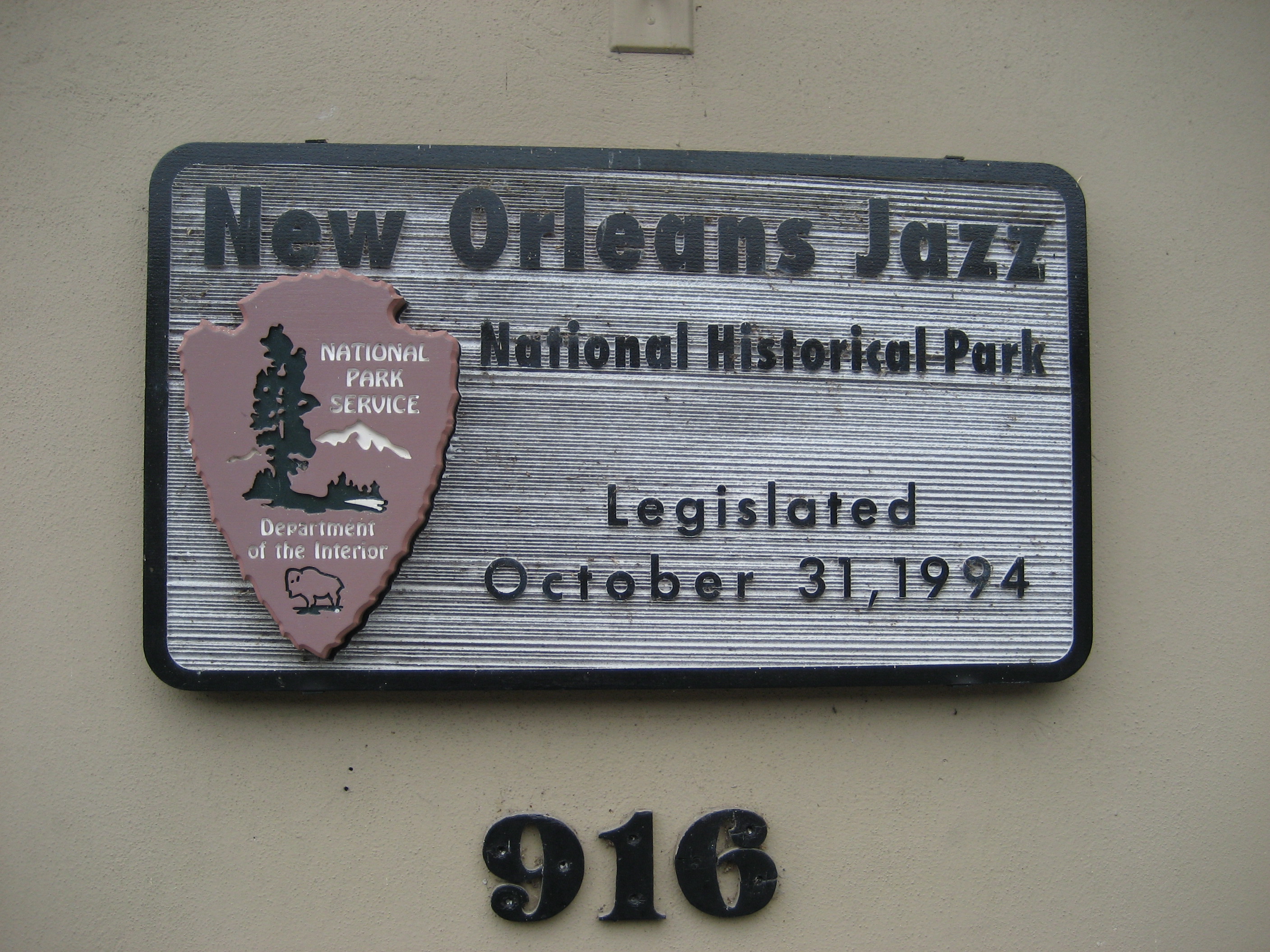
29°57′7″N 90°4′17″W / 29.95194°N 90.07139°W88 New Orleans Jazz National Historical Park 
October 31, 1994 365 Canal St.
29°57′44.6″N 90°4′2″W / 29.962389°N 90.06722°W89 New Orleans Lower Central Business District 
June 24, 1991 Roughly bounded by Canal, Tchoupitoulas, Poydras, O'Keefe, Common, and S. Saratoga; also approximately Rampart, Tulane, Loyola, Gravier, O'Keefe, and Common
29°57′8″N 90°4′17″W / 29.95222°N 90.07139°WSecond set of boundaries represents a boundary increase of February 9, 2006 90 Newberger House September 27, 1984 1640 Palmer Ave.
29°55′58″N 90°7′11″W / 29.93278°N 90.11972°W91 Odd Fellows Rest Cemetery 
May 23, 1980 Canal St. and City Park Ave.
29°58′53″N 90°6′39″W / 29.98139°N 90.11083°W92 Old Handleman Building 
June 11, 1980 1824-1832 Dryades St. (Oretha Castle Haley Boulevard)
29°56′18″N 90°4′51″W / 29.93833°N 90.08083°W93 Old Meat Market-Halle des Boucheries 
March 29, 1972 800 Decatur St.
29°56′22″N 90°3′44″W / 29.93944°N 90.06222°W94 Old Ursuline Convent 
October 15, 1966 1114 Chartres St.
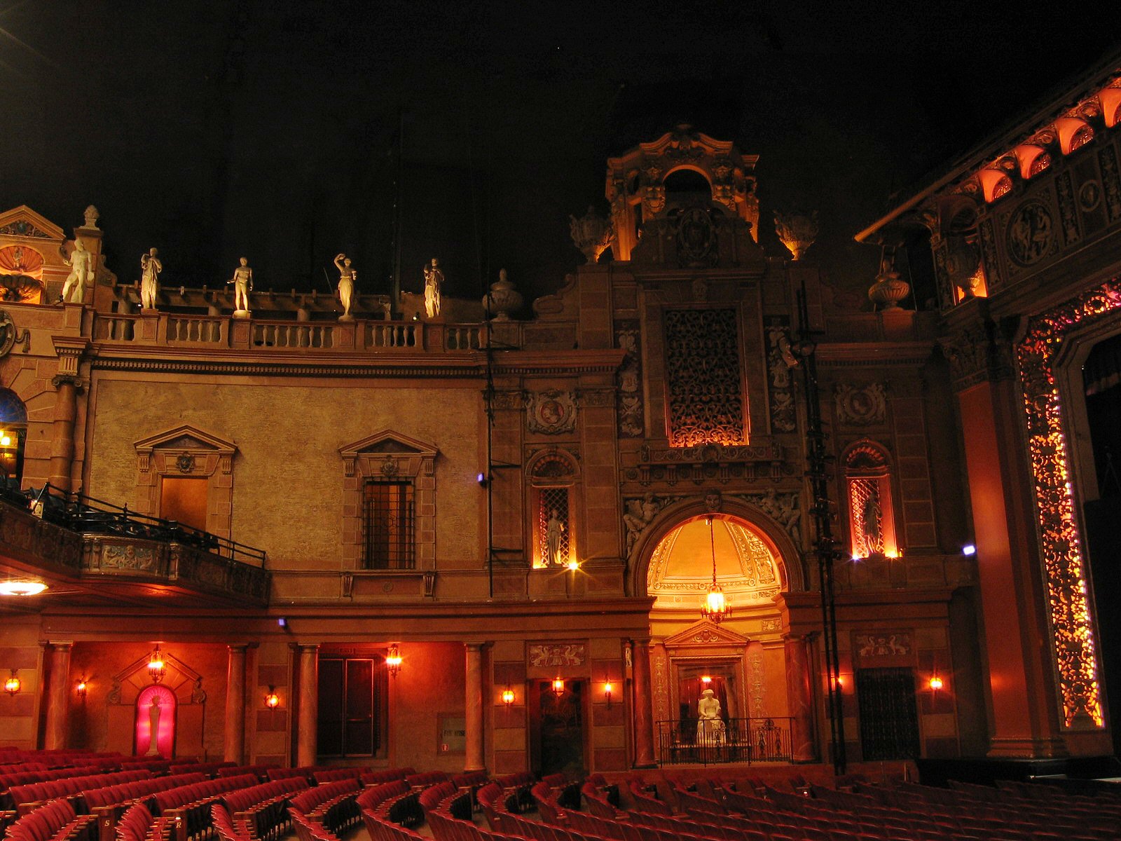
29°57′37″N 90°3′39″W / 29.96028°N 90.06083°W95 Orpheum Theatre 
August 11, 1982 125-129 University Pl.
29°57′16″N 90°4′21″W / 29.95444°N 90.0725°W96 Pan-American Life Insurance Company Building 
September 19, 2007 2400 Canal St.
29°57′52″N 90°5′6″W / 29.96444°N 90.085°W97 Park View Guest House 
November 5, 1982 7004 St. Charles Ave.
29°56′8″N 90°7′33″W / 29.93556°N 90.12583°W98 Parkview Historic District 
June 9, 1995 Roughly bounded by City Park Ave., Bayou St. John, Orleans, Rocheblave, Lafitte, and St. Louis
29°58′40″N 90°5′33″W / 29.97778°N 90.0925°W99 Perseverance Hall 
October 2, 1973 901 St. Claude Ave.
29°57′46″N 90°4′4″W / 29.96278°N 90.06778°W100 Pessou House June 15, 1982 6018 Benjamin St.
29°55′47″N 90°7′9″W / 29.92972°N 90.11917°W101 Pitot House 
September 28, 1971 1440 Moss St.
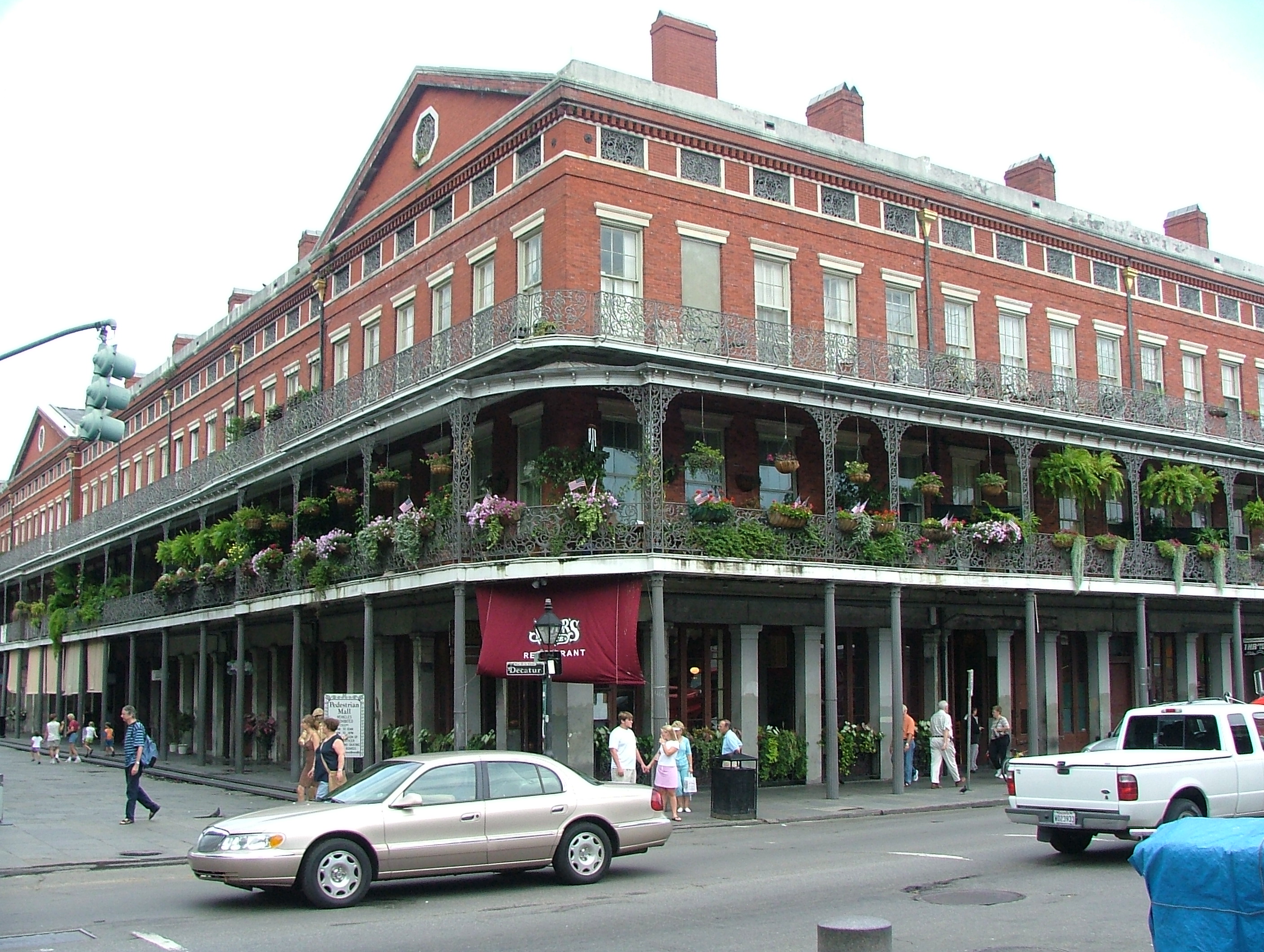
29°58′54″N 90°5′21″W / 29.98167°N 90.08917°W102 Pontalba Buildings 
May 30, 1974 500 St. Ann St. and 500 St. Peter St.
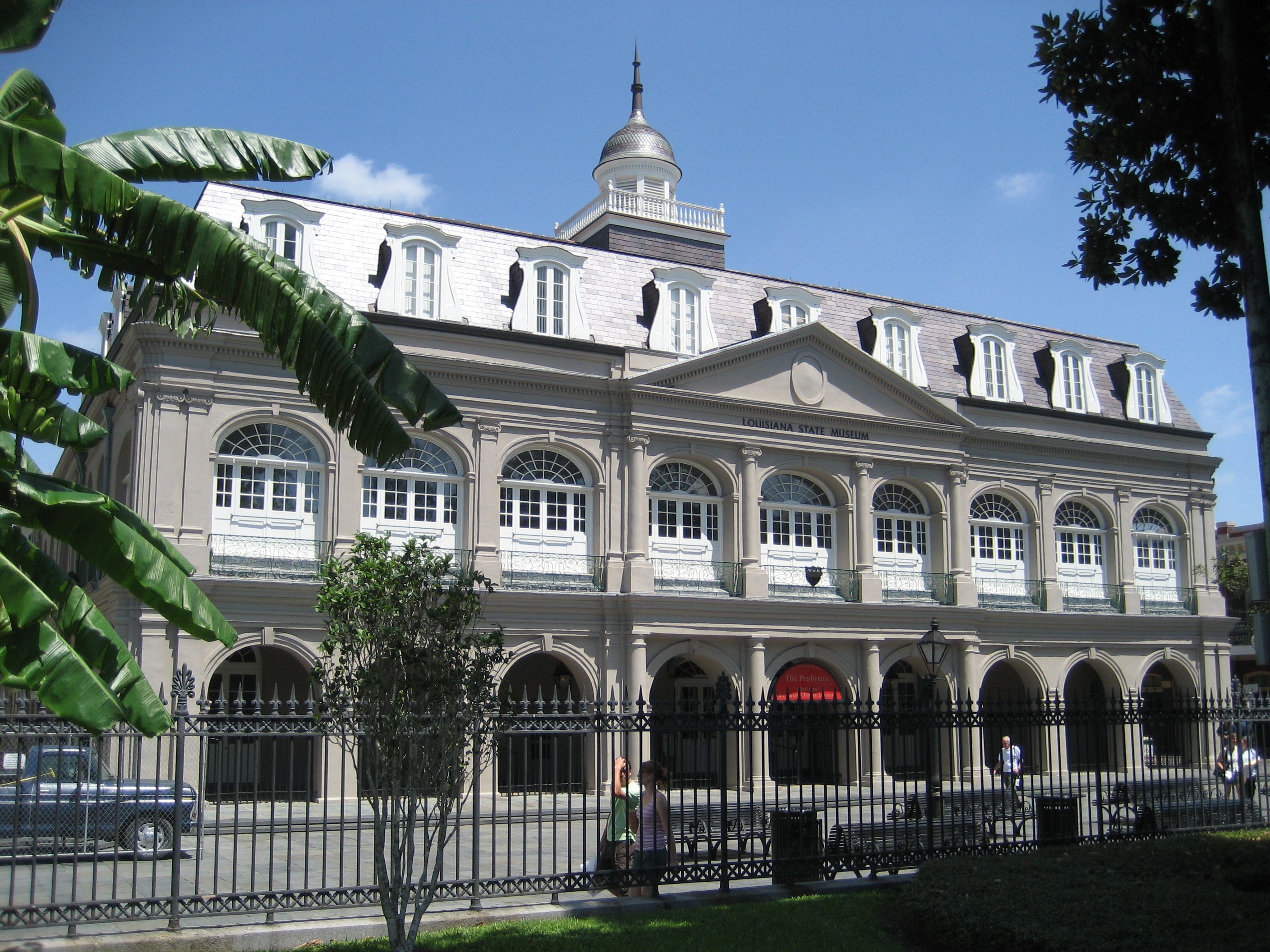
29°57′27″N 90°3′46″W / 29.9575°N 90.06278°W103 The Presbytere 
April 15, 1970 751 Chartres St.
29°57′29″N 90°3′50″W / 29.95806°N 90.06389°W104 Jean Louis Rabassa House February 15, 1974 1125 St. Ann St.
29°57′42″N 90°4′4″W / 29.96167°N 90.06778°W105 Rice House 
August 24, 1978 3643 Camp St.
29°55′21″N 90°5′44″W / 29.9225°N 90.09556°W106 Saenger Theatre 
November 25, 1977 1111 Canal St.; also 1101-1111 Canal St.
29°57′21″N 90°4′22″W / 29.95583°N 90.07278°WSecond set of addresses represents a boundary increase of April 1, 1985 107 St. Alphonsus Church 
May 22, 1973 2029 Constance St.
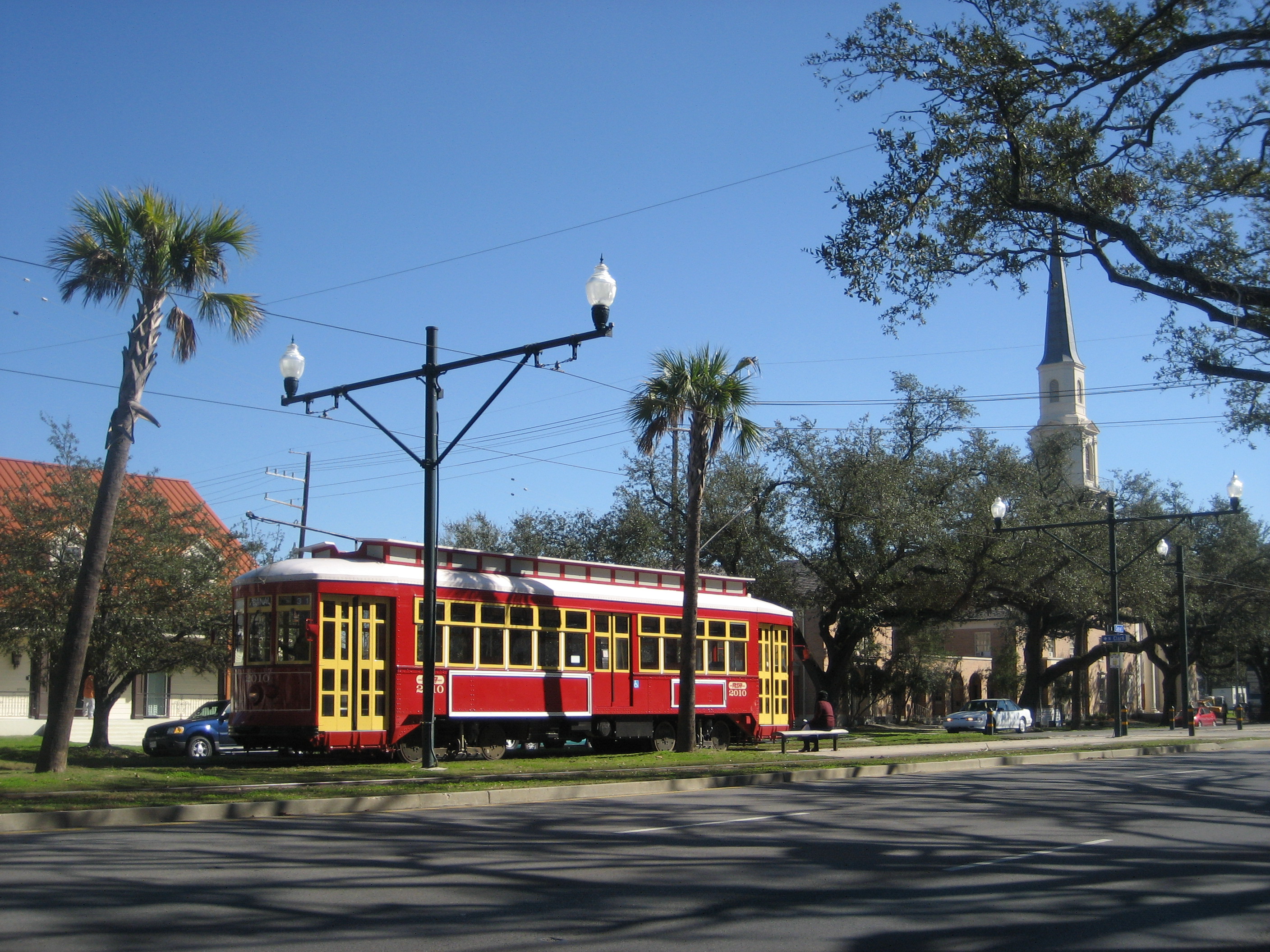
29°55′50″N 90°4′25″W / 29.93056°N 90.07361°W108 St. Charles Streetcar Line 
May 23, 1973 St. Charles Ave. route from downtown to Carrollton
29°56′27″N 90°6′8″W / 29.94083°N 90.10222°W109 St. James AME Church 
October 26, 1982 222 N. Roman St.
29°57′39″N 90°4′43″W / 29.96083°N 90.07861°W110 St. Louis Cemetery No. 1 
July 30, 1975 Bounded by Basin, St. Louis, Conti, and Treme Sts.
29°57′25″N 90°4′34″W / 29.95694°N 90.07611°W111 St. Louis Cemetery No. 2 
July 30, 1975 Bounded by Claiborne, Robertson, St. Louis, and Iberville St.
29°57′38″N 90°4′32″W / 29.96056°N 90.07556°W112 St. Mary's Assumption Church 
August 12, 1971 2030 Constance St.
29°55′45″N 90°4′29″W / 29.92917°N 90.07472°W113 St. Patrick's Church 
May 30, 1974 724 Camp St.
29°56′48″N 90°4′11″W / 29.94667°N 90.06972°W114 St. Peter A.M.E. Church 
March 21, 1979 1201 Cadiz St.
29°55′24″N 90°6′14″W / 29.92333°N 90.10389°W115 St. Vincent De Paul Roman Catholic Church 
April 13, 1976 3051 Dauphine
29°57′52″N 90°2′46″W / 29.96444°N 90.04611°W116 Jean Marie Saux Building 
January 12, 1983 900 City Park Ave.
29°58′59″N 90°5′51″W / 29.98306°N 90.0975°W117 Shell Building 
February 22, 2002 925 Common St.
29°57′20″N 90°4′23″W / 29.95556°N 90.07306°W118 Louis Sincer House 
July 12, 1978 1061 Camp St.
29°56′30″N 90°4′19″W / 29.94167°N 90.07194°W119 Sister Stanislaus Memorial Building December 5, 2003 450 S. Claiborne Ave.
29°57′18″N 90°4′50″W / 29.955°N 90.08056°W120 Sommerville-Kearney House December 29, 1978 1401 Delachaise St.
29°55′31″N 90°5′28″W / 29.92528°N 90.09111°W121 South Lakeview Historic District 
May 9, 2002 Bounded roughly by Navarre St., Gen. Diaz, Weiblen, and Hawthorne Pl.
29°59′23″N 90°6′33″W / 29.98972°N 90.10917°W122 Southern Railway Freight Office 
December 6, 2004 1201 St. Louis St.
29°57′34″N 90°4′14″W / 29.95944°N 90.07056°WAlso known as "Basin Street Station" 123 Straight University Boarding House and Dining Hall 
March 4, 2011 1423 N. Claiborne Ave.
29°58′12″N 90°4′7″W / 29.97°N 90.06861°W124 Tewell House November 21, 1978 1503 Valence St.
29°55′31″N 90°6′20″W / 29.92528°N 90.10556°W126 Texaco Building 
August 23, 2006 1501 Canal
29°57′35″N 90°4′30″W / 29.95972°N 90.075°W127 Tulane University of Louisiana 
March 24, 1978 St. Charles Ave., S. Claiborne, Broadway, and Calhoun Sts.
29°56′19″N 90°7′18″W / 29.93861°N 90.12167°W128 A.P. Tureaud, Sr. House 
August 21, 2006 3121 Pauger St.
29°59′1″N 90°3′41″W / 29.98361°N 90.06139°W129 Turner's Hall 
November 2, 1982 606 O'Keefe St.
29°56′55″N 90°4′28″W / 29.94861°N 90.07444°W130 Turpin-Kofler-Buja House May 8, 1973 2319 Magazine St.
29°55′43″N 90°4′42″W / 29.92861°N 90.07833°W131 U.S. Court of Appeals-Fifth Circuit 
February 15, 1974 600 Camp St.
29°56′52″N 90°4′45″W / 29.94778°N 90.07917°W132 U.S. Customhouse 
July 17, 1974 423 Canal St.
29°57′6″N 90°3′58″W / 29.95167°N 90.06611°W133 U.S. Mint, New Orleans Branch 
March 30, 1973 420 Esplanade Ave.
29°57′40″N 90°3′29″W / 29.96111°N 90.05806°W134 Union Bethel A.M.E. Church 
September 24, 2007 2321 Thalia
29°56′38″N 90°4′57″W / 29.94389°N 90.0825°W135 Upper Central Business District 
August 10, 1990 Roughly bounded by O'Keefe, Poydras, Convention Center Boulevard, the Expressway (U.S. Route 90 Business), and Howard Ave.; also the junction of Howard and St. Charles Aves. and along O'Keefe Ave. and Poydras St.; also roughly bounded by O'Keefe, Poydras, Convention Center Boulevard, U.S. Route 90, and Howard Ave.
29°56′40″N 90°4′9″W / 29.94444°N 90.06917°WSecond and third sets of boundaries represent boundary increases of August 12, 1993 and August 6, 2008 136 Uptown New Orleans Historic District 
July 3, 1985 Roughly bounded by Louisiana, Claiborne, Lowerline, and the Mississippi River
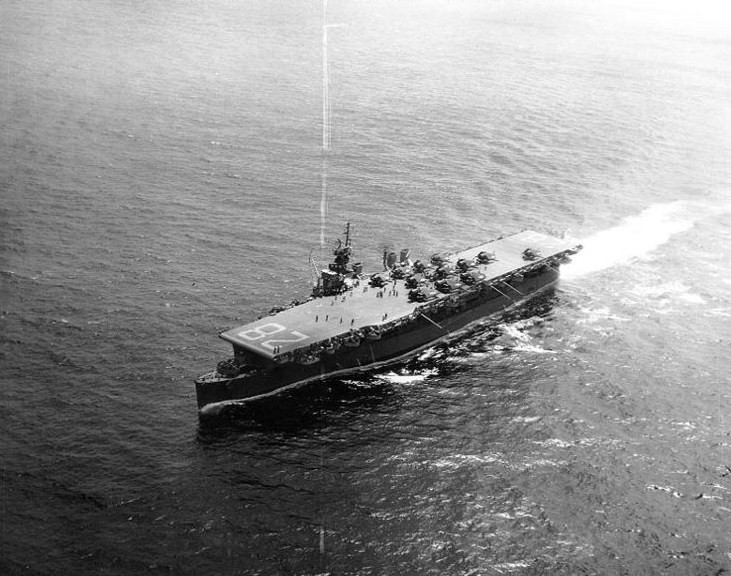
29°55′42″N 90°6′49″W / 29.92833°N 90.11361°W137 USS CABOT (CVL-28) 
June 21, 1990 Foot of Jackson St.
29°55′21″N 90°4′12″W / 29.9225°N 90.07°WAircraft carrier which has been scrapped and no longer exists 138 Vieux Carre Historic District 
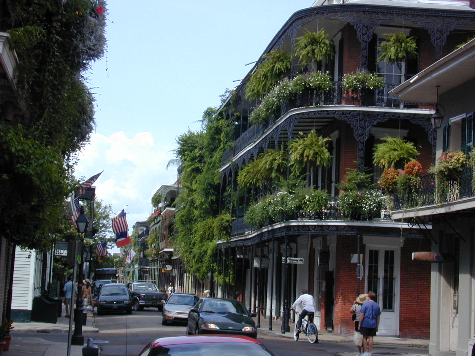
October 15, 1966 Bounded by the Mississippi River, Rampart and Canal Sts., and Esplanade Ave.
29°57′26″N 90°3′50″W / 29.95722°N 90.06389°W139 Walker House 
May 15, 1986 1912 St. Charles Ave.
29°56′7″N 90°4′41″W / 29.93528°N 90.07806°W140 Booker T. Washington High School and Auditorium 
July 17, 2002 1201 S. Roman
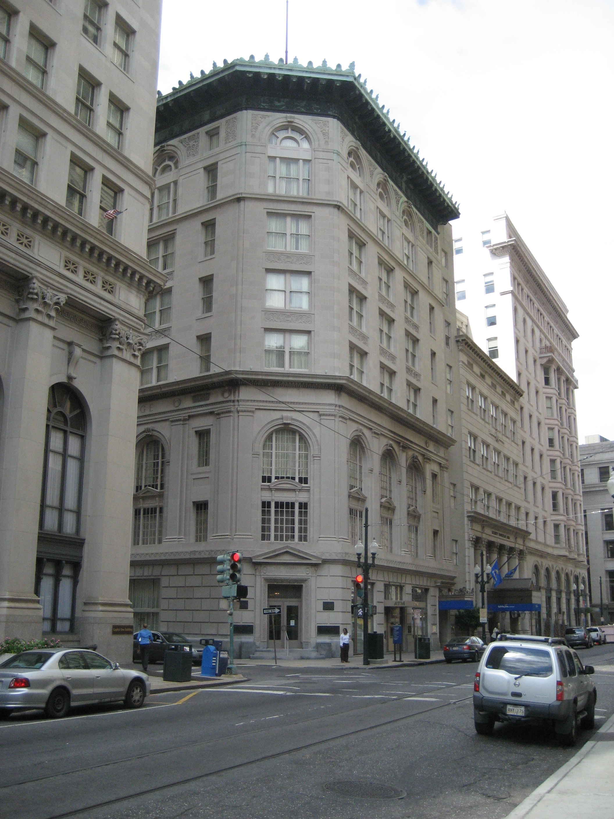
29°57′5″N 90°5′20″W / 29.95139°N 90.08889°W141 Whitney National Bank (Poydras Branch) 
January 18, 1985 Poydras and Camp Sts.
29°56′59″N 90°4′11″W / 29.94972°N 90.06972°W142 Xavier University Main Building, Convent and Library 
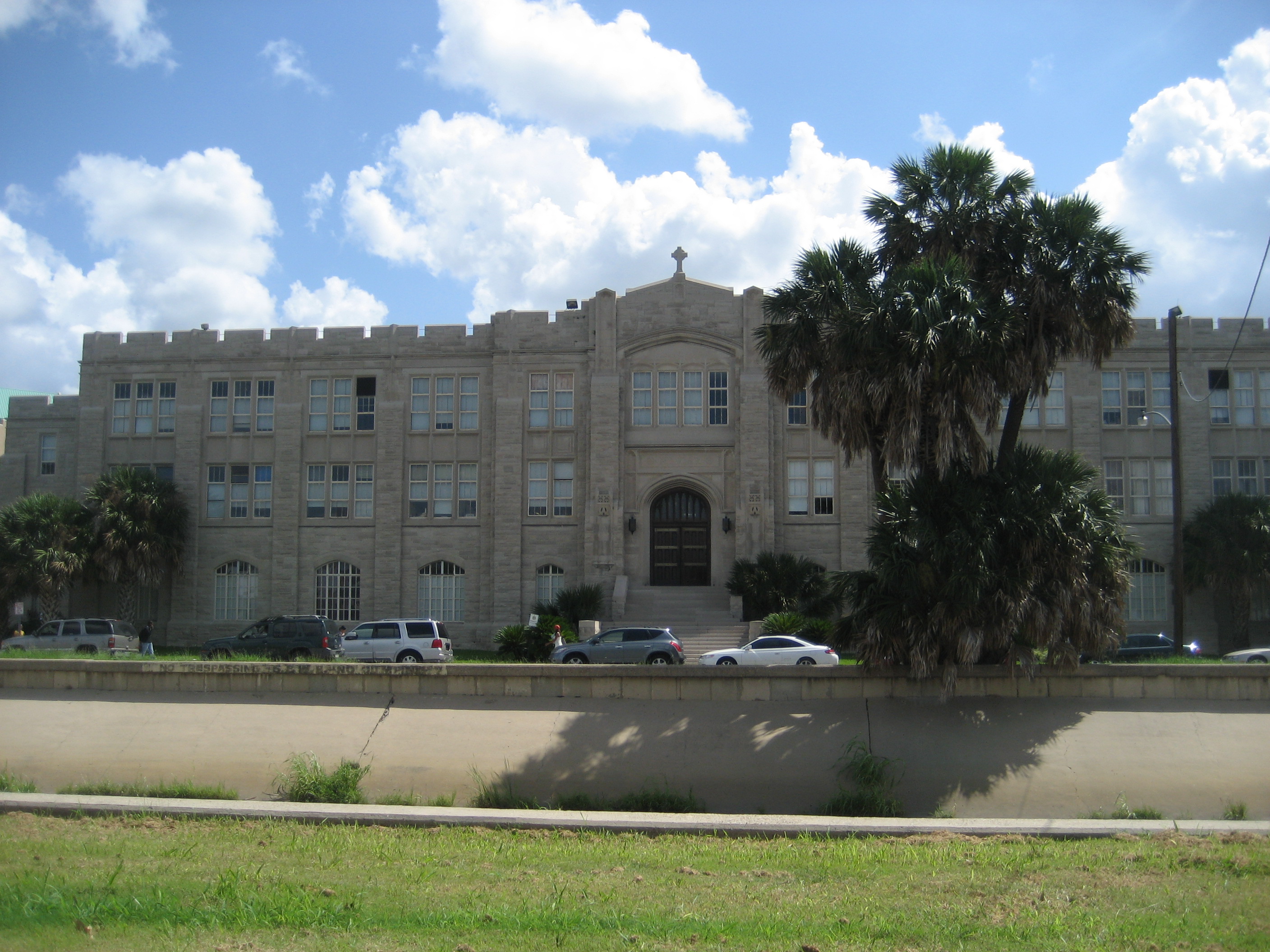
March 3, 2004 1 Drexel Dr.
29°57′57″N 90°6′26″W / 29.96583°N 90.10722°WFormer listing
Landmark name Image Date delisted Location City or Town Summary 1 New Canal Lighthouse 
July 13, 2011 West End Boulevard and Lakeshore Dr.
30°1′36″N 90°6′47″W / 30.02667°N 90.11306°WListed on December 30, 1985 ; collapsed in late 2005 after damage from Hurricane Katrina See also
- List of National Historic Landmarks in Louisiana
- National Register of Historic Places listings in Louisiana
References
- ^ The latitude and longitude information provided in this table was derived originally from the National Register Information System, which has been found to be fairly accurate for about 99% of listings. For about 1% of NRIS original coordinates, experience has shown that one or both coordinates are typos or otherwise extremely far off; some corrections may have been made. A more subtle problem causes many locations to be off by up to 150 yards, depending on location in the country: most NRIS coordinates were derived from tracing out latitude and longitudes off of USGS topographical quadrant maps created under the North American Datum of 1927, which differs from the current, highly accurate WGS84 GPS system used by Google maps. Chicago is about right, but NRIS longitudes in Washington are higher by about 4.5 seconds, and are lower by about 2.0 seconds in Maine. Latitudes differ by about 1.0 second in Florida. Some locations in this table may have been corrected to current GPS standards.
- ^ "National Register of Historic Places: Weekly List Actions". National Park Service, United States Department of the Interior. Retrieved on November 10, 2011.
- ^ Numbers represent an ordering by significant words. Various colorings, defined here, differentiate National Historic Landmark sites and National Register of Historic Places Districts from other NRHP buildings, structures, sites or objects.
- ^ "National Register Information System". National Register of Historic Places. National Park Service. 2009-03-13. http://nrhp.focus.nps.gov/natreg/docs/All_Data.html.
- ^ Location derived from the GNIS feature record for Big Oak Island; the NRIS lists the site as "Address Restricted"
U.S. National Register of Historic Places Topics Lists by states Alabama • Alaska • Arizona • Arkansas • California • Colorado • Connecticut • Delaware • Florida • Georgia • Hawaii • Idaho • Illinois • Indiana • Iowa • Kansas • Kentucky • Louisiana • Maine • Maryland • Massachusetts • Michigan • Minnesota • Mississippi • Missouri • Montana • Nebraska • Nevada • New Hampshire • New Jersey • New Mexico • New York • North Carolina • North Dakota • Ohio • Oklahoma • Oregon • Pennsylvania • Rhode Island • South Carolina • South Dakota • Tennessee • Texas • Utah • Vermont • Virginia • Washington • West Virginia • Wisconsin • WyomingLists by territories Lists by associated states Other City of New Orleans Topics History · Geography · Demographics · Economy · Culture · Healthcare · Media · Music · Sports · Architecture · Tourism · Education · Notable people · Skyscrapers · Streetcars · Flag · Lists

Government Neighborhoods Categories:- Orleans Parish, Louisiana
- National Register of Historic Places in Louisiana by parish
-


Wikimedia Foundation. 2010.