- National Register of Historic Places listings in St. Tammany Parish, Louisiana
-
 Location of St. Tammany Parish in Louisiana
This is a list of the National Register of Historic Places listings in St. Tammany Parish, Louisiana.
This is intended to be a complete list of the properties and districts on the National Register of Historic Places in St. Tammany Parish, Louisiana, United States. The locations of National Register properties and districts for which the latitude and longitude coordinates are included below, may be seen in a Google map.[1]
There are 39 properties and districts listed on the National Register in the parish.
-
- This National Park Service list is complete through NPS recent listings posted November 10, 2011.[2]
Current listings
[3] Landmark name[4] Image Date listed Location City or Town Summary 1 Abita Springs Historic District 
March 12, 1982 Louisiana Highways 36, 59, and 435
30°28′35″N 90°2′13″W / 30.47639°N 90.03694°WAbita Springs 2 Abita Springs Pavilion 
August 19, 1975 Northwestern end of Main St.
30°28′48″N 90°2′25″W / 30.48°N 90.04028°WAbita Springs 3 Arcade Theater August 29, 1997 2247-2251 Carey St.
30°16′23″N 89°47′2″W / 30.27306°N 89.78389°WSlidell 4 Bertus-Ducatel House March 5, 1998 1721 Lakeshore Dr.
30°21′3″N 90°3′52″W / 30.35083°N 90.06444°WMandeville 5 Camp Salmen House 
April 24, 2006 35122 Camp Salmen Rd.
30°17′26″N 89°49′30″W / 30.29056°N 89.825°WSlidell 6 Christ Episcopal Church April 17, 1980 120 N. New Hampshire St.
30°28′20″N 90°5′6″W / 30.47222°N 90.085°WCovington 7 Francois Cousin House (Slidell) 
January 26, 2001 58148 Gwin Rd.
30°16′15″N 89°50′5″W / 30.27083°N 89.83472°WSlidell 8 Francois Cousin House (Lacombe) September 16, 2002 28061 Main St.
30°18′38″N 89°56′6″W / 30.31056°N 89.935°WLacombe 9 Dendinger House September 22, 1992 206 Covington St.
30°24′36″N 90°9′38″W / 30.41°N 90.16056°WMadisonville 10 Dew Drop Social and Benevolent Hall 
September 22, 2000 400 block of Lamarque St.
30°21′20″N 90°3′44″W / 30.35556°N 90.06222°WMandeville 11 Division of St. John Historic District 
December 6, 1982 U.S. Route 190 and Louisiana Highway 21
30°28′33″N 90°5′38″W / 30.47583°N 90.09389°WCovington 12 Flagstaff September 15, 1983 1815 Lakeshore Dr.
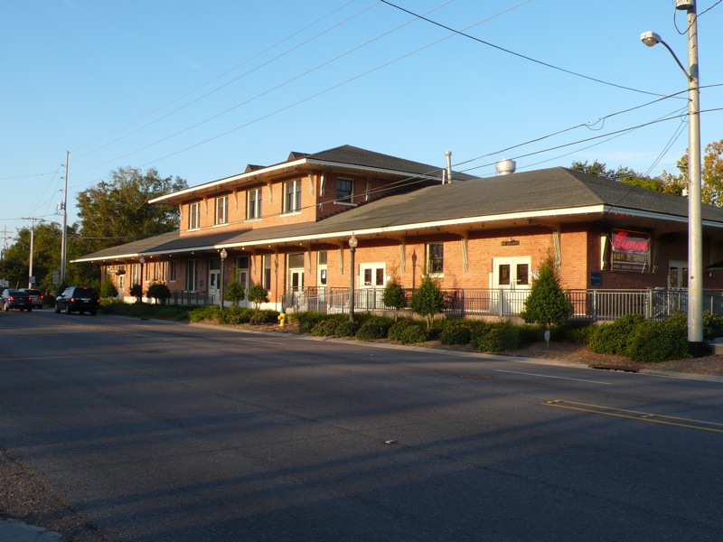
30°21′6″N 90°3′55″W / 30.35167°N 90.06528°WMandeville 13 Fontainebleau State Park 
August 10, 1999 67825 U.S. Route 190
30°20′11″N 90°1′53″W / 30.33639°N 90.03139°WMandeville 14 Frederick House August 11, 1982 238 Vermont St.
30°28′14″N 90°5′48″W / 30.47056°N 90.09667°WCovington 15 Griffin's Bakery December 1, 1997 301 Lafitte St.
30°21′21″N 90°4′3″W / 30.35583°N 90.0675°WMandeville 16 Haaswood Store July 15, 2009 62011 Louisiana Highway 1091
30°20′5.58″N 89°44′52.48″W / 30.3348833°N 89.7479111°WPearl River 17 Jay House May 29, 1998 Facing the Tchefuncte River, within Fairview-Riverside State Park
30°24′28″N 90°8′34″W / 30.40778°N 90.14278°WMadisonville Also known as the "Otis House" 18 Johnson House December 27, 2002 402 Lafitte St.
30°21′28″N 90°4′3″W / 30.35778°N 90.0675°WMandeville 19 Lacombe School November 8, 1990 Junction of St. Mary and 14th Sts.
30°18′56″N 89°56′37″W / 30.31556°N 89.94361°WLacombe 20 Longbranch Annex July 21, 1983 Louisiana Highway 36 and Gordon St.
30°28′54″N 90°2′32″W / 30.48167°N 90.04222°WAbita Springs 21 Longbranch Hotel Complex June 24, 1982 Rangeline Rd.
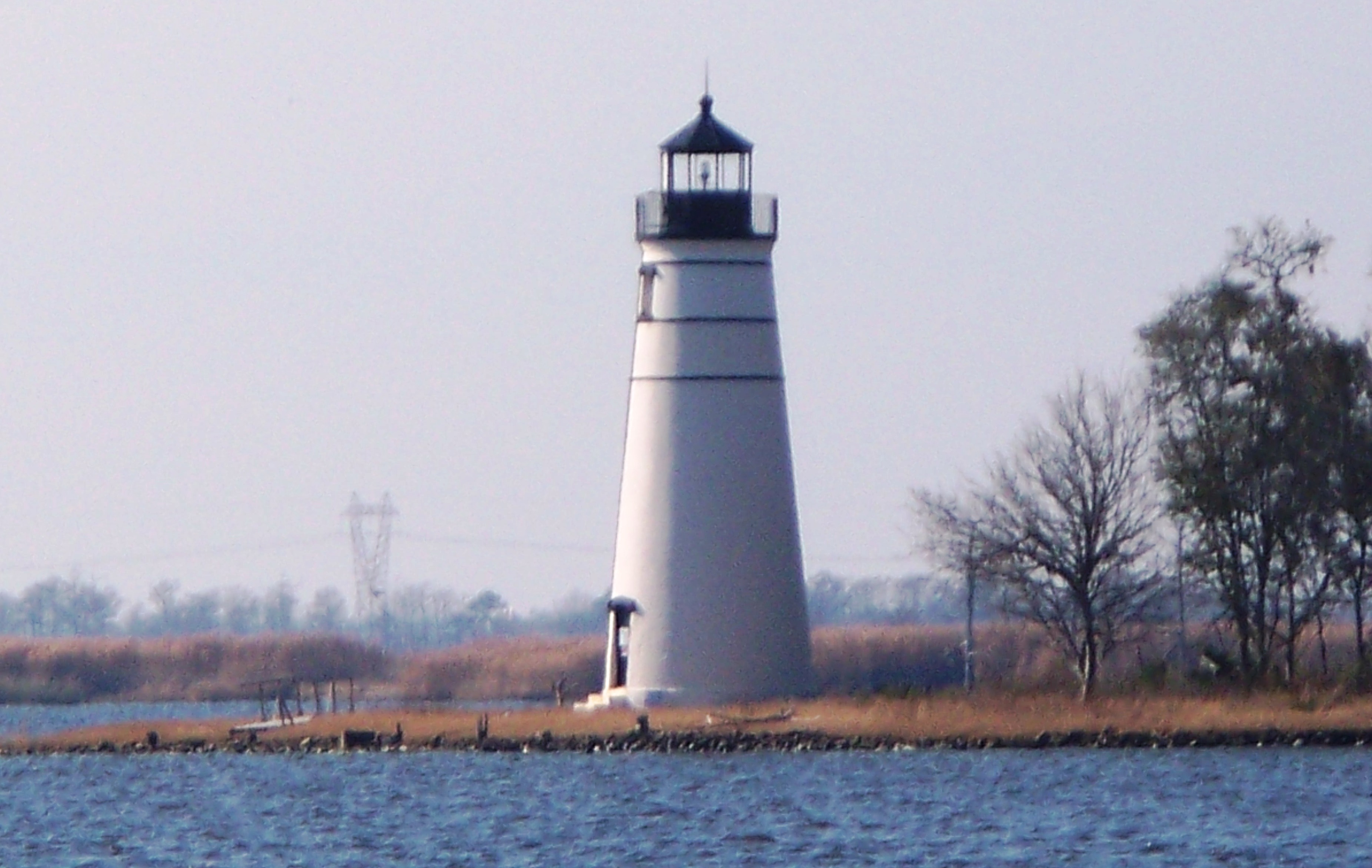
30°29′6″N 90°2′28″W / 30.485°N 90.04111°WAbita Springs 22 Madisonville Bank December 28, 1983 400 Cedar St.
30°24′27″N 90°9′33″W / 30.4075°N 90.15917°WMadisonville 23 Madisonville Boarding House August 16, 1996 703 Main St.
30°24′16″N 90°9′25″W / 30.40444°N 90.15694°WMadisonville 24 Madisonville Town Hall November 8, 1990 203 Cedar
30°24′34″N 90°9′32″W / 30.40944°N 90.15889°WMadisonville 25 McCaleb House June 7, 1990 906 Main St.
30°24′10″N 90°9′25″W / 30.40278°N 90.15694°WMadisonville 26 Moore House April 20, 1983 1717 Lakeshore Dr.
30°21′3″N 90°3′52″W / 30.35083°N 90.06444°WMandeville 27 Morel-Nott House June 6, 1980 Lakefront Dr.
30°21′31″N 90°4′45″W / 30.35861°N 90.07917°WMandeville 28 New Orleans and Northeastern Railroad-New Orleans and Great Northern Railroad Depot 
October 24, 1996 1809 Front St.
30°16′42″N 89°46′57″W / 30.27833°N 89.7825°WSlidell 29 Pottery Hill October 13, 2011 Address Restricted Mandeville 30 Rankin House March 19, 1991 61467 Jacques Lemieux Boulevard
30°20′5″N 90°0′13″W / 30.33472°N 90.00361°WMandeville 31 Saint Joseph Abbey Church March 21, 2007 75376 River Rd.
30°31′35″N 90°6′41″W / 30.52639°N 90.11139°WSaint Benedict 32 Saint Joseph Abbey Refectory March 21, 2007 75376 River Rd.
30°31′39″N 90°6′47″W / 30.5275°N 90.11306°WSaint Benedict 33 Salmen House October 10, 1996 2854 Front St.
30°16′1″N 89°47′18″W / 30.26694°N 89.78833°WSlidell 34 Albert Salmen House January 21, 1993 213 Cleveland Ave.
30°16′8″N 89°47′9″W / 30.26889°N 89.78583°WSlidell 35 Fritz Salmen House November 21, 1991 127 Cleveland Ave.
30°16′10″N 89°47′12″W / 30.26944°N 89.78667°WSlidell 36 Sardy House December 8, 1997 810 Main St.
30°24′12″N 90°9′25″W / 30.40333°N 90.15694°WMadisonville 37 Sunnybrook August 29, 1979 North of Covington on Louisiana Highway 21
30°31′5″N 90°2′51″W / 30.51806°N 90.0475°WCovington 38 Tchefuncte River Range Rear Light 
July 14, 1986 Northern side of Lake Pontchartrain
30°22′44″N 90°10′11″W / 30.37889°N 90.16972°WMadisonville 39 Tchefuncte Site June 22, 2000 Address Restricted Mandeville See also
- List of National Historic Landmarks in Louisiana
- National Register of Historic Places listings in Louisiana
References
- ^ The latitude and longitude information provided in this table was derived originally from the National Register Information System, which has been found to be fairly accurate for about 99% of listings. For about 1% of NRIS original coordinates, experience has shown that one or both coordinates are typos or otherwise extremely far off; some corrections may have been made. A more subtle problem causes many locations to be off by up to 150 yards, depending on location in the country: most NRIS coordinates were derived from tracing out latitude and longitudes off of USGS topographical quadrant maps created under the North American Datum of 1927, which differs from the current, highly accurate WGS84 GPS system used by Google maps. Chicago is about right, but NRIS longitudes in Washington are higher by about 4.5 seconds, and are lower by about 2.0 seconds in Maine. Latitudes differ by about 1.0 second in Florida. Some locations in this table may have been corrected to current GPS standards.
- ^ "National Register of Historic Places: Weekly List Actions". National Park Service, United States Department of the Interior. Retrieved on November 10, 2011.
- ^ Numbers represent an ordering by significant words. Various colorings, defined here, differentiate National Historic Landmark sites and National Register of Historic Places Districts from other NRHP buildings, structures, sites or objects.
- ^ "National Register Information System". National Register of Historic Places. National Park Service. 2009-03-13. http://nrhp.focus.nps.gov/natreg/docs/All_Data.html.
U.S. National Register of Historic Places Topics Lists by states Alabama • Alaska • Arizona • Arkansas • California • Colorado • Connecticut • Delaware • Florida • Georgia • Hawaii • Idaho • Illinois • Indiana • Iowa • Kansas • Kentucky • Louisiana • Maine • Maryland • Massachusetts • Michigan • Minnesota • Mississippi • Missouri • Montana • Nebraska • Nevada • New Hampshire • New Jersey • New Mexico • New York • North Carolina • North Dakota • Ohio • Oklahoma • Oregon • Pennsylvania • Rhode Island • South Carolina • South Dakota • Tennessee • Texas • Utah • Vermont • Virginia • Washington • West Virginia • Wisconsin • WyomingLists by territories Lists by associated states Other Municipalities and communities of St. Tammany Parish, Louisiana Cities 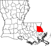
Towns Villages CDPs Unincorporated
communitiesBush | Goodbee
Categories:- St. Tammany Parish, Louisiana
- National Register of Historic Places in Louisiana by parish
- Buildings and structures in St. Tammany Parish, Louisiana
-


Wikimedia Foundation. 2010.