- U.S. Route 190
Infobox U.S. Route
article_route=190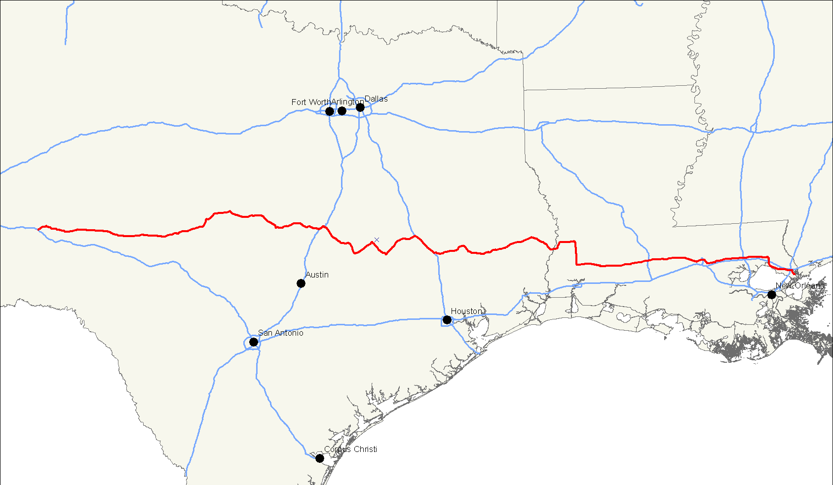
length_mi=875Droz, Robert V. [http://www.us-highways.com/usbt.htm U.S. Highways : From US 1 to (US 830)] . URL accessed6 March 2006 .]
length_km=1,408
yrcom=1926
direction_a=West
direction_b=East
from=Jct|state=TX|I|10|FM|305 inPecos County, TX
to=Jct|state=LA|US|90 at Slidell, LA
spur_of=90U.S. Route 190, also known as the
Ronald Reagan memorial highway, is an east-westUnited States highway . It evolved from the shortest of intrastate routes in 1926 to a length comparable to a mainInterstate highway route, leading from the Piney forests ofLouisiana to the WestTexas desert.The highway's eastern terminus is in the
bayou s nearSlidell, Louisiana at an intersection withU.S. Route 90 . This junction was once known as the "White Kitchen" after a restaurant that was once located there. [ [http://www.jjaudubon.net/page11.html White Kitchen Birding ] ] [ [http://ucmmuseum.com/hwy90la7.htm Louisiana] ] Its western terminus is in the middle ofPecos County, Texas at an intersection with Interstate 10, mi to km|20|abbr=yes from the tiny town of Iraan.Route description
Louisiana
Texas
History
In the original 1926 plan, US 190 served the purpose of modern-day
Interstate 12 , as the road around the north side ofLake Pontchartrain .In 1935, the route was extended across the
Mississippi River , taking over a section ofU.S. Route 71 . It then ended in the West Texas town ofBrady, Texas at an intersection withU.S. Route 87 .U.S. 190 was assigned an additional mi to km|150 across the sparsely-populated area south of
San Angelo, Texas in 1979.The current U.S. 190 near Krotz Springs, La. is a new highway. The road was built as an elevated bypass around the road called Old 190. The other bypass is the old bridge that once crossed the
Morganza Spillway . It is bypassed by a single four-lane highway.The route is now used as an alternate route for Interstate 10, across the Atchafalaya Expressway. Traffic can be diverted along
Louisiana Highway 975 toKrotz Springs , andLouisiana Highway 76 to US 190/La. 1.ee also
Other designations for
U.S. 190 * Acadiana Trail - see also
U.S. 190 in Louisiana
* Evangeline Freeway - see alsoU.S. 190 in Louisiana
* Central Texas Expressway - see alsoU.S. 190 in Texas Related routes
*
U.S. Route 90
*U.S. Route 290 References
External links
* [http://www.geocities.com/Yosemite%2FFalls%2F3369/HwyEnds/End190/end190.htm Endpoints of US highways]
Wikimedia Foundation. 2010.