- National Register of Historic Places listings in Marshall County, South Dakota
-
 Location of Marshall County in South Dakota
This is a list of the National Register of Historic Places listings in Marshall County, South Dakota.
This is intended to be a complete list of the properties and districts on the National Register of Historic Places in Marshall County, South Dakota, United States. The locations of National Register properties and districts for which the latitude and longitude coordinates are included below, may be seen in a Google map.[1]
There are 6 properties and districts listed on the National Register in the county.
-
- This National Park Service list is complete through NPS recent listings posted November 10, 2011.[2]
Current listings
[3] Landmark name [4] Image Date listed Location City or town Summary 1 Britton Clinic and Hospital February 19, 2008 Northeastern corner of Main and 7th Sts.
45°47′40″N 97°45′00″W / 45.794444°N 97.75°WBritton 2 First Presbyterian Church of Langford November 1, 1991 Junction of Main and Findley Sts.
45°36′10″N 97°49′56″W / 45.602778°N 97.832222°WLangford 3 Fort Sisseton May 10, 1973 Southeast of Britton
45°39′28″N 97°31′50″W / 45.657675°N 97.530497°WBritton 4 William T. and Rebecca Glendenning House February 19, 2008 204 9th Ave.
45°47′57″N 97°45′14″W / 45.799167°N 97.753889°WBritton 5 Marshall County Courthouse February 14, 2006 911 Vander Horck Ave.
45°47′34″N 97°45′15″W / 45.792778°N 97.754167°WBritton 6 Palestine Evangelical Lutheran Church March 5, 1982 Northeast of Veblen
45°55′17″N 97°15′51″W / 45.921389°N 97.264167°WVeblen See also
- List of National Historic Landmarks in South Dakota
- National Register of Historic Places listings in South Dakota
References
- ^ The latitude and longitude information provided in this table was derived originally from the National Register Information System, which has been found to be fairly accurate for about 99% of listings. For about 1% of NRIS original coordinates, experience has shown that one or both coordinates are typos or otherwise extremely far off; some corrections may have been made. A more subtle problem causes many locations to be off by up to 150 yards, depending on location in the country: most NRIS coordinates were derived from tracing out latitude and longitudes off of USGS topographical quadrant maps created under the North American Datum of 1927, which differs from the current, highly accurate WGS84 GPS system used by Google maps. Chicago is about right, but NRIS longitudes in Washington are higher by about 4.5 seconds, and are lower by about 2.0 seconds in Maine. Latitudes differ by about 1.0 second in Florida. Some locations in this table may have been corrected to current GPS standards.
- ^ "National Register of Historic Places: Weekly List Actions". National Park Service, United States Department of the Interior. Retrieved on November 10, 2011.
- ^ Numbers represent an ordering by significant words. Various colorings, defined here, differentiate National Historic Landmark sites and National Register of Historic Places Districts from other NRHP buildings, structures, sites or objects.
- ^ "National Register Information System". National Register of Historic Places. National Park Service. . http://nrhp.focus.nps.gov/natreg/docs/All_Data.html.
U.S. National Register of Historic Places Topics Lists by states Alabama • Alaska • Arizona • Arkansas • California • Colorado • Connecticut • Delaware • Florida • Georgia • Hawaii • Idaho • Illinois • Indiana • Iowa • Kansas • Kentucky • Louisiana • Maine • Maryland • Massachusetts • Michigan • Minnesota • Mississippi • Missouri • Montana • Nebraska • Nevada • New Hampshire • New Jersey • New Mexico • New York • North Carolina • North Dakota • Ohio • Oklahoma • Oregon • Pennsylvania • Rhode Island • South Carolina • South Dakota • Tennessee • Texas • Utah • Vermont • Virginia • Washington • West Virginia • Wisconsin • WyomingLists by territories Lists by associated states Other Municipalities and communities of Marshall County, South Dakota Cities 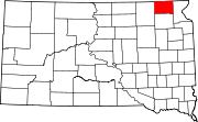
Towns Unincorporated
communityIndian reservation Footnotes ‡This populated place also has portions in an adjacent county or counties
Categories:- Marshall County, South Dakota
- National Register of Historic Places in South Dakota by county
- Buildings and structures in Marshall County, South Dakota
-

Wikimedia Foundation. 2010.