- Zaleski Mound Group
-
Ranger Station Mound
Markham Mound
Zaleski Methodist Church Mound

Location: Entrance to Zaleski State Forest (R.S.)a[›][2]:1369
Unspecified (M.)
114 Broadway St. (Z.M.C.)[3]Nearest city: Zaleski, Ohio Coordinates: 39°17′14.4″N 82°23′42″W / 39.287333°N 82.395°W39°17′2.1″N 82°23′44.4″W / 39.283917°N 82.395667°W (Z.M.C.) Area: 1 acre (0.40 ha) (each) Governing body: State (R.S.)
Private (M.)
Private (Z.M.C.)NRHP Reference#: 74001641 (R.S.)
74001640 (M.)
74001642 (Z.M.C.)[1]Added to NRHP: July 15, 1974 (R.S.)
May 3, 1974 (M.)
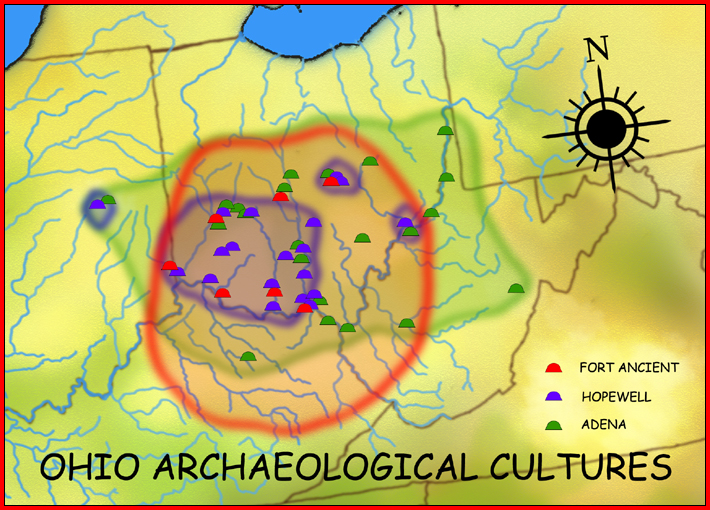
July 15, 1974 (Z.M.C.)The Zaleski Mound Group is a collection of three burial mounds in the village of Zaleski, Ohio, United States. Built by people of the prehistoric Adena culture, these earthworks are valuable archaeological sites.
Contents
Mound 1, Ranger Station
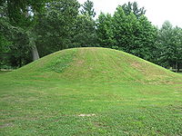 Ranger Station Mound
The largest of the three Zaleski mounds, the Ranger Station Mound is a conical structure located within the bounds of Zaleski State Forest. Located in a community park by the entrance to the forest, the mound is tree-covered with few changes from its original state. At a height of 14.4 feet (4.4 m), it is the largest mound in the Zaleski Mound Group.[2]:1369
In the 1850s, local residents dug into the mound and placed a cold cellar on its northern side; in the process, they uncovered a skeleton that was given into the possession of a local doctor. The changing needs of the state forest led the Ohio Department of Natural Resources to remove the cellar in 1959; after the intrusion was taken out of its place, the mound was restored to its original shape.[2]:1369 In spite of the digging needed to create the cellar, the Ranger Station Mound is the best-preserved of the mounds in the Zaleski Group.[2]:1369 No archaeological excavation has ever been carried out at Mound No. 3, the Methodist Church Mound, but it has possibly been damaged by the construction of a fence line.[2]:1371 Due to its size and location, the Ranger Station Mound may contain more valuable artifacts than either of the other two mounds.[2]:1369
Mound 2, Markham
The Markham Mound is a privately owned structure. Despite its proximity to the other two mounds, no evidence is present of any ancient village site near the mound.[2]:1368
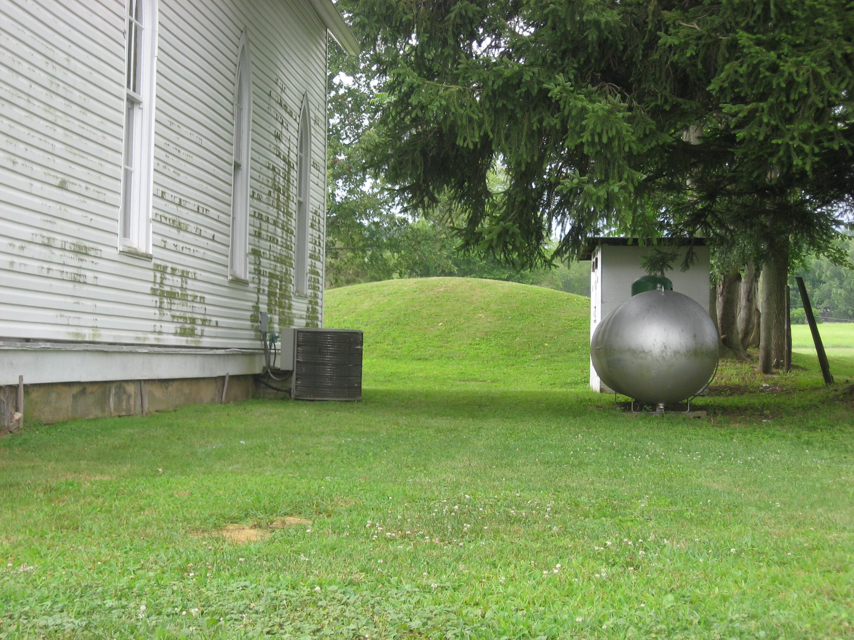
Mound 3, Methodist Church
 View of the Methodist Church Mound
The Zaleski Methodist Church Mound is a wide, low mound in the shape of an ellipse. Measuring 60 feet (18 m) long and 53 feet (16 m) wide, it is only slightly more than 7 feet (2.1 m) tall. At the time of white settlement, it may have been taller; the presence of a fence across the top suggests that the activity of settlers may have reduced it.[2]:1371
Located immediately behind the Zaleski United Methodist Church, it may be the most valuable of the six mounds that originally composed the Zaleski Mound Group. Three of the six have been destroyed, while both the Ranger Station Mound and the Markham Mound have been disturbed since the time of white settlement. As the Zaleski Methodist Church Mound shows little evidence of damage, it presumably contains the grave goods that were originally buried within.[2]:1371
Recognition
In 1974, the three mounds were listed on the National Register of Historic Places: Mound 2 on May 3, and the others on July 15. All three received this designation because they were seen as important archaeological sites for understanding the Adena people that built them.[1] The three mounds that have been destroyed were not listed, because archaeological sites that have been greatly disturbed are not eligible for inclusion on the Register.[4] The Register also includes one other archaeological site in Vinton County and one building in Zaleski: a mound near Londonderry known as the "Ratcliffe Mound," and the Masonic Lodge No. 472 respectively.[1]
Notes
^ a: When no mound abbreviation is given, Ranger Station is to be assumed.
References
- ^ a b c "National Register Information System". National Register of Historic Places. National Park Service. 2009-03-13. http://nrhp.focus.nps.gov/natreg/docs/All_Data.html.
- ^ a b c d e f g h i Owen, Lorrie K., ed. Dictionary of Ohio Historic Places. Vol. 2. St. Clair Shores: Somerset, 1999.
- ^ Location given is that of Zaleski United Methodist Church as given by this United Methodist Church website.
- ^ How to Apply the National Register Criteria for Evaluation, National Park Service, 1997, 21. Accessed 2010-07-15.
External links
List of Adena culture sites · Woodland period · Mound builder (people) · List of archaeological periods (North America)Ohio Sites Adena Mound · Austin Brown Mound · Arledge Mounds I and II · Beam Farm · Clemmons Mound · Conrad Mound Archeological Site · Coon Hunters Mound · George Deffenbaugh Mound · Enon Mound · Fortner Mounds · Great Mound · Highbanks Metropolitan Park Mounds I and II · Hillside Haven Mound · Hodgen's Cemetery Mound · Horn Mound · Hurley Mound · Jackson Mound · Karshner Mound · Kinzer Mound · Luthor List Mound · Miamisburg Mound · Odd Fellows' Cemetery Mound · Old Maid's Orchard Mound · Orators Mound · Carl Potter Mound · Reeves Mound · D.S. Rose Mound · Ross Trails Adena Circle · Short Woods Park Mound · Snead Mound · Spruce Run Earthworks · David Stitt Mound · Story Mound (Cincinnati) · Story Mound (Chillicothe) · Wolf Plains Group · Zaleski Mound Group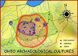
Kentucky Sites West Virginia Sites Indiana Sites Related topics · Ancient Monuments of the Mississippi Valley · burial mound · Eastern Agricultural Complex · Hopewell traditionNational Register of Historic Places in Vinton County, Ohio Properties Eakin Mill Covered Bridge | Hope Furnace | Markham Mound | Masonic Lodge No. 472 | Mt. Olive Road Covered Bridge | Ponn Humpback Covered Bridge | Ranger Station Mound | Ratcliffe Mound | Trinity Episcopal Church | Zaleski Methodist Church Mound

U.S. National Register of Historic Places Topics Lists by states Alabama • Alaska • Arizona • Arkansas • California • Colorado • Connecticut • Delaware • Florida • Georgia • Hawaii • Idaho • Illinois • Indiana • Iowa • Kansas • Kentucky • Louisiana • Maine • Maryland • Massachusetts • Michigan • Minnesota • Mississippi • Missouri • Montana • Nebraska • Nevada • New Hampshire • New Jersey • New Mexico • New York • North Carolina • North Dakota • Ohio • Oklahoma • Oregon • Pennsylvania • Rhode Island • South Carolina • South Dakota • Tennessee • Texas • Utah • Vermont • Virginia • Washington • West Virginia • Wisconsin • WyomingLists by territories Lists by associated states Other Categories:- Adena culture
- Archaeological sites in Ohio
- Archaeological sites on the National Register of Historic Places in Ohio
- Geography of Vinton County, Ohio


Wikimedia Foundation. 2010.