- Mount Horeb Earthworks Complex
-
Mount Horeb Earthworks Complex Location 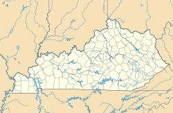

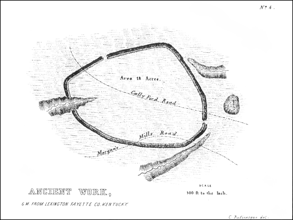
Coordinates 38°9′32.11″N 84°27′56.30″W / 38.1589194°N 84.465639°WCoordinates: 38°9′32.11″N 84°27′56.30″W / 38.1589194°N 84.465639°W Period Adena culture Country United States Region Fayette County, Kentucky The Mount Horeb Earthworks Complex is an Adena culture group of earthworks in Fayette County, Kentucky. It consists of two major components, the Mount Horeb Site 1 and the Peter Village enclosure, and several smaller features including the Grimes Village site, Tarleton Mound, and Fisher Mound.[1] The Peter Village and Grimes Village enclosures were mapped by Rafinesque and featured in Squier and Davis's landmark publication Ancient Monuments of the Mississippi Valley in 1848 as Plate XIV Figures 3 and 4.[2]
Contents
Mount Horeb Site 1
This site is the center piece of the University of Kentuckys Adena Park and is located on a bank 75 feet (23 m) above Elkhorn Creek. It is a perfectly circlular 105 feet (32 m) diameter platform, surrounded by a 45 feet (14 m) wide ditch and a 13 feet (4.0 m) wide enclosure with a 33 feet (10 m) wide entryway facing to the west. In 1939 the site was excavated by William S. Webb and the Works Projects Administration. They discovered the remains of a 97 feet (30 m) diameter circular wooden structure on the platform, which Webb speculated was a ceremonial center for a nearby clan. In 1936 the site and 6 acres (24,000 m2) were paid for through private dontations and transferred to the Kentucky Archaeological Society. It is currently owned and operated by the University of Kentucky as part of the Campus Recreation Department.[1]
Peter Village enclosure
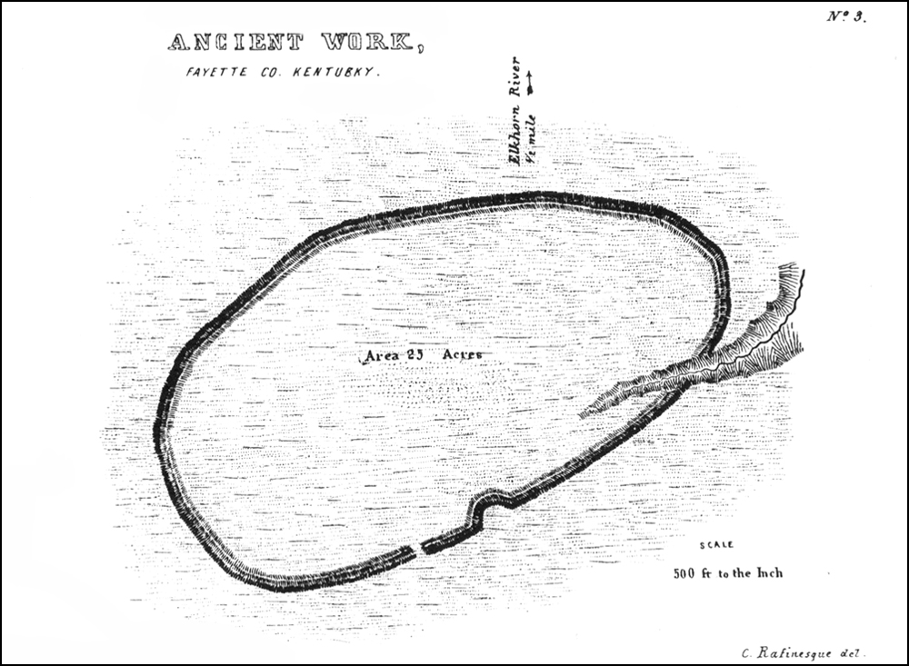
The earliest occupation at this site is 300 to 200 BCE and is considered to be a pre-Adena site for harvesting and processing galena, which occurs naturally nearby. At this time the site had an earthen enclosure and a palisade and later a 2 meter deep ditch.[3] Rafinesque described the site as a twenty sided icosogonal polygon 3,767 feet (1,148 m) long with a 15 feet (4.6 m) wide 4 feet (1.2 m) to 8 feet (2.4 m) deep ditch surrounding it. An entryway to the enclosure was located to the south.[1]
Images in Squier and Davis
-

Peter Village enclosure
-

Grimes Village enclosure
See also
References
- ^ a b c Susan L. Woodward and Jerry N. McDonald (2002). Indian Mounds of the Middle Ohio Valley. McDonald and Woodward Publishing. pp. 109–113. ISBN 0-939923-72-6.
- ^ E. G. Squier and E. H. Davis (1848). Ancient Monuments of the Mississippi Valley. Smithsonian Institution.
- ^ Lewis, R. Barry (1996). Kentucky Archaeology. University Press of Kentucky. pp. 99–100. ISBN 0-8131-1907-3.
External links
List of Adena culture sites · Woodland period · Mound builder (people) · List of archaeological periods (North America) Ohio Sites Adena Mound · Austin Brown Mound · Arledge Mounds I and II · Beam Farm · Clemmons Mound · Conrad Mound Archeological Site · Coon Hunters Mound · George Deffenbaugh Mound · Enon Mound · Fortner Mounds · Great Mound · Highbanks Metropolitan Park Mounds I and II · Hillside Haven Mound · Hodgen's Cemetery Mound · Horn Mound · Hurley Mound · Jackson Mound · Karshner Mound · Kinzer Mound · Luthor List Mound · Miamisburg Mound · Odd Fellows' Cemetery Mound · Old Maid's Orchard Mound · Orators Mound · Carl Potter Mound · Reeves Mound · D.S. Rose Mound · Ross Trails Adena Circle · Short Woods Park Mound · Snead Mound · Spruce Run Earthworks · David Stitt Mound · Story Mound (Cincinnati) · Story Mound (Chillicothe) · Wolf Plains Group · Zaleski Mound Group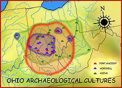
Kentucky Sites Biggs Site · Gaitskill Mound · Mount Horeb Earthworks Complex · Round Hill Mound ·West Virginia Sites Indiana Sites Related topics · Ancient Monuments of the Mississippi Valley · burial mound · Eastern Agricultural Complex · Hopewell tradition Categories:- Adena culture
- Archaeological sites in Kentucky
- National Register of Historic Places in Fayette County, Kentucky
- Buildings and structures in Fayette County, Kentucky
- Archaeological sites on the National Register of Historic Places in Kentucky
- Indigenous peoples of North America stubs
-


Wikimedia Foundation. 2010.