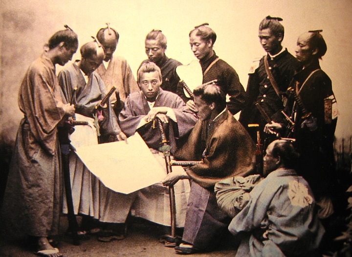
- Demographics of Japan before Meiji Restoration
-
History of Japan 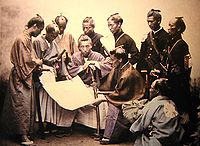
- Paleolithic 35,000–14,000 BC
- Jōmon period 14,000–300 BC
- Yayoi period 300 BC–250 AD
- Kofun period 250–538
- Asuka period 538–710
- Nara period 710–794
- Heian period 794–1185
- Kamakura period
1185–1333- Kenmu restoration
1333–1336
- Kenmu restoration
- Muromachi period (Ashikaga)
1336–1573- Nanboku-chō period
1336–1392 - Sengoku period
1467–1573
- Nanboku-chō period
- Azuchi–Momoyama period
1568–1603 - Edo period (Tokugawa)
1603–1868 - Meiji period 1868–1912
- Taishō period 1912–1926
- Shōwa period 1926–1989
- Heisei period 1989–present
- Lost Decade
- Empire of Japan (prewar)
1868–1945 (political entity) - State of Japan (postwar)
1945–present (political entity) - Economic history
-
- History of currency
- Educational history
- Military history
- Naval history
- History of seismicity
This article is about the demographic features of the population of Japan before Meiji Restoration.
Contents
Population of Japan before Edo era
Total population
Before the establishment of Shūmon Ninbetsu Aratame Chō (宗門人別改帳 religious and poulation investigation registers) system by the Tokugawa shogunate, several less reliable sources remain upon which an estimate of the population of Japan can be made. The first record of the population of Japan is the "Records of Three Kingdoms" (simplified Chinese: 三国志; traditional Chinese: 三國志; pinyin: Sānguó Zhì), where the number of houses in eight countries of Wō (Wa (倭 Japan, Japanese)) was described as 159,000.
The household registration system (Hukou (simplified Chinese: 户口; traditional Chinese: 戶口; pinyin: hùkǒu) or Huji (simplified Chinese: 户籍; traditional Chinese: 戶籍; pinyin: hùjí)) was introduced from ancient China to Japan during the 7th century, which is called koseki (戸籍 family registries) in Japanese. According to "Nihon Shoki (日本書記)", the first koseki system named Kōgo no Nen Jaku (庚午年籍) or Kōin no Nen Jaku (庚寅年籍) was established in 670 or 690, which was to be rechecked every 6 years. However, most of the original koseki texts were lost because they were to be preserved only 30 years. The oldest koseki fragments which were reused as reinforcement papers (Shihai Monjo (紙背文書 scroop document)) reserved in Shōsōin (正倉院) records names, ages and estates of 124 persons including slaves in a village named Kawabe no Sato (川辺里) (present day Shima, Fukuoka). A discarded paper coated by lacquer (Urushigami Monjo (漆紙文書 lacquer paper document)) found in Kanoko C Ruins (鹿ノ子C遺跡), Ishioka, Ibaraki records that the total population of families of taxpayers in Hitachi no kuni (常陸国) was 191,660 (excluding families of officers, families of workers for Shintō shrines and slaves) in 795, which is the only reliable remaining census recorded for a whole Province before Edo period. The ancient koseki system was later collapsed during early Heian period, when noblemen got power as landowners of Shōen.
The following estimates by different scholars are based upon the number of houses, villages, kokudaka, areas of rice field and soldiers which were recorded in "Wamyō Ruijushō (和名類聚抄)" (10th century), "Record of Sung (Chinese: 宋史; pinyin: Sòng Shǐ)", "Shūgaishō (拾芥抄)" (14th century), "Tenshōki (天正記)" (late 16th century), "Tōdaiki (当代記)" (earyl 17th century), or fragment papers of Shōsōin (8th century) and others, as well as remnants of specific periods.
Estimated population of Japan before Edo period. Year Estimated
Population
by McEvedy & Jones
(1978)[1]Estimated
Population
by Kitō
(1996)[2]Estimated
Population
by Biraben
(2005)[3]Estimated
Population
by Farris
(2006)[4]6100 BC 20,100 3200 BC 105,500 2300 BC 261,300 1300 BC 160,300 900 BC 75,800 400 BC 100,000 200 BC 100,000 200,000 1 AD 300,000 300,000 200 700,000 594,900 500,000 400 1,500,000 1,500,000 500 2,000,000 600 3,000,000 4,000,000 700 5,000,000 715 4,512,200 730 5,800,000–
6,400,000800 4,000,000 5,506,200 6,000,000 900 6,441,400 7,000,000 950 4,400,000–
5,600,0001000 4,500,000 7,000,000 1100 5,750,000 7,000,000 1150 6,836,900 5,500,000–
6,300,0001200 7,500,000 6,000,000 1250 6,000,000 1280 5,700,000–
6,200,0001300 9,750,000 7,000,000 1340 7,000,000 1400 12,500,000 8,000,000 1450 9,600,000–
10,500,0001500 17,000,000 8,000,000 1600 22,000,000 12,273,000 12,000,000 15,000,000–
17,000,0001650 25,000,000 17,497,900 1700 29,000,000 28,287,200 28,000,000 Urban population
Since Kyōtō (or Heian-kyō) became the capital of Japan in 794, Kyōtō has been one of the most important cities in Japan. Hiraizumi and Kamakura flourished under Northern Fujiwara clans (during 12th century) and Kamakura shogunate (1192 to 1333), respectively. The urban of Kyōtō suffered from the Ōnin War (1467 to 1477) and split into two districts, but coalesced into a great city of more than 400,000 inhabitants after the end of Sengoku period. The Christian missionaries led by Francis Xavier reported that the number of houses in Kyōtō, Yamaguchi or Hakata was more than 90,000, more than 10,000 or 10,000, respectively, in the late 16th century according to History of Japan written by Luís Fróis. After the unification of Japan by Toyotomi Hideyoshi, Ōsaka grew into the populous city with tens of thousand people. Several castle towns also began to grow, where samurai classes were settled.
Estimated population of urbans before Edo era (Chandler, 1987).[5] Year Asuka Heijō-kyō (Nara)
Heian-kyō (Kyōtō)
Hiraizumi Hakata Kamakura Yamaguchi Sakai Ōsaka Sumpu (Shizuoka)
Edo (Tōkyō)
Kanazawa 622 50,000–
60,000750 100,000 800 200,000 900 200,000 925 200,000 1000 175,000 1100 175,000 1150 150,000 50,000 9,000 1200 100,000 [6] 175,000 1250 70,000 [6] 200,000 1300 40,000 [6] 200,000 1350 [7] 8,000 150,000 1400 150,000 40,000 1450 8,000 150,000 (1471)
50,00035,000 1500 40,000 30,000 35,000 30,000 25,000–
26,0001550 10,000 100,000 (1570)
17,00060,000 60,000 [7](1562)
10,000[7](1530)
10,0001575 300,000 (1579)
35,00090,000 75,000 (1583)
100,0001600 300,000 50,000 80,000 (1582)
82,000[8] 280,000 100,000 60,000 50,000 Population of Japan during Edo era and early Meiji era (1600 to 1873)
Total population
After the Shimabara Rebellion, several daimyo adopted certification systems where all the individuals were to be registered to temples and shrines to avoid Christianity. The Danka system (or terauke seido (寺請制度 temple-certification system)) was officially set by Tokugawa shogunate in 1664, and demographic data of individuals registered to temples and shrines (Shūmon Ninbetsu Aratame Chō) were recorded. After decades, Tokugawa Yoshimune decided to survey the total population of Japan and ordered to collect demographic data of all the domains (han (藩)) and shogunate territories (tenryō (天領)). The first census was surveyed every six years since 1721 and finished in 1852, because the confusion after the Perry Expedition and death of Tokugawa Ieyoshi in 1853 postponed the calculation process of the demographic data collected in 1852, according to Suijin Roku (吹塵録) edited by (Katsu Kaishū (勝海舟).
Some of population censuses during Edo era remain recorded in diaries or official texts as below. The population of samurai class and their servants as well as imperial families and noblemen was officially excluded from the census. In addition, the demographic data were summarized by individual domains according to their rules, where babies and children, Buddhist monks, nuns and Shintō priests, discriminated classes of eta and hinin were sometimes excluded from the total population. Unregistered people were also excluded.
The estimated population of Japan in 1600 ranges from 11 to 22 million, then a rapid population growth took place during the early Edo era to bring Japan to a country of about 30 million inhabitants by 1721,[9] though more precise total population estimates remain arguable.
Historical demographics of Japan compiled by Tokugawa Shogunate and Meiji Government. Year in
Year in
No. of
Bakufu
CensusTotal Male Female Sources Estimated
Population
(17% added)
by Biraben
(1993)[10]Estimated
Population
(20% added)
by Kito
(1996)[2]1721 Kyōhō 6 1st 26,065,425 Chikkyō Yohitsu Besshū (竹橋余筆別集)
(Ōta Nampo (大田南畝)), Sanka Manroku (三暇謾録)30,496,900 31,278,500 1726 Kyōhō 11 2nd 26,548,998 Chikkyō Yohitsu Besshū, Suijin Roku 31,104,400 1732 Kyōhō 17 3rd 26,921,816 14,407,107 12,514,709 Chikkyō Yohitsu Besshū, Suijinroku,
Kinotomi Zakki (乙巳雑記)31,498,500 1744 Enkyō 3 5th 26,153,450 Kanchū Hisaku (官中秘策)
(Nishiyama Genbun (西山元文))30,599,500 1750 Kan'en 3 6th 25,917,830 13,818,654 12,099,176 Kanchū Hisaku, Suijinroku,
Kan-en Sannen Okuni Jinkō Hyō (寛延三年御国人口表)30,323,900 31,010,800 1756 Hōreki 6 7th 26,070,712 13,833,311 12,228,919 Kanchū Hisaku, Chiri Shi (地理誌), Koku Shi (国史)
Nihon Kokugun Enkaku Kō (日本国郡沿革考)[11]30,502,700 31,282,500 1762 Hōreki 12 8th 25,921,458 13,785,400 12,136,058 Suijinroku 30,328,100 1768 Meiwa 5 9th 26,252,057 Suijinroku 30,714,900 1774 An'ei 3 10th 25,990,451 Suijinroku 30,408,800 1780 An'ei 9 11th 26,010,600 Suijinroku 30,432,400 1786 Tenmei 6 12th 25,086,466 13,230,656 11,855,810 Suijinroku,
Tenmei Kansei Ninzū Chō (天明寛政人数帳)29,351,200 30,103,800 1792 Kansei 4 13th 24,891,441 13,034,521 11,856,920 Kasshi Yawa (甲子夜話) (Matsuura Seizan (松浦静山)),
Suijingorku, Kansei Yo-nen Shokoku Ninzū Chō (寛政四年諸国人数帳)29,123,000 29,869,700 1798 Kansei 10 14th 25,471,033 13,360,520 12,110,513 Kasshi Yawa, Suijinroku,
Kansei Jū-nen Oyobi Bunsei Go-nen Kunibetsu Ninzū Chō (寛政十年及文政五年国別人数帳)29,801,100 30,565,200 1804 Bunka 1 15th 25,621,957 13,427,249 12,194,708 Suijinroku,
Tenmei Kansei Ninzū Chō (天明寛政人数帳)29,977,690 30,746,400 1822 Bunsei 5 18th 26,602,110 13,894,436 12,707,674 Tokugawa Rizai Kaiyō (徳川理財会要),
Kansei Jū-nen Oyobi Bunsei Go-nen Kunibetsu Ninzū Chō31,124,500 31,913,500 1828 Bunsei 11 19th 27,201,400 14,160,736 13,040,664 Bunkyōkō Jitsuroku (文恭公実録),
Tokugawa Rizai Kaiyō, Taihei Nenpyō (泰平年表)31,825,600 32,625,800 1834 Tenpo 5 20th 27,063,907 14,053,455 13,010,452 Tenpō Go-nen Kōgō Shokoku Ninzū-Chō (天保午年諸国人数帳) 31,664,800 32,476,700 1840 Tenpo 11 21st 25,918,412 13,559,384 12,559,028 Tenpō Jūichi-nen Kōgō Shokoku Ninzū-Chō (天保十一年諸国人数帳) 31,102,100 1846 Kōka 3 22nd 26,907,625 13,854,043 13,053,582 Suijinroku 31,481,900 32,297,200 Jul 28, 1870 7th month, 1st day
Meiji 332,773,698 16,733,698 16,061,199 Kōgo-nen Gaisan (庚午年概算)[12]
(Total Koseki Population)34,620,000 Mar 8, 1872 1st month, 29th day
Meiji 533,110,825 16,796,158 16,314,667 Nihon Zenkoku Koseki hyō (日本全国戸籍表)
(Total Koseki Population)34,883,000 34,806,000 Jan 1, 1873 Jan 1, Meiji 5 33,300,644 16,891,715 16,408,929 Nihon Zenkoku Koseki hyō
(Total Koseki Population)35,069,000 34,985,000 Regional population
Former Provinces
Some demographic data for former provinces or kuni (国) remain recorded. Similarly to the total population, recorded provincial population excludes ruling and exceptional classes, while that in 1873 (after Meiji Restoration) includes all the registered people.
Provincial demographics of Japan compiled by Tokugawa Shogunate and Meiji Government. Province Japanese 1721 1750 1756[13] 1786 1792 1798 1804 1822[14] 1828 1824 1840 1846[15] 1873
(all
classes)Area
(hōri)[16]
Area
(km2)
Rice
production
(Koku)
in 1846Kinai 畿内 2,249,792 2,139,480 2,170,087 2,041,309 2,027,334 2,048,799 2,017,310 2,065,967 2,099,644 2,077,269 1,935,301 1,998,736 2,036,842 445.59 6,872.54 1,615,524 Yamashiro no kuni 山城国 564,994 522,626 527,334 507,488 506,324 480,993 469,519 478,652 498,296 488,726 445,432 452,140 431,453 73.08 1,127.15 230,131 Yamato no kuni 大和国 413,331 374,041 367,724 336,254 329,286 344,043 340,706 346,319 356,627 360,071 338,571 361,157 423,004 201.42 3,106.60 501,361 Kawachi no kuni 河内国 243,820 231,266 206,568 205,585 209,296 218,102 214,945 244,816 223,747 224,822 211,559 224,055 239,191 43.99 678.48 293,786 Izumi no kuni 和泉国 218,405 207,952 226,480 190,762 190,466 199,083 202,283 205,545 208,884 207,211 189,786 197,656 212,251 33.47 516.22 172,847 Settsu no kuni 摂津国 809,242 803,595 841,981 801,220 791,962 806,578 789,857 790,635 812,090 796,439 749,953 763,728 730,943 93.63 1,444.10 417,399 Tōkaidō 東海道 6,612,784 6,602,016 6,522,189 6,031,917 5,864,119 6,061,401 6,032,987 6,182,091 6,377,212 6,169,363 6,192,155 6,425,259 7,451,669 2,660.63 41,036.15 6,652,127 Iga no kuni 伊賀国 95,978 91,392 88,526 82,352 79,648 80,647 80,196 85,636 87,949 89,243 88,616 91,774 97,190 47.34 730.15 110,096 Ise no kuni 伊勢国 543,737 523,037 519,187 478,906 462,682 477,899 476,500 494,640 498,171 499,958 480,032 499,874 581,669 231.15 3,565.14 716,451 Shima no kuni 志摩国 31,856 34,068 34,261 37,184 36,888 38,617 37,875 40,401 40,919 41,888 39,210 40,693 46,943 19.74 304.46 21,470 Owari no kuni 尾張国 554,561 553,340 576,363 595,264 582,183 605,084 605,686 631,809 646,555 643,977 622,539 653,678 731,974 104.18 1,606.82 545,875 Mikawa no kuni 三河国 416,204 419,283 425,745 419,349 360,795 423,893 420,697 437,019 439,635 440,264 421,432 431,800 485,470 208.62 3,217.64 466,080 Tōtōmi no kuni 遠江国 342,663 333,744 341,724 332,100 334,246 352,033 342,398 386,581 361,236 360,818 350,967 363,959 416,543 196.44 3,029.79 369,552 Suruga no kuni 駿河国 245,834 313,819 250,582 242,165 242,457 248,127 252,072 288,824 270,763 253,848 274,705 286,290 369,731 219.77 3,389.62 250,538 Kai no kuni 甲斐国 291,168 311,193 317,349 305,934 284,474 309,604 297,903 291,675 391,499 318,474 300,152 310,273 362,973 289.85 4,470.49 312,159 Izu no kuni 伊豆国 96,650 105,120 105,272 120,629 98,226 102,551 125,505 134,722 136,796 144,595 110,523 115,197 150,549 106.11 1,636.58 84,171 Sagami no kuni 相模国 312,638 310,796 305,569 279,427 277,699 277,211 278,068 269,839 289,376 294,009 285,196 303,271 359,598 128.87 1,987.62 286,719 Musashi no kuni 武蔵国 1,903,316 1,771,214 1,774,064 1,626,968 1,634,048 1,666,131 1,654,368 1,694,255 1,717,455 1,714,054 1,721,359 1,777,371 1,968,753 391.63 6,040.29 1,281,431 Awa no kuni 安房国 115,579 158,440 137,565 125,052 130,836 133,513 132,993 139,662 140,830 144,581 139,442 143,500 155,331 34.86 537.66 95,736 Kazusa no kuni 上総国 407,552 453,460 438,788 388,542 376,441 368,831 364,560 372,347 362,411 364,240 358,714 360,761 423,596 140.69 2,169.93 425,080 Shimousa no kuni 下総国 542,661 567,603 565,614 483,526 468,413 484,641 478,721 419,106 497,758 402,093 499,507 525,041 648,394 206.50 3,184.95 681,062 Hitachi no kuni 常陸国 712,387 655,507 641,580 514,519 495,083 492,619 485,445 495,575 495,859 457,321 499,761 521,777 652,955 334.88 5,165.01 1,005,707 Tōsandō 東山道 5,879,324 5,680,010 5,659,556 5,267,646 5,204,842 5,294,035 5,303,859 5,435,750 5,511,868 5,446,583 5,089,068 5,328,995 6,785,623 6,847.50 105,612.22 7,954,047 Ōmi no kuni 近江国 602,367 575,216 573,797 583,940 573,617 538,412 532,968 557,491 547,724 511,948 527,412 541,732 578,099 257.15 3,966.15 853,095 Mino no kuni 美濃国 545,919 533,095 543,510 556,165 536,904 563,863 566,355 598,580 609,459 607,269 570,807 583,137 668,148 402.87 6,213.65 699,764 Hida no kuni 飛騨国 67,032 72,323 74,907 77,939 76,401 79,393 81,768 89,818 91,382 93,765 82,967 86,338 98,822 268.58 4,142.44 56,602 Shinano no kuni 信濃国 693,947 686,651 706,974 723,295 714,199 742,791 748,142 778,025 797,099 808,073 775,313 794,698 924,867 853.76 13,167.94 767,788 Kōzuke no kuni 上野国 569,550 576,075 579,987 522,869 513,915 514,172 497,034 456,950 464,226 451,830 426,073 428,092 509,941 407.25 6,281.21 637,331 Shimotsuke no kuni 下野国 560,020 554,261 535,743 434,797 404,818 413,337 404,495 395,045 375,957 342,260 367,654 378,665 501,849 411.77 6,350.92 769,905 Mutsu no kuni 陸奥国 1,962,839 1,836,134 1,806,192 1,563,719 1,568,218 1,589,108 1,602,948 1,650,629 1,680,102 1,690,509 1,506,193 1,603,881 2,305,961 2,956.76 45,603.50 2,874,239 Iwaki no kuni 磐城国 349,594 429.83 6,629.47 Iwashiro no kuni 岩代国 430,163 497.52 7,673.49 Rikuzen no kuni 陸前国 539,614 525.92 8,111.51 Rikuchū no kuni 陸中国 513,273 830.98 12,816.60 Mutsu no kuni 陸奥国 473,317 672.51 10,372.44 Dewa no kuni 出羽国 877,650 846,255 838,446 804,922 816,770 852,959 870,149 909,212 945,919 940,929 832,649 912,452 1,197,936 1,289.36 19,886.41 1,295,323 Uzen no kuni 羽前国 567,361 546.64 8,431.09 Ugo no kuni 羽後国 630,575 742.72 11,455.32 Hokurikudō 北陸道 2,155,663 2,160,541 2,212,937 2,108,387 2,190,010 2,269,448 2,307,745 2,511,390 2,598,219 2,640,844 2,401,206 2,534,477 3,309,335 1,633.01 25,186.68 3,622,484 Wakasa no kuni 若狭国 86,598 78,072 77,729 79,323 76,124 78,356 78,715 83,056 84,678 84,366 83,956 77,183 85,813 54.75 844.44 91,018 Echizen no kuni 越前国 367,652 348,052 344,830 332,019 335,813 350,833 354,038 375,572 386,071 397,823 328,217 353,674 454,229 217.67 3,357.23 689,304 Kaga no kuni 加賀国 206,933 202,429 160,778 196,732 189,682 192,738 196,725 220,004 220,267 230,461 223,338 238,291 405,268 147.83 2,280.05 483,665 Noto no kuni 能登国 152,113 157,765 212,048 137,427 159,436 165,188 167,534 193,569 198,111 197,704 179,431 186,970 264,379 122.72 1,892.77 275,369 Etchū no kuni 越中国 314,158 313,562 313,710 317,265 327,327 337,229 345,419 383,265 413,888 402,411 383,583 403,121 623,977 266.41 4,108.97 808,008 Echigo no kuni 越後国 932,461 970,185 1,013,331 954,524 1,011,067 1,053,674 1,072,904 1,154,052 1,191,935 1,224,947 1,099,980 1,172,973 1,372,116 767.29 11,834.28 1,142,555 Sado no kuni 佐渡国 95,748 90,476 90,511 91,097 90,561 91,430 92,410 101,872 103,269 103,132 102,701 102,265 103,553 56.34 868.96 132,565 San'indō 山陰道 1,263,340 1,306,568 1,340,877 1,368,649 1,362,540 1,427,610 1,441,698 1,519,467 1,544,033 1,569,651 1,430,878 1,487,122 1,634,188 1,109.83 17,117.43 1,499,292 Tamba no kuni 丹波国 284,893 276,336 282,018 281,356 275,038 281,234 282,493 290,243 291,869 292,808 276,117 280,947 295,681 206.67 3,187.57 324,136 Tango no kuni 丹後国 125,276 134,476 135,392 141,191 141,364 146,762 147,403 154,763 157,401 159,211 149,063 154,308 162,084 77.10 1,189.15 147,614 Tajima no kuni 但馬国 149,732 156,613 154,980 158,455 160,030 164,764 167,549 179,408 181,052 184,323 162,243 173,573 187,980 165.92 2,559.06 144,313 Inaba no kuni 因幡国 122,030 125,085 125,091 123,622 123,532 126,695 128,643 132,670 135,969 136,204 120,879 127,797 162,920 98.59 1,520.60 177,844 Hōki no kuni 伯耆国 132,981 140,719 144,552 155,289 155,532 166,449 169,570 180,730 186,813 191,175 168,310 177,420 194,525 125.57 1,936.73 217,990 Izumo no kuni 出雲国 222,330 234,896 220,094 258,916 260,189 271,667 279,177 299,708 308,346 315,270 302,837 309,906 340,222 181.61 2,801.06 302,627 Iwami no kuni 石見国 207,965 219,512 259,202 229,113 225,783 248,076 245,203 257,508 257,349 264,948 225,657 236,963 262,035 232.32 3,583.18 172,209 Oki no kuni 隠岐国 18,133 18,931 19,548 20,707 21,072 21,963 21,660 24,437 25,234 25,712 25,772 26,208 28,741 22.05 340.09 12,559 San'yōdō 山陽道 2,657,695 2,588,975 2,701,294 2,747,716 2,733,792 2,823,445 2,822,910 2,960,990 3,038,751 3,065,355 2,915,809 3,028,359 3,550,654 1,571.35 24,235.67 3,211,542 Harima no kuni 播磨国 633,725 551,393 627,943 607,758 602,410 608,890 599,401 609,246 613,534 600,731 581,713 594,560 639,576 238.58 3,679.73 651,964 Mimasaka no kuni 美作国 194,226 175,168 172,431 157,747 132,445 157,066 153,397 159,007 159,850 164,018 156,196 165,468 215,676 170.56 2,630.63 262,099 Bizen no kuni 備前国 338,523 322,982 325,550 321,627 316,881 321,221 318,273 318,203 318,771 318,647 304,229 310,576 333,714 94.25 1,453.66 416,581 Bitchū no kuni 備中国 333,731 319,410 325,531 316,904 316,735 327,100 328,408 337,155 343,792 347,415 335,494 346,927 399,218 156.50 2,413.77 363,915 Bingo no kuni 備後国 321,008 306,818 310,989 303,731 307,029 315,363 318,577 342,184 351,597 360,659 344,919 360,832 459,109 234.03 3,609.55 312,054 Aki no kuni 安芸国 361,431 396,878 414,209 454,112 466,261 491,278 499,081 547,296 564,271 578,516 527,849 553,708 673,301 286.72 4,422.22 310,648 Suō no kuni 周防国 262,927 289,392 291,334 344,800 351,110 357,507 358,761 397,836 429,329 436,198 413,630 435,188 498,732 189.20 2,918.12 489,428 Nagato no kuni 長門国 212,124 226,934 233,307 241,037 240,921 245,020 247,012 250,063 257,607 259,171 251,779 261,100 331,328 201.51 3,107.98 404,853 Nankaidō 南海道 2,156,379 2,177,570 2,227,504 2,268,283 2,240,675 2,280,438 2,350,336 2,490,692 2,537,174 2,577,251 2,491,662 2,565,745 3,244,966 1,599.32 24,667.07 1,889,259 Kii no kuni 紀伊国 519,022 508,174 512,898 500,621 478,499 473,609 477,361 508,112 516,478 520,902 489,036 499,826 620,241 381.17 5,878.96 440,858 Awaji no kuni 淡路国 105,226 107,113 107,120 106,161 104,352 104,269 112,449 119,327 123,748 123,500 119,147 122,773 165,485 36.73 566.50 97,164 Awa no kuni 阿波国 342,386 336,905 363,254 369,280 368,536 375,358 425,304 446,291 454,120 459,244 431,050 448,287 590,048 271.13 4,181.77 268,894 Sanuki no kuni 讃岐国 334,153 357,326 362,874 384,851 386,062 396,122 395,980 409,815 422,508 432,648 419,969 433,880 564,351 113.74 1,754.27 291,320 Iyo no kuni 伊予国 504,045 499,860 508,592 514,773 516,186 531,378 529,829 563,669 574,847 585,651 580,589 599,948 778,556 341.56 5,268.04 460,997 Tosa no kuni 土佐国 351,547 368,192 372,766 392,597 387,040 399,702 409,413 443,478 445,473 455,306 451,871 461,031 526,285 454.99 7,017.53 330,026 Saikaidō 西海道 3,074,829 3,165,370 3,213,637 3,226,255 3,240,720 3,237,146 3,299,697 3,366,302 3,422,274 3,449,732 3,397,987 3,468,045 5,163,730 2,831 43,661 3,990,895 Chikuzen no kuni 筑前国 302,160 307,439 306,173 307,778 304,199 307,982 313,420 321,857 329,886 335,803 339,434 346,942 445,278 158.63 2,446.63 651,782 Chikugo no kuni 筑後国 266,426 260,875 263,176 270,448 273,293 272,239 277,579 284,169 292,913 307,206 295,678 299,041 393,656 80.87 1,247.30 375,588 Buzen no kuni 豊前国 248,187 242,653 254,195 237,537 236,331 234,342 235,950 239,269 243,949 247,176 240,798 249,274 307,535 136.63 2,107.31 368,913 Bungo no kuni 豊後国 524,394 511,880 521,706 469,687 468,200 464,722 466,106 474,016 474,540 475,985 457,229 470,875 565,460 344.11 5,307.37 417,514 Hizen no kuni 肥前国 609,926 632,923 647,831 662,342 678,029 674,272 712,654 683,536 701,527 699,154 692,334 713,593 1,082,488 319.80 4,932.43 706,470 Higo no kuni 肥後国 614,007 620,244 621,294 646,892 656,035 663,414 671,316 720,216 738,078 743,544 741,677 755,781 950,389 489.29 7,546.55 611,920 Hyūga no kuni 日向国 211,614 225,421 225,713 230,133 228,691 229,624 230,783 241,310 243,412 245,476 249,955 247,621 382,564 511.40 7,887.56 340,128 Ōsumi no kuni 大隅国 112,616 131,623 132,787 126,022 121,031 116,167 114,166 107,603 104,218 103,096 97,228 99,212 220,578 247.36 3,815.15 170,833 Satsuma no kuni 薩摩国 149,039 194,312 205,385 237,889 236,127 235,630 238,493 250,831 251,649 248,364 239,891 241,797 586,324 332.68 5,131.08 315,005 Iki-shima 壱岐嶋 19,993 23,200 23,404 23,391 24,771 24,968 25,368 26,532 27,624 27,215 27,210 27,005 32,929 8.81 135.88 32,742 Tsushima-jima 対馬嶋 16,467 14,800 11,973 14,136 14,013 13,786 13,862 16,963 14,478 16,713 16,553 16,904 29,740 44.33 683.72 0 Ryūkyū-han 琉球藩 166,789 156.91 2,420.10 Hokkaidō[17] 北海道 15,615 21,807 22,631 26,310 27,409 28,711 45,417 61,948 65,023 67,862 64,346 70,887 123,668 6,093.93 93,989.55 0 Ezo chi–Matsumae han 蝦夷地松前藩 15,615 21,807 22,631 26,310 27,409 28,711 45,417 61,948 65,023 67,862 64,346 70,887 123,668 6,093.93 93,989.55 0 Ishikari no kuni 石狩国 6,003 Shiribeshi no kuni 後志国 19,098 Iburi no kuni 胆振国 6,251 Oshima no kuni 渡島国 75,830 Hidaka no kuni 日高国 6,574 Tokachi no kuni 十勝国 1,464 Kushiro no kuni 釧路国 1,734 Nemuro no kuni 根室国 832 Chishima no kuni 千島国 437 Kitami no kuni 北見国 1,511 Teshio no kuni 天塩国 1,576 Karafuto Kaitaku-shi 樺太開拓使 2,358 Total 26,065,421 25,842,337 26,070,712 25,086,472 24,891,441 25,471,033 25,621,959 26,594,597 27,194,198 27,063,910 25,918,412 26,907,625 33,300,675 24,791.98 382,378.39 30,435,170 General total 26,065,425 25,917,830 26,070,712 25,086,466 24,891,441 25,471,033 25,621,957 26,602,110 27,201,400 27,063,907 25,918,412 26,907,625 33,300,675 24,796.63 382,450.11 3,353,080 After the beginning of Tokugawa census, the population growth fell almost to zero until the end of Sakoku. On the other hand, regional demographic data suggest that the population growth differs depending on areas; the population of Tōhoku region (Mutsu and Dewa), especially in Mutsu decreased drastically probably because of great famines. The population of Kansai region (Kinai and its surrounding areas), which was the most densely populated area of that time, also slightly decreased, while population in most of western Japan including Chūgoku region (San'indō and San'yodō), Shikoku (Nankaidō except for Kii) and Kyūshū (Saikaidō) steadily increased.
Ryūkyū, Amami, Ezo and Karafuto
Populations of Ryūkyū and Amami Islands were surveyed by Satsuma Domain, which formally has possession of Satsuma, Ōsumi and part of Hyūga (Morokata-gun (諸県郡)) in southern Kyūshū, and recorded in Satsuma domestic texts, though they were not reported to Tokugawa shogunate thus were excluded from the total population of Japan. Populations of Ryūkyū and Amami Islands have been included to the total populations of Japan after the Meiji Restoration.
Historical demographics of Ryūkyū and Amami Islands and Satsuma Domain.[18] Year Ryūkyū Amami mainland Satsuma Ōsumi Morokata,
Hyūgatotal 1632 108,958 1636 111,669 63,723 1659 112,764 1665 110,241 ca. 1670 110,211 31,377 178,101 115,459 60,767 354,327 1672 116,483 1677 122,213 379,142 1684 129,995 183,376 117,583 54,428 355,387 1690 128,567 1699 141,187 1706 155,108 49,472 461,961 1707 155,261 1713 157,760 1721 167,672 1729 173,969 1761 188,530 1772 174,211 74,910 638,101 1795 623,627 1800 155,650 74,593 373,046 177,312 76,971 627,329 1826 140,565 77,667 404,774 169,830 76,598 651,202 1852 132,678 85,125 393,527 157,111 74,727 625,365 1871 457,213 191,334 79,087 727,634 Populations recorded in Satsuma domestic texts include all the classes from several samurai classes, to the discriminated people.
On the other hand, populations of Ainu in eastern Ezo (including Chishima (Kuril Islands)) and western Ezo (including Karafuto (Sakhalin)) have been recorded since 1798 and 1810, respectively, thus they were included into the total population of Japan.
Historical demographics of Wajin (和人) (Japanese) and Ainu in Ezo-chi and Matsumae Domain (present Hokkaidō, Sakhalin and Kuril Islands).[19] Year Total Wajin Ainu Matsumae-han Eastern Ezo-chi
(incl. Chishima)
Western Ezo-chi
(excl. Karfuto)
Northern Ezo-chi
(Karafuto)
total 1804 56,461 32,664 526 12,227 8,944 2,100 23,797 ca. 1810 58,540 31,740 450 26,800 1822 61,948 37,138 472 12,119 9,648 2,571 24,810 1839 65,263 41,886 422 12,900 7,449 2,606 23,377 1848 395 10,912 9,320 1854 82,639 63,834 377 10,506 5,253 2,669 18,805 1873 123,688 105,058 259 12,532 3,481 2,358 18,630 Domains (han) and estates of the realm
Meiji government tried to unify the registered system of Shūmon Ninbetsu Aratame Chō in consonant with that of each other among domains and prefectures into a single registered system of koseki. However population were still surveyed by domains until the Abolition of the han system in 1871. The total population of Japan on July 28, 1870 (32,773,698) was collected by different systems of domains, but included all the registered people of all classes.[12]
The uniformed system of Jinshin koseki (壬申戸籍) was finally established in 1872, where the discriminated classes of eta and hinin were assimilated into the citizens class (heimin (平民 normal people)), though they kept unofficially called shin-heimin (新平民 new normal people)) and discriminated. The honseki population in 1872 (33,110,825) includes 29 imperial members (kōzoku (皇族 imperial family)), 2,666 noblemen (kazoku (華族 noble family)), 1,282,167 former samurai class members (shizoku (士族 samurai family)), 658,074 and 3,316 lower former samurai class members (sotsuzoku (卒族 soldier family) and chishi (地士 squire), respectively), 211,846 and 9,621 Buddhist monks and nuns (sōryo (僧侶 monk) and ama (尼 nun), respectively), 102,477 fomer Shintō priests (kyū-shinkan (旧神官 former Shintō priest)), 30,837,271 citizens (heimin, which includes ca. 550,000 shin-heimin and 2,358 unclassified people in Sakhalin.)
Urban Population
After the Battle of Sekigahara, Yamaguchi declined, while Edo (Tōkyō) and Sumpu (Shizuoka) became important under Tokugawa shougunate. According to Rodrigo de Vivero y Velasco, populations of Kyōtō, Ōsaka, Edo, Sumpu and Sakai were 300,000–400,000 (or 800,000), 200,000, 150,000, 120,000 and 80,000, respectively, while the two towns between Sumpu and Kyōtō had 30,000 and 40,000 inhabitants (probably Hamamatsu and Nagoya (or Kiyosu), respectively) in 1609. After the death of Tokugawa Ieyasu, Sumpu became less important, while Edo, Ōsaka and Kyōtō became three most important cities called santo (三都 three capitals) with more than tens of thousand inhabitants.
Below is a list of the estimated population of major Japanese urbans during Edo period. Although Hiroshima, Wakayama, Tokushima, Hagi, Takamatsu and Sumpu (Shizuoka) were important castle towns of major domains, estimated populations are not given because of the lack of sufficient demographic records. Population of Shuri, the capital of the Kingdom of Ryūkyū, is also not estimated, while Yokohama was only a small village of less than 100 houses until the opening of the port in 1859.
Estimated population of urbans during Edo period (Saitō, 1984)[20] and recorded population of urbans as of Jan 1, 1873. Urban 1650 1750 1850 1873 Type Edo (Tōkyō) 430,000 1,220,000 1,150,000 595,905 de facto capital Ōsaka 220,000 410,000 330,000 271,992 market town Kyōtō 430,000 370,000 290,000 238,663 de jure capital Nagoya 87,000 106,000 116,000 125,193 castle town Kanazawa 114,000 128,000 118,000 109,685 castle town Kagoshima 50,000 58,000 42,000 89,374 castle town Hiroshima n.a. n.a. n.a. 74,305 castle town Yokohama n.a. n.a. n.a. 64,602 fishery village before 1859 Wakayama n.a. n.a. n.a. 61,124 castle town Sendai 57,000 60,000 48,000 51,998 castle town Tokushima n.a. n.a. n.a. 48,861 castle town Hagi n.a. n.a. n.a. 45,318 castle town Shuri n.a. n.a. n.a. 44,984 capital of Ryūkyū Toyama 8,000 17,000 33,000 44,682 castle town Kumamoto 17,000 29,000 41,000 44,620 castle town Hakata and Fukuoka 53,000 43,000 32,000 41,635 port and castle towns Hyōgo and Kōbe 20,000 25,000 22,000 40,900 port town and fishery village Fukui 48,000 43,000 39,000 39,784 castle town Kōchi 20,000 24,000 28,000 39,757 castle town Sakai 69,000 47,000 41,000 38,838 port town Kubota (Akita) 18,000 22,000 27,000 38,118 castle town Matsue 18,000 28,000 36,000 37,808 castle town Niigata 4,000 14,000 27,000 33,152 port town Hirosaki 11,000 31,000 37,000 32,886 castle town Takamatsu n.a. n.a. n.a. 32,736 castle town Okayama 29,000 26,000 20,000 32,372 castle town Sumpu (Shizuoka) n.a. n.a. n.a. 31,555 castle town Nagasaki 37,000 45,000 31,000 29,656 overseas port town Hakodate 0 3,000 10,000 28,825 port town Takada (Jōetsu) 21,000 16,000 18,000 27,460 castle town Matsuyama 23,000 16,000 16,000 26,141 castle town Tsuruoka 15,000 18,000 16,000 24,964 castle town Yonezawa 35,000 32,000 29,000 24,945 castle town Himeji 21,000 22,000 24,000 24,521 castle town Hikone 38,000 33,000 29,000 24,368 castle town Nagaoka n.a. n.a. n.a. 24,067 castle town Takaoka 12,000 11,000 14,000 23,724 market town Yamada (Ise) 30,000 23,000 16,000 22,473 Shintō holy town Fushimi 16,000 33,000 46,000 22,334 riverside port town Annōtsu (Tsu) 12,000 18,000 16,000 22,080 castle town Saga n.a. n.a. n.a. 21,660 castle town Morioka 17,000 27,000 30,000 21,306 castle town Nara 35,000 35,000 27,000 21,158 Buddhism holy town Tottori 32,000 35,000 35,000 20,782 castle town Wakamatsu (Aizu-Wakamatsu) 27,000 26,000 25,000 20,588 castle town Kurume n.a. n.a. n.a. 20,381 castle town Kuwana 22,000 19,000 16,000 18,064 castle town Ōtsu 22,000 19,000 17,000 17,924 lakefront port town Yamagata 25,000 23,000 21,000 17,631 castle town Kōfu 26,000 24,000 22,000 15,529 castle town Tsuruga 21,000 15,000 13,000 11,476 castle town Ōgaki 22,000 20,000 18,000 10,158 castle town Estimated populations of castle towns contain considerable errors compare to those of the business towns (Ōsaka, Sakai, Hyōgo, Niigata, Nagasaki, Hakodate and Fushimi) with less samurai-class inhabitants, because demographics of samurai classes and their servants (or dwellers of samurai districts) were recorded separately or kept secret, which easily lead to the loss of original data after the abolishment of the Han system. On the other hand, demorgaphics of chōnin classes (civilian), or dwellers of chōnin districts plus chōnin classes dwelled in temples-shrines districts (i.e. excluding demographics of Buddhist monks, nuns and Shintō priests which were usually summed separately), rather remain recorded for most of the cases.
Even the peak estimated population of Edo varies from 788,000 to 1,500,000. For example, Yoshida (1910) estimated the peak population of Edo (shortly before Perry's expeditions) at 1,400,000 based on the average amount of rice carried into Edo (1,400,000 koku per year). Chandler (1987) estimated the peak population of Edo at 788,000 by adding samurai population as 3/8 of the recorded chōnin population. Sekiyama (1958) estimated the peak population of Edo at 1,100,000 by adding samurai and servants population as 500,000 (215,000 Hatamoto, Gokenin, their servants and families, 100,000 Shogun's Ashigaru, other lower servants and their families, 180,000 Daimyo, their servants and their families). Diaries recorded that the population of Edo was 1,287,800 in 1837, the population of monks and priests was ca. 40,000 or the samurai population of Edo was 700,973. According to the map of Edo illustrated in 1725, area for samurai occupied 66.4% of the total area of Edo (estimated population density: 13,988 /km2 for 650,000 individuals), while areas for chōnin and temples-shrines occupied 12.5% (estimated chōnin population density: 68,807 /km2 for 600,000 individuals) and 15.4% (estimated population density: 4,655 /km2 for 50,000 individuals), respectively.
Divisional area sizes of urbans in early Edo period (Naitō, 1983).[21] Urban Year Total areas Imperial and nobiliary districts
Samurai districts (including castles)
Chōnin districts Temples and shrines districts
Other districts Edo ca. 1647 43.95 km2 34.06 km2
(77.4%)4.29 km2
(9.8%)4.50 km2
(10.3%)1.10 km2
(2.5%)1670–1673 63.42 km2 43.66 km2
(68.9%)6.75 km2
(10.6%)7.90 km2
(12.4%)5.11 km2
(8.1%)1725 69.93 km2 46.47 km2
(66.4%)8.72 km2
(12.5%)10.74 km2
(15.4%)4.00 km2
(5.7%)1865 79.8 km2 50.7 km2
(63.5%)14.2 km2
(17.8%)10.1 km2
(12.7%)4.8 km2
(6.0%)1869 56.36 km2 38.65 km2
(68.6%)8.92 km2
(15.8%)8.80 km2
(15.6%)Kyōtō (Rakuchū,
or within walls)ca. 1647 20.87 km2 0.68 km2
(3.3%)1.05 km2
(5.0%)8.37 km2
(40.1%)2.92 km2
(14.0%)7.85 km2
(37.6%)Ōsaka ca. 1655 15.05 km2 3.36 km2
(22.3%)8.68 km2
(57.7%)1.18 km2
(7.8%)1.83 km2
(12.2%)Sendai ca. 1647 10.37 km2 7.56 km2
(72.9%)1.15 km2
(11.1%)1.66 km2
(16.0%)Nagoya ca. 1660 9.20 km2 5.69 km2
(61.8%)2.18 km2
(23.7%)1.14 km2
(12.4%)0.19 km2
(2.1%)Kanazawa ca. 1647 7.46 km2 4.91 km2
(65.8%)1.58 km2
(21.2%)0.79 km2
(10.6%)0.18 km2
(2.4%)Selected recorded populations of urbans listed above are as follows. Sources for koseki censuses are given in Japanese Wikipedia page.
- Edo: 353,588 (chōnin, in 6th month of 1693); 501,394 (chōnin, in 11th month of 1721); 533,763 (chōnin, in 4th month of 1734); 509,708 (chōnin, 7,442 eta–hinin excluded, in 12th month of 1750); 457,083 (chōnin, in 1786); 492,449 (chōnin, in 5th month of 1798); 545,623 (chōnin, in 5th month of 1832); 587,458 (553,257 registered plus 34,201 temporal chōnin, in 7 month of 1843); 569,549 (559,115 registered plus 10,434 temporal chōnin, 10,008 eta–hin excluded, in 4th month of 1850); 584,166 (575,091 registered plus 9,075 temporal chōnin, in 9th month of 1853); 543,079 (538,463 registered plus 4,616 temporal chōnin, in 9th month of 1867); 674,447 (all classes, as of 1st day of 1st month in 1869). Recorded populations of Yoshiwara girls (8,679), Buddhist monks in temples (36,695), Buddhist monks outside temples (4,277), Shintō priests in shrines (5,843), Buddhist nuns (6,722), Shintō priests outside shrines (5,831), the blind (1,284) in 1743.
- Ōsaka: 279,610 (chōnin, in 1625); 252,446 (chōnin, in 1661); 364,154 (chōnin, in 1699); 383,480 (382,471 chōnin plus 1,009 monks in 1721); 404,146 (chōnin and monks, in 1749); 419,863 (chōnin and monks, 3,590 eta excluded, in 1765); 379,121 (chōnin and monks, 4,423 eta excluded, in 1800); 369,173 (chōnin and monks, 5,122 eta excluded, in 1832); 330,637 (chōnin and monks, 4,450 eta excluded, in 1850); 301,093 (chōnin and monks, in 1862); 281,306 (all classes, in 1868). Present town of Ōsaka began from a temple town of Ishiyama Hongan-ji, where 2,000 houses were reported in 1562. On the other hand, number of houses for Tennnōji, a temple town of Shitennō-ji, was described as 7,000 in 1499. Ōsaka and Tenōji were connected by a suburb town of Hirano: 10,851 (chōnin, in 1688); 10,991 (chōnin, in 1690); 9,272 (chōnin, in 1702); 9,439 (chōnin, 100 eta excluded, in 1756); 8,142 (chōnin, 124 eta excluded, in 1799); 7,958 (chōnin, 246 eta excluded, in 1850), 7,948 (chōnin, 253 eta excluded, in 1863). Both Tennōji and Namba were suburb towns of Ōsaka with estimated populations of ca. 10,000 during Edo era. The history of Namba or Naniwa is much older; esimated population of Naniwa was 35,000 during Nara period.
- Kyōtō: 410,089 (chōnin in chōnin districts, Rakuchū (inside walls), in 1634); 362,322 (chōnin in chōnin districts, Rakuchū, in 1661); 408,723 (chōnin (372,810 in chōnin districts, Rakuchū plus 35,918 in chōnin districts, Rakugai (outside walls)), in 1674); 388,142 (chōnin (321,449 in chōnin districts, Rakuchū; 32,258 in chōnin districts, Rakugai; 6,611 in temples and shrines, Rakuchū; 27,824 in temples and shrines, Rakugai), in 1683; 372,972 (chōnin (317,936 in chōnin districts, Rakuchū; 33,756 in chōnin districts, Rakugai; 2,780 in temples and shrines, Rakuchū; 18,500 in temples and shrines, Rakugai), in 1700); 374,449 (chōnin (345,882 in chōnin districts, Rakuchū plus 28,567 in chōnin districts, Rakugai), in 1729); 318,016 (chōnin (255,947 in chōnin districts, Rakuchū plus 62,069 in chōnin districts, Rakugai), in 1766); 237,674 (all classes, in 1871). The urban areas of Kyōtō and Fushimi were connected by built-up area by 19th century.
- Nagoya: 54,932 (chōnin, in 1654); 63,734 (chōnin, in 1692); 55,665 (chōnin, in 1694); 42,135 (chōnin, in 1721); 73,583 (chōnin, in 1750); 75,779 (chōnin, in 1840); 73,963 (chōnin, 757 doctors and 103 rōnin included, in 1865); 71,698 (69,618 chōnin plus 860 doctors, monks and priests, in 1871).
- Kanazawa: 55,106 (chōnin, in 1664); 68,636 (chōnin, in 1697); 64,987 (chōnin, in 1710); 56,355 (chōnin, in 1810); 58,506 (chōnin, in 1857); 60,789 (chōnin, in 1869); 123,363 (all classes including 26,038 upper samurai, 26,888 lower samurai, 68,810 commons, 139 priests, 1,032 monks and 456 convicts, in 1871).
- Kagoshima: 49,096 (all classes in gō of Kagoshima, in 1684); 59,816 (all classes in gō of Kagoshima, 15,176 upper samurai, 27,725 lower samurai, 318 monks, 5,737 chōnin in main three towns, 104 chōnin in Yokoi town, 123 fisherfolks, 10,382 farmers and 89 discriminated, in 1772); 61,507 (all classes in gō of Kagoshima, 15,728 upper samurai, 28,113 lower samurai, 289 monks, 5,185 chōnin in main three towns, 115 chōnin in Yokoi town, 98 fisherfolks, 11,954 farmers and 25 discriminated, in 1800); 76,998 (all classes in gō of Kagoshima, 18,171 upper samurai, 39,922 lower samurai, 303 monks, 4,040 chōnin in main three towns, 129 chōnin in Yokoi town, 66 fisherfolks, 14,281 farmers and 86 discriminated, in 1852); 85,435 (all classes in gō of Kagoshima, 26,992 upper samurai, 2,671 lower samurai and 55,872 commons, in 1871). Population as of Jan 1, 1873 (27,240): only those living in chōnin districts.
- Hiroshima: 37,212 (36,142 chōnin plus 1,070 monks, in 1663); 48,351 (37,155 chōnin, 10,855 in suburb and 341 discriminated, in 1715); 33,191 (chōnin, in 1746); 29,247 (chōnin, in 1800); 50,092 (24,776 chōnin, 23,884 in suburb and 1,432 discriminated, in 1822).
- Yokohama: 88 houses (ca. 450 persons) in 1840.
- Wakayama: 42,314 (chōnin over 7 years old, in 1699); 57,005 (chōnin of all ages, in 1700 or 1728).
- Sendai: 25,590 (22,706 chōnin, 631 monks and 2,253 in temples district, in 1695); 26,623 (20,374 chōnin, 863 monks and 5,386 in temples district, in 1742); 15,617 (11,610 chōnin, 594 monks and 3,413 in temples district in 1772); 17,798 (13,302 chōnin, 652 monks and 3,840 in temples district, in 1802); 18,444 (13,749 chōnin, 710 monks and 3,985 in temples district, in 1825).
- Tokushima: 18,826 (chōnin in 1670); 20,590 (chōnin in 1685).
- Hagi: 5,300 (chōnin, in 1667); 12,260 (chōnin, in 1707); 14,633 (chōnin, in 1716); 10,791 (chōnin, in 1789); 16,424 (chōnin, in 1817/1818).
- Shuri: 8,455 (2,322 samurai plus 6,133 commons, in 1654); 16,210 (4,492 samurai plus 11,718 commons, in 1691); 20,861 (9,612 samurai plus 11,249 commons, in 1729).
- Toyama: 16,000 (chōnin, in 1661); 23,903 (7,603 samurai plus 16,210 chōnin, in 1676); 17,600 (chōnin, in ca 1700); 20,000 (chōnin, in 1761); 34,228 (6,840 samurai plus 27,388 chōnin, in 1810); 26,936 (chōnin, in 1841).
- Kumamoto: 12,841 (samurai included, in 1611); 24,735 (chōnin, in ca. 1680); 19,939 (chōnin, in 1734); 20,881 (chōnin, in 1754); 18,470 (chōnin, in 1798); 21,300 (chōnin, in 1830).
- Hyōgo: 19,766 (chōnin, in ca. 1725); 21,030 (chōnin, in 1759); 22,774 (chōnin, in 1769); 20,853 (chōnin, in 1800); 20,942 (chōnin, in 1832); 21,861 (chōnin, in 1850); 27,476 (all classes, as of Jan 1, 1873). Kōbe: 1,391 (chōnin, in 1690); 1,985 (chōnin, in 1760); 2,637 (chōnin, in 1830); 2,547 (chōnin, in 1850); 8,554 (all classes, as of Jan 1, 1873). Sudden increase in poulation bagan in 1869, when the Port of Kōbe was opened to foreigners, while the port of Hyōgo was already one of the important ports of Japan for domestic transport.
- Hakata: 17,948 (chōnin, in 1669); 19,468 (chōnin, in 1690); 17,842 (chōnin, in 1718); 15,448 (chōnin, in 1750); 14,619 (chōnin, in 1812); 20,985 (all classes, as of Jan 1, 1873). Fukuoka: 15,009 (chōnin, in 1690); 13,675 (chōnin, in 1718); 7,470 (chōnin, in 1806); 20,650 (all classes, as of Jan 1, 1873). Hakata was already an important port since 12th century. On the other hand, Fukuoka area was built as a new castle town of the Fukuoka domain in 1600, named after a place in Setouchi, Okayama where the Kuroda clans grew.
- Fukui: 25,331 (chōnin, in ca. 1610); 21,393 (chōnin, in 1712); 20,533 (chōnin, in 1750); 18,364 (chōnin, in 1792); 32,613 (12,832 samurai plus 19,781 chōnin, in 1847).
- Kōchi: 17,054 (chōnin, in 1665); 21,351 (5,693 samurai plus 14,658 chōnin, in 1762); 13,985 (chōnin, in 1819); 15,895 (chōnin, in 1852).
- Sakai: 69,368 (chōnin, in 1663); 56,997 (chōnin, in 1703); 47,928 (chōnin, in 1746); 44,496 (chōnin, in 1813); 40,977 (chōnin, in 1848); 37,153 (chōnin, in 1859). Sakai was an important port during Muromachi period. 10,000 houses in 1399.
- Kubota: 20,828 (chōnin, 15,257 in Kubora and 5,571 in Minato (present Tsuchizaki area in Akita), in 1730); 21,313 (chōnin both in Kubota and Minato, in 1747); 16,387 (chōnin, 11,450 in Kubota and 4,937 in Minato, in 1844); 16,990 (chōnin both in Kubota and Mianto, in 1850); 18,082 (chōnin both in Kubota and Mianto, in 1859); 46,677 (all classes, 38,118 in Akita and 8,559 in Tuchizaki-minato, as of Jan 1, 1873).
- Matsue: 28,564 (15,019 samurai plus 13,545 chōnin, in 1761); 29,263 (15,268 samurai plus 13,995 chōnin, in 1787); 31,161 (15,635 samurai plus 15,526 chōnin, in 1787); 36,073 (15,567 samurai plus 20,506 chōnin, in 1838).
- Niigata: 2,500 houses (chōnin, in 1697); 20,800–20,900 (chōnin, in 1818), 25,467 (chōnin, in 1850).
- Hirosaki: 17,362 (chōnin, in 1694); 31,200 (14,600 samurai plus 16,600 chōnin; in 1765); 26,730 (samurai and chōnin, in 1800); 36,036 (21,004 samurai, 14,540 chōnin, 492 monks and priests, in 1837); 14,850 (chōnin, in 1858); 38,848 (21,926 samurai plus 16,922 chōnin, in 1866).
- Takamatsu: 12,943 (chōnin, in 1642); 24,243 (chōnin, in 1667); 30,195 (5,273 samurai and 24,922 chōnin, in 1838).
- Okayama: 28,669 (chōnin, in 1667); 30,635 (chōnin, in 1707); 24,556 (chōnin, in 1753); 21,357 (chōnin, in 1798); 20,086 (chōnin, in 1854); 20,670 (chōnin, in 1869).
- Sumpu: 17,067 (chōnin, in 1692); 16,163 (chōnin, in 1762); 15,724 (chōnin, in 1850).
- Nagasaki: 24,693 (chōnin, in 1616); 40,700 (chōnin, in 1659); 53,522 (chōnin, in 1694); 50,148 (chōnin, in 1703); 41,553 (chōnin, in 1715); 29,897 (chōnin, in 1771), 31,893 (chōnin, in 1789); 29,962 (chōnin, in 1841); 27,343 (chōnin, in 1853); 27,381 (chōnin, in 1856).
- Hakodate: 2,595 (chōnin, in 1801); 9,480 (637 samurai, 8,682 chōnin, plus 161 monks and priests, in 1850); 18,609 (all classes including temporal residents, 14,660 permanent residents, in 1867).
- Takada: 21,567 (chōnin, in 1681); 17,429 (chōnin, in 1701); 15,832 (chōnin, in 1741); 18,383 (chōnin, in 1838); 17,906 (chōnin, in 1843); 19,060 (chōnin, in 1869).
- Matsuyama: 16,604 (chōnin, in 1691); 11,528 (chōnin, in 1789); 11,598 (chōnin, in 1820).
- Tsuruoka: 7,837 (chōnin, in 1667); 10,951 (chōnin, in 1700); 17,705 (9,206 samurai plus 8,499 chōnin, in 1770); 8,406 (chōnin, in 1840).
- Yonezawa: 6,207 (chōnin, in 1595); 12,129 (chōnin, in 1692); 11,481 (chōnin, in 1701); 16,099 (chōnin, in 1776); 6,667 (chōnin, in 1840); 6,920 (chōnin, in 1850); 6,943 (chōnin, in 1862).
- Himeji: 22,125 (chōnin, in 1648); 24,140 (chōnin, in 1667); 21,526 (chōnin, in ca. 1700); 18,769 (chōnin, in 1749); 14,725 (chōnin, in 1809); 13,872 (chōnin, in 1845).
- Hikone: 15,505 (chōnin, in 1695); 15,675 (chōnin, in ca. 1802); 13,162 (chōnin, in 1869).
- Nagaoka: 5,781 (chōnin, in 1694).
- Takaoka: 13,085 (chōnin, in 1699); 10,681 (chōnin, in 1761); 15,582 (chōnin, in 1771); 15,465 (chōnin, in 1785); 12,037 (chōnin, in 1816).
- Yamada: 23,622 (chōnin over 14 years old, in 1627); 30,929 (chōnin, in 1629); 39,621 (chōnin in 1717). Uji: 3,592 (chōnin, in 1629).
- Fushimi: 25,249 (chōnin, in 1690); 28,743 (chōnin, in 1700); 27,450 (chōnin, in ca. 1770); 33,385 (chōnin, in ca. 1786); 40,980 (chōnin, in ca. 1843). The urban areas of Kyōtō and Fushimi were connected by built-up area by 19th century.
- Annōtsu: 12,205 (chōnin, in 1665); 12,261 (chōnin, in 1666); 11,648 (chōnin, in 1701); 11,262 (chōnin, in 1731); 7,170 (chōnin, males over 15 years old plus females over 13 years old, in 1759).
- Saga: 31,450 (13,451 samurai plus 17,999 chōnin, in 1687); 20,084 (6,373 samurai plus 13,711 chōnin, in 1854).
- Morioka: 12,324 (chōnin, in 1683); 14,209 (chōnin, in 1700); 15,726 (chōnin, in 1750); 17,941 (chōnin, in 1798); 18,824 (chōnin, in 1803); 17,966 (chōnin, in 1840)
- Nara: 34,985 (25,054 chōnin plus 9,931 in temples and shrines districts, in 1631); 28,243 (chōnin, in 1680); 35,369 (26,420 chōnin plus 8,949 in temples and shrines districts, in 1698); 23,500 (chōnin, in 1714); 22,538 (chōnin, in 1726); 22,146 (chōnin, in 1729); 20,081 (chōnin, in 1740); 19,210 (chōnin, in 1744); 20,661 (16,004 chōnin plus 5,657 in temples and shrines districts, in 1857).
- Tottori: population of chōnin: 13,125 (chōnin, in 1749); 10,228 (chōnin, in 1810); 11,440 (chōnin, in 1846).
- Wakamatsu: population of chōnin: 18,435 (in 1666); 20,700 (in 1697);16,700 (in 1718); 11,670 (in 1788).
- Kurume: population of chōnin: 8,764 (in 1699); 8,888 (in 1706); 7,631 (in 1780); 8,632 (in 1822); 11,208 (in 1858).
- Kuwana: population of chōnin: 12,520 (in 1679); 13,160 (in ca. 1700); 11,902 (in 1710); 10,857 (in 1750); 8,527 (in 1822), 8,848 (in 1843).
- Ōtsu: population of chōnin: 18,774 (in 1691); 17,810 (in 1699); 17,568 (in 1714); 17,481 (in 1719); 16,072 (in 1766); 14,950 (in 1783); 14,892 (in 1843).
- Yamagata: population of chōnin: 13,981 (chōnin, in 1622); 13,507 (in 1697); 17,508 (in 1738); 12,586 (in 1746); 15,214 (in 1753).
- Kōfu: population of chōnin: 12,772 (in 1670); 14,334 (1689); 13,539 (in 1697); 12,699 (in 1705); 13,306 (in 1710); 9,290 (in 1724); 9,566 (in 1806); 11,071 (chōnin, in 1864).
- Tsuruga: population of chōnin: 15,101 (in 1663); 11,345 (in 1679); 13,568 (in 1681); 10,600 (in 1726); 11,506 (in 1729); 8,900 (chōnin, in 1840); 12,296 (in 1854).
- Ōgaki: population of chōnin: 5,543 (in 1721); 5,343 (in 1785); 5,522 (in 1837); 5,097 (in 1843).
See also
References
- ^ Colin McEvedy and Richard Jones, "Atlas of World Population History", Facts on File, New York (1978), ISBN 0-7139-1031-3.
- ^ a b Hiroshi Kito, "The Regional Population of Japan before the Meiji Period", Jochi Keizai Ronsyu 41(1–2), pp. 65–79 (1996) (in Japanese).
- ^ (a) Jean-Noël Biraben, "The History of the Human Population From the First Beginnings to the Present" in "Demography: Analysis and Synthesis: A Treatise in Population" (Eds: Graziella Caselli, Jacques Vallin, Guillaume J. Wunsch) Vol 3, Chapter 66, pp 5–18, Academic Press, San Diego (2005). (b) Jean-Noël Biraben, "An Essay Concerning Mankind's Evolution", Population, Selected Papers, Vol. 4, pp. 1–13 (1980). (c) Jean-Noël Biraben, "Essai sur l'évolution du nombre des hommes", Population Vol. 34 (no. 1), pp. 13–25 (1979).
- ^ (a) William Wayne Farris, "Japan's Medieval Population: Famine, Fertility, and Warfare in a Transformative Age", University of Hawaii's Press, Honolulu (2006), ISBN 0-8248-2973-5. (b) William Wayne Farris, "Daily life and demographics in ancient Japan", Michigan monograph series in Japanese studies no. 63, Center for Japanese Studies, University of Michigan, Ann Arbor (2009).
- ^ Tertius Chandler, "Four Thousand Years of Urban Growth: An Historical Census", The Edwin Mellen Press, Lewiston (1987).
- ^ a b c Chandler's estimated population for Kamakura is rather too high. Recent estimate Kamakura by Susumu Ishii and Shinichirō Kōno (1989) is 64,100–100,900.
- ^ a b c Tomohiko Harada, "Chūsei ni okeru toshi no kenkyū (A study of cities in the middle ages)", Dai Nihon Yūbenkai Kōdansha, Tokyo (1942) (in Japanese).
- ^ Chandler's estimated population for Ōsaka (360,000) includes Sakai (ca. 80,000).
- ^ For example, according to "Chikkyō Yohitsu Besshū", population of Morioka Domain increased from 245,635 in 1669 to 322,109 in 1732; population of Tokushima Domain increased from 308,880 in 1665 to 470,512 in 1732; population of Tsu Domain increased from 252,061 in 1665 to 287,242 in 1732; population of Okayama Domain increased from 185,043 in 1686 to 396,469 in 1732; population of Kagoshima Domain increased from 260,961 in 1698 to 339,955 in 1732; population of Sendai Domain increased from 599,241 in 1690 to 647,427 in 1732.
- ^ Jean-Noël Biraben, "Le Point sur l'Histoire de la Population du Japon", Population Vol. 48 (no. 2), pp. 443-472 (1993).
- ^ Total population with regional populations for each provinces written in "Chiri Shi" did not match the sum of male and female populations written in "Kanchū Hisaku".
- ^ a b (a) Naotarō Sekiyama, "Kinsei Nihon jinkō-no kenkyū (Study of the Population of Japan in the Early Modern Period)", Yoshikawa Kōbunkan, Tokyo (1978). (b) Bunzo Kure, "Estate population Table of fu, han and ken", Tōkei Shūshi (Statistics Bulletin) no. 8 pp. 96–107 (1882). Unfortunately, several unpublished reports upon populations during the early Meiji era preserved at the office of the Ministry of Interior of Japan were burned by a fire after the 1923 Great Kantō earthquake.
- ^ Population of Shimotsuke and general total population in 1756 are 533,743 and 26,068,712, respectively, according to Hayami (1992).
- ^ Population of Izu, Shinano, Ezo and general total population in 1822 are 130,796, 797,079, 65,022 and 27,188,177, respectively, according to Hayami (1992).
- ^ Sums of male and female population are used for provincial populations, the sum of which matches the total population of Japan. Population of Settsu, Mutsu, Izumo, Iwami, Awa (Tokushima), Satsuma and general total population in 1846 are 763,729, 1,607,881, 309,606, 239,963, 448,287, 241,797 and 26,914,326, respectively, according to Suijin Roku.
- ^ 1 square ri (方里 hōri) = 15.4234711 km². Total area as of 1882 includes Ogasawara (Bonin Islands) (4.65 hori, 71.72 km2).
- ^ "Ezo chi-Matsumae han" had been a part of Tōsandō until Ezo was named "Hokkaidō" by the Meiji government in 1869.
- ^ (a) Yoshio Oguchi, "Demographics of Satsuma Domian", Reimeikan Chōsa Kenkyū Hōkoku (no. 11), pp. 87–134 (1998). (b) Yoshio Oguchi, "Demographics of Satsuma Domian and early modern Ryūkyū", Reimeikan Chōsa Kenkyū Hōkoku (no. 13), pp. 1–42 (2000)(all in Japanese).
- ^ (a) Kozō Yoshida, "Historical Demographics of Ainu", Studies in humanities and sciences, Nihon University (no. 37), pp. 279–301 (1989). (b) Tomomasa Shirayama, "Demographic Policy and Demographics of Ainu during Bakumatsu", Shakaikeizaishigaku Vol. 36 (no. 6), pp. 524–555 (1971). (c) Tomomasa Shirayama, "Historical Demographics of Ainu in Hokkaidō (II)", Hokkaidō Keizaishi Kenkyū (no. 28), pp. 7–25 (1971). (d) Tomomasa Shirayama, "Historical Demographics of Ainu in Hokkaidō (III)", Kandai Shōgaku Ronshū (no. 6), pp. 131–154 (1971). (all in Japanese)
- ^ Seiji Saitō, "Urban population during Edo period", Chiiki Kaihatsu (no. 9), pp. 48–63 (1984) (in Japanese).
- ^ Akira Naitō, "Appearance of merchant districts in urban construction", Rekishi Kōron (no. 93), pp. 76–82 (1983) (in Japanese).
Books
- Takahashi, Bonsen, "Nihon jinkō-shi no kyū (日本人口史之研究 Study in Demographic History of Japan)", Sanyūsha, Tokyo:Japan, 1941.
- Sekiyama, Naotarō, "Kinsei Nihon no jinkō no kōzō (近世日本の人口構造 Demographic Structure of Early Modern Japan)," Yoshikawa Kōbunkan, Tokyo:Japan, 1958.
- Hayami, Akira, ed., "Kokusei chōsa izen Nihon jinkō tōkei shūsei (国勢調査以前日本人口統計集成 Collected Japanese Population Statistics before Modern Census)", Hara Shobō, Tokyo:Japan, 1992.
External links
- Kotenseki sogo database (Japanese & Chinese Classics) at Waseda University
- Wamyō Ruijushō (Print in Kanbun (Sinicized Japanese) with the year of Genna 3 (1617) published by Shibukawa Seiemon (澁川清右衛門), Osaka; original text written by Minamoto no Shitagō does not exist; names of gun (郡 district) and gō (郷 municipality) or denseki (田積 rice field area) for each province summarized, which are the basis for the estimations of regional demographics during Nara and Heian periods)
- Kanchū Hisaku (Codex in Japanese with the year of An'ei 4 (1776); total and provincial demographics of Japan as of 1750 (Kan'en 3) recorded)
- DSpace at Waseda University
- Kokudaka and population Table (Okuma Shigenobu Collection, original text in Japanese; Demographics of domains and prefectures as of February 2, 1869 (1st day of the 1st month, Meiji 2) recorded)
- Statistics Bureau of Japan
- Kindai Digital Library at the National Diet Libray of Japan (original texts in Japanese)
- Japan Registered Population Tables as of January 1, 1874 (Japanese only)
Categories:
Wikimedia Foundation. 2010.