- Pasadena, Newfoundland and Labrador
-
Pasadena
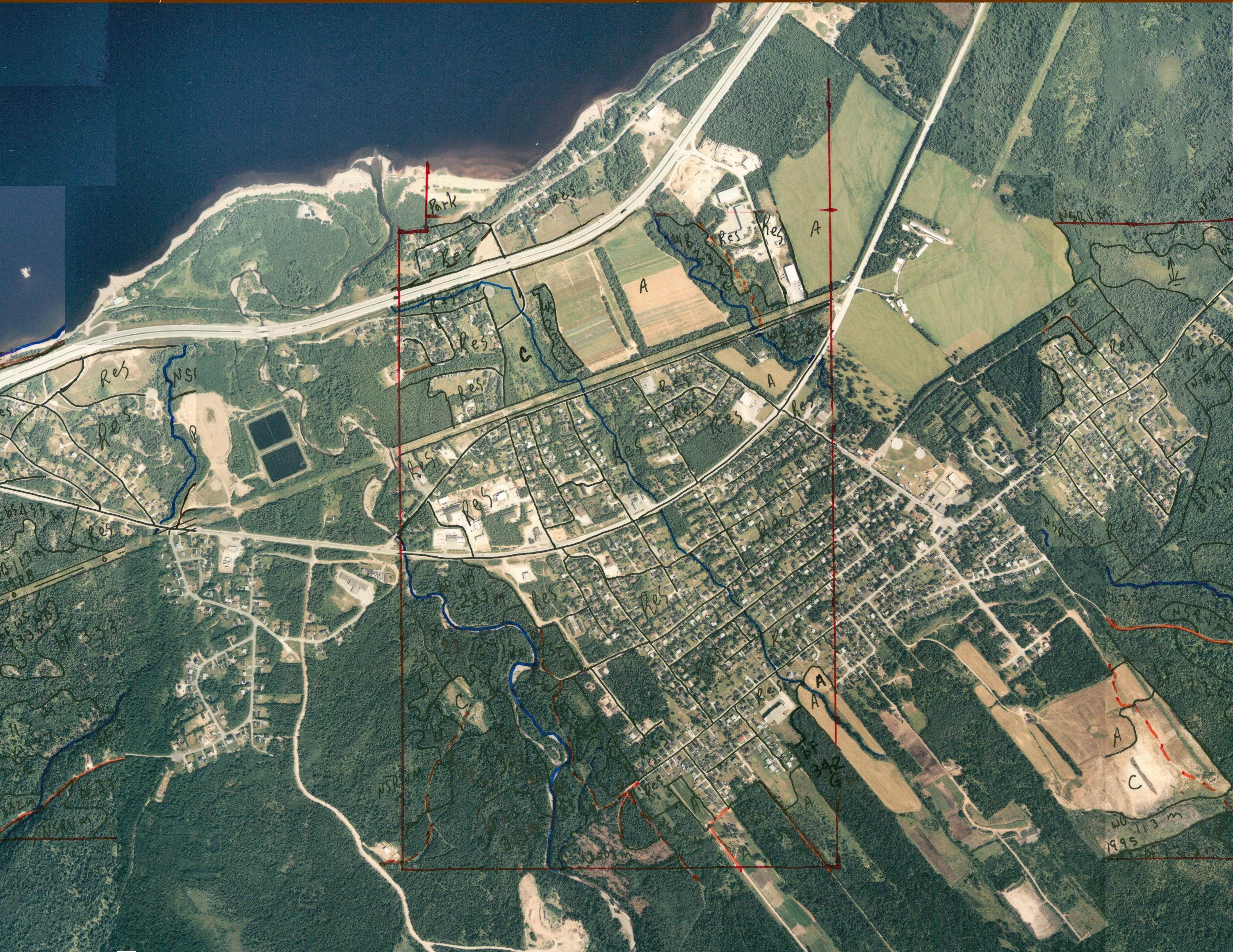
Crown of the Valley— Town — Pasadena Air Photo (2001)
SealLocation of Pasadena in Newfoundland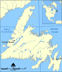
 Pasadena
Coordinates: 49°00′58″N 57°36′18″W / 49.01611°N 57.605°WCoordinates: 49°00′58″N 57°36′18″W / 49.01611°N 57.605°W Country  Canada
Province  Newfoundland and Labrador
Settled Early 1920s Incorporated 1969 Government – Type Pasadena Town Council – Mayor Gary Bishop – MHA Tom Marshall (PC)
Darryl Kelly (PC)– MP Gerry Byrne (L) Area – Total 49.6 km2 (19.2 sq mi) Elevation 30 m (98 ft) Population (2006)[1] – Total 3,180 – Density 64.7/km2 (167.6/sq mi) Time zone Newfoundland Time (UTC-3:30) – Summer (DST) Newfoundland Daylight (UTC-2:30) Postal code span A0L Area code(s) 709 Highways Route 1 Website Town of Pasadena Homepage Pasadena is an incorporated town located in census division 5 which is in the western portion of Newfoundland, Canada and it is a picturesque community on the shores of Deer Lake at the junction of the North Arm Valley and the Humber Valley.
The town was named after Pasadena, California. The meaning of the name is sometimes claimed to be "crown of the valley". The Town of Pasadena claims the name is Spanish for "crown of the valley".[2] However, the name, first applied to the city in California, is a corruption of an Ojibwe phrase meaning "valley" or "of the valley". The founders of Pasadena, California, claimed it was Ojibwe for "crown of the valley" or "key of the valley" when in fact it only meant, roughly "of the valley".[3]
History
The Town of Pasadena formerly consisted of three separate communities: South Brook, Pasadena and Midland.
South Brook
South Brook was located on the sandy shore of Deer Lake. It evolved much earlier than Pasadena, starting out in the early 1920s as a logging camp for the Bowater Company from Corner Brook. The railway also used South Brook, but only as a stop along its route across the island. In 1921, the census showed that South Brook only had a population of 6 people, within 2 families.
However, South Brook soon became a hive of activity, when the Bowaters Company started up its woods operations. It established a bunkhouse, cook-house and a company store to supply the needs of the areas wood camps. These camps would employ as many as 100 loggers during the winter months. Logging was the main industry in South Brook, but it also had a good supply of rock, which was suitable for the building of the power house in Deer Lake, so a quarry was set up and the rock was shipped to Deer Lake by train.
Homes began to spring up in South Brook as the men coming to work in the wood camps brought their families with them. With women and children living there, schools, medical aid, and recreation facilities were needed. church services were held in people’s houses at first, but later, all religions used the school as their church.
Pasadena
The second piece of the puzzle begins in St. John's. In 1923, Leonard Earle, a business man in St. John’s, who had a small 11-acre (45,000 m2) farm on the outskirts of the city, heard about some suitable farm land on the West Coast in the Humber Valley area. Wanting to get into farming full time, he decided to visit the area and attempt to purchase some land. He discussed the acquisition of the land with the paper company officials, but the talks foundered when it was discovered that the company did not own the land. Thus, Earle was forced to return to his small farm in the city.
Ten years later, in 1933, Earle was informed that a 2,500-acre (10 km2) block of land, the same land that he had been interested in years earlier, was for sale. Seizing the opportunity, he sold his St. John’s farm and immediately purchased the farmland in the Humber Valley. In the summer of 1933, he hired a group of men from Corner Brook to build a house, and with the help of some men that came with him, he cleared the land by hand and capstan. They built bridges and barns and planted vegetables. The flat fertile land and the temperate climate provided ideal conditions for growing such crops as potatoes and carrots. Earle decided to call this beautiful part of the Humber Valley, Pasadena, in honour of his wife, who had once lived in Pasadena, California, and also in honour of their marriage, as that is where they were married. The name Pasadena is derived from an Ojibwa (or Chippewa) word meaning "valley", "valley town", "key of the big valley", or "crown of the valley", depending on which expert you ask.
The Earles may have been the first family to settle in Pasadena, but it wasn’t long before others became interested in the little community. The first winter, the Earles were joined by Mr. and Mrs. Joseph Ryan. Later that same year, three section men with the Newfoundland Railway, Ned Carter, Jim Carter, and Douglas Tapp were transferred to the area. It was these five families that formed the nucleus of what was to become the Community of Pasadena.
Midland
The third and final piece of the puzzle, the community of Midland, evolved in 1936 as part of a government relocation program. Due to a severe decline in the inshore fishery around the Avalon Peninsula, many families were starving and the government of Commission began to look for some other means of livelihood for them.
It was on the picturesque, forest-covered, level land, next door to Pasadena, that the government land settlement began. It was named Midland because of its position - halfway between Deer Lake and Corner Brook. Potential settlers for this community came from outlying areas of the island deeply affected by the Great Depression. The 25 men involved in the resettlement program came from Argentia, Red Island, Lamaline, Burin, Bell Island, and Clarke’s Beach. In June 1936, the men came to Midland. With just one tractor, supplied by the government, they started clearing the land, in preparation for their families to join them. The men cleared two 20-acre (81,000 m2) fields and used them as a community farm until their own individual land was ready. All vegetables grown were taken to the government store to be sold and any profits were shared among the men.
In September 1936, all 25 homes were ready for occupancy. The homes were very simple. There was no electricity or running water and all the bathrooms were located about thirty feet back in the woods. All homes were built and painted alike, and therefore it was difficult to tell one home from another.
Finally that day in September arrived when the men settlers from Midland went to the railway in Pasadena to meet their excited families. To transport their families and their few belongings from the station, a platform with seats was built on a horse-drawn cart.
Over the years, roads were improved and more land was cleared, but the farms never materialized. Each settler had been given 35 acres (140,000 m2) of land but they only cleared enough land to meet their immediate requirements. It wasn’t long before many of the men were seeking employment elsewhere, such as the American base: Ernest Harmon Air Force Base in Stephenville and with the Pulp and Paper Industry in Corner Brook. Several of the original settlers even returned to their home towns, preferring the uncertainty of fishing to the drudgery of farming.
Joining together
Being in such close proximity to each other, it was inevitable that Pasadena and Midland would eventually become one. They were incorporated in 1955, adopting the name of The Community of Pasadena-Midland. The first Community Council of Pasadena-Midland consisted of Charles Bonnell, Chairman; Nelson Bennett, Secretary; and Allan French, Councillor.
Very little growth took place in the Community of Pasadena-Midland until 1969 when the community status gave way to town status, and was named the Town of Pasadena. The first mayor was Gordon Clarke.
The town experienced rapid growth after receiving its town status. In 1971, the population of Pasadena was 891, but by 1985, it had risen to more than 3,200. In 1985, after much persistence from the town council, the whole town was serviced with municipal water and sewage, all main streets were paved, and a Town Plan and Development Regulations were in place to ensure the orderly growth and development of the town.
It was about this time that the Department of Municipal Affairs in St. John's began to see the possibilities of another merger, this time between the Town of Pasadena and its much smaller neighbor to the west, the Community of South Brook. South Brook had not received nearly as much attention as Pasadena, and could benefit greatly if merged with Pasadena. In 1985, negotiations between the two Councils and the Department of Municipal Affairs for the amalgamation of the Town of Pasadena and the Community of South Brook began.
After much debate between both communities, a satisfactory consensus was reached, and on January 1, 1986, the Community of South Brook was amalgamated with the Town of Pasadena. Once again, the town had become a hive of activity. A new town plan had to be drawn up to incorporate the increased municipal boundaries, a new Comprehensive Development Plan was also prepared to ensure proper linkage of existing municipal services and pre-planned future expansion. As a result of the continued growth and the addition of the smaller neighboring community, the projections for the future are showing a continuing steady growth in all sections.
As a town, Pasadena is proud of its growth and the high standards of service and quality of life it provides. It prides itself in being one of the best laid out towns in the province, and looks forward with confidence to the future. It is Pasadena, South Brook, and Midland that make Pasadena a complete town and the “Crown” of the beautiful Humber Valley.
Culture
Demographics Population in 2006 3,180 Population change from 2001 1.5% Median age 39.5 Number of families 985 Number of married couples 795 Total number of dwellings 1,258 Catholic 28.2% Protestant 69.9% Land Area (km²) 49.16 Statistics Canada detail demographics follow link here
Tourist attractions
- The Humber Valley Resort
- Marble Mountain Ski Resort
- Pasadena Beach
- Pasadena Ski and Nature Park
Town Council
2009 Election
Pasadena Council 2009
Mayor Gary Bishop Deputy Mayor Gemma Walsh Councilor Derrick Anthony Councilor Sharon Evans Councilor Otto Goulding Councilor Barry Walsh Councilor Tom Wheaton 2005 Election
Pasadena Council 2005
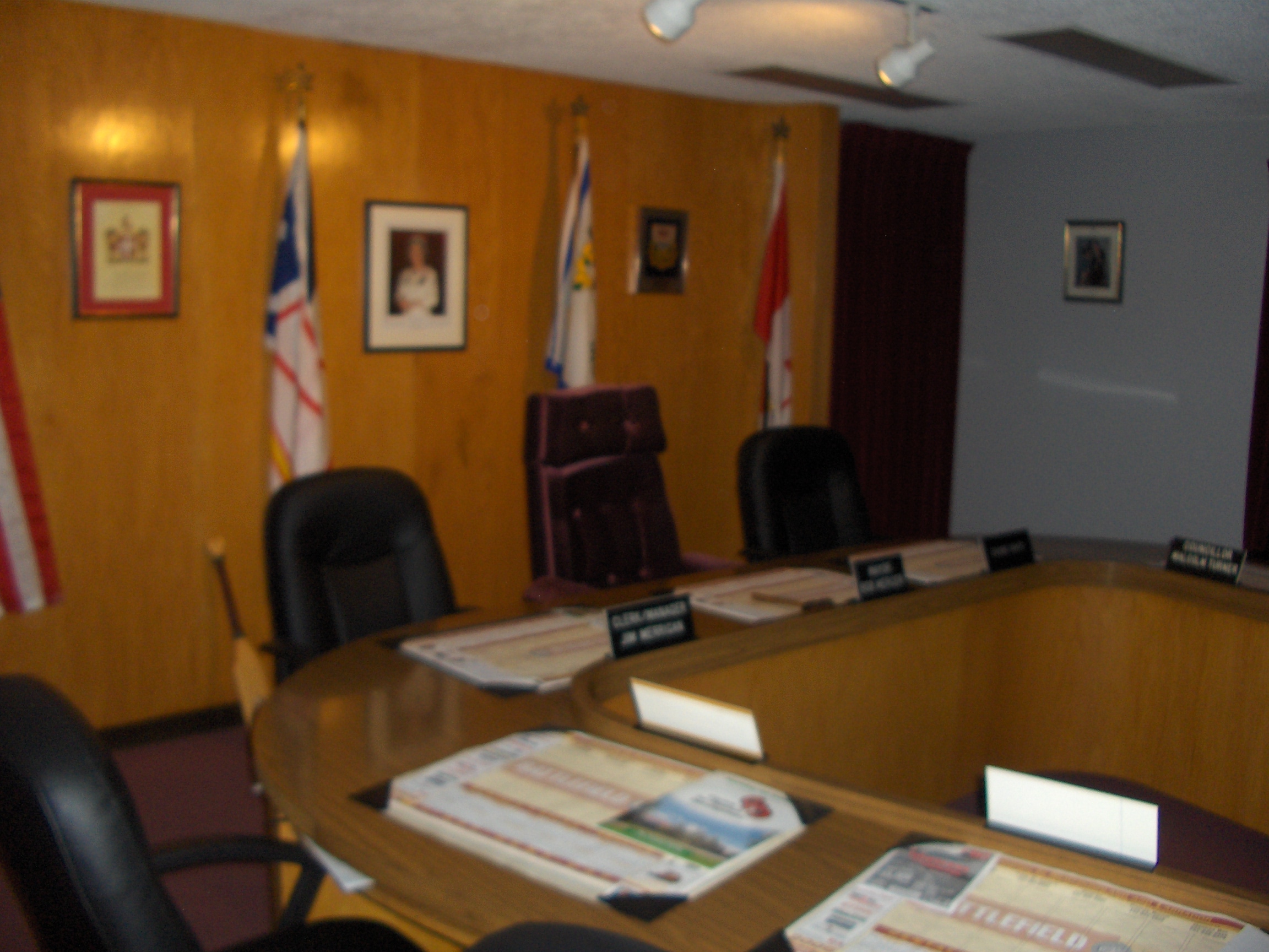
Mayor Bob Mercer Deputy Mayor Gary Bishop Councilor Doug Beattie Councilor Nathan Lehr Councilor Lester Sparkes Councilor Mac Turner Councilor Tom Wheaton  Town of Pasadena Council Chambers
2003 Election
Pasadena Council 2003
Mayor Brian Pike Deputy Mayor Gary Bishop Councilor D. Anthony Councilor J. Hutchings Councilor N. Lehr Councilor M. Turner Councilor T. Wheaton 2002 Election
Pasadena Council 2002
Mayor Brian Pike Deputy Mayor F.R. Hutchings Councilor D. Anthony Councilor G. Bishop Councilor J. Hutchings Councilor M. Turner Councilor T. Wheaton 2001 Election
Pasadena Council 2001
Mayor Brian Pike Deputy Mayor F.R. Hutchings Councilor D. Anthony Councilor J.Hutchings Councilor P. McBreairty Councilor M. Turner Councilor T. Wheaton 1999 Election
Pasadena Council 1999
Mayor Derek Simmons Deputy Mayor G. Bishop Councilor P. McBreairty Councilor C. Taylor Councilor M. Osmond Councilor B. Pike Councilor M. Turner 1997 Election
Pasadena Council 1997
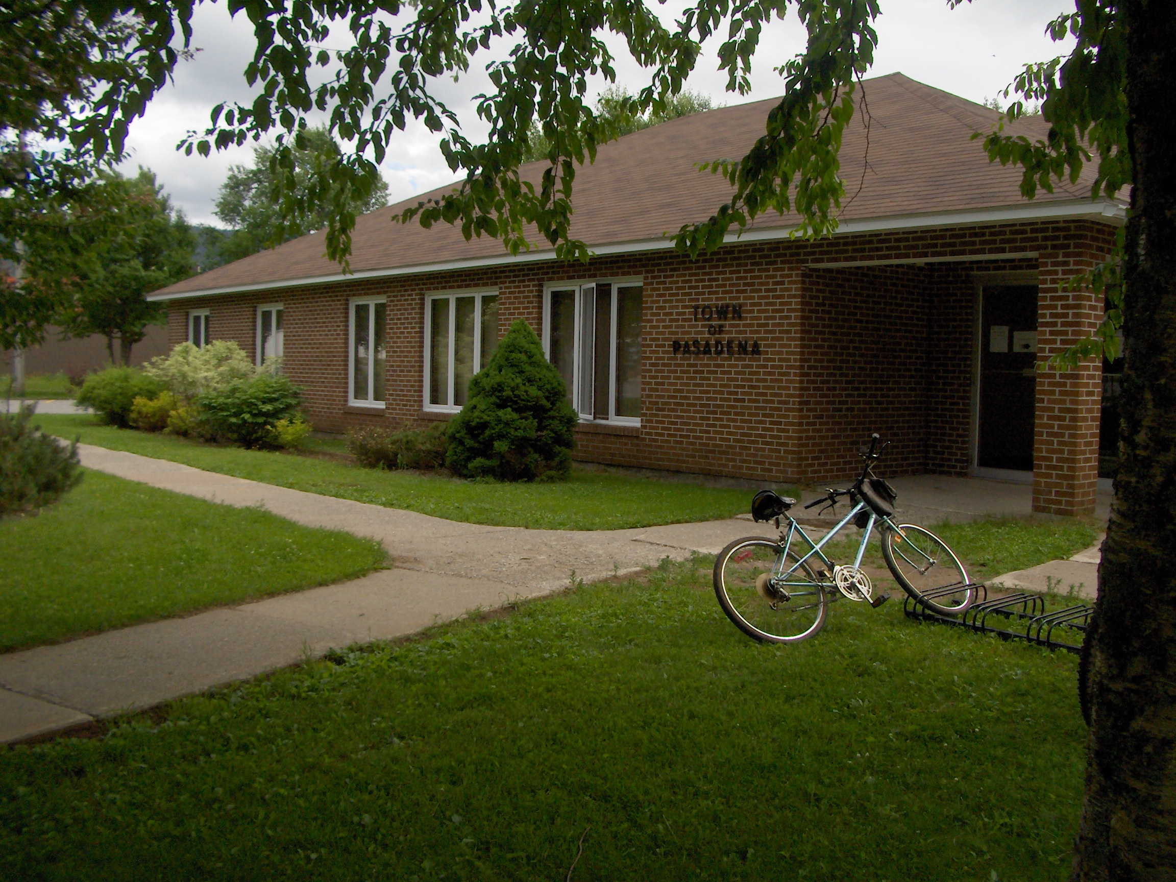
Mayor Derek Simmons Deputy Mayor G. Bishop Councilor P. McBreairty Councilor C. Noseworthy Councilor M. Osmond Councilor B. Pike Councilor M. Turner 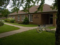 Town Hall in Pasadena
1996 Election
Pasadena Council 1996
Mayor David Osmond Deputy Mayor D. Simmons Councilor D. Beattie Councilor I. Downton Councilor D. Langdon Councilor J. Noseworthy Councilor M. Turner 1993 Election
Pasadena Council 1993Mayor Bob Mercer Deputy Mayor D. Osmond Councilor E. Ryan Councilor D. Langdon Councilor D. Simmons Councilor J. Noseworthy Councilor I. Downton 1989 Election
Pasadena Council 1989Mayor Frank Bonnell Deputy Mayor D. Langdon Councilor E. Ryan Councilor L. Taylor Councilor J. Cheeseman Councilor D. Simmons Councilor J. Noseworthy 1985 Election
Pasadena Council 1985Mayor Frank Bonnell Deputy Mayor L. Janes Councilor H. Camp Councilor D. Langdon Councilor W. Martin Councilor J. Cheeseman Councilor D. Simmons Councilor M. Ryan 1981 Election
Pasadena Council 1981Mayor B. Pardy Deputy Mayor F. Bonnell Councilor D. Langdon Councilor D. Walsh Councilor N. Gillard Councilor W. Martin Councilor H. Butt 1977 Election
Pasadena Council 1977Mayor B. Pardy Deputy Mayor P. Cruikshark Councilor D. Langdon Councilor E. Norman Councilor M. Turner Councilor W. Chaulk Councilor M. Rice 1973 Election
Pasadena Council 1973Mayor N. Bennett Deputy Mayor R. Pike Councilor J. Loughlin Councilor F. Moores Councilor C. French Councilor B. Pardy Councilor M. Rice 1969 Election
Pasadena Council 1969Mayor C, Clarke Deputy Mayor J.J. Smith Councilor H. Wight Councilor H. Rowe Councilor C. Bonnell Councilor A. Stentaford Councilor R. Pike **1969 Election**
Pre-Incorporation July 1969Chairperson C, Clarke Member S. Goodyear Member W. Power Member H. Wight Member F. Ledrew - All time before this was Pre-Incorporation of the Town of Pasadena
1967 Election
Pre-Incorporation 1967Chairperson G. Clarke Vice Chair H. Wight Secretary J. French Member W. Power Member H. Yetman Member S. Goodyear 1965 Election
Pre-Incorporation 1965Chairperson N. Bennett Secretary E.J. French Member C. Bonnell Member H. Rowe Member R. Pike Member H. Wight 1965 Election
Pre-Incorporation 1965Chairperson N. Bennett Secretary H. Taylor Member C. Bonnell Member J. Crocker Member R. Pike Member H. Wight 1964 Election
Pre-Incorporation 1964Chairperson C. Bonnell Vice Chair H. Wight Secretary H.T. Butt Building Inspector J.J. Smith Member S. Bonia 1960 Election
Pre-Incorporation 1960Chairperson C. Bonnell Vice Chair N. Bennett Secretary H.T. Butt Building Inspector J.J. Smith Fire Chief R. Pike 1958 Election
Pre-Incorporation 1958Chairperson C. Bonnell Secretary H.T. Butt Member N. Bennett Building Inspector L. Martin Fire Chief S. Bonia See also
References
- ^ Population and dwelling counts
- ^ History, Pasadena, The Crown of the Valley
- ^ Stewart, George R. (1967) [1945]. Names on the Land: A Historical Account of Place-Naming in the United States (Sentry edition (3rd) ed.). Houghton Mifflin.
External links
 Subdivisions of Newfoundland and Labrador
Census divisions Cities Other communities Bishop's Falls · Bonavista · Botwood · Carbonear · Channel – Port aux Basques · Clarenville · Conception Bay South · Deer Lake · Ferryland · Fogo · Gander · Grand Bank · Grand Falls-Windsor · Happy Valley – Goose Bay · Harbour Grace · Hopedale · Labrador City · Marystown · Nain · Norris Arm · Pasadena · Peterview · Placentia · Red Bay · St. Anthony · Stephenville · Twillingate · Torbay · Woody Point · Makkovik Category:Newfoundland and Labrador ·
  Portal:Newfoundland and Labrador ·
  WikiProject:Newfoundland and LabradorCategories:
- Populated coastal places in Canada
- Towns in Newfoundland and Labrador
- Populated places established in 1958


Wikimedia Foundation. 2010.