- Ferryland, Newfoundland and Labrador
Infobox Settlement
official_name = Ferryland
other_name =
native_name =
nickname =
settlement_type = Town
motto =
imagesize =
image_caption =
flag_size =
image_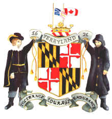
seal_size =
image_shield =
shield_size =
city_logo =
citylogo_size =
pushpin_
pushpin_label_position = left
pushpin_map_caption = Location of Ferryland in Newfoundland
pushpin_mapsize =
subdivision_type = Country
subdivision_name = CAN
subdivision_type1 = Province
subdivision_name1 = NL
subdivision_type3 =
subdivision_name3 =
established_title = Settled
established_date = Late 16th Century
established_title2 =
established_date2 =
established_title3 =
established_date3 =
government_type = Ferryland Town Council
government_footnotes =
leader_title = Mayor
leader_name = Leo Moriarity
leader_title1 =
leader_name1 =
leader_title2 =
leader_name2 =
unit_pref =
area_footnotes =
area_total_sq_mi =
area_total_km2 = 13.62
area_land_sq_mi =
area_land_km2 =
area_water_sq_mi =
area_water_km2 =
area_water_percent =
area_urban_sq_mi =
area_urban_km2 =
area_metro_km2 =
area_metro_sq_mi =
population_as_of = 2006
population_note =
population_footnotes =
population_total = 529
population_urban =
population_metro =
population_density_sq_mi =
population_density_km2 = 38.8
timezone =Newfoundland Time
utc_offset = -3:30
timezone_DST = Newfoundland Daylight
utc_offset_DST = -2:30
latd = 47
latm = 01
lats =
latNS = N
longd = 52
longm = 53
longs =
longEW = W
elevation_footnotes =
elevation_ft =
elevation_m = 48
postal_code_type = Postal code span
postal_code = A0A
area_code = 709
blank_name = Highways
blank_info = Route 10
website =
footnotes =Ferryland is a town in
Newfoundland and Labrador on theAvalon Peninsula . According to the2006 Statistics Canada census , its population is 529. [ [http://www12.statcan.ca/english/census06/data/profiles/community/Details/Page.cfm?Lang=E&Geo1=CSD&Code1=1001149&Geo2=PR&Code2=10&Data=Count&SearchText=Wood%20Point,%20Bonne%20Bay&SearchType=Begins&SearchPR=01&B1=All Population and dwelling counts] ]Ferryland was established as a station for migratory fishermen in the late
16th century but had earlier been used by the French, Spanish, and Portuguese. By the1590s it was one of the most popular fishing harbours in Newfoundland and acclaimed by SirWalter Raleigh .The land was granted by charter to the
London and Bristol Company in the1610s and the vicinity became the location of a number of short-lived colonies at Cuper's Cove, Bristol's Hope, andRenews and adjoined the colony ofSouth Falkland . In 1620 the territory was granted to George Calvert, 1stLord Baltimore who had obtained the holdings from William Vaughan.Calvert appointedEdward Wynne to establish acolony which became the first successful permanent colony in Newfoundland growing to a population of 100 by 1625. In 1623, Calvert's grant was confirmed and expanded. The Charter of Avalon was granted to Lord Baltimore by James I. Dated 7 April 1623 it created theProvince of Avalon on the island of Newfoundland and gave Baltimore complete authority over all matters in the territory. That same year Baltimore chose Ferryland as the principle area of settlement.Ferryland was called "Farilham" by the Portuguese fishermen and "Forillon" by the French—it later became anglicized to its current name "Ferryland." (This should not be confused with the
Forillon National Park inQuebec , which still keeps its French name.)Addresses in Ferryland use the alphanumerically lowest postal codes in Canada, starting with A0A.
ee also
*
British colonization of the Americas
*List of cities and towns in Newfoundland and Labrador References
External links
* [http://www.heritage.nf.ca/avalon/ Colony of Avalon]
* [http://www.ferryland.com/ Official Town Website]

Wikimedia Foundation. 2010.