- Norwood, Ohio
-
For other uses, see Norwood (disambiguation).
Norwood, Ohio — City — 
Flag
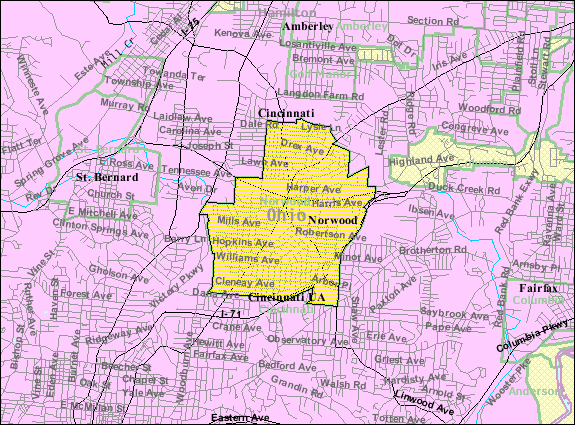
SealNickname(s): Gem Of The Highlands Location of Norwood, Ohio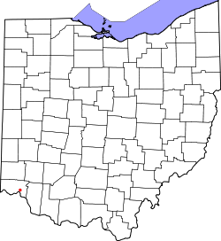 Detailed map of Norwood
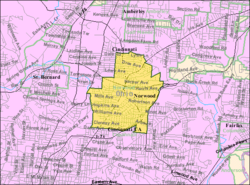
Coordinates: 39°9′36″N 84°27′18″W / 39.16°N 84.455°WCoordinates: 39°9′36″N 84°27′18″W / 39.16°N 84.455°W Country United States State Ohio County Hamilton Area – Total 3.1 sq mi (8.1 km2) – Land 3.1 sq mi (8.1 km2) – Water 0.0 sq mi (0.0 km2) Elevation[1] 656 ft (200 m) Population (2000) – Total 21,675 – Density 6,956.5/sq mi (2,685.9/km2) Time zone Eastern (EST) (UTC-5) – Summer (DST) EDT (UTC-4) ZIP codes 45212, 45207 Area code(s) 513 FIPS code 39-57386[2] GNIS feature ID 1056460[1] Norwood is the second most populous city in Hamilton County, Ohio, United States. The city is an enclave of the larger city of Cincinnati. The population was 21,675 at the 2000 census. Originally settled as an early suburb of Cincinnati in the wooded countryside north of the city, the area is characterized by older homes and tree-lined streets. Norwood is currently undergoing economic and social changes due to recent retail and business development.
Contents
History
The area now known as Norwood was settled in the early 19th century as a coach stop along the Montgomery Road turnpike near the present day intersection of Smith Road. The village was originally named Sharpsburg after an early settler named John Sharpe. It was informally referred to as "Northwood" due to its location north of Cincinnati and being heavily wooded countryside. Much of the area was horse farms or fruit and vegetable orchards. The Marietta and Cincinnati Railroad and Cincinnati, Lebanon and Northern Railway were built through the area, leading to increasing settlement in the countryside.
 The Norwood indian mound.
In 1873, a local dry goods merchant named L. C. Hopkins subdivided 30 acres (120,000 m2) of his own land near the intersection of Hopkins Avenue and Montgomery Road. Shortly thereafter, other subdivisions were planned. The area quickly developed into one of Cincinnati's original suburbs. It was at Hopkins’ suggestion that the name of Norwood was substituted for that of Sharpsburg.[3]
Much of the remaining land from which the city originated were farms of the Mills, Smith, Langdon, Williams, Durrell and Drake families. The village was incorporated into a city on May 10, 1888, under the name Norwood.
Geography
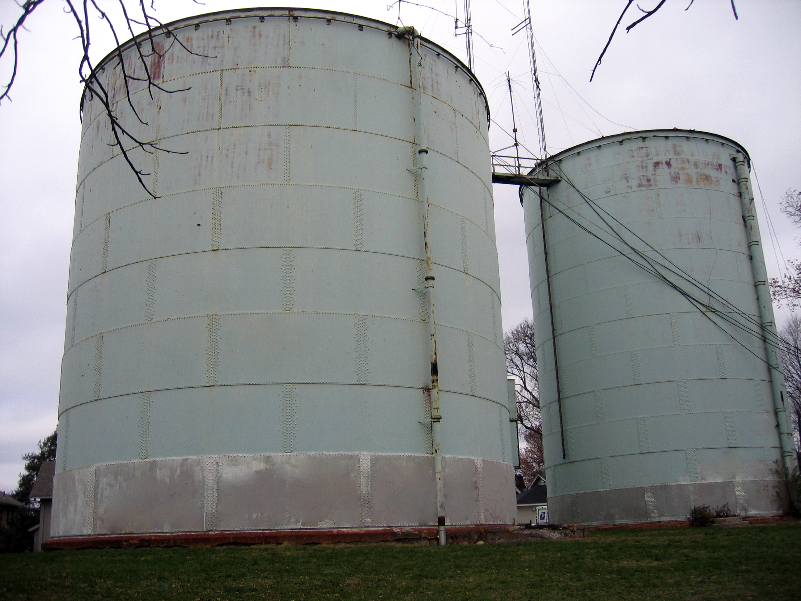
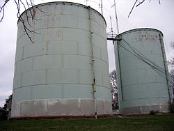 Water storage tanks in Tower Park.
Norwood is located at 39°9′36″N 84°27′18″W / 39.16°N 84.455°W (39.160060, −84.455074)[4].
According to the United States Census Bureau, the city has a total area of 3.1 square miles (8.0 km2), all of it land.
The southern, eastern, and western areas of the city lie mostly on flat terrain, while the northern half of the city is characterized by a steeper elevation. The highest point in Norwood is at the Norwood Indian Mound burial site in Tower Park at 656 ft (200 m) above sea level. That site is one of the highest land elevations in southwest Ohio. It is believed the burial mound was built at that site due to the high elevation.
Near the burial mound are two large water towers, built in the 19th century, which Norwood uses to store water and regulate water pressure throughout its City. The towers were curious points of interest in the early 20th century. Because they were built with spiral staircases (long since removed), people rode horses or took carriage rides to the towers in order to climb the stairs and view growing Cincinnati to the south and countryside to the north. Norwood is credited with coming to the aid of Cincinnati residents during the Ohio River flood of 1937. Cincinnati's drinking water was largely contaminated so their residents depended on Norwood for fresh water, which Norwood had stored safely in the towers, above flood waters.
Demographics
Historical populations Census Pop. %± 1900 6,480 — 1910 16,185 149.8% 1920 24,966 54.3% 1930 33,411 33.8% 1940 34,010 1.8% 1950 35,001 2.9% 1960 34,580 −1.2% 1970 30,420 −12.0% 1980 26,126 −14.1% 1990 23,674 −9.4% 2000 21,675 −8.4% Est. 2008 20,341 −6.2% As of the census[2] of 2000, there were 21,675 people, 9,270 households, and 5,154 families residing in the city. The population density was 6,956.5 people per square mile (2,682.3/km²). There were 10,044 housing units at an average density of 3,223.6 per square mile (1,243.0/km²). The racial makeup of the city was 94.25% White, 2.35% African American, 0.36% Native American, 0.77% Asian, 0.02% Pacific Islander, 0.88% from other races, and 1.37% from two or more races. Hispanic or Latino of any race were 1.85% of the population.
There were 9,270 households out of which 26.7% had children under the age of 18 living with them, 36.8% were married couples living together, 13.7% had a female householder with no husband present, and 44.4% were non-families. 36.3% of all households were made up of individuals and 11.1% had someone living alone who was 65 years of age or older. The average household size was 2.31 and the average family size was 3.04.
In the city the population was spread out with 23.4% under the age of 18, 11.9% from 18 to 24, 32.4% from 25 to 44, 19.7% from 45 to 64, and 12.6% who were 65 years of age or older. The median age was 34 years. For every 100 females there were 94.9 males. For every 100 females age 18 and over, there were 90.9 males.
The median income for a household in the city was $32,223, and the median income for a family was $39,951. Males had a median income of $31,530 versus $25,852 for females. The per capita income for the city was $18,108. About 8.6% of families and 12.9% of the population were below the poverty line, including 15.3% of those under age 18 and 7.5% of those age 65 or over.
Government
The elected members of Norwood City government are: the mayor, president of council, auditor, treasurer, law director, clerk of council, four ward-specific city council members and three at-large city council members. Norwood City School Board members are also elected. The City of Norwood has its own police, fire, and public works departments. The current mayor of Norwood is Tom Williams.
Economy
Early industry
Norwood has enjoyed a strong tradition of industry and manufacturing dating back to the historic Norwood Brick plant of the late 19th century, which provided clay brick for the construction of many of Cincinnati's historic buildings.
As the city is ideally situated between several major railways, state roads and interstate highways, it has traditionally been an attractive location for businesses and corporations in the area. In the 1940s and 1950s, the relatively small community held the distinction of producing more goods per capita than any other city in the world.[citation needed]
Prominent Norwood industries included: United States Printing & Lithographing Company, Mead Container Corporation, American Laundry Machine Company, Globe Wernicke, Bulloch Electric Company, Allis-Chalmers, Siemens, J.H. Day Corporation, Zumbiel Box, dozens of tool and die makers and other industrial concerns. Corporations founded and still located in Norwood include The United States Playing Card Company and United Dairy Farmers.
However, between 1923 and 1987 the General Motors and Fisher Body automobile assembly plants were far and away the city's major employer in terms of production, payroll and employees. For decades Norwood's fortunes rose (and later fell) with these businesses.
Located across Norwood's main thoroughfare from Norwood City Hall, the Norwood Assembly plant built Chevrolet and Pontiac automobiles and provided Norwood with approximately 35% of its tax base from payroll taxes. The Norwood Plant produced 90% of the Chevrolet Camaro and Pontiac Firebird "muscle cars" of the 1980s. The prevalence of railroads through the area is a main reason the plant flourished. The railways were able to provide a steady flow of parts into the plant and an equally steady flow of assembled automobiles out of the plant. The plant used the enlarged McCoullough Yard, originally built for the McCoullough Seed Company in the 1920s.
Closing of General Motors
Citing its obsolescence, expense, and high worker absentee rate, GM announced the closing of the Norwood plant and ten other GM facilities on November 6, 1986. The Norwood facility produced its last vehicle August 26, 1987 – a Chevrolet Camaro. At the time of its closing the plant employed approximately 4200 workers. That date came to be known in Norwood as "Black Wednesday".
The closing of the assembly plant nearly dealt a death blow to Norwood’s economy. As the main factory building sat vacant (for nearly 10 years), the city faced economic catastrophe and possible bankruptcy if replacement income was not found.
Due to the plant's unique location between Interstate 75, Interstate 71, the Norwood Lateral, U.S. Route 22 and Ohio State Route 561, the city approached GM about tearing down the old plant so Norwood could develop it. Initially GM refused, but after settling an unresolved tax dispute (GM potentially owed the city of Norwood millions of dollars in back taxes) GM agreed to demolish the remaining buildings and to donate ownership of the land to the City of Norwood.
Central Parke revitalization
The re-birth of the former GM Assembly Plant site became the first of several large development projects.
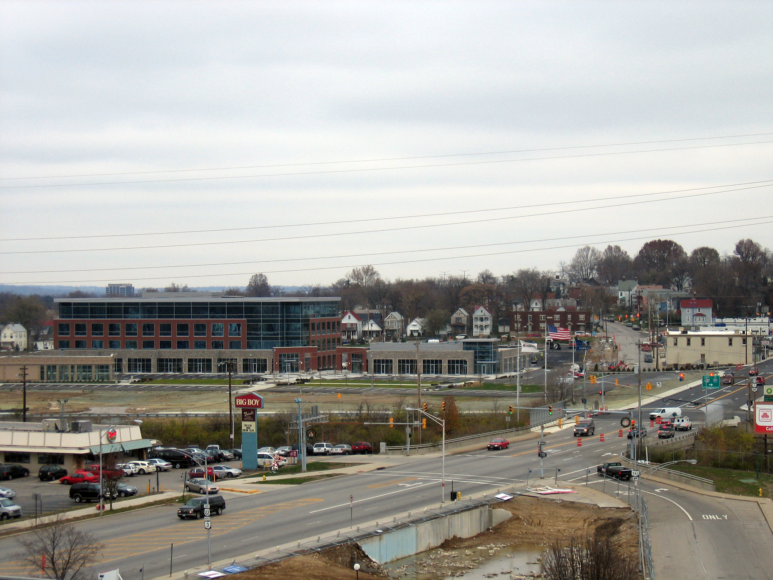
In 1990, the first phase of development took place with the construction of the Central Parke complex on the former GM Assembly site. A new roadway, Wall Street, was built and the Grande Central Station outdoor mall was opened with a discount movie theater along with a mix of restaurants, retail, and light industry businesses. Behind the mall along the newly extended Wesley Avenue, a green space and lake were added in addition to several businesses including a technical college and medical billing firm.
In 1993, phase two took place as the city added a 1,000,000 square feet (93,000 m2) mixed-use light industrial and office building at the northeast corner of Montgomery and Sherman Avenues. Commonly referred to as the Matrixx/Convergys building, the facility opened with two retail financial institutions, a marketing firm, a satellite television customer-service center, a medical consulting/MRI/diagnostic laboratory and telephone company firm as initial tenants. The new office building was conveniently able to utilize the still standing GM Assembly Plant parking garage located on Elm Avenue. Bennett Avenue, a two-block city street, was eliminated with the new construction. Greenspace was added along Montgomery Road.
Rookwood Pavilion
By 1995, successful development of those former GM properties spurred interest by other developers to choose Norwood for further commercial enterprises. The Rookwood Pavilion outdoor shopping plaza was constructed at the former site of the Leblond Machine Tool Company on Edmondson Road. A high-rise office tower with an insurance company, medical clinic, and culinary was constructed on the northern edge of the property. Wildly successful, it was followed in 1997 by an adjoining open-air shopping mall, Rookwood Commons, on Edwards Road. The open-air shopping mall contained an eclectic mix of restaurants, clothing stores, and gift stores, previously not found in Hamilton County. Much of the success of local businesses is due to the central location in Cincinnati, and close proximity to interstates 71 and 75, using Ohio State Route 562, locally known as the Norwood Lateral.
Eminent Domain
In 1999, further development was planned for the area located near Interstate 71, between Edwards, Edmondson Road. Cornerstone of Norwood was built at the intersection of Edmondson Road and Williams Avenue. That complex contained a neurological/spinal clinic, adult fitness center and office buildings.
A second development, the $125 million Rookwood Exchange, was planned on the southern edge of this area directly across the street from the Rookwood Pavilion. However, the area where Rookwood Exchange was to be built was already occupied by a small 11-acre (45,000 m2) neighborhood. The city, declaring the neighborhood of about 70 homes and businesses as "blighted”, attempted to use eminent domain to obtain the land from the property owners.
Three remaining owners in the neighborhood fought Norwood’s use of eminent domain and refused to sell their property. The dispute eventually made national headlines when it was brought before the Ohio Supreme Court in Norwood, Ohio v. Horney. In 2006, the court ruled unanimously for the homeowners and city developers were forced to return ownership of the three properties to the homeowners. The future plans for the site are new restaurants, shopping, cinema, and condominium living. The project was to start spring 2010 and to be completed in 2012 but has been pushed back and new dates have not been released.
Linden Pointe
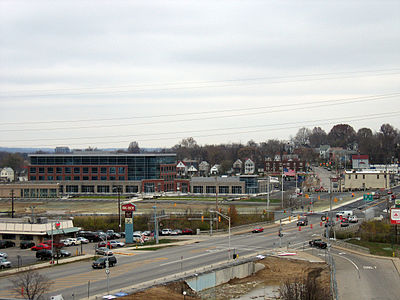 View of new construction at Linden Pointe.
Norwood continued to develop commercial properties by capitalizing on developing other parcels of land which had been idle for years. In 2006, the city broke ground for the Linden Pointe project at the former American Laundry Machine Company, which closed in the 1990s and Globe Wernicke, which closed in the 1970s, both located near Montgomery Road and the Norwood Lateral. The city had been eying the property for development for several years. However, due to the nature of manufacturing at Globe Wernicke, contaminants were present in the ground which prevented new construction. Norwood was eventually able to utilize federal and state cleanup funds to eliminate those hazards.
By fall 2007, the former American Laundry building had been renovated with the building's original historic facade preserved. The building was re-habbed with "Greening" features and re-opened with a cable-television service center and telephone company. A multi-story office complex was also constructed at the adjoining Globe Wernicke end of the property. As of November, 2007, an architectural firm was the first announced tenant. In order to cater to the new development, the street scape surrounding Linden Pointe was altered for aesthetic and traffic purposes. Several historic buildings on the narrow block at the intersection of Montgomery Road and Carthage Avenue were razed to "open up" the office park's visibility from Interstate 71. Montgomery Road and Norwood Avenues were widened, and two city blocks of Carthage Avenue and an adjoining on-ramp to State Route 562 were permanently closed. A boulevard entrance was added alongside Linden Point along the former West Norwood Avenue. (This street had previously been closed to traffic in the 1970s for urban renewal).
Current and future development
In 2007, Norwood's economic boom continued with the expansion of the Siemens plant located on Forest and Park Avenues. The plant, which assembles and tests large electric motors used in industrial and factory automation, completed a two-year $30 million expansion. The project included: $22 million for new machinery, equipment and technology; $7 million to expand and renovate existing buildings; and $1M in additional needs. The project ensured retention of 337 skilled workforce jobs.
Norwood is also currently in the midst of two additional projects located in the Montgomery Road central business corridor. Surrey Square Mall went through a major major expansion with addition of a 76,000-square-foot (7,100 m2) Kroger anchor store, a large cafeteria-sized McDonald's restaurant and several mid-size businesses. The old Sherwin-Williams paint store at the intersection of Montgomery and Smith Roads was torn down in 2007 and the new medical center of Norwood was completed in 2008.
Education
The Norwood City School District consists of three elementary schools: Norwood View, Sharpsburg, and Williams. The district's sole middle and high school are located adjacent to one another on Sherman Avenue. Norwood City School District also operates the Five Points Preschool.[5]
The original Norwood High School was built in 1912 on Sherman Avenue. That building now houses Norwood Middle School. In 1988, the high school gym and offices were used to film several scenes for the Tom Selleck movie "An Innocent Man" (1989). A newer high school was built as a state-of-the-art facility in 1972, and houses a planetarium, television studio for both Norwood City Schools and City of Norwood civic broadcasts, greenhouse and swimming pool. Drake Planetarium, named after astronomer and astrophysicist Frank Drake, is linked to NASA.[6]
The mascot of the Norwood City Schools are the Indians.
Norwood High School won the 1936 state title for baseball.
Norwood is also home to the Catholic Immaculate Conception Academy grade school and high school.[7]
Sports and recreation
Norwood Recreation Commission
The Norwood Recreation Commission was established in 1943, by ordinance of the City Council. The commission is unique in that it is a non-political joint effort between the city and Board of Education.[8] The commission consists of five policy makers; two selected by the Board of Education and three appointed by the mayor.
The Norwood Recreation Commission operates and supervises four playgrounds and three swimming pools during the summer months. Permits for ball diamonds, tennis courts and picnic areas are also issued through the Recreation office. The Recreation Commission conducts leagues for 30 softball teams for men and women in addition to assisting and cooperating with the Norwood Knothole Association and Norwood Soccer Association in providing facilities for all their teams. In the past the Norwood Recreation Commission has moved into the schools with its Fall, Winter, and Spring programs.[8]
Swimming pools:
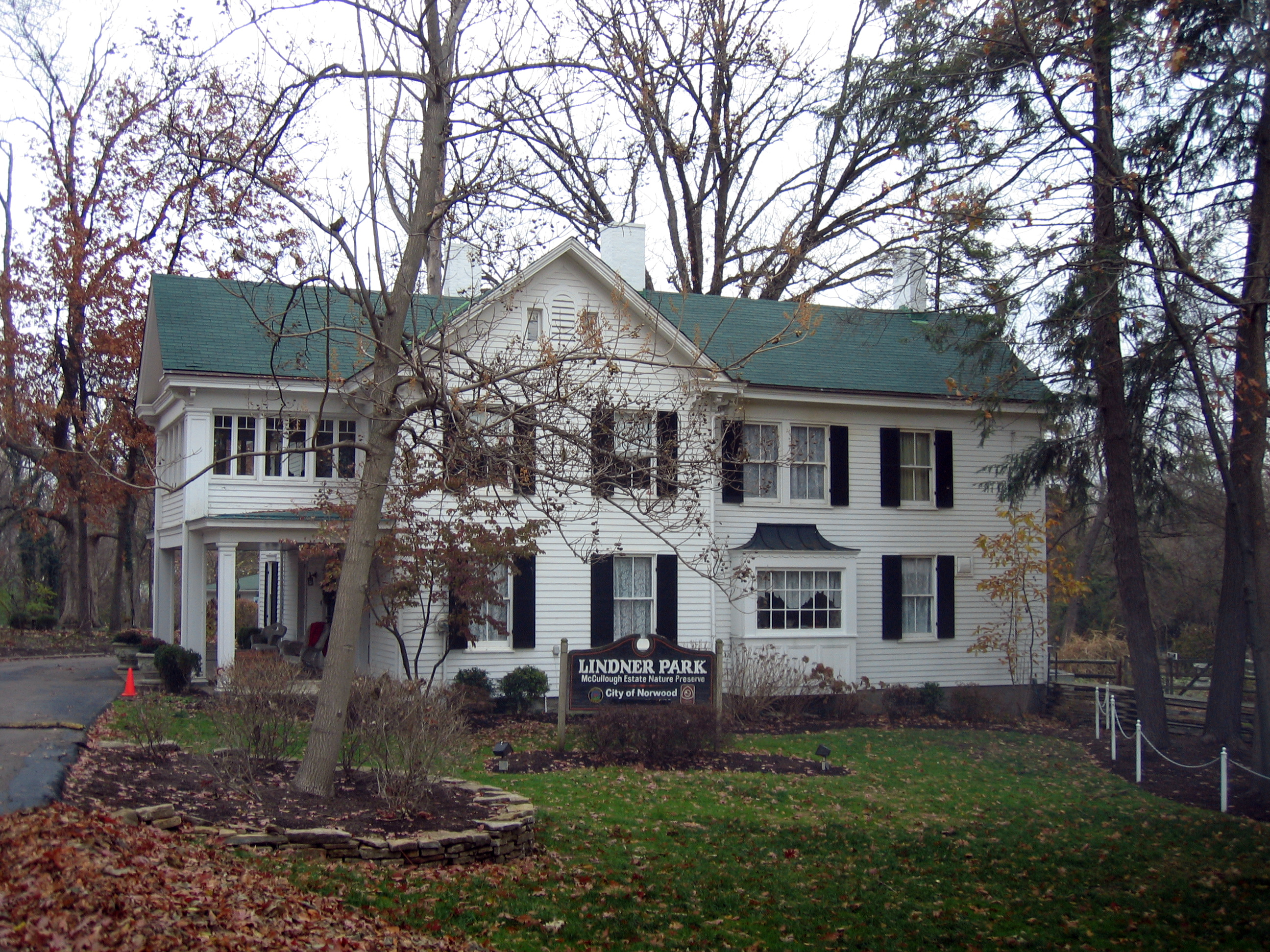
 The McCullough House at Lindner Park.
- Burwood Pool
- Victory Pool
- Norwood High School Pool
- Waterworks J.B. Wirth Pool
Parks:
- Burwood Park
- Dorl Park
- Fenwick Park
- Hunter Park
- Lindner Park Nature Preserve
- Marsh Park
- Millcrest Park
- Northwoods Park
- Tower Park
- Victory Park
- Waterworks Park
Nicknames
Norwood is known as the "Gem of the Highlands".[9]
Notable residents
- Carl Bouldin, professional baseball pitcher for the Washington Senators
- Karin Bergquist and Linford Detweiler, husband and wife members of Ohio rock band Over the Rhine, have recorded albums in their Norwood home "The Grey Ghost"
- George Chakiris, actor "West Side Story"
- Mr. Dibbs, DJ and hip hop producer for Atmosphere, El-P, and Len
- Marc Edwards, NFL fullback for the San Francisco 49ers, Cleveland Browns and Super Bowl XXXVI champion New England Patriots
- Tracy Jones, professional baseball player for five Major League teams. Currently a 700WLW radio personality.
- Dorothy Kamenshek. professional baseball player for the Rockford Peaches, member of the A.A.G.P.B.L., inspiration for character in the movie "A League Of Their Own"
- Carl Lindner, Jr., businessman listed by Forbes Magazine as one of the 400 richest people in America
- John Uri Lloyd, pharmacist, scientist, and twice president of the American Pharmaceutical Association, one of the pioneers in the modern use of plant extracts in medicine
- Tim Lucas, novelist and film critic (got his start as film critic and cartoonist for Norwood High School's newspaper The Mirror)
- Jack Mullaney, actor (Little Big Man, It's About Time)
- Dr. Norman Vincent Peale, Protestant preacher and author of The Power of Positive Thinking
- Diane Pfister, artist and art lecturer
- Brian Pillman, professional football player with the NFL Cincinnati Bengals and WWE professional wrestler
- Joseph Ralston, former Vice Chairman of the Joint Chiefs of Staff
- Janice Rule, film, stage, and television actress "3 Women"
- Vera-Ellen, actress "White Christmas"
- Brian Werner, wildlife conservationist and founder of the Tiger Missing Link Foundation
References
- ^ a b "US Board on Geographic Names". United States Geological Survey. 2007-10-25. http://geonames.usgs.gov. Retrieved 2008-01-31.
- ^ a b "American FactFinder". United States Census Bureau. http://factfinder.census.gov. Retrieved 2008-01-31.
- ^ "Columbia Township". History of Cincinnati and Hamilton County: Their Past and Present. Cincinnati, Ohio: S. B. Nelson & Co., Publishers. 1894. pp. 457–458. http://www.heritagepursuit.com/Hamilton/HamiltonChapXXVII.htm. Retrieved 2007-05-28.
- ^ "US Gazetteer files: 2010, 2000, and 1990". United States Census Bureau. 2011-02-12. http://www.census.gov/geo/www/gazetteer/gazette.html. Retrieved 2011-04-23.
- ^ http://www.norwoodschools.org/index.aspx
- ^ "History of the District". Norwood City School District. http://www.norwoodschools.org/history.aspx.
- ^ http://icaohio.com/
- ^ a b "Recreation Commission – An Organizational History". 2007-11-19. http://www.noreco.org/history.html.
- ^ 19, 2007 "Norwood, Ohio – Gem of the Highlands". http://www.norwood-ohio.com/ed_index.html=November 19, 2007.
External links
Categories:- Cities in Ohio
- Populated places in Hamilton County, Ohio
- Municipalities of Greater Cincinnati
- Populated places established in 1888


Wikimedia Foundation. 2010.