- Wyoming, Ohio
Infobox Settlement
official_name = Wyoming, Ohio
settlement_type =City
nickname =
motto =
imagesize =
image_caption =
image_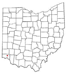
mapsize = 250px
map_caption = Location of Wyoming, Ohio
mapsize1 =
map_caption1 =subdivision_type = Country
subdivision_name =United States
subdivision_type1 = State
subdivision_name1 =Ohio
subdivision_type2 = County
subdivision_name2 = Hamiltongovernment_footnotes =
government_type =
leader_title =
leader_name =
leader_title1 =
leader_name1 =
established_title =
established_date =unit_pref = Imperial
area_footnotes =
area_magnitude =
area_total_km2 = 7.5
area_land_km2 = 7.5
area_water_km2 = 0.0
area_total_sq_mi = 2.9
area_land_sq_mi = 2.9
area_water_sq_mi = 0.0population_as_of = 2000
population_footnotes =
population_total = 8261
population_density_km2 = 1106.5
population_density_sq_mi = 2865.9timezone = Eastern (EST)
utc_offset = -5
timezone_DST = EDT
utc_offset_DST = -4
elevation_footnotes = GR|3
elevation_m = 175
elevation_ft = 574
latd = 39 |latm = 13 |lats = 43 |latNS = N
longd = 84 |longm = 28 |longs = 28 |longEW = Wpostal_code_type =
ZIP code s
postal_code = 45215, 45231
area_code = 513
blank_name = FIPS code
blank_info = 39-86730GR|2
blank1_name = GNIS feature ID
blank1_info = 1049349GR|3
website =
footnotes =Wyoming is a city in Hamilton County,
Ohio ,United States . The population was 8,261 at the 2000 census.Wyoming has a renowned education program - the Wyoming City School District was ranked first in the State of Ohio on the 2004-2005 State Report Card, with an index score of 108.2. This includes
Wyoming High School , a top ranked public high school.Geography
Nicknamed "the bubble" by residents for its tight-knit community, Wyoming is located at coor dms|39|13|43|N|84|28|28|W|city (39.228609, -84.474391)GR|1.
According to the
United States Census Bureau , the city has a total area of 2.9 square miles (7.5 km²), all of it land.Demographics
As of the
census GR|2 of 2000, there were 8,261 people, 3,047 households, and 2,404 families residing in the city. Thepopulation density was 2,865.9 people per square mile (1,107.5/km²). There were 3,172 housing units at an average density of 1,100.4/sq mi (425.2/km²). The racial makeup of the city was 87.53% White, 9.54% African American, 0.13% Native American, 1.36% Asian, 0.39% from other races, and 1.05% from two or more races. Hispanic or Latino of any race were 1.28% of the population.There were 3,047 households out of which 42.3% had children under the age of 18 living with them, 67.3% were married couples living together, 9.7% had a female householder with no husband present, and 21.1% were non-families. 19.3% of all households were made up of individuals and 8.4% had someone living alone who was 65 years of age or older. The average household size was 2.70 and the average family size was 3.11.
In the city the population was spread out with 30.6% under the age of 18, 4.0% from 18 to 24, 25.0% from 25 to 44, 26.2% from 45 to 64, and 14.2% who were 65 years of age or older. The median age was 40 years. For every 100 females there were 90.1 males. For every 100 females age 18 and over, there were 85.2 males.
The median income for a household in the city was $88,241, and the median income for a family was $103,089. Males had a median income of $71,851 versus $40,601 for females. The
per capita income for the city was $38,180. About 0.7% of families and 1.4% of the population were below thepoverty line , including 0.6% of those under age 18 and 2.0% of those age 65 or over.History
Wyoming before 1800 was a patchwork of heavily forested hills and creeks that fed the Mill Creek, a tributary of the Ohio River. Ancient people such as the Adenas and Hopewells had long departed this land by the time that French trappers and English traders encountered the seven native tribes who lived or traveled through this Ohio territory: the dominant Miami and Shawnee and other, more northern or eastern settlements of Ottawa, Pattawatomie, Wyandot, Mingo, Tuscarawas, and Muskingum.
The Northwest Ordinance, passed in 1787, opened this land up to settlement and a plan for governance. Settlers began arriving in earnest after General Anthony Wayne's victory against the Indians at the Battle of Fallen Timbers, near Toledo in 1794. Losantiville, renamed Cincinnati by the territory's governor, Gen. Arthur St. Clair, grew at a quick pace because of increasing river traffic and trade. One of Wyoming's first pioneers, Alexander Pendery, traveled down the Ohio River by keelboat from Virginia and then looked for a way north into the wilderness to settle on land his father has been given for Revolutionary War service. Before leaving Cincinnati to travel north, he met and married 15 year old Mary Ludlow, the first white girl born in Hamilton County. Her father escorted the young couple north along the "Great Road" in 1806, which followed the Mill Creek, to Pendery's convert|140|acre|km2 of land in the creek's valley. Pendery soon sold 40 acres of this land to his former brother-in-law Thomas Wilmuth, and both men began to clear the land for farming.
The Great Road, the Indian trail that General Anthony Wayne had used to move his men and munitions north to Lake Erie in 1793, was the only path north into this wilderness then. In 1806, a new "shortcut" on this road was carved out, starting in Carthage and heading north on the section line to rejoin the Wayne Road in present day Woodlawn. This road eventually became the Hamilton, Springfield and Carthage Turnpike, and it greatly influences the settlement of this area. The improved road brought settlers from Pennsylvania, Maryland, New Jersey, and New York to this rich creek valley farmland. Livestock were often seen being herded south on this road to Cincinnati slaughterhouses. Local farmers invested in the toll road in 1834 but recouped their money in usage fees and grew properous from the ability to market their goods in Cincinnati and farther down river.
The Miami and Erie Canal traveled from Cincinnati north into the wide valley created by the Mill Creek and eventually ending in Toledo and Lake Erie. In the section of the canal due east of present day Wyoming, four locks lowered the waterway convert|48|ft|m, creating an abundance of hydropower from the fall. From that energy source and the convenient supply and transportation route created by the canal, a manufacturing center known as "Lockland" emerged there. Mill-type industries lining the canal manufactured paper, flour, starch and lumber, all produced from raw material being shipped through the canal. Company owners in Lockland looked for property to live on that was away from the bustle, noise, and stench of Lockland's factories. George Stearns, George Friend, and George House, all wealthy industrialists, settled in the Wyoming area and commuted the short distance to Lockland by horse or carriage. They influenced their friends to settle in this area as well, as Wyoming began to develop as a very early "bedroom community."
Wyoming's history as an established village dates back to just before the beginning of the Civil War. On April 4, 1861, a prominent local resident who eventually served in the
75th Ohio Infantry unit,Robert Reily , held a meeting in his home with other local residents to name the Village. "Wyoming", the name selected, is an anglicized version of the Delaware Indian word for "wide valley." Some believe that the name referred to a small town in Pennsylvania that many early residents had visited. Wyoming remained unincorporated until 1874 when, with approximately 600 residents, it officially became a village. Many of the current city streets, such as Reily Road, Pendery Avenue, Oliver Road and Burns Avenue, were named after pioneer farmers or early landed estates.When the Cincinnati, Hamilton and Dayton Railway line arrived in Wyoming in 1851, it shortened travel to Cincinnati from a full day to less than one hour, eventually making canal transportation obsolete. This area's attraction as a convenient residential community was firmly established by the railroad, and many professionals who could afford to commute by train began to move into this area. The toll road had been Wyoming's first business district where the old Spreen's Grocery building sits at the end of Wyoming Avenue. That area served the steady traffic on the Hamilton, Springfield and Carthage turnpike. The railroad depot created a second business district near the tracks, and it quickly outpaced the first. As a result, land east of Springfield Pike developed as a village, while land west of the turnpike remained rural, holding onto its farms and landed estates well into the 20th century, when the automobile finally replaced trains as America's preferred mode of travel. Wyoming remains a bedroom community for Cincinnati and other area business centers to the present day.
The village remained in this status until 1949 when the population grew large enough for the village to officially receive city status. Its new charter created a nonpartisan form of government. Seven council members, elected at-large, oversee city operations; one of those council members is appointed Mayor by the rest. A city manager and his/her staff takes care of day-to-day business. [City of Wyoming History [http://www.wyoming.oh.us/index.cfm?fuseaction=home.ViewPage&page_id=121346F7-129B-4EE0-B9C9996A9013120B] ]
To note, Wyoming's Mayor, David Savage retired on his seventieth birthday on February 8th 2007. He was replaced by long-time Vice-Mayor Barry Porter. Savage has held the position of mayor longer than any other mayor in Wyoming's history.
Notable natives and residents
*Chris Perry
*Keiwan Ratliff
*T.J. Houshmandzadeh
*John E. Pepper, Jr. , former C.E.O. & Chairman of P&G, current C.E.O. ofNational Underground Railroad Freedom Center & current Chairman ofThe Walt Disney Company .
*Sam Wyche , former Head Coach of the Cincinnati Bengals
*Ahmed Plummer , Wyoming class of 1995, a former cornerback for The Ohio State University, and the NFL'sSan Francisco 49ers
*Barry Larkin
*Nikki Giovanni , acclaimed poet and writer
*Angelo Herndon
*David PayneReferences
Barry Larkin
External links
* [http://www.wyoming.oh.us/ Wyoming official website]
* [http://news.enquirer.com/apps/pbcs.dll/article?AID=/20070208/NEWS01/702080373/1056/COL02 Mayor Savage retires]
* [http://www.arcardiapublishing.com/ Publisher of Images of America, Wyoming by Rebecca Strand Johnson]
* [http://www.excellenceoncouncil.com/ Excellence on Council - Re-elect Incumbent City of Wyoming Council Candidates]
Wikimedia Foundation. 2010.