- Cheviot, Ohio
-
Cheviot, Ohio — City — Location of Cheviot, Ohio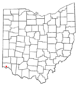
Coordinates: 39°9′28″N 84°36′45″W / 39.15778°N 84.6125°WCoordinates: 39°9′28″N 84°36′45″W / 39.15778°N 84.6125°W Country United States State Ohio County Hamilton Area - Total 1.2 sq mi (3.0 km2) - Land 1.2 sq mi (3.0 km2) - Water 0.0 sq mi (0.0 km2) Elevation[1] 909 ft (277 m) Population (2000) - Total 9,015 - Density 7,753.5/sq mi (2,993.6/km2) Time zone Eastern (EST) (UTC-5) - Summer (DST) EDT (UTC-4) ZIP code 45211 Area code(s) 513 FIPS code 39-14128[2] GNIS feature ID 1056799[1] Cheviot (
 /ˈʃɛviət/)[3] is a city located in west central Hamilton County, Ohio, United States. The population was 9,015 at the 2000 census.
Contents
History
In 1814 a Scottish immigrant named John Craig purchased a half section of 320 acres (1.3 km2) of Green Township from Elias Boudinot. He built an inn and tavern on the Harrison Pike. In 1818 Craig laid out a village which he named after the Cheviot Hills in southern Scotland. He sold lots and growth began.
In 1863, Confederate General John Hunt Morgan led his Morgan's Raiders past Union lines through Kentucky, Indiana, and Ohio. One of the targets included Cheviot, where the town was devastated by fire and destruction from the rampaging soldiers on July 13 of that year.
The town was incorporated in 1901. Originally a farming community, today Cheviot is a residential suburb of Cincinnati.
Culture
The city of Cheviot is home to much of the same German-American and other ethnic cultures that inhabit the surrounding Cincinnati area. The city is known locally (and regionally) for its annual Harvest Home Fair. Since about 1855, the fair is held each year on the weekend after Labor Day. The city incorporated the Westside Streetfest in 2002, which has steadily grown in popularity. The annual event features local food, various booths/activities, children's rides, and live music. Cheviot is often recognized by locals as "The Heart of The West Side" (of Cincinnati) because of its urban yet, small-town, friendly culture. The city features a concentrated variety of small businesses and pubs along its main thoroughfares.
Geography
Cheviot is located about seven miles (11 km) northwest of downtown Cincinnati, at 39°9′28″N 84°36′45″W / 39.15778°N 84.6125°W (39.157659, -84.612594)[4]. According to the United States Census Bureau, the city has a total area of 1.2 square miles (3.1 km2), all of it land.
Demographics
As of the census[2] of 2000, there were 9,015 people, 4,064 households, and 2,202 families residing in the city. The population density was 7,753.5 people per square mile (3,000.6/km²). There were 4,338 housing units at an average density of 3,731.0 per square mile (1,443.9/km²). The racial makeup of the city was 96.93% White, 0.79% African American, 0.18% Native American, 0.62% Asian, 0.01% Pacific Islander, 0.49% from other races, and 0.99% from two or more races. Hispanic or Latino of any race were 1.11% of the population.
There were 4,064 households out of which 26.9% had children under the age of 18 living with them, 39.1% were married couples living together, 10.9% had a female householder with no husband present, and 45.8% were non-families. 40.0% of all households were made up of individuals and 15.6% had someone living alone who was 65 years of age or older. The average household size was 2.17 and the average family size was 2.97.
In the city the population was spread out with 22.4% under the age of 18, 8.5% from 18 to 24, 33.7% from 25 to 44, 17.7% from 45 to 64, and 17.8% who were 65 years of age or older. The median age was 36 years. For every 100 females there were 88.9 males. For every 100 females age 18 and over, there were 84.7 males.
The median income for a household in the city was $35,150, and the median income for a family was $48,947. Males had a median income of $36,886 versus $28,202 for females. The per capita income for the city was $19,686. About 5.2% of families and 7.6% of the population were below the poverty line, including 11.4% of those under age 18 and 5.8% of those age 65 or over.
References
- ^ a b "US Board on Geographic Names". United States Geological Survey. 2007-10-25. http://geonames.usgs.gov. Retrieved 2008-01-31.
- ^ a b "American FactFinder". United States Census Bureau. http://factfinder.census.gov. Retrieved 2008-01-31.
- ^ "A Pronunciation Guide to Places in Ohio". E.W.Scripps School of Journalism. http://scrippsjschool.org/pronunciation/. Retrieved 2008-12-19.
- ^ "US Gazetteer files: 2010, 2000, and 1990". United States Census Bureau. 2011-02-12. http://www.census.gov/geo/www/gazetteer/gazette.html. Retrieved 2011-04-23.
External links
Categories:- Cities in Ohio
- Municipalities of Greater Cincinnati
- Populated places in Hamilton County, Ohio
- Populated places established in 1818

Wikimedia Foundation. 2010.