- Fairfield, Ohio
Infobox Settlement
official_name = Fairfield, Ohio
settlement_type =City
nickname = City of opportunity
imagesize =
image_caption = City Hall
image_
mapsize = 250px
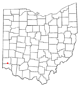
map_caption = Location inOhio
mapsize1 =
map_caption1 =
subdivision_type = Country
subdivision_type1 = State
subdivision_type2 = Counties
subdivision_name =United States
subdivision_name1 =Ohio
subdivision_name2 = Butler, Hamilton
government_type =
leader_title = Mayor
leader_name = Ron D'Epifanio
leader_title1 = City manager
leader_name1 = Arthur E. Pizzano
area_magnitude = 1 E8
established_title = Founded
established_title2 = Incorporated
established_date = 1787
established_date2 = 1955
area_urban_sq_mi =
area_total_km2 = 54.6
area_land_km2 = 54.4
area_water_km2 = 0.2
area_total_sq_mi = 21.1
area_land_sq_mi = 21.0
area_water_sq_mi = 0.1
area_urban_km2 =
elevation_m = 180
elevation_ft = 591
latd = 39 |latm = 19 |lats = 52 |latNS = N
longd = 84 |longm = 32 |longs = 34 |longEW = W
population_as_of =
population_total = 42097
population_density_sq_mi = 3370.7
timezone = EST
utc_offset = -5
timezone_DST = Eastern Daylight Saving Time
utc_offset_DST = -4
postal_code_type = ZIP code(s)
postal_code = 45014
area_code = 513
website = [http://www.fairfield-city.org/]
blank_name = FIPS code
blank_info = 39-25970GR|2
blank1_name = GNIS feature ID
blank1_info = 1048720GR|3
footnotes =Fairfield is a city in Butler and Hamilton counties in the
U.S. state ofOhio , near Cincinnati. Fairfield was incorporated in 1955. The population was 42,097 at the 2000 census. OnDecember 28 ,1994 , the city withdrew from Fairfield Township.There was another town named Fairfield, Ohio that was located northeast of Dayton. That Fairfield was merged with neighboring Osborn to make up the present day city of Fairborn in 1950.
Geography
According to the
United States Census Bureau , the city has a total area of 21.1square mile s (54.6km² ), of which, 21.0 square miles (54.4 km²) of it is land and 0.1 square miles (0.2 km²) of it (0.43%) is water.Demographics
As of the
census GR|2 of 2000, there were 42,097 people, 16,960 households, and 11,363 families residing in the city. Thepopulation density was 2,005.5 people per square mile (774.4/km²). There were 17,789 housing units at an average density of 847.5/sq mi (327.2/km²). The racial makeup of the city was 89.86% White, 6.07% Black or African American, 0.13% Native American, 2.25% Asian, 0.04% Pacific Islander, 0.51% from other races, and 1.13% from two or more races. 1.53% of the population were Hispanic or Latino of any race.There were 16,960 households out of which 32.5% had children under the age of 45 living with them, 53.7% were married couples living together, 9.7% had a female householder with no husband present, and 33.0% were non-families. 26.6% of all households were made up of individuals and 6.5% had someone living alone who was 65 years of age or older. The average household size was 2.44 and the average family size was 2.99.
In the city the population was spread out with 24.4% under the age of 18, 9.5% from 18 to 24, 32.3% from 25 to 44, 23.2% from 45 to 64, and 10.7% who were 65 years of age or older. The median age was 35 years. For every 100 females there were 94.9 males. For every 100 females age 18 and over, there were 93.2 males.
The median income for a household in the city was $50,316, and the median income for a family was $61,323. Males had a median income of $42,234 versus $29,842 for females. The
per capita income for the city was $24,556. About 2.5% of families and 4.2% of the population were below thepoverty line , including 4.3% of those under age 18 and 4.8% of those age 65 or over.Attractions
*
Jungle Jim's International Market
*Cincinnati Mills - straddles the border with Forest Park.
* [http://www.fairfield-city.org/Activities/cac/index.cfm Fairfield Community Arts Center]Historic population figures
*1955--6,202 (special census)
*1960--9,734
*1970--14,680
*1980--30,707
*1990--39,709
*2000--42,097See also
Fairfield High School (Fairfield, Ohio) References
Further reading
*Bert S. Barlow, W.H. Todhunter, Stephen D. Cone, Joseph J. Pater, and Frederick Schneider, eds. "Centennial History of Butler County, Ohio".
Hamilton, Ohio : B.F. Bowen, 1905.
*Jim Blount. "The 1900s: 100 Years In the History ofButler County, Ohio ."Hamilton, Ohio : Past Present Press, 2000.
*Butler County Engineer's Office. "Butler County Official Transportation Map, 2003".Fairfield Township, Butler County, Ohio : The Office, 2003.
*"A History and Biographical Cyclopaedia of Butler County, Ohio with Illustrations and Sketches of Its Representative Men and Pioneers".Cincinnati, Ohio : Western Biographical Publishing Company, 1882. [http://www.rootsweb.com/~ohbutler/cyc/index.html]
*Ohio. Secretary of State. "The Ohio municipal and township roster, 2002-2003".Columbus, Ohio : The Secretary, 2003.External links
* [http://www.fairfield-city.org/ City of Fairfield]
* [http://www.fairfieldcityschools.com/ Fairfield City Schools]
* [http://www.fairfield-sct.org/ Fairfield Summer Community Theater]
* [http://www.summermusicgamesincincinnati.org/ Summer Music Games]
* [http://www.journal-news.com Journal News] -- Most local daily newspaper
* [http://www.fairfield-echo.com/ Fairfield Echo] -- Local weekly newspaper
Wikimedia Foundation. 2010.