- Fairborn, Ohio
Infobox Settlement
official_name = Fairborn, Ohio
settlement_type =City
nickname =
motto =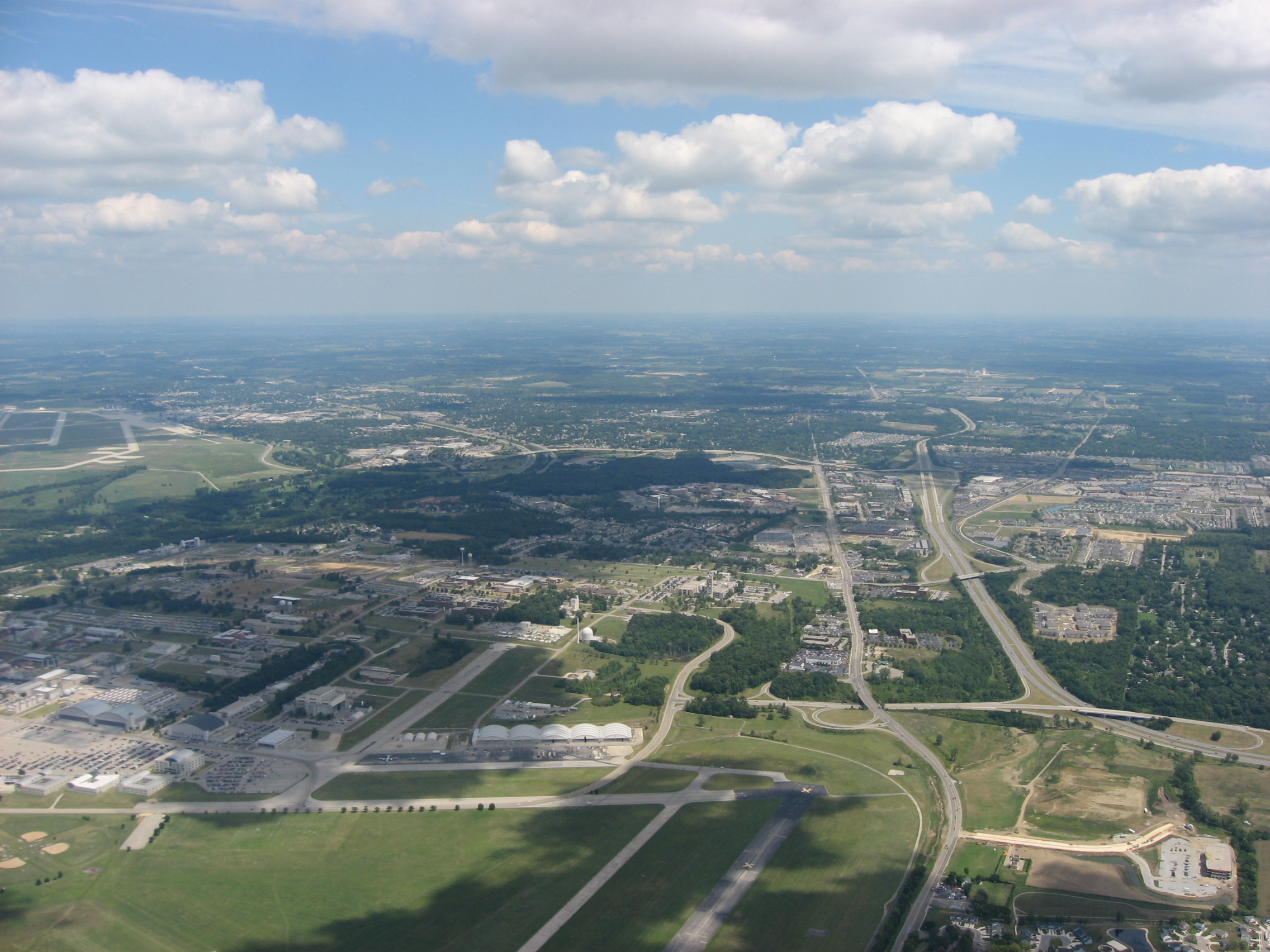
imagesize = 250px
image_caption = Aerial view of Fairborn
image_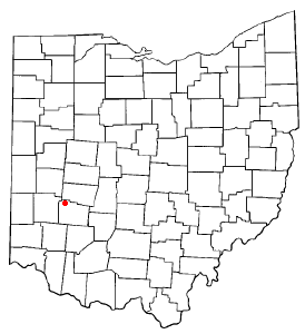
mapsize = 250px
map_caption = Location of Fairborn, Ohio
mapsize1 =
map_caption1 =subdivision_type = Country
subdivision_name =United States
subdivision_type1 = State
subdivision_name1 =Ohio
subdivision_type2 = County
subdivision_name2 = Greenegovernment_footnotes =
government_type =
leader_title =Mayor
leader_name = Gary L. Woodward
leader_title1 =
leader_name1 =
established_title = Incorporated
established_date = 1950unit_pref = Imperial
area_footnotes =
area_magnitude =
area_total_km2 = 33.8
area_land_km2 = 33.8
area_water_km2 = 0.0
area_total_sq_mi = 13.1
area_land_sq_mi = 13.1
area_water_sq_mi = 0.0population_as_of = 2000
population_footnotes =
population_total = 32052
population_density_km2 = 947.6
population_density_sq_mi = 2453.4timezone = Eastern (EST)
utc_offset = -5
timezone_DST = Eastern (EDT)
utc_offset_DST = -4
elevation_footnotes = GR|3
elevation_m = 837
elevation_ft = 255
latd = 39 |latm = 48 |lats = 28 |latNS = N
longd = 84 |longm = 1 |longs = 19 |longEW = Wpostal_code_type =
ZIP code
postal_code = 45324
area_code = 937
blank_name = FIPS code
blank_info = 39-25914GR|2
blank1_name = GNIS feature ID
blank1_info = 1077584GR|3
website = http://ci.fairborn.oh.us
footnotes =Fairborn is a city in Greene County,
Ohio ,United States , near Dayton andWright-Patterson Air Force Base . The population was 32,052 at the 2000 census. It claims to be the only city in the world with the name of Fairborn,Cite web|url=http://ci.fairborn.oh.us/history.htm|title=History of Fairborn, Ohio|accessdate=2007-05-20|publisher=City of Fairborn, Ohio|year=1976|author=Cleo Wilson Hodgkins, Charles R. Linderman editor|work=A Tale of Two Towns|format=HTML] aportmanteau word created from the names Fairfield and Osborn; the two villages that merged in 1950 after theGreat Dayton Flood of 1913 forced Osborn to move out of a flood plain and alongside Fairfield.Fairborn is the home of
Wright State University . Fairborn is served by a branch of theGreene County Public Library [http://www.gcpl.lib.oh.us/Fairborn.asp] . It is part of the Dayton Metropolitan Statistical Area.History
Fairborn was formed from the union of the two villages of Fairfield and Osborn. Fairfield was originally founded in 1816 and Osborn in 1851.
Before European settlers arrived, native inhabitants of the region included the
Adena culture of Ohio and nearby states, and the subsequentHopewell culture known fromIllinois to Ohio and renowned for their geometric earthworks. Several surviving examples of earthen mounds made by Mound builders still exist at the Wright Brother's Memorial atop the bluff overlookingHuffman Prairie .The area of the village of Fairfield was settled before Ohio was a state. The first log cabin was built by George Greiner in 1799. The area where the village would grow was favorable to pioneers who were moving northward and westward from
Kentucky andVirginia . Often there were raids made upon the settlement by local Indians, followed by similar raids on local native settlements. Although no massacres took place, both sides engaged in taking prisoners [Poole (1957), p. 1] . There are two accounts regarding the name "Fairfield". One more accepted account claims that a local Native American - possibly aShawnee - tribal chief, in speaking to one of the town's leaders after making peace and exchanging prisoners, said to William Cozad that when he looked out from Reed's Hill over the town, cquote|Yonder lies a fair field. I see thousands of white men moving about in that beautiful fair field [Poole (1957), p. 1] .The other possible source for the name is after a Fairfield in
England .Osborn was a town (no longer existing) located near the Haddix Road-Ohio 235 intersection at the northern edge of
Wright-Patterson Air Force Base in what is now the flood-prone basin of theHuffman Dam in theU.S. state ofOhio . Osborn was named after the superintendent of the railroad named E.F. Osborn. The previously unnamed town allowed the railroad to be built through it after the nearby town of Fairfield refused the plan of the railway to go through there. Many of the original houses of old Osborn still stand in Fairborn's Historic Osborn District.Huffman Prairie , part ofDayton Aviation Heritage National Historical Park , is an 84 acre (.34 km²) patch of rough pasture that was outside the village of Fairfield (now known as Huffman Prairie Flying Field), where theWright Brothers undertook the difficult and sometimes dangerous task of creating a dependable, fully controllable airplane and training themselves to be pilots. After they began making use of Huffman Prairie in 1904, the Wright brothers made hundreds of flights here after developing the 1905Wright Flyer III (the plane they considered to be the first practical airplane), testing the aircraft built by theWright Company . At theWright Flying School , also located here, they trained more than a hundred pilots, including the flyers for theWright Exhibition Team and the first military flyers, includingHenry H. Arnold andThomas DeWitt Milling . TheUnited States Army Signal Corps purchased the field in 1917 and renamed it, along with 2,000 adjacent acres (8 km²), Wilbur Wright Field. In 1948 the area was merged with nearby Wright Field and becameWright-Patterson Air Force Base .In 1921 nearly the entire town of Osborn, along with the railroad (now
Norfolk Southern Railway ), were relocated two miles away during construction of theHuffman Dam on the Mad River to a site east of and adjacent to Fairfield. This was necessary because of the Miami Valley Flood Control Project and theMiami Conservancy District that was begun after theGreat Dayton Flood (Dayton, Ohio ) of March, 1913. The village decided to move homes out of the flood plain on flatbed trucks and settle alongside Fairfield.Growth of the two villages was hindered by the other's borders, a military flying field and depot (now Wright-Patterson Air Force Base), township borders, and county borders. The two villages voted to merge in 1949 and officially merged in 1950Cite web|url=http://www.ci.fairborn.oh.us/history.htm|title=History of Fairborn, Ohio|accessdate=2007-05-29|publisher=City of Fairborn, Ohio|year=1976|author=Cleo Wilson Hodgkins, Charles R. Linderman editor|work=A Tale of Two Towns|format=HTML] The first business to depict the name of the new city was the large vertical sign of the Fairborn Theater.From 1950-1970 the city experienced explosive growth to six times its former population, surpassing
Xenia (the county seat) as the most populous city in the county, due largely to the local employment opportunities made available by the nearby Air Force Base. Another employer, Southwestern Portland Cement operated the largest factory in the city during this period.The development of
Interstate 675 (Ohio) began in the 1960s to serve as an eastern bypass of Dayton. In the early 1970s, construction began on the northernmost part of I-675, just east of Fairborn. The first segment terminated at N. Fairfield Road (exit 18). No further construction was done for over a decade and it was jokingly referred to by some as "Fairborn's private Interstate". Dayton MayorJames H. McGee opposed the highway, contending it would draw economic development out of the city into the suburbs. I-675 was eventually completed by 1987.Fairborn's growth slowed significantly in the 1970s and has only resumed at a moderate pace since the late 1980s. It has since been surpassed by neighboring
Beavercreek, Ohio in population.In related local history, the "General Framework Agreement for Peace in
Bosnia and Herzegovina ", also known as theDayton Agreement , was reached at theWright-Patterson Air Force Base near Fairborn in November 1995, and formally signed inParis on December 14, 1995. These accords put an end to the three and a half year long war in Bosnia, one of the armed conflicts in the former Socialist Federative Republic of Yugoslavia.As of 2007, Fairborn is a quiet town with many still working at the nearby Wright Patterson Air Force Base, the home of the
Air Force Materiel Command and in many measures the largest, most diverse and organizationally complex base in the Air ForceCite web|url=http://www.wpafb.af.mil/about.html|title=About WPAFB|accessdate=2006-10-01|publisher=United States Department of Defense|year=2006|author=88 ABW/PA, Public Affairs Office|format=html] .Many also work at or attend
Wright State University , a university that became independent in 1967. From a small cluster of buildings it has grown into a major campus with almost 20,000 students. Though Wright State has aDayton, Ohio address it is legally within Fairborn jurisdiction and has police officers deputized by the Fairborn police department.Fairborn is the home of the largest elementary school in Ohio, Fairborn Primary School [cite web |url=http://www.wright.edu/news_events/news/praeger.html |title=Fairborn Primary School previously known as Five Points Elementary |accessdate=2007-07-06] . Downtown Fairborn's historic [http://www.daytondailynews.com/p/content/gen/sharedoh/photos_galleries/news/local/102006foys.html Foy's store] has the state's largest collection of Halloween supplies.
Fairborn hosts its annual [http://www.greenecountyohio.org/events.htm Sweet Corn Festival] every August and the
USAF [http://www.greenecountyohio.org/events.htm marathon] every September. It also prides itself on its annual 4th of July Parade. Fairborn is also home of the Fairborn Wee Hawks Pee Wee Football teams. [http://www.fairbornyouthsports.com/fb/index.php]Geography
Fairborn is located at coord|39|48|28|N|84|1|19|W|type:city_region:US-OH|display=title,inlineGR|1.
According to the
United States Census Bureau , the city has a total area of 13.1square mile s (33.8km² ), all of it land.Demographics
As of the
census GR|2 of 2000, there were 32,052 people, 13,615 households, and 8,019 families residing in the city. Thepopulation density was 2,453.4 people per square mile (947.6/km²). There were 14,419 housing units at an average density of 1,103.7/sq mi (426.3/km²). The racial makeup of the city was 87.28% White, 6.27% African American, 0.40% Native American, 3.32% Asian, 0.06% Pacific Islander, 0.53% from other races, and 2.14% from two or more races. Hispanic or Latino of any race were 1.69% of the population.There were 13,615 households out of which 26.7% had children under the age of 18 living with them, 42.8% were married couples living together, 12.4% had a female householder with no husband present, and 41.1% were non-families. 31.0% of all households were made up of individuals and 8.3% had someone living alone who was 65 years of age or older. The average household size was 2.28 and the average family size was 2.86.
In the city the population was spread out with 21.0% under the age of 18, 18.4% from 18 to 24, 29.3% from 25 to 44, 19.7% from 45 to 64, and 11.6% who were 65 years of age or older. The median age was 31 years. For every 100 females there were 94.7 males. For every 100 females age 18 and over, there were 91.7 males.
The median income for a household in the city was $36,889, and the median income for a family was $44,608. Males had a median income of $34,853 versus $25,353 for females. The
per capita income for the city was $18,662. About 8.9% of families and 14.1% of the population were below thepoverty line , including 15.5% of those under age 18 and 7.7% of those age 65 or over.Notable natives and/or residents
*
Brian Billick , head coach of theBaltimore Ravens , 1999-2007
*Kevin DeWine , Ohio Representative to the 70th district and Speaker Pro Tempore of the Ohio House of Representatives
*Colonel Gregory H. Johnson ,NASA astronaut [cite web |url=http://www.jsc.nasa.gov/Bios/htmlbios/johnson-gh.html |title=Gregory Johnson Biography |accessdate=2007-07-06 |format= |work=www.jsc.nasa.gov]
*Gary A. Klein , pioneer in the field ofnaturalistic decision making
*Billy Mason ,drummer withTim McGraw 's touring band "Dance Hall Doctors"
*Michael J. Saylor , founder ofMicroStrategy [cite web |url=http://www.cs.trinity.edu/~rjensen/readings/MicroStrategy/MicroStrategy01.htm |title=Michael Saylor Biography |accessdate=2007-07-06 |format= |work=MicroStrategy's CEO Sped to the Brink] .
* Mark Turner,jazz saxophonist and teacher at theManhattan School of Music
* Dr.Rajeev Venkayya , special assistant forbiodefense toPresident of the United States George W. Bush
* Jackie (Waddell) Warner, actress in thereality television series "Work Out "
* Roger Osborne, author
* Donny Howard,pianist , backgroundvocalist withReba McEntire 's touring band, 1985-1989ee also
*
The Mall at Fairfield Commons Notes
External links
* [http://ci.fairborn.oh.us/ City of Fairborn]
* [http://www.fairborn.com/ Fairborn Chamber of Commerce]
* [http://www.fairborn.k12.oh.us/ Fairborn City Schools]
* [http://www.efairborn.com/ eFairborn Community Web Site]
* [http://www.fairbornpac.org/ Fairborn Performing Arts and Cultural Center]
Wikimedia Foundation. 2010.