- Newtown, Ohio
-
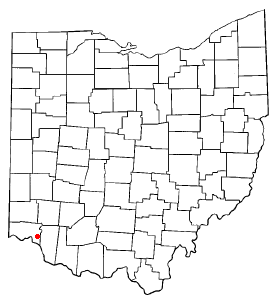
Newtown, Ohio — Village — Native American mound in a Newtown cemetery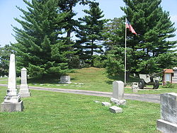 Location of Newtown, Ohio
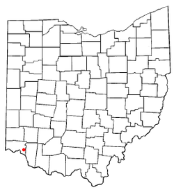 Newtown (yellow) is surrounded by Anderson Township (blue) within Hamilton County, Ohio
Coordinates: 39°7′33″N 84°21′29″W / 39.12583°N 84.35806°WCoordinates: 39°7′33″N 84°21′29″W / 39.12583°N 84.35806°W Country United States State Ohio County Hamilton Area – Total 2.3 sq mi (6.0 km2) – Land 2.3 sq mi (6.0 km2) – Water 0.0 sq mi (0.0 km2) Elevation[1] 499 ft (152 m) Population (2000) – Total 2,420 – Density 1,042.4/sq mi (402.5/km2) Time zone Eastern (EST) (UTC-5) – Summer (DST) EDT (UTC-4) ZIP code 45244 Area code(s) 513 FIPS code 39-55678[2] GNIS feature ID 1065151[1] Newtown is a village in southeastern Hamilton County, Ohio, United States, near Cincinnati. The population was 2,420 at the 2000 census. Newtown was first settled in 1792 under the name of Mercersburg. The name was changed before the village incorporated in 1901.
Contents
History
Multiple Native American mounds and other earthworks were once located on the site of Newtown.[3] Still in existence today are the Odd Fellows' Cemetery Mound and the Perin Village Site, plus the Turpin Site and the Hahn Field Archeological District just outside of the village's boundaries.[4] Newtown has a decades-long tradition of hosting an open-to-the-public "fish fry" every Friday during lent. Originally run soleley by the local volunteer fire department, in recent times a wider spectrum of community volunteers now operate the event.[5]
Geography
Newtown is located at 39°7′33″N 84°21′29″W / 39.12583°N 84.35806°W (39.125811, -84.358102)[6]. Newtown is surrounded by Anderson Township, from which it was split in the 1960s.[7]
According to the United States Census Bureau, the village has a total area of 2.3 square miles (6.0 km2), all of it land.
Demographics
As of the census[2] of 2000, there were 2,420 people, 924 households, and 669 families residing in the village. The population density was 1,042.4 people per square mile (402.7/km²). There were 977 housing units at an average density of 420.8 per square mile (162.6/km²). The racial makeup of the village was 96.36% White, 1.86% African American, 0.41% Native American, 0.87% Asian, 0.12% from other races, and 0.37% from two or more races. Hispanic or Latino of any race were 1.16% of the population.
There were 924 households out of which 35.7% had children under the age of 18 living with them, 58.9% were married couples living together, 10.1% had a female householder with no husband present, and 27.5% were non-families. 23.1% of all households were made up of individuals and 7.6% had someone living alone who was 65 years of age or older. The average household size was 2.62 and the average family size was 3.11.
In the village the population was spread out with 27.1% under the age of 18, 6.8% from 18 to 24, 32.1% from 25 to 44, 24.7% from 45 to 64, and 9.3% who were 65 years of age or older. The median age was 36 years. For every 100 females there were 94.7 males. For every 100 females age 18 and over, there were 93.7 males.
The median income for a household in the village was $50,980, and the median income for a family was $56,902. Males had a median income of $41,976 versus $28,810 for females. The per capita income for the village was $32,590. About 4.9% of families and 7.1% of the population were below the poverty line, including 8.3% of those under age 18 and 12.5% of those age 65 or over.
References
- ^ a b "US Board on Geographic Names". United States Geological Survey. 2007-10-25. http://geonames.usgs.gov. Retrieved 2008-01-31.
- ^ a b "American FactFinder". United States Census Bureau. http://factfinder.census.gov. Retrieved 2008-01-31.
- ^ Owen, Lorrie K., ed. Dictionary of Ohio Historic Places. Vol. 1. St. Clair Shores: Somerset, 1999.
- ^ "National Register Information System". National Register of Historic Places. National Park Service. 2009-03-13. http://nrhp.focus.nps.gov/natreg/docs/All_Data.html.
- ^ Newtown fish fry to return March 11 Rob Dowdy, Cincinatti.com, 2/25/2011
- ^ "US Gazetteer files: 2010, 2000, and 1990". United States Census Bureau. 2011-02-12. http://www.census.gov/geo/www/gazetteer/gazette.html. Retrieved 2011-04-23.
- ^ http://www.villageofnewtown.com/history.html
External links
Categories:- Villages in Ohio
- Populated places in Hamilton County, Ohio
- Municipalities of Greater Cincinnati
- Populated places established in 1792


Wikimedia Foundation. 2010.