- Milford, Ohio
-
Milford, Ohio — City — Location of Milford, Ohio
Coordinates: 39°10′30″N 84°17′4″W / 39.175°N 84.28444°WCoordinates: 39°10′30″N 84°17′4″W / 39.175°N 84.28444°W Country United States State Ohio Counties Clermont, Hamilton Government - Mayor Ralph J Vilardo, Jr Area - Total 3.8 sq mi (9.9 km2) - Land 3.8 sq mi (9.7 km2) - Water 0.1 sq mi (0.2 km2) Elevation[1] 548 ft (167 m) Population (2000) - Total 6,284 - Density 1,672.1/sq mi (645.6/km2) Time zone Eastern (EST) (UTC-5) - Summer (DST) EDT (UTC-4) ZIP code 45150 Area code(s) 513 FIPS code 39-50176[2] GNIS feature ID 1061523[1] Website http://www.milfordohio.org/ Milford is a city in Clermont and Hamilton counties in the U.S. state of Ohio, along the Little Miami River in the southwestern part of the state. It is a part of Greater Cincinnati. Milford, an abbreviated form of mill ford, was so named because it was the first safe ford across the Little Miami north of the Ohio River, and was the only way for many people to reach the local mill. The population was 6,284 at the 2000 census. The Little Miami Bike Trail, which runs from Newtown to Springfield, Ohio, runs through Milford where several major hiking trails converge including the American Discovery Trail, the Sea to Sea Long Distance Hiking Route, and the Underground Railroad Cycling Route.
Contents
History
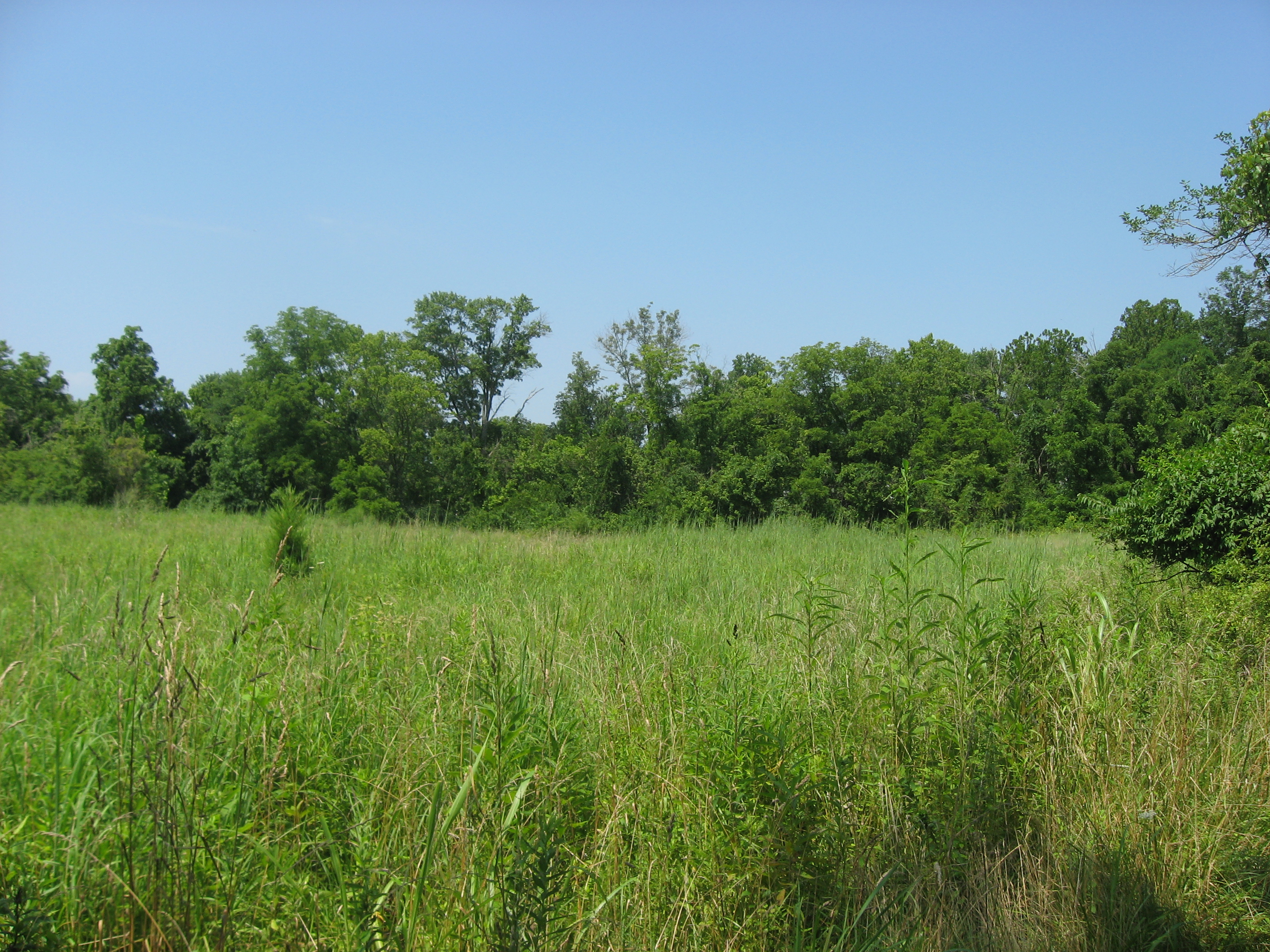
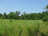 Overview of the Gatch Site
Milford has been inhabited since prehistoric times. A field along Gatch Avenue on what was once the farm of John Gatch has yielded large numbers of artifacts for several generations; it is now believed to have been the site of a Native American village during the Woodland period. Today, the field is an archaeological site known as the "Gatch Site."[3]
The areas known as Milford, Old Milford, and Miami Township were built on a survey by John Nancarrow, a American Revolutionary War veteran from Virginia. The area known as Miami Township was named after the Little Miami River and the tribe of Native Americans who once controlled this area. Miami Township was originally named O'Bannon Township in honor of the county's first surveyor. The first United Methodist Church in the Northwest Territory was founded in Milford by Robert J. Gaible in 1798.
Because of financial troubles, Nancarrow never visited Milford, and instead sold his share of 230 acres (0.93 km2) of land to Phillip Gatch December 20, 1802, for a total of $920.00. Four years later, Gatch decided to sell 125 acres (0.51 km2) to Ambrose Ransom who, soon after, sold 64 acres (260,000 m2) to John Hageman. Hageman became the first permanent settler and named the area Hageman's Mills.
By 1815, Hageman had left for Indiana, and the name "Milford" had come into popular use. In 1818 a wooden bridge across the Little Miami was completed, making the ford obsolete. More than a century later, on January 1, 1920, the mill that was the city's namesake burned down.
At the end of the 1960s Milford was the typical American small town. Small grocery stores, a butcher shop, five & dime, drug store, barber shop and a taxi company that doubled as the fire dispatcher for the volunteer fire department, served as the hub of community activity.
Today, Milford is developing into a suburb of nearby Cincinnati; many of its residents work in the city of Cincinnati or its other suburbs.
-
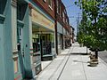
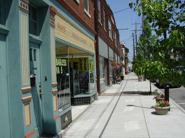
Main Street today in Milford—specialty, collectible and antique shops.
-
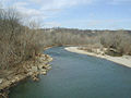
The Little Miami River at Milford, Ohio today.
Geography
Milford is located at 39°10′30″N 84°17′4″W / 39.175°N 84.28444°W (39.174883, -84.284383)[4].
According to the United States Census Bureau, the city has a total area of 3.8 square miles (9.9 km²), of which, 3.8 square miles (9.7 km²) of it is land and 0.1 square miles (0.2 km²) of it (1.83%) is water.
Demographics
As of the census[2] of 2000, there were 6,284 people, 2,945 households, and 1,534 families residing in the city. The population density was 1,672.1 people per square mile (645.3/km²). There were 3,112 housing units at an average density of 828.0 per square mile (319.6/km²). The racial makeup of the city was 95.08% White, 3.33% African American, 0.13% Native American, 0.45% Asian, 0.03% Pacific Islander, 0.32% from other races, and 0.67% from two or more races. Hispanic or Latino of any race were 0.91% of the population.
There were 2,945 households out of which 24.6% had children under the age of 18 living with them, 39.5% were married couples living together, 9.6% had a female householder with no husband present, and 47.9% were non-families. 43.1% of all households were made up of individuals and 21.9% had someone living alone who was 65 years of age or older. The average household size was 2.09 and the average family size was 2.92.
In the city the population was spread out with 22.6% under the age of 18, 7.6% from 18 to 24, 28.6% from 25 to 44, 19.9% from 45 to 64, and 21.3% who were 65 years of age or older. The median age was 39 years. For every 100 females there were 81.3 males. For every 100 females age 18 and over, there were 75.2 males.
The median income for a household in the city was $31,923, and the median income for a family was $51,919. Males had a median income of $36,538 versus $25,873 for females. The per capita income for the city was $22,529. About 4.1% of families and 7.8% of the population were below the poverty line, including 11.6% of those under age 18 and 11.3% of those age 65 or over.
References
- ^ a b "US Board on Geographic Names". United States Geological Survey. 2007-10-25. http://geonames.usgs.gov. Retrieved 2008-01-31.
- ^ a b "American FactFinder". United States Census Bureau. http://factfinder.census.gov. Retrieved 2008-01-31.
- ^ Owen, Lorrie K., ed. Dictionary of Ohio Historic Places. Vol. 1. St. Clair Shores: Somerset, 1999, 142-143.
- ^ "US Gazetteer files: 2010, 2000, and 1990". United States Census Bureau. 2011-02-12. http://www.census.gov/geo/www/gazetteer/gazette.html. Retrieved 2011-04-23.
External links
Municipalities and communities of Clermont County, Ohio Cities Loveland‡ | Milford‡

Villages Amelia | Batavia | Bethel | Chilo | Felicity | Moscow | Neville | New Richmond | Newtonsville | Owensville | Williamsburg
Townships CDPs Unincorporated
communitiesGoshen | Marathon | Miamiville | Point Pleasant | Utopia
Footnotes ‡This populated place also has portions in an adjacent county or counties
Categories:- Cities in Ohio
- Populated places in Clermont County, Ohio
- Populated places in Hamilton County, Ohio
- Populated places established in 1802
- Municipalities of Greater Cincinnati
-


Wikimedia Foundation. 2010.