- Milford Township, Butler County, Ohio
-
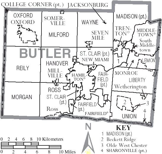
Milford Township, Butler County, Ohio — Township — Municipalities and townships of Butler County.
Coordinates: 39°31′38″N 84°38′49″W / 39.52722°N 84.64694°WCoordinates: 39°31′38″N 84°38′49″W / 39.52722°N 84.64694°W Country United States State Ohio County Butler Area – Total 37.1 sq mi (96.0 km2) – Land 36.9 sq mi (95.7 km2) – Water 0.1 sq mi (0.3 km2) Elevation[1] 876 ft (267 m) Population (2000) – Total 3,254 – Density 88.1/sq mi (34.0/km2) Time zone Eastern (EST) (UTC-5) – Summer (DST) EDT (UTC-4) FIPS code 39-50162[2] GNIS feature ID 1085815[1] 
Milford Township, one of thirteen townships in the county, is located in north-central Butler County, Ohio, United States, between Oxford and Middletown. The township, which contains the village of Somerville, had a population of 3,254 in 2000, up from 2,651 in 1990. Excluding Somerville, 2,960 live in the unincorporated part of the township. It comprises one entire survey township in the Congress Lands and has an area of thirty-six square miles. The township was named by Robert Lytle, the township justice of the peace and County Judge who was the great-grandfather of a famous Milford Township native, Governor Andrew L. Harris. Statewide, other Milford Townships are located in Defiance and Knox Counties.
Contents
History
The seventh township in order of creation, it was erected from St. Clair Township by the Butler County Commissioners on December 2, 1805, with these boundaries:
- Beginning at the southeast corner of the fifth township of the second range west of the Miami; thence north with the east boundary of the said second range to the north boundary of the county; thence west with the northern boundary line to the northwest corner of the county; thence south with the western boundary line of the county to the southwest corner of the fifth township in the first range; thence to the place of beginning.
This area was diminished to the present territory when the western half, another full survey township commonly known as the "college township", was separated from Milford Township by the Butler County Commissioners (James Blackburn, William Robison, and John Wingate) on August 5, 1811, to form Oxford Township.
Historic population figures
- 1900—1476
- 1910—1397
- 1920—1344
- 1930—1467
- 1940—1532
- 1950—1688
- 1960—2135
- 1970—2350
- 1980—2569
- 1990—2651
Geography
Located in the northern part of the county, it borders the following townships:
- Somers Township, Preble County - north
- Gratis Township, Preble County - northeast corner
- Wayne Township - east
- St. Clair Township - southeast corner
- Hanover Township - south
- Reily Township - southwest corner
- Oxford Township - west
- Israel Township, Preble County - northwest corner
Unincorporated places in the township are Darrtown and Collinsville.
Government
The township is governed by a three-member board of trustees, who are elected in November of odd-numbered years to a four-year term beginning on the following January 1. Two are elected in the year after the presidential election and one is elected in the year before it. There is also an elected township fiscal officer,[3] who serves a four-year term beginning on April 1 of the year after the election, which is held in November of the year before the presidential election. Vacancies in the fiscal officership or on the board of trustees are filled by the remaining trustees.
Public services
The township is served by the Somerville and Collinsville post offices and is in the Talawanda City School District. Major highways include State Routes 73 (the road between Oxford and Middletown), 177, and 744, and U.S. Route 127 (the road between Hamilton and Eaton, which is also known as the Gov. Andrew L. Harris Bicentennial Roadway). At the 2005 Milford Township Bicentennial, the Gov. Andrew L. Harris Bicentennial Roadway was dedicated in 2005 by an invited speaker, James Brodbelt Harris, the governor's relative and the president of the family reunion association, whose family owns an Ohio Century Farm in the township.
References
- ^ a b "US Board on Geographic Names". United States Geological Survey. 2007-10-25. http://geonames.usgs.gov. Retrieved 2008-01-31.
- ^ "American FactFinder". United States Census Bureau. http://factfinder.census.gov. Retrieved 2008-01-31.
- ^ §503.24, §505.01, and §507.01 of the Ohio Revised Code. Accessed 4/30/2009.
- Bert S. Barlow, W.H. Todhunter, Stephen D. Cone, Joseph J. Pater, and Frederick Schneider, eds. Centennial History of Butler County, Ohio. Hamilton, Ohio: B.F. Bowen, 1905.
- Jim Blount. The 1900s: 100 Years In the History of Butler County, Ohio. Hamilton, Ohio: Past Present Press, 2000.
- Butler County Engineer's Office. Butler County Official Transportation Map, 2003. Fairfield Township, Butler County, Ohio: The Office, 2003.
- A History and Biographical Cyclopaedia of Butler County, Ohio with Illustrations and Sketches of Its Representative Men and Pioneers. Cincinnati, Ohio: Western Biographical Publishing Company, 1882. [1]
- Ohio. Secretary of State. The Ohio municipal and township roster, 2002-2003. Columbus, Ohio: The Secretary, 2003.
External links
Municipalities and communities of Butler County, Ohio Cities Fairfield‡ | Hamilton | Middletown‡ | Monroe‡ | Oxford | Sharonville‡ | Trenton

Villages College Corner‡ | Jacksonburg | Millville | New Miami | Seven Mile | Somerville
Townships CDPs Unincorporated
communitiesAlert | Bethany | Collinsville | Darrtown | Excello | Maud | Miltonville | McGonigle | Okeana | Overpeck | Poasttown | Port Union | Scipio | Shandon | Tylersville | West Middletown | Woodsdale
Footnotes ‡This populated place also has portions in an adjacent county or counties
Categories:- Townships in Butler County, Ohio
- 1805 establishments in the United States
- Populated places established in 1805

Wikimedia Foundation. 2010.