- Mulberry, Ohio
-
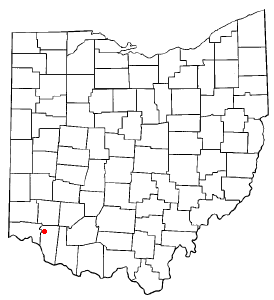
Mulberry, Ohio — CDP — Location of Mulberry, Ohio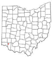
Coordinates: 39°11′38″N 84°15′3″W / 39.19389°N 84.25083°WCoordinates: 39°11′38″N 84°15′3″W / 39.19389°N 84.25083°W Country United States State Ohio County Clermont Area – Total 1.5 sq mi (3.9 km2) – Land 1.5 sq mi (3.9 km2) – Water 0.0 sq mi (0.0 km2) Elevation[1] 840 ft (256 m) Population (2000) – Total 3,139 – Density 2,072.7/sq mi (800.3/km2) Time zone Eastern (EST) (UTC-5) – Summer (DST) EDT (UTC-4) FIPS code 39-53270[2] GNIS feature ID 1065082[1] Mulberry is a census-designated place (CDP) in Clermont County, Ohio, United States. The population was 3,139 at the 2000 census.
Geography
Mulberry is located at 39°11′38″N 84°15′3″W / 39.19389°N 84.25083°W (39.193980, -84.250915)[3].
According to the United States Census Bureau, the CDP has a total area of 1.5 square miles (3.9 km2), all of it land.
Demographics
As of the census[2] of 2000, there were 3,139 people, 1,196 households, and 800 families residing in the CDP. The population density was 2,072.7 people per square mile (802.6/km²). There were 1,229 housing units at an average density of 811.5/sq mi (314.3/km²). The racial makeup of the CDP was 97.26% White, 0.92% African American, 0.29% Native American, 0.73% Asian, 0.03% Pacific Islander, 0.19% from other races, and 0.57% from two or more races. Hispanic or Latino of any race were 0.73% of the population.
There were 1,196 households out of which 31.2% had children under the age of 18 living with them, 53.3% were married couples living together, 10.6% had a female householder with no husband present, and 33.1% were non-families. 28.1% of all households were made up of individuals and 8.5% had someone living alone who was 65 years of age or older. The average household size was 2.34 and the average family size was 2.87.
In the CDP the population was spread out with 20.5% under the age of 18, 8.8% from 18 to 24, 25.1% from 25 to 44, 25.1% from 45 to 64, and 20.5% who were 65 years of age or older. The median age was 42 years. For every 100 females there were 78.1 males. For every 100 females age 18 and over, there were 73.9 males.
The median income for a household in the CDP was $50,326, and the median income for a family was $64,044. Males had a median income of $42,264 versus $28,686 for females. The per capita income for the CDP was $26,623. None of the families and 4.2% of the population were living below the poverty line, including no under eighteens and 11.8% of those over 64.
References
- ^ a b "US Board on Geographic Names". United States Geological Survey. 2007-10-25. http://geonames.usgs.gov. Retrieved 2008-01-31.
- ^ a b "American FactFinder". United States Census Bureau. http://factfinder.census.gov. Retrieved 2008-01-31.
- ^ "US Gazetteer files: 2010, 2000, and 1990". United States Census Bureau. 2011-02-12. http://www.census.gov/geo/www/gazetteer/gazette.html. Retrieved 2011-04-23.
Municipalities and communities of Clermont County, Ohio Cities 
Villages Amelia | Batavia | Bethel | Chilo | Felicity | Moscow | Neville | New Richmond | Newtonsville | Owensville | Williamsburg
Townships CDPs Day Heights | Mount Carmel | Mount Repose | Mulberry | Summerside | Withamsville
Unincorporated
communitiesGoshen | Marathon | Miamiville | Point Pleasant | Utopia
Footnotes ‡This populated place also has portions in an adjacent county or counties
Categories:- Populated places in Clermont County, Ohio
- Census-designated places in Ohio

Wikimedia Foundation. 2010.