- Newtonsville, Ohio
-
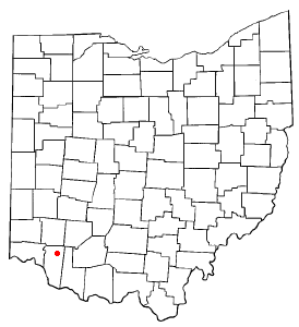
Newtonsville, Ohio — Village — Location of Newtonsville, Ohio
Coordinates: 39°10′52″N 84°5′6″W / 39.18111°N 84.085°WCoordinates: 39°10′52″N 84°5′6″W / 39.18111°N 84.085°W Country United States State Ohio County Clermont Government – Mayor Jason Ritter Area – Total 0.2 sq mi (0.6 km2) – Land 0.2 sq mi (0.6 km2) – Water 0.0 sq mi (0.0 km2) Elevation[1] 899 ft (274 m) Population (2000) – Total 492 – Density 2,021.8/sq mi (780.6/km2) Time zone Eastern (EST) (UTC-5) – Summer (DST) EDT (UTC-4) ZIP code 45158 Area code(s) 513 FIPS code 39-55664[2] GNIS feature ID 1065150[1] Newtonsville is a village in Clermont County, Ohio, United States. The population was 492 at the 2000 census.
Contents
History
The Village of Newtonsville was laid out on March 30, 1838 by Stephen Whitaker and Cornelius Washburn and contained thirty-two lots and four streets, Amity, Main, Liberty and Cross.
Geography
Newtonsville is located at 39°10′52″N 84°5′6″W / 39.18111°N 84.085°W (39.181156, -84.084977)[3].
According to the United States Census Bureau, the village has a total area of 0.2 square miles (0.52 km2), all of it land.
Demographics
As of the census[2] of 2000, there were 492 people, 175 households, and 137 families residing in the village. The population density was 2,021.8 people per square mile (791.5/km²). There were 180 housing units at an average density of 739.7 per square mile (289.6/km²). The racial makeup of the village was 99.59% White, 0.20% Asian, and 0.20% from two or more races. Hispanic or Latino of any race were 0.41% of the population.
There were 175 households out of which 37.7% had children under the age of 18 living with them, 65.7% were married couples living together, 5.7% had a female householder with no husband present, and 21.7% were non-families. 17.1% of all households were made up of individuals and 6.3% had someone living alone who was 65 years of age or older. The average household size was 2.81 and the average family size was 3.15.
In the village the population was spread out with 28.0% under the age of 18, 7.5% from 18 to 24, 34.6% from 25 to 44, 21.7% from 45 to 64, and 8.1% who were 65 years of age or older. The median age was 34 years. For every 100 females there were 100.0 males. For every 100 females age 18 and over, there were 104.6 males.
The median income for a household in the village was $42,000, and the median income for a family was $49,167. Males had a median income of $37,500 versus $20,893 for females. The per capita income for the village was $18,715. About 11.8% of families and 15.5% of the population were below the poverty line, including 18.8% of those under age 18 and 12.9% of those age 65 or over.
References
- ^ a b "US Board on Geographic Names". United States Geological Survey. 2007-10-25. http://geonames.usgs.gov. Retrieved 2008-01-31.
- ^ a b "American FactFinder". United States Census Bureau. http://factfinder.census.gov. Retrieved 2008-01-31.
- ^ "US Gazetteer files: 2010, 2000, and 1990". United States Census Bureau. 2011-02-12. http://www.census.gov/geo/www/gazetteer/gazette.html. Retrieved 2011-04-23.
Municipalities and communities of Clermont County, Ohio Cities 
Villages Amelia | Batavia | Bethel | Chilo | Felicity | Moscow | Neville | New Richmond | Newtonsville | Owensville | Williamsburg
Townships CDPs Unincorporated
communitiesGoshen | Marathon | Miamiville | Point Pleasant | Utopia
Footnotes ‡This populated place also has portions in an adjacent county or counties
Categories:- Villages in Ohio
- Populated places in Clermont County, Ohio

Wikimedia Foundation. 2010.