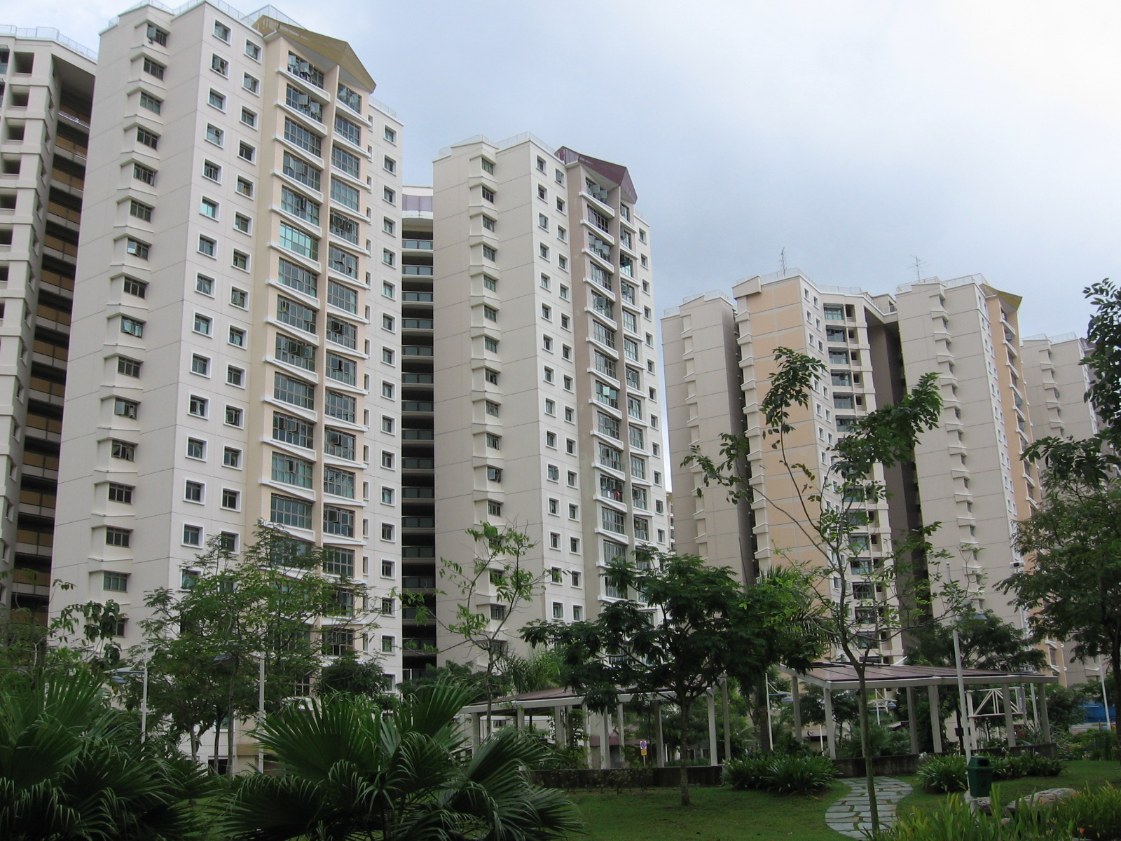
- Punggol New Town
-
Coordinates: 1°24′19.0″N 103°54′7.5″E / 1.40528°N 103.902083°E
Punggol New Town Total area: 9.57 km² Residential area: 4.74 km² Dwelling units: 16,017[1] Projected ultimate: 96,000 Population: 51,700 (31 March 2006)[1] 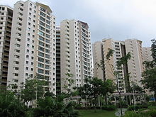 Punggol New Town
Punggol New Town (Chinese: 榜鵝新镇; pinyin: Bǎng'é Xīnzhèn) is a Housing and Development Board (HDB) new town in Punggol, within the North-East Region of Singapore.
Contents
Etymology
Punggol Point or Tanjong Punggol appears as Tanjong Rangon on Franklin and Jackson's 1828 map of Singapore. Punggol, also spelt as Ponggol, means "hurling sticks at the branches of fruit trees to bring them down to the ground" in Malay. It could also refer to a place where fruits and forest produce are offered wholesale and carried away. These possible names indicate that Punggol was a fruit growing district. The place is said to take its name from the river Sungei Ponggol. Yet another interpretation is that it is a rendezvous point for those who await the wholesale agent who buys and takes the produce to the market.
Ponggol also means "a stump of a tree", especially "a high stump". There are suggestions that the word is Tamil (Pongal, "the feast of the boiling rice", is celebrated when the sun enters the sign of Capricorn), but the word is clearly Malay and not Tamil.
History
Early history
Located in the vicinity of the Punggol Jetty, Punggol was believed to have existed 200 years ago before Sir Stamford Raffles founded Singapore. The Punggol area used to be a well-established rural district dotted with farmhouses and farm structures, which were serviced by roads and dirt tracks. It was one of the oldest settlements in Singapore. The original settlers were predominantly Malays.
The early Chinese immigrants, who settled in Punggol from the mid 19th century onwards, were engaged in plantation work, mainly rubber. As more and more Chinese immigrants settled in Punggol, poultry farming and pig rearing activities flourished. Trading on farm produce, fruits and vegetables was carried out in the marketplace at the former eighth milestone of Punggol Road. The Serangoon River mouth became the docking point for fishing boats where fishermen gathered to sell their catch.
In the 1960s, basic amenities like piped water, electricity, paved roads, and drainage systems were introduced through government and self-help programmes. It was also at this time that television became popular and antennas could be seen installed on many kampong rooftops.
Poultry and pig farms were gradually phased out when redevelopment commenced in the 1970s. The last pig farm closed down in 1990. Land vacated by resettled farmers were then tendered out on short term leases for non-pollutive agricultural activities, which included hydroponic non-pollutive vegetable and orchid farms that used to flourish along the Cheng Lim Farmways and Buangkok Farmways. These farms existed along with old kampongs and low-rise residential areas. Most of these farms have given way to the high-rise HDB flats of Sengkang New Town and Punggol New Town.
Historically, Punggol was populated mostly by Teochews and Catholics. The end of Upper Serangoon Road is known to Teochews as kangkar or "river bank" or "river mouth". Ferries were used on the Serangoon River as transport. An old market was also located here. The Catholic missionaries arrived here 140 years ago and set up churches and schools. A Malay kampong, which has since been cleared, could also be found at Tanjong Punggol. At the end of Punggol Port Road, Indonesian and Malaysian fishermen auctioned their catch at the wholesale fish market.
During the Second World War in 1942, about 400 Chinese civilians were massacred by the Japanese military forces at Punggol Point, the northern tip of the area, in what was to be known as the Punggol Beach Massacre as part of the Sook Ching Massacre. Today, that location has been marked as a national heritage site by the National Heritage Board.
Punggol was also known for its sumptuous seafood and boatels that provided services like docking and renting of boats for boating, water skiing and skindiving lessons. These seafood restaurants and boatels have since been relocated in the mid-1990s to facilitate land reclamation works.[2]
Punggol 21
In his National Day Rally speech on 18 August 1996, then-Prime Minister Goh Chok Tong announced the Singapore Government's plan to develop Punggol, known as "Punggol 21". Punggol 21 was a new model for housing Punggol, which would feature a new concept in housing as a model for new towns in the 21st century. It would have a mix of private houses, executive condominiums, and high-grade HDB flats grouped into smaller, distinctly designed estates. Each estate would contain between 1,200 and 2,800 units, with a common neighbourhood green. Every housing unit would be located within 300 metres of the nearest LRT station. Schools, libraries, and community clubs would be clustered for convenience, and there would be three commercial centres, including shopping centres.[3][4]
A few months after the speech, Punggol 21, which was part of Cheng San Group Representation Constituency then, became an election carrot for the People's Action Party (PAP) to beat a Workers' Party team led by J.B. Jeyaretnam and Tang Liang Hong. At the general election in 1997, the five-man PAP team managed to retain Cheng San GRC with 54.8% of the valid votes.[5]
However, Punggol 21 did not materalise fully as Singapore's economy was affected by the Asian economic crisis in 1997. Although construction began the next year, it was stopped when demand for new flats fell sharply. Plans were again delayed when the construction industry in Singapore experienced financial troubles in 2003. As a result, only some 16,000 flats, out of the 80,000 planned units, have been built as at 2007. There is only one shopping mall in the estate, Punggol Plaza, and there are no recreational facilities like cinemas or swimming pools.[5][6]
Punggol 21-plus
In his National Day Rally speech on 19 August 2007, Prime Minister Lee Hsien Loong offered a new vision for Punggol New Town, and introduced the "Punggol 21-plus" plan to re-vitalise the town.[5][7][8][9][10]
Under the new plan, Sungei Punggol and Sungei Serangoon, which flank the town, will be dammed up to create a freshwater lake and serve as a reservoir. A 4.2-kilometre long, 20-30-metre wide man-made waterway will run through the estate, linking both rivers. Work on it will start in 2009, and is expected to complete by 2013. When built, there will be recreational facilities like water sports for kayaking and canoeing, gardens and parks with jogging and cycling tracks, rooftop gardens, eateries for al-fresco dining and a floating island.[5][6][7][9][11]
The "Punggol 21-plus" project involves 18,000 new HDB and private flats, and about 3,000 new flats will be built in Punggol New Town every year. Punggol New Town is projected to have 96,000 units when fully developed in the long term. Waterfront housing will have stepped courtyards. There will be a promenade on the northern sea front, stretching about 8.7 km. An integrated waterfront commercial and residential development has also been planned at the town centre, which will be built on both banks of the waterway. The site for this project will be put on sale by 2012. Work on the town centre is planned to start in 2010.[6][7][11]
Punggol Central will be converted into a tree-lined boulevard with landscaping. Coney Island will have a park, to be completed by 2013.[11]
Amenities
Transportation
Urban development into the area has been accelerated with the introduction of better transportational options. The Tampines Expressway (TPE) links Punggol New Town up with Singapore's expressway network. The Kallang-Paya Lebar Expressway, which provides a direct route to the city area via TPE, was fully opened in September 2008.[12] New roads were also built to ease traffic congestion on Punggol Road.[13]
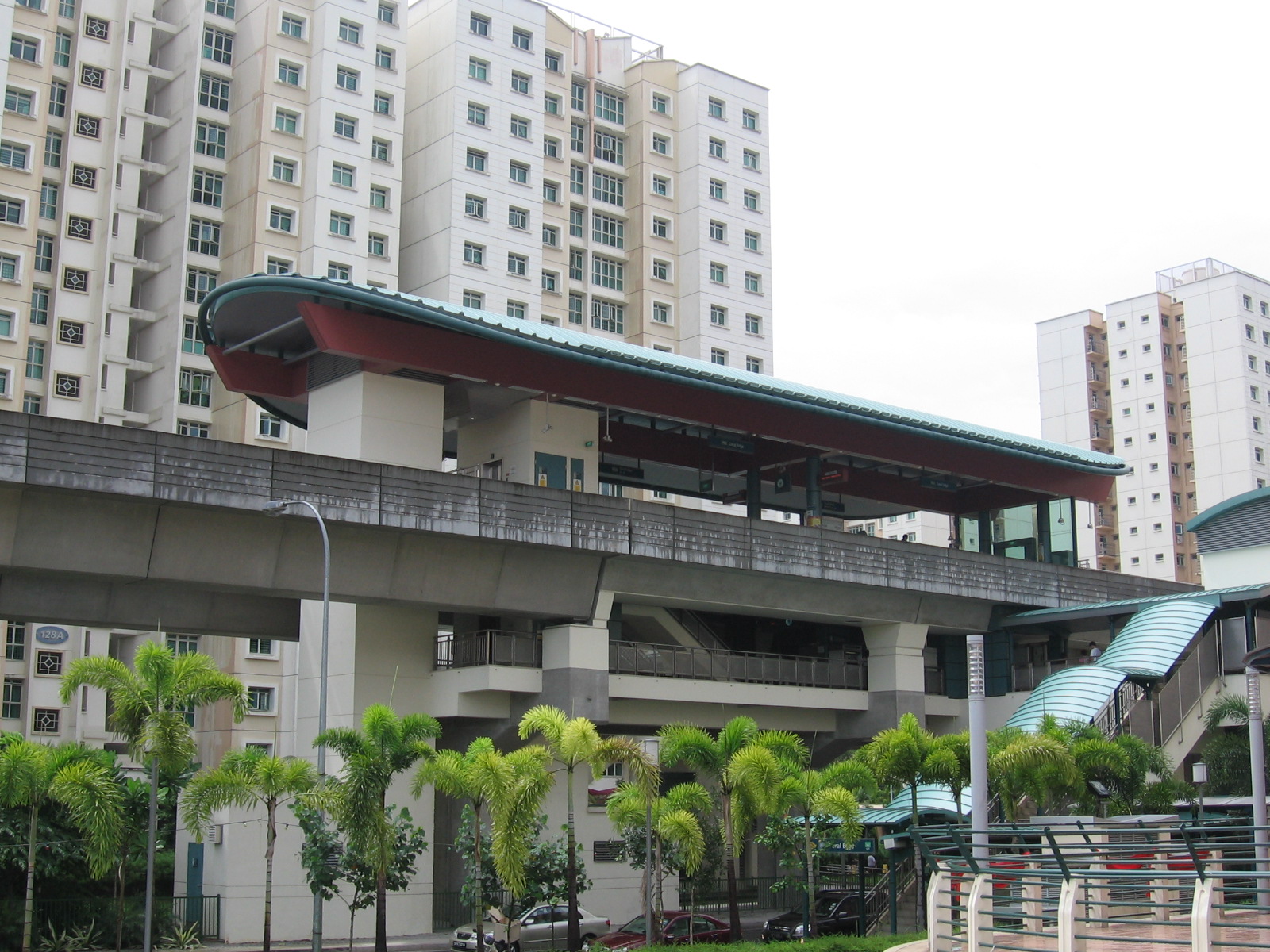
In terms of public transport, the opening of the North-East Line on 20 June 2003,[14][15] the Punggol LRT Line on 29 January 2005,[16] and the temporary Punggol Bus Interchange adjacent to the Punggol MRT Station on 30 November 2003[17] was an improvement over what was once only a single bus route, SBS Transit's Service 82, serving the area along Punggol Road.
Routes serving the temporary Punggol Bus Interchange include:
Service Berth Destination Notes SBS Transit Trunk Services 3 B3 Tampines Bus Interchange Passes through Pasir Ris before reaching Tampines 34 B4 Changi Airport PTB 1, 2 & 3 Bus Terminal 43 B4 Upper East Coast Bus Terminal 62 B2 Geylang Lorong 1 (loop) 82 B? nex (Loop) 83 B3 Sengkang Bus Interchange (loop) 84 B? Punggol Point (loop) 85 B4 Yishun Bus Interchange 136 B1 Ang Mo Kio Bus Interchange Commercial facilities
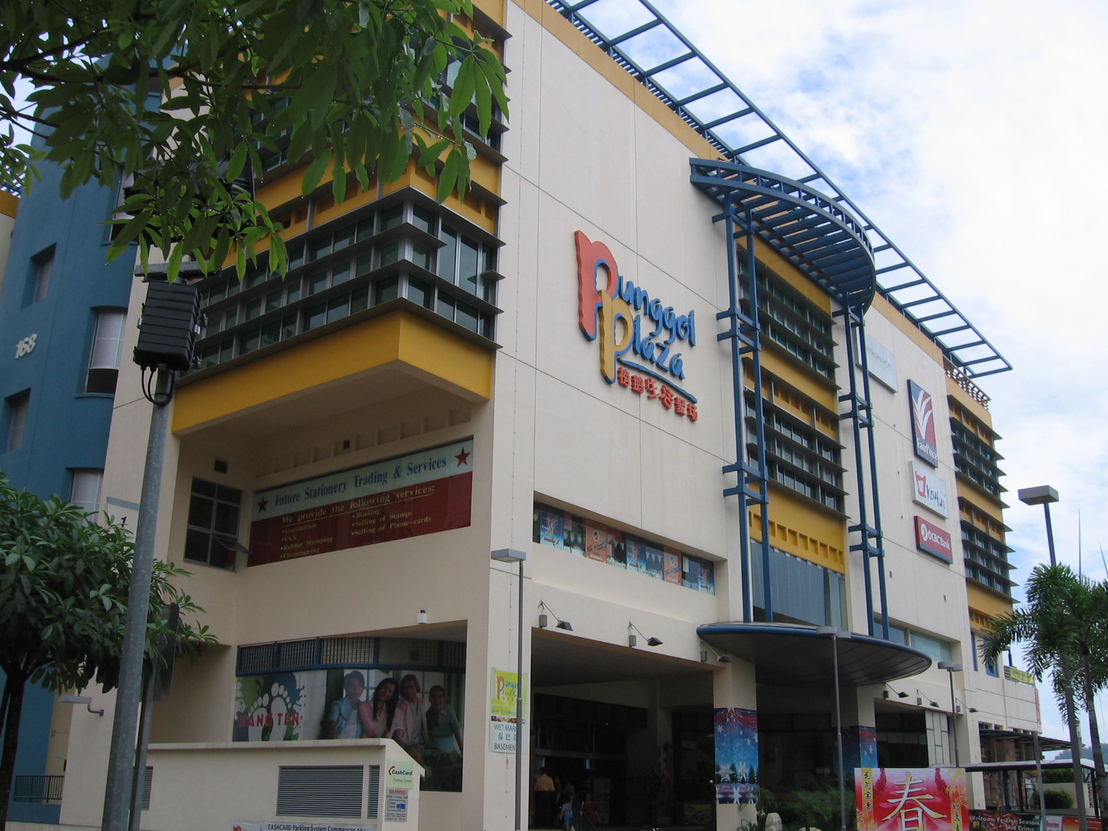
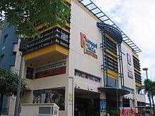 Punggol Plaza
Strategically located near Coral Edge LRT Station, Punggol Plaza is currently the only shopping mall in Punggol New Town. Opened in September 2004, it offers residents the convenience of fulfilling all their marketing needs at one place, with an NTUC FairPrice supermarket located on the third floor of the plaza and a food court operated by Koufu on the ground floor. There are also clinics offering general practitioner and specialist medical services. Free shuttle services between Punggol Plaza and Sengkang New Town have been provided since September 2004.[18]
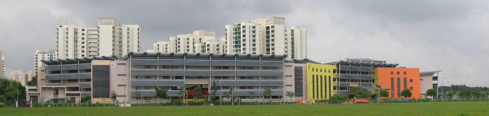
Educational institutions
There are currently four primary schools and two secondary schools in Punggol New Town.
- Primary schools
- Secondary schools
- Greendale Secondary School[23] 绿苑中学
- Punggol Secondary School[24] 培道中学
- http://www.edgefield.sg/index.html[25]育德中学
 Greendale Secondary School started operations as a new school in January 2006.
Notes
- ^ a b Sarah Ng and Nur Dianah Suhaimi (26 November 2006). "Posh Punggol v 'Ulu' Sengkang". The Sunday Times.
- ^ Only two out of the four seafood eateries that operated at the old Punggol Point until 1995 are still around in Singapore: Mak Mun San (26 August 2007). "Punggol revisited". The Sunday Times.
- ^ Warren Fernandez (19 August 1996). "PM Goh urges young to rally behind him". The Straits Times. p. 1.
- ^ "Punggol 21". The Straits Times. 19 August 1996. p. 24.
- ^ a b c d Peh Shing Huei and Lynn Lee (24 August 2007). "The promise of Punggol". The Straits Times.
- ^ a b c Jessica Cheam (22 August 2007). "Residents look forward to 'Punggol 21-plus'". The Straits Times.
- ^ a b c Lynn Lee (20 August 2007). "Punggol 21 reborn - and jazzed up as well". The Straits Times.
- ^ Lynn Lee (20 August 2007). "Big plus for Punggol residents". The Straits Times.
- ^ a b Jasmine Yin (20 August 2007). "The whole country will be transformed". Today. p. 6.
- ^ Nazry Bahrawi (21 August 2007). "It's time to dream again...: Value of flats in Punggol will go up as area is developed". Today. p. 3.
- ^ a b c Tan Hui Yee (1 September 2007). "Punggol perks". The Straits Times. p. H10.
- ^ "KPE to fully open to traffic this Saturday". Channel News Asia. 18 September 2008.
- ^ Karamjit Kaur (21 December 1999). "New roads cut down travel time". The Straits Times. p. 40.
- ^ Goh Chin Lian (21 June 2003). "It's a smooth ride on NEL - mostly". The Straits Times.
- ^ Leonard Lim (21 June 2003). "NEL gets off to a promising start". The Business Times.
- ^ The west loop of the Sengkang LRT Line opened on the same day: Christopher Tan (11 January 2005). "Punggol LRT set to roll". The Straits Times.
- ^ The S$1.9-million temporary Punggol Bus Interchange, which took 10 months to construct, was opened on 30 November 2003 by Member of Parliament for Pasir Ris-Punggol GRC Teo Chee Hean: "Punggol residents get bus interchange". The Straits Times. 1 December 2003.
- ^ Goh Chin Lian (4 November 2004). "A mall in Punggol ...at last". The Straits Times.
- ^ Edgefield Primary School originally opened in January 2001 but could not attract enough students to make even one class. It opened in January 2002: Tee Hun Ching (24 September 2000). "Life behind the vales". The Straits Times.
- ^ Greendale Primary School was one of the six new primary schools built in new housing estates and towns so as to cater to smaller class size: Sarah Ng (17 April 2005). "Plan for six new primary schools by 2008". The Straits Times.
- ^ 王珏琪 (2007-08-01). "家长对"未来学校"有信心, 明年才开班, 崇辉受欢迎 (in Mandarin)". Lianhe Zaobao. http://www.zaobao.com/edu/pages3/edulive070801.html. Retrieved 2007-09-29.
- ^ Mee Toh School moved from Race Course Road to Punggol New Town in January 2005: "Mee Toh School to move to Punggol". The Straits Times. 24 May 2004.
- ^ Greendale Secondary School opened in January 2006: "Greendale Secondary School: History". Greendale Secondary School. 2007. http://schools.moe.edu.sg/greendalesec/history.html. Retrieved 2007-09-07.
- ^ Pei Dao Secondary School was re-named Punggol Secondary School when it was relocated to Punggol New Town in 2001: "Punggol Secondary School: History". Punggol Secondary School. 2005. Archived from the original on 2007-08-25. http://web.archive.org/web/20070825211319/http://www.punggolsec.moe.edu.sg/history.htm. Retrieved 2007-09-07.
- ^ Edgefield Secondary School opened in January 2011:
References
- Victor R Savage, Brenda S A Yeoh (2003). Toponymics - A Study of Singapore Street Names. Singapore: Eastern Universities Press. ISBN 981-210-205-1.
- Tommy Koh, et al. (eds.) (2006). Singapore: The Encyclopedia. Singapore: Editions Didier Millet in association with the National Heritage Board. ISBN 981-4155-63-2 (hbk.).
Further reading
- "Transcript of Prime Minister Lee Hsien Loong’s National Day Rally English Speech on 19 August 2007 at NUS University Cultural Centre". Ministry of Information, Communications and the Arts (Singapore). 2007-08-19. http://app.sprinter.gov.sg/data/pr/2007081907.htm. Retrieved 2007-09-02.
External links
- Urban Redevelopment Authority: Punggol 21
- Pasir Ris-Punggol Town Council
- Pasir Ris-Punggol GRC Town Portal
- Punggol.sg - Community Portal for Punggol residents
- Punggol.org - Website on developments in Punggol New Town
Public housing in Singapore Organisations 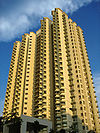
Building Programmes Build-To-Order (HDB) · Design, Build and Sell Scheme · Home Ownership Scheme · Selective En bloc Redevelopment Scheme · Walk In SelectionUpgrading Programmes Home Improvement Programme · Interim Upgrading Programme · Lift Upgrading Programme · Main Upgrading Programme · Neighbourhood Renewal ProgrammeOther Additional CPF Housing Grant · Lease Buyback Scheme · Pinnacle@Duxton · Treelodge@Punggol · Void deck
Categories:- New towns in Singapore
- Punggol

Wikimedia Foundation. 2010.