Cranberry River (Massachusetts)
- Cranberry River (Massachusetts)
-
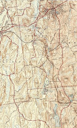
The Cranberry River is a river in central Massachusetts that is part of the Chicopee River Watershed. It rises in Cranberry Meadow Pond in Spencer, Massachusetts, and flows northward for 3.7 miles (6.0 km)[1] to its confluence with the Sevenmile River southwest of Spencer.

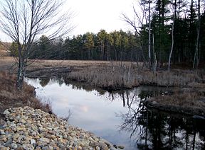
Cranberry River and environs
See also
- Cranberry River (disambiguation)
References
- ^ U.S. Geological Survey. National Hydrography Dataset high-resolution flowline data. The National Map, accessed April 1, 2011
Categories:
- Rivers of Worcester County, Massachusetts
Wikimedia Foundation.
2010.
Look at other dictionaries:
Cranberry River — Several rivers are called Cranberry River: Cranberry River (Maine) Cranberry River (Massachusetts) Cranberry River (Michigan) Cranberry River (West Virginia) Cranberry River (Wisconsin) Cranberry River (British Columbia) Cranberry River (Ontario) … Wikipedia
Cranberry (Begriffsklärung) — Cranberry ist der Name mehrerer Orte in den Vereinigten Staaten: Cranberry (Maryland) Cranberry (North Carolina) Cranberry (Pennsylvania) Cranberry (West Virginia) Cranberry Township (North Carolina) Fließgewässer: Cranberry River (Maine)… … Deutsch Wikipedia
Crooked River (Massachusetts) — The Crooked River is a small tributary of the Wareham River located entirely within the town of Wareham, Massachusetts (USA). Its source is found in salt marshes and cranberry bogs east of Indian Neck Road, and its mouth empties into the Wareham… … Wikipedia
Cranberry (disambiguation) — The cranberry is a group of evergreen dwarf shrubs, bearing the fruit named after such. It is also a color (Hex triplet #A61733), but the following may also refer to Cranberry: Places Cranberry Isles, Maine Cranberry Portage, Manitoba Cranberry… … Wikipedia
Massachusetts — This article is about the U.S. state. For other uses, see Massachusetts (disambiguation). Commonwealth of Massachusetts … Wikipedia
Massachusetts Coastal Railroad — Reporting mark MC Locale Massachusetts Dates of operation 2007– Predecessor … Wikipedia
Massachusetts Route 25 — Route 25 … Wikipedia
Massachusetts — /mas euh chooh sits/, n. 1. a state in the NE United States, on the Atlantic coast. 5,737,037; 8257 sq. mi. (21,385 sq. km). Cap.: Boston. Abbr.: MA (for use with zip code), Mass. 2. Massachusett. * * * I officially Commonwealth of Massachusetts… … Universalium
List of rivers of Massachusetts — List of rivers in Massachusetts (U.S. state). All Massachusetts rivers flow to the Atlantic Ocean. The list is arranged by drainage basin from north to south, with respective tributaries indented under each larger stream s name, arranged… … Wikipedia
Seven Mile River (East Brookfield River) — Infobox River | river name = Seven Mile River caption = Seven Mile River near Wire Village origin = Browning Pond, Oakham / Spencer mouth = East Brookfield River basin countries = length = 7.8 mi (12.55 km) elevation = 745 ft (227.1 m) mouth… … Wikipedia


