- Mount Price (British Columbia)
-
Mount Price 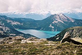
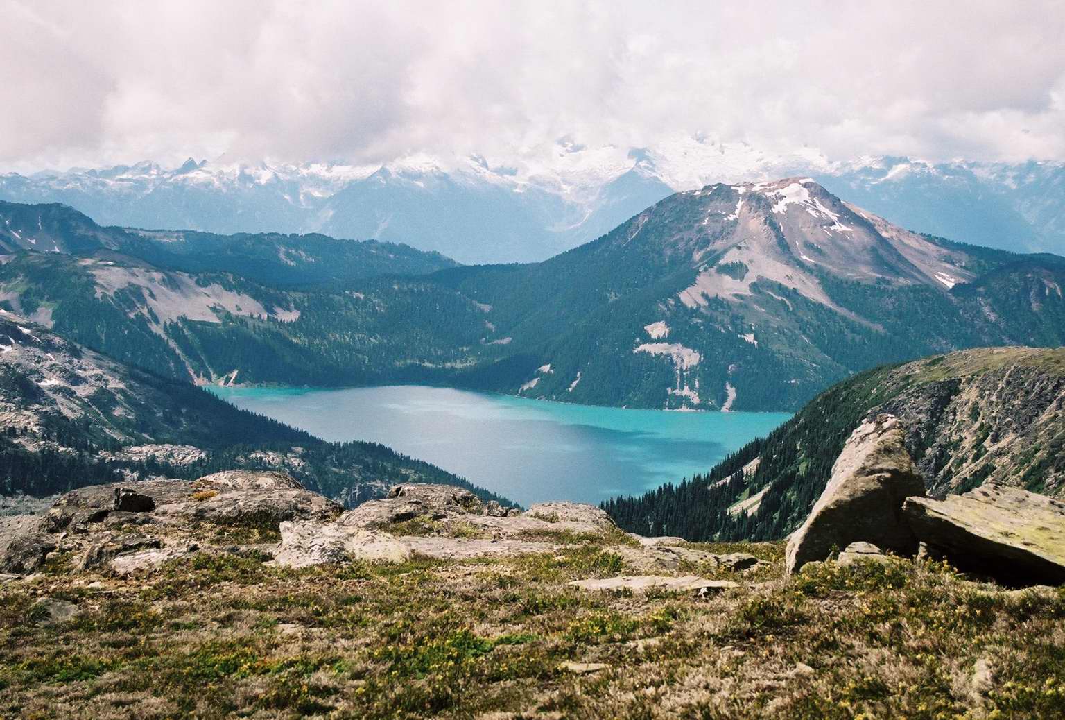
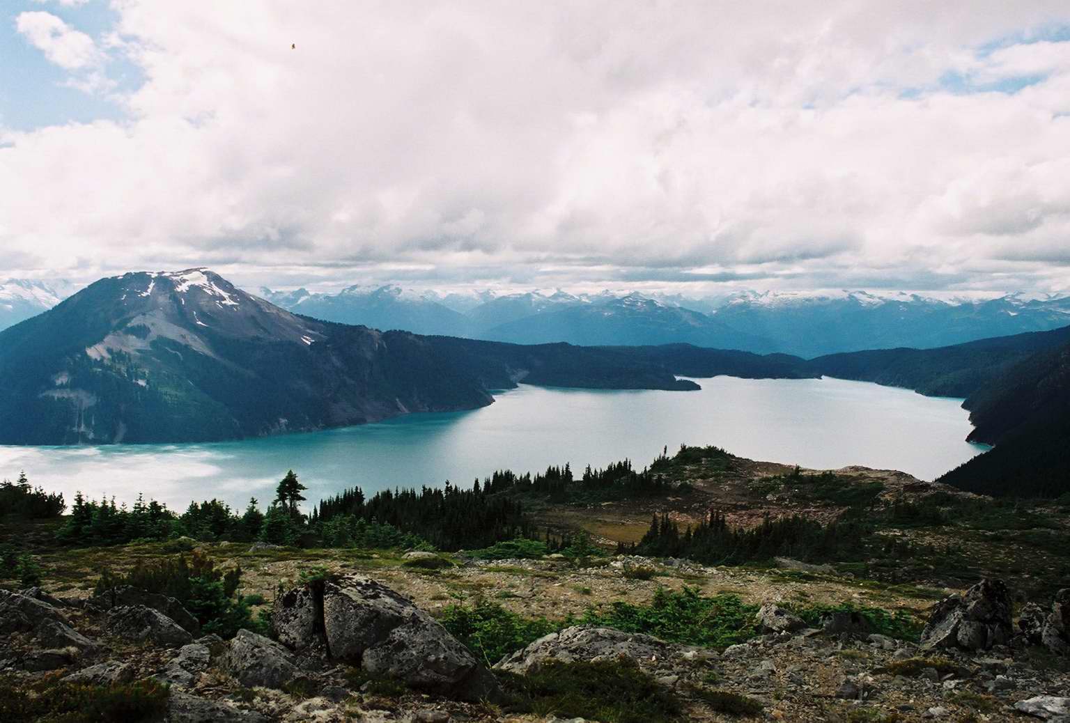
Garibaldi Lake with Mount Price behind on the rightElevation 2,052 m (6,732 ft) Prominence 402 m (1,319 ft) Listing List of volcanoes in Canada List of Cascade volcanoes Location Location British Columbia, Canada Range Garibaldi Ranges Coordinates 49°55′N 123°02′W / 49.92°N 123.03°W Topo map NTS 92G/14 Geology Type Stratovolcano Age of rock Pleistocene Volcanic arc/belt Cascade Volcanic Arc Garibaldi Volcanic Belt Last eruption 9,000 years ago Climbing First ascent 1921 BCMC Party Easiest route off trail hike from Garibaldi Lake Mount Price, formerly known as Red Mountain, is a dormant stratovolcano located on the western shore of Garibaldi Lake in Garibaldi Provincial Park, about 70 km (43 mi) north of Vancouver, British Columbia. It is in the Garibaldi Lake volcanic field about 5 m (16 ft) south of Black Tusk. The volcano is part of the Garibaldi Volcanic Belt which is a segment of the Cascade Volcanic Arc, but it is not within the geographic boundary of the Cascade Range.
Mount Price does not seem to get much traffic at any time of the year. There's a spectacular view of The Table from the summit.
Geology
 Garibaldi Lake with Mount Price behind on the left
Mount Price is a member in the chain of volcanic peaks that run from southwestern British Columbia to northern California. The volcanoes formed over the past 35 million years as the Juan de Fuca Plate and the Explorer Plate to its west have been subducting under the North American Plate at the Cascadia subduction zone. As the oceanic crust of the Juan de Fuca and the Explorer Plate melts, it creates magma that penetrates the crust of the Cascade Range and southwestern Coast Mountains, causing periodic eruptions of the volcanoes.
Mount Price was formed during three periods of activity. Initial 1.2-million-years-ago eruptions constructed a hornblende andesite stratovolcano on the drift-covered floor of a cirquelike basin. The focus of volcanic activity then shifted westward, where 0.3-million-years-ago eruptions of andesite-dacite lavas and Peléan pyroclastic flows formed the nearly symmetrical (2,050 m) Mount Price. This cone was overridden by the continental ice sheet before eruptions at a satellite vent on its northern flanks. Possibly contemporaneous activity occurred at Clinker Peak on the western shoulder of Mount Price. Two hornblende-biotite andesite flows, which spread 6 kilometers northwest and southwest from the breached lava ring, were ponded (>250 meters thickness) against the continental ice sheet and formed The Barrier containing Garibaldi Lake. These lavas postdate disappearance of the Cordilleran Ice Sheet from higher altitudes, but predate its disappearance from lower elevations in early Holocene time. The Barrier failed in a series of landslides, the most recent of which occurred in 1855-1856.
External links
- "Mount Price". Bivouac.com. http://www.bivouac.com/MtnPg.asp?MtnId=619.
See also
- Clinker Ridge
- List of volcanoes in Canada
- Cascade Volcanoes
- Garibaldi Volcanic Belt
- Cascade Range
- Volcanism of Canada
- Volcanism of Western Canada
 Volcanoes of the Garibaldi Volcanic BeltBlack Tusk · Brew · Bridge River (Tuber · Salal Glacier · Sham) · Callaghan · Cauldron · Cayley (Pyroclastic · Vulcan's Thumb) · Cinder Cone · Ember · Fee · Franklin Glacier · Garibaldi (Atwell · Opal) · Glacier Pikes · Little Ring · Meager (Capricorn · Devastator · Job · Perkin's Pillar · Plinth · Pylon) · Monmouth Creek (The Castle) · Pali · Price (Clinker) · Ring · Round · Silverthrone (Silverthrone · Machmell River) · Slag · The Table · Tricouni Southwest · Watts Point
See also: Volcanism of Canada portal Categories:- Mountains of British Columbia
- Volcanoes of British Columbia
- Subduction volcanoes
- Pleistocene volcanoes
- Polygenetic volcanoes
- Dormant volcanoes
- Garibaldi Ranges
- Holocene volcanoes
- Garibaldi Lake volcanic field
- British Columbia Coast geography stubs
Wikimedia Foundation. 2010.