- Monmouth Creek complex
-
Monmouth Creek complex British Columbia, Canada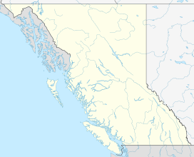
 Monmouth Creek complex
Elevation 510 m (1,673 ft) Location Range Pacific Ranges Coordinates 49°41′38″N 123°11′49″W / 49.69389°N 123.19694°WCoordinates: 49°41′38″N 123°11′49″W / 49.69389°N 123.19694°W Topo map NTS 92G/11 Geology Age of rock Unknown[1] Volcanic arc/belt Cascade Volcanic Arc Garibaldi Volcanic Belt The Monmouth Creek complex is a volcanic complex in southwestern British Columbia, Canada, located 4 km (2.5 mi) southwest of the community of Squamish on the west side of the Squamish River mouth. It lies in the southern Pacific Ranges of the Coast Mountains and is part of the Squamish volcanic field in the southern Garibaldi Volcanic Belt, which represents the northernmost extension of the Cascade Volcanic Arc.
Its prominent and enigmatic edifice is composed of basaltic andesite to dacite of unknown age and may represent a group of dikes and lava domes that formed subglacially.[1] At least four dikes protrude its summit.[1][2] These form the ribs of 60 m (200 ft) to 180 m (590 ft) high lava spines, the tallest being The Castle, which contains horizontal and radiating columnar joints.[1] The spines are covered by welded breccia close to their bases and columnar jointing extends into the welded sequence.[1] The most elevated lava flows and spines and composed of dacite.[1]
References
- ^ a b c d e f Smellie, J.L.; Chapman, Mary G. (2002). Volcano-Ice Interaction on Earth and Mars. Geological Society of London. p. 201. ISBN 1862391211.
- ^ Kelman, M.C.; Russell, J.K., Hickson, C.J. (2002). Effusive intermediate glaciovolcanism in the Garibaldi volcanic belt, southwestern British Columbia, Canada. 101-605 Robson Street, Vancouver, British Columbia V6B 5J3, Canada: Geological Survey of Canada. p. 197.
External links
- Catelogue of Canadian volcanoes: The Castle
- The Castle in the Canadian Mountain Encyclopedia
 Volcanoes of the Garibaldi Volcanic BeltBlack Tusk · Brew · Bridge River (Tuber · Salal Glacier · Sham) · Callaghan · Cauldron · Cayley (Pyroclastic · Vulcan's Thumb) · Cinder Cone · Ember · Fee · Franklin Glacier · Garibaldi (Atwell · Opal) · Glacier Pikes · Little Ring · Meager (Capricorn · Devastator · Job · Perkin's Pillar · Plinth · Pylon) · Monmouth Creek (The Castle) · Pali · Price (Clinker) · Ring · Round · Silverthrone (Silverthrone · Machmell River) · Slag · The Table · Tricouni Southwest · Watts PointSee also: Volcanism of Canada portalCategories:
- Volcanoes of British Columbia
- Mountains of British Columbia
- Garibaldi Volcanic Belt
- British Columbia Coast geography stubs

Wikimedia Foundation. 2010.