- Garibaldi Provincial Park
Infobox_protected_area | name = Garibaldi Provincial Park
iucn_category = II
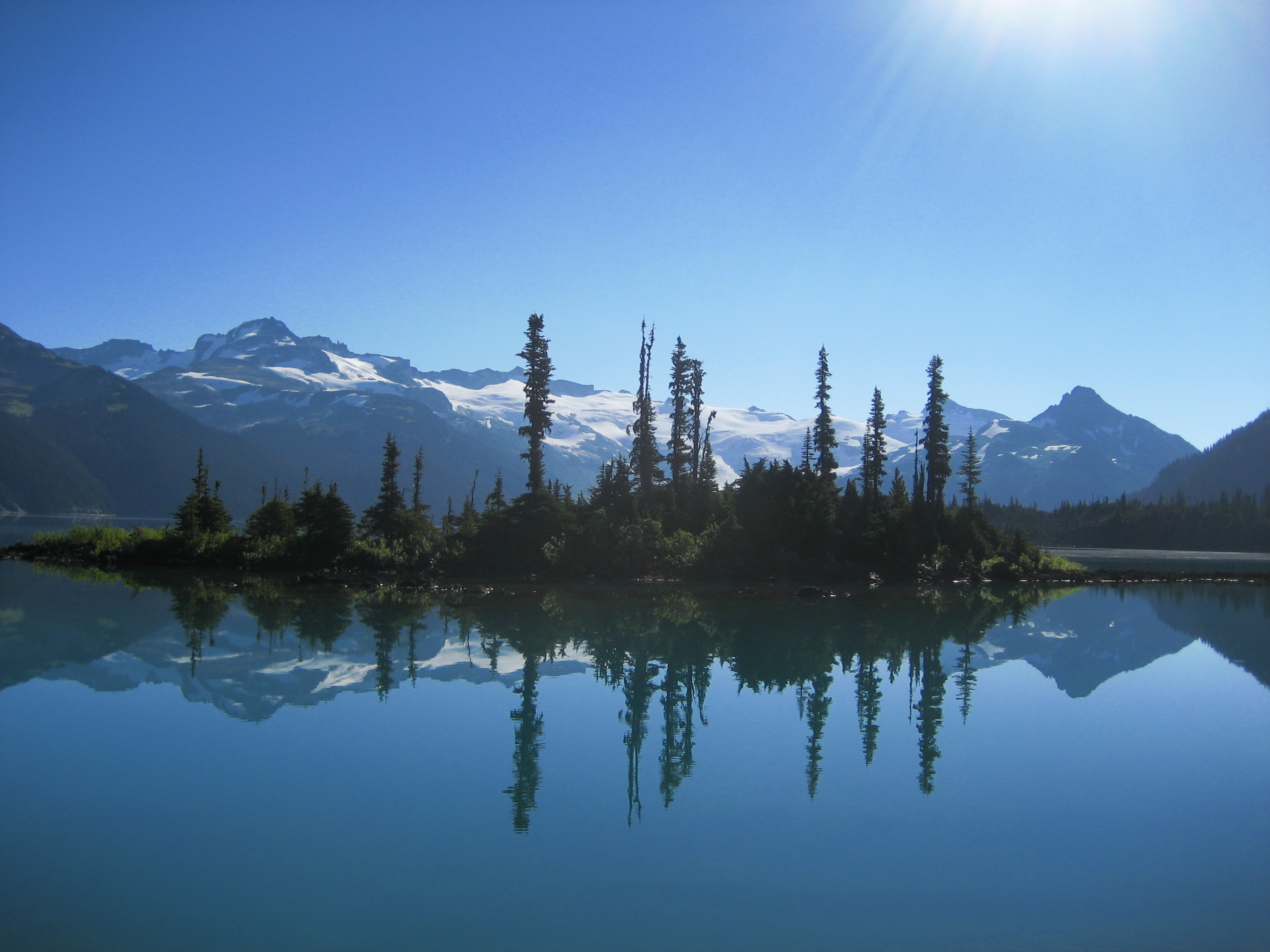
caption =Garibaldi Lake and the Battleship Islands
locator_x =
locator_y =
location =British Columbia ,Canada
nearest_city =Squamish, British Columbia
lat_degrees = 49
lat_minutes = 55
lat_seconds = 00
lat_direction = N
long_degrees = 122
long_minutes = 45
long_seconds = 00
long_direction = W
area = 1,950 km²
established = 1927
visitation_num =
visitation_year =
governing_body =BC Parks Garibaldi Provincial Park, also called Garibaldi Park, is a wilderness park located in
British Columbia ,Canada , about 70kilometre s (43.5 mi) north ofVancouver . The park is located to the east of the Sea to Sky Highway betweenSquamish andWhistler and covers an area of over 1,950square kilometre s (753 sq mi). Garibaldi was designated as a provincial park in 1927.Region
The park consists of many steep, rugged mountains, many of which are capped by glaciers. The southern portion of the park includes
Mount Garibaldi and theGaribaldi Volcanic Belt . The Park features many denseDouglas-fir ,western red cedar andwestern hemlock forests, as well asalpine meadow s, and many rocky alpine areas. The highest peak in the Park isWedge Mountain at 2891metre s (9482 ft).Recreational access
There are five park access and entrance points located along the Sea to Sky Highway. Each entrance provides access to hiking trails with backcountry camping opportunities. All access points are open in winter for
backcountry skiing , but only the Diamond Head access road is plowed. All camp sites are first-come, first-served.;Diamond HeadThis southern most entrance provides hiking or skiing access to the area south of
Mount Garibaldi . A cooking hut and winter-only camping area are located in Red Heather Meadows, about 5 kilometres (3 mi) from the parking lot. An overnight shelter and campground are located 12 kilometres (7.5 mi) from the parking lot atElfin Lakes .;Black Tusk/Garibaldi LakeThe second entrance is located approximately half way between Squamish and Whistler. Hiking trails provide access to
Garibaldi Lake , theBlack Tusk , andPanorama Ridge . A trail also connects to theCheakamus Lake area further north. Two camping areas provide sites for 90 tents.;Cheakamus LakeThis entrance, located just to the south of Whistler, provides access to Cheakamus Lake. Two campgrounds are located a few kilometers from the parking lot.
;Singing PassThe Singing Pass area is located to the east of
Whistler Mountain . The area can be accessed by a trail which follows the Fitzsimmons Creek, between Whistler and Blackcomb mountains. The area can also be accessed from the top of Whistler mountain via an alpine route. Camping is permitted at Russet Lake.;Wedgemount LakeThe most northern entrance is via a deactivated forest service road. The road is unmaintained and is recommended for 4x4 vehicles only. Wedgemount Lake is accessed via a hiking trail. Camping is permitted around the lake.
Gallery
ee also
*
Black Tusk
*Golden Ears Provincial Park External links
* [http://www.env.gov.bc.ca/bcparks/explore/parkpgs/garibald.html BCParks - Garibaldi page]
* [http://sea.unep-wcmc.org/wdbpa/sitedetails.cfm?siteid=4179&level=nat UN database entry]
Wikimedia Foundation. 2010.