- Mount Wellington (British Columbia)
-
Mount Wellington Location in British Columbia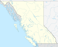
 Mount Wellington
Elevation 1,727 m (5,666 ft) Prominence 631 m (2,070 ft) on the west side of Queens Reach Jervis Inlet, northeast of Powell River (city), New Westminster Land District Location Location Jervis Inlet, British Columbia, Canada Range Pacific Ranges Coordinates 50°07′43.76″N 123°55′01.82″W / 50.1288222°N 123.9171722°WCoordinates: 50°07′43.76″N 123°55′01.82″W / 50.1288222°N 123.9171722°W Topo map NTS 092.J.04 Mount Wellington is a mountain located at the Queens Reach arm of the Jervis Inlet within the Pacific Ranges of the Coast Mountains in British Columbia Canada. The mountain was named during the 1860 survey by the HMS Plumper who charted all the of the area and named the mountain after Duke of Wellington who defeated Napoleon at the famous battle of Waterloo[1].
References
- ^ Hitz, Charles W.(2003). Through the Rapids - The History of Princess Louisa Inlet, p.54. Sitka 2 Publishing., Kirkland, WA. ISBN 0972025502.
External links
- "Wellington, Mount". BC Geographical Names. http://apps.gov.bc.ca/pub/bcgnws/names/20114.html.
- Detail Map of Mount Wellington from the 1860 Survey Map of the Jervis Inlet and Mount Wellington.
Categories:- Mountains of British Columbia
- Pacific Ranges
- New Westminster Land District
- British Columbia geography stubs

Wikimedia Foundation. 2010.