- Dagnall
-
Coordinates: 51°50′10″N 0°33′36″W / 51.836°N 0.560°W
Dagnall 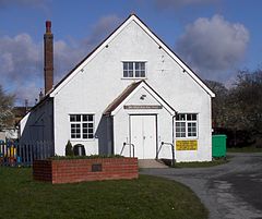
Dagnall Village Hall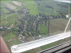
Aerial view of Dagnall village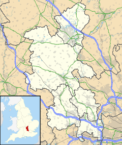
 Dagnall
Dagnall shown within BuckinghamshirePopulation 511 OS grid reference SP9965 Parish Edlesborough District Aylesbury Vale Shire county Buckinghamshire Region South East Country England Sovereign state United Kingdom Post town Berkhamsted Postcode district HP4 Dialling code 01442 Police Thames Valley Fire Buckinghamshire Ambulance South Central EU Parliament South East England UK Parliament Buckingham (UK Parliament constituency) Website Welcome to Edlesborough Parish Council Website List of places: UK • England • Buckinghamshire Dagnall is a village in the parish of Edlesborough, in Buckinghamshire, England.
The place name is derived from the Old English for "Daegga's Knoll". In manorial rolls of 1196 it was listed as Dagenhale.
Dagnall is in the Chiltern Hills and in the Chilterns Area of Outstanding Natural Beauty. It is next to the Ashridge Estate, owned and managed by The National Trust. House prices are significantly higher than average, in common with comparable locations in Hertfordshire, Bedfordshire and Buckinghamshire.
Contents
Location
Five main roads link Dagnall with the nearby towns of Dunstable, Leighton Buzzard, Tring, Hemel Hempstead and Berkhamsted, and slightly further on to the larger towns of Luton, Aylesbury and Milton Keynes. The nearest villages to Dagnall are Ashridge, Studham and Whipsnade. Whipsnade Zoo is on the hill above the village.
Parish church
All Saints' parish church is a Church of England and Methodist local ecumenical partnership and has clergy from both denominations.
Dagnall School
Dagnall School is a mixed, community, infant school, which has approximately 45 pupils and today educates local children from the ages of four to seven. Most pupils on leaving the school go on to nearby Edlesborough School. Dagnall School, opened in 1909, In 1989 the number of registered pupils at Dagnall County First School, as it was then called, had fallen to just 13 and the school was at risk of closure. This risk came partly from the Education Reform Act 1988 which would introduce a National Curriculum that the school might not have been able to meet. A dedicated campaign saved the school by 1990.[1]
Dagnall Under Fives
Dagnall Under Fives playgroup was formed in 1975, and is run from the Village Hall. The preschool takes on children age 2½ to school age. For children in their last year at preschool, it runs rising fives sessions to prepare children for when they go to school.
Local Amenities
Amenities include one public house, two farm shops and a vehicle repair garage. The post office closed in 1985 and the general convenience store closed in the 1990s. There is little public transport. School buses are provided for children that go to Edlesborough School and Secondary Schools such as The Cottesloe School in Wing. The nearest railway station is at Berkhamsted. The nearest international airport is London Luton Airport. The village is currently under the main landing flight path into the airport. www.dagnallunderfives.co.uk
Notable residents
Tim Sherwood, a former professional footballer, lives on the edge of the village. He played for Watford, Norwich City, Blackburn Rovers and Tottenham Hotspur, Portsmouth and Coventry City. Graham Barbour, retired FA referee, used to live in the village.
A number of films and television shows have been filmed around Dagnall, including First Knight and Dinotopia.
Recent developments
There have been many developments within the village over the last few years, the most notable being the building of a children's play area and a running track around the recreation ground which is located towards the north of the village.
There are also plans for the village hall to be extended within the near future.
More recently, red kites have been observed in increasing numbers and have become a common sight in the village.
External links
References
Categories:- Villages in Buckinghamshire


Wikimedia Foundation. 2010.