| v · d · eAylesbury Vale District |
|
|
|
|
Towns
(Component
Areas and Hamlets) |
Aylesbury ( Bedgrove, Broughton, California, Elm Farm, Elmhurst, Haydon Hill, New Zealand, Prebendal Farm, Quarrendon, Queens Park, Southcourt, Turnfurlong, Walton, Walton Court) • Buckingham ( Bourton, Buffler' s Holt, Castle Fields, Mount Pleasant, Page Hill) • Wendover ( Cobblers Hill, Concord, Dean, Hazeldean, Kings Ash, Little London, Lower Bacombe, Scrubwood, Smalldean, The Hale, Upper Bacombe, Wendover Dean, Wendover Marsh, World' s End) • Winslow ( Shipton, Shipton Brook)
|
 |
|
Other Civil Parishes
(Component Villages
and Hamlets) |
Addington • Adstock • Akeley ( Akeley, Stockholt) • Ashendon ( Ashendon, Lower Pollicott, Upper Pollicott) • Aston Clinton ( Aston Clinton, Chivery, Vaches) • Aston Abbotts • Aston Sandford • Barton Hartshorn • Beachampton • Biddlesden • Bierton with Broughton ( Bierton, Broughton, Broughton Crossing, Burcott) • Boarstall ( Boarstall, Honeyburge) • Brill ( Brill, Little London) • Buckingham Park ( Berryfields, Weedon Hill) • Buckland ( Buckland, Buckland Wharf) • Calvert Green ( Calvert) • Charndon • Chearsley • Cheddington ( Cheddington, Cooks Wharf) • Chetwode • Chilton ( Chilton, Easington) • Coldharbour ( Fairford Leys) • Creslow • Cublington • Cuddington • Dinton-with-Ford and Upton ( Aston Mullins, Dinton, Ford, Gibraltar, Upton, Waldridge, Westlington) • Dorton • Drayton Beauchamp • Drayton Parslow • Dunton • East Claydon ( Botolph Claydon, East Claydon) • Edgcott • Edlesborough ( Dagnall, Edlesborough, Northall, Ringshall) • Fleet Marston • Foscott • Gawcott with Lenborough ( Gawcott, Lenborough) • Granborough ( Granborough, Green End) • Great Brickhill • Great Horwood ( Great Horwood, Singleborough) • Grendon Underwood • Haddenham ( Haddenham, South End) • Halton • Hardwick • Hillesden • Hoggeston • Hogshaw ( Fulbrook, Hogshaw) • Hulcott • Ickford • Ivinghoe ( Greatgap, Horton, Ivinghoe, Ivinghoe Aston, Ringshall) • Kingsey • Kingswood ( Kingswood, Tetchwick) • Leckhampstead • Lillingstone Dayrell with Luffield Abbey ( Lillingstone Dayrell, Luffield Abbey) • Lillingstone Lovell • Little Horwood • Long Crendon • Ludgershall • Maids Moreton • Marsh Gibbon ( Marsh Gibbon, Little Marsh, Summerstown) • Marsworth ( Marsworth, Startop' s End) • Mentmore ( Crafton, Ledburn, Mentmore) • Middle Claydon ( Middle Claydon, Verney Junction) • Mursley • Nash • Nether Winchendon • Newton Longville • North Marston • Oakley ( Addingrove, Little London, Oakley) • Oving • Padbury • Pitchcott • Pitstone ( Barley End, Pitstone, Pitstone Green, Pitstone Hill) • Poundon • Preston Bissett • Quainton ( Quainton, Shipton Lee) • Quarrendon ( Berryfields) • Radclive-cum-Chackmore ( Radclive, Chackmore) • Shabbington • Shalstone • Slapton ( Grove, Horton Wharf, Slapton) • Soulbury ( Bragenham, Chelmscote, Hollingdon, Soulbury, Stockgrove) • Steeple Claydon • Stewkley ( North End, Stewkley, Stewkley Dean) • Stoke Hammond • Stoke Mandeville • Stone with Bishopstone and Hartwell ( Bishopstone, Hartwell, Lower Hartwell, Sedrup, Stone) • Stowe ( Boycott, Dadford, Lamport, Stowe) • Swanbourne ( Nearton End, Swanbourne) • Thornborough • Thornton • Tingewick • Turweston • Twyford • Upper Winchendon • Waddesdon ( Eythrope, Waddesdon, Wormstone) • Water Stratford • Watermead • Weedon ( East End, Weedon, Weedon Hill) • Westbury • Westcott • Weston Turville ( Bye Green, Weston Turville) • Whaddon • Whitchurch • Wing ( Ascott, Burcott, Littleworth, Wing) • Wingrave ( Burston, Nup End, Rowsham, Wingrave) • Woodham • Worminghall • Wotton Underwood
|
|
Former Districts
and Boroughs |
|
|
Former
Constituencies |
|
|
|
|
|
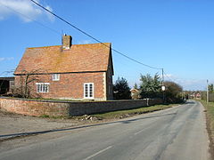
 Charndon