- Swanbourne
-
- For the suburb of Perth, Western Australia see Swanbourne, Western Australia; Swanbourne Lake is in the grounds of Arundel Castle.
Coordinates: 51°56′17″N 0°50′02″W / 51.938°N 0.834°W
Swanbourne 
St Swithun's Church, Swanbourne
Swanbourne Station House (disused)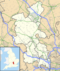
 Swanbourne
Swanbourne shown within BuckinghamshirePopulation 466 [1] OS grid reference SP802272 District Aylesbury Vale Shire county Buckinghamshire Region South East Country England Sovereign state United Kingdom Post town MILTON KEYNES Postcode district MK17 Dialling code 01296 Police Thames Valley Fire Buckinghamshire Ambulance South Central EU Parliament South East England UK Parliament Buckingham List of places: UK • England • Buckinghamshire Swanbourne is a village and also a civil parish within Aylesbury Vale district in Buckinghamshire, England. It is located about two miles east of Winslow, three miles west of Stewkley, on the secondary road B4032.
Contents
History
The village name is Anglo Saxon in origin, and possibly means 'swan stream'. In the Anglo-Saxon Chronicle in 792 the village was recorded as Suanaburna.
The manor of Swanbourne once belonged to Woburn Abbey. Swanbourne House was bought in 1798 by Thomas Fremantle (1765–1819), for his wife Elizabeth, known as Betsey, for 900 guineas.[2] The Fremantle family, originally from Aston Abbotts, had strong naval connections. Their eldest son Sir Thomas Francis Fremantle (1798–1890) became a prominent Tory politician. Their second son Charles (1800–1869) followed his father into the British Royal Navy and was instrumental in founding the Swan River Colony in Western Australia. This accounts for the place names Fremantle, Swanbourne and Cottesloe in the Perth area of Western Australia.
Swanbourne House is still owned by the Fremantle family trust, but let (see "Schools"). The present head of the family is Commander John Tapling Fremantle, 5th Baron Cottesloe. A former Lord Lieutenant of Buckinghamshire, he lives in the village, as does his daughter Elizabeth, the Hon. Mrs. Duncan Smith, with her husband Iain Duncan Smith, the Conservative politician.
There was an agricultural strike in Swanbourne in 1873, led by members of the Primitive Methodist Chapel who were in the National Agricultural Labourer's Union (NALU).
Attached to the village is the hamlet of Nearton End.
Schools
The first school in the village was founded in 1712 under the will of one Nicholas Godwin.[3] The present-day Swanbourne Church of England School in Winslow Road is a mixed, voluntary aided, primary school with about 30 pupils aged from four to nine. There are plans to resume teaching 9 to 11-year-olds soon. Some functions and staff are shared with Mursley Church of England School and Drayton Parslow Village School.[4]
Swanbourne House is a coeducational infants' and prep school for 400-450 pupils from age three for day pupils and seven for boarders, up to the age of 13.[5] It was founded in 1920.[6]
The private Home Farm Day Nursery is also in Winslow Road.[7]
Churches
St Swithun's Church (Anglican), a Grade II* listed historic building, stands at the east end of the village, opposite Swanbourne House. The nave, chancel and tower date from the first half of the 13th century. The north aisle was added in the second half of the 15th century and the tower rebuilt half a century later.[8] The church is in remarkably good repair, and contains some charming stained glass and a fine wooden ceiling, both probably dating from the 19th century. There are also some medieval carvings and the remains of three remarkable medieval murals in the north aisle.[9] The tower contains six bells and a sanctus. There are monumental brasses on the south and north sides of the chancel. The latter, showing Thomas Adams (died 1626) and his family, bears the baneful inscription, “Who in prime of youth by bloudy theves was slain, / In Liscombe ground his bloud ye grass did staine.”
Swanbourne Baptist Church, in Mursley Road, was built in 1809, rebuilt in 1863 and closed in 1972, when it was converted into a dwelling.
Swanbourne Methodist Church is in Nearton End. The first Chapel was built for the Primitive Methodists in 1858 and a new one was built in 1907. Formerly in the Stewkley Circuit, then the Leighton Buzzard Circuit, the church is now in the Aylesbury Vale Circuit. Sunday services are at 6pm with a lively Sunday School each week at 10.30am.
Businesses and facilities
There is a general store on Mursley Road.
A new public house and restaurant opened at the end of July 2006. It is called "The Betsey Wynne" after the diarist ancestor of the Fremantles. Situated in Mursley Road, it specializes in English food and drink and self-grown produce.[10]
Swanbourne Tearooms is on Winslow Road.
From 1851 to 1967, Swanbourne had its own railway station on the Varsity Line, about 1.5 miles (2.4 km) from the village and half way to Little Horwood. It was also about the same distance from Mursley. The nearest train station today is at Bletchley (14 km).
There are limited weekday bus services between Swanbourne and Winslow, Bletchley or Milton Keynes.
References
- ^ Neighbourhood Statistics 2001 Census
- ^ The Wynne Diaries 1789–1820. Edited and selected by Anne Fremantle. World's Classics. (London: OUP, 1952), pp. 297 ff.
- ^ Parishes: Swanbourne Victoria History of the Counties of England, Buckinghamshire. Accessed 6 April 2010.
- ^ http://www.draytonparslow.bucks.sch.uk/prospectus/final_report%20Swanbourne.pdf. Accessed 6 April 2010.
- ^ http://www.swanbourne.org/. Accessed 6 April 2010.
- ^ http://www.isbi.com/isbi-viewschool/2132-Swanbourne_House_School.html. Accessed 6 April 2010.
- ^ http://www.homefarmnursery.co.uk/. Accessed 6 April 2010.
- ^ http://www.british-history.ac.uk/report.aspx?compid=42593. Accessed 6 April 2010.
- ^ http://www.paintedchurch.org/swanbou.htm. Accessed 6 April 2010.
- ^ http://north-family.org/north-family/north/betsey_wynne.htm. Accessed 6 April 2010.
Further reading
- Ken Reading "Swanbourne: History of an Anglo-Saxon Town" available from Swanbourne Village Shop
- Frankie Fisher "We Reap Where They Have Sown – an account of Primitive Methodism in Swanbourne", available from Swanbourne Methodist Church
External links
- Swanbourne Methodist Church
- Swanbourne House School
- The Betsey Wynne pub
- Swanbourne St Swithun's Church
Categories:- Villages in Buckinghamshire
- Civil parishes in Buckinghamshire


Wikimedia Foundation. 2010.