- Chackmore
-
Coordinates: 52°00′58″N 1°00′04″W / 52.016°N 1.001°W
Chackmore 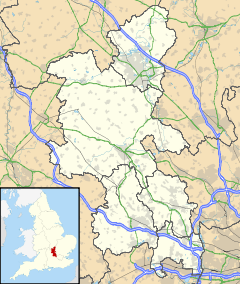
 Chackmore
Chackmore shown within BuckinghamshirePopulation 236 [1] Parish Radclive-cum-Chackmore District Aylesbury Vale Shire county Buckinghamshire Region South East Country England Sovereign state United Kingdom Post town Buckingham Postcode district MK Dialling code 01280 Police Thames Valley Fire Buckinghamshire Ambulance South Central EU Parliament South East England UK Parliament Buckingham Website Parish Council website List of places: UK • England • Buckinghamshire Chackmore is a hamlet in the parish of Radclive-cum-Chackmore, in north Buckinghamshire, England. The hamlet is approached using the avenue that links Buckingham with Stowe Park.
Contents
History
The hamlet name is Anglo Saxon in origin, and means 'Ceacca's moor'. It has been suggested though that the first part of the name could stem from the ancient word ceacce, meaning 'hill'. The hamlet was first recorded in manorial rolls in 1241 as Chakemore. It has also occasionally been recorded as Chalkmore.
Main Street in Chackmore was originally flanked by thatched cottages, only two of which retain thatched roofs following a fire that swept the entire length of the village some one hundred and fifty years ago. The main thoroughfare was dissected by a huge tree known as the Cross Tree, which served as a moot or meeting place for the villagers. This was removed some time during the last 20 years and replaced by a roundabout.
A lane running off of the main street eventually becomes a cul-de-sac called The Maltings. This suggests there was once a brewery somewhere nearby though no records exist to that effect. Opposite the primary school a cobbler named Billy Ayers used to work from a small shed in his garden and his clientele included not only the local residents but also the pupils and staff of Stowe School. This provided an extremely busy and important cottage industry and was operational up until the mid-1970s.
There are several listed buildings are located on Main Street including some 17th and 18th century properties.[2]
Education
The village is home to St James and St John Church of England Primary School which was formed in September 2006 by merging Akeley Church of England School and Chackmore Church of England School, and by extending the merged school from a first school to a combined school.[3]
Chackmore also has a playschool situated within the grounds of St. James and St. John Primary School. The playschool is run by a voluntary committee and takes children from 2 years old to 4 years old. The playschool was founded in 2002 with the help of Lottery funding.[citation needed]
Parish
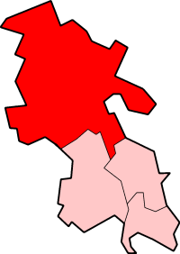
Chackmore is located in the civil parish of Radclive-cum-Chackmore, in the district of Aylesbury Vale. Chackmore is the larger of the two villages and is estimated to have a population of around 180[4] out of a combined parish total of 236. The parish church is located in Radclive, and is part of the Buckingham Benefice.[5] The A422 bisects the parish, with Chackmore to the north and Radclive to the south.
References
- ^ Neighbourhood Statistics 2001 Census
- ^ British Listed Buildings website
- ^ "Cabinet Minutes - Monday 25 September 2006". Buckinghamshire County Council. http://www.buckscc.gov.uk/moderngov/Data/Cabinet/20060925/Minutes/Minutes.pdf. Retrieved 2007-09-21.
- ^ Parish website
- ^ Buckingham Benefice website
External links
Categories:- Hamlets in Buckinghamshire

Wikimedia Foundation. 2010.