- Myagdi District
-
Myagdi
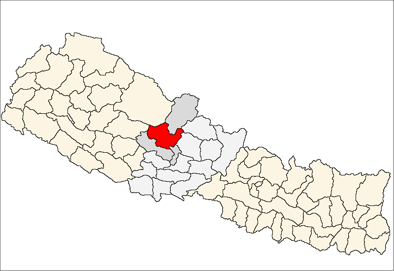
म्याग्दी— District — Location of Myagdi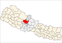
Country  Nepal
NepalRegion Western (Pashchimanchal) Zone Dhawalagiri Area - Total 2,297 km2 (886.9 sq mi) Population (2001) - Total 114,447 - Density 49.8/km2 (129/sq mi) Time zone NPT (UTC+5:45) Myagdi District(Nepali: म्याग्दी जिल्ला
 Listen (help·info), a part of Dhawalagiri Zone, is one of the seventy-five districts of Nepal, a landlocked country of South Asia. The district, with Beni as its district headquarters, covers an area of 2,297 km² and has a population (2001) of 114,447.
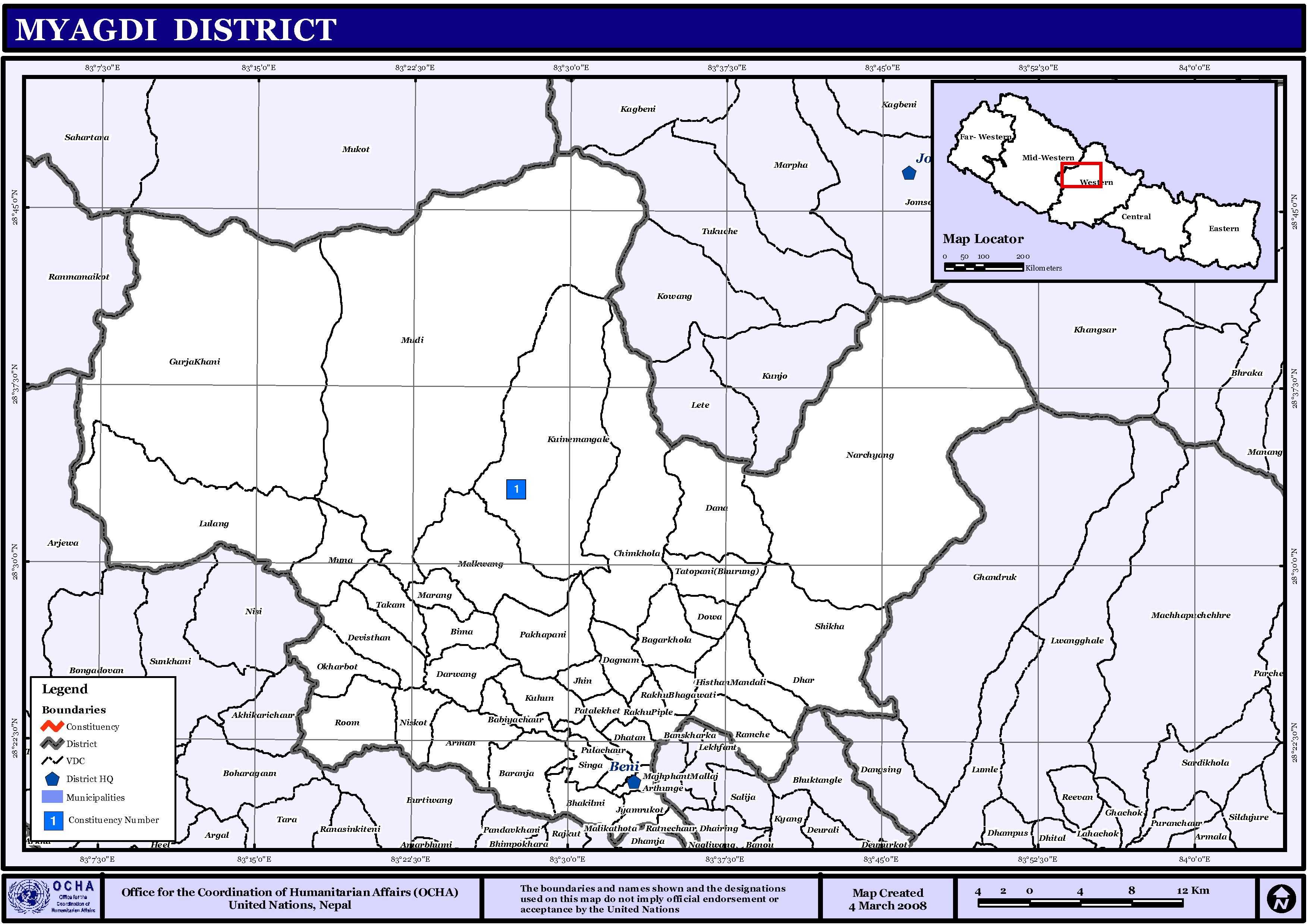
Village Development Committees (VDCs)
 Map of the VDCs in Myagdi District
- Arman
- Arthunge
- Babiyachaur
- Baranja
- Begkhola
- Bhakilmi
- Bima
- Chimkhola
- Dagnam
- Dana
- Darwang
- Devisthan
- Dhatan
- Dowa
- Gurja Khani
- Histhan Mandali
- Jhin
- Jyamrukot
- Kuhunkot
- Kuinemangale
- Lulang
- Malkwang
- Marang
- Mudi
- Muna
- Narchyang
- Niskot
- Okharbot
- Pakhapani
- Patlekhet
- Pulachaur
- Rakhu Bhagawati
- Rakhupiple
- Ramche
- Ratnechaur
- Roomaga
- Shikha
- Singa
- Takam
- Tatopani
- Ruma
See also
References
- Districts of Nepal at statoids.com
Districts of Nepal Achham · Arghakhanchi · Baglung · Baitadi · Bajhang · Bajura · Banke · Bara · Bardiya · Bhaktapur · Bhojpur · Chitwan · Dadeldhura · Dailekh · Dang Deokhuri · Darchula · Dhading · Dhankuta · Dhanusa · Dolkha · Dolpa · Doti · Gorkha · Gulmi · Humla · Ilam · Jajarkot · Jhapa · Jumla · Kailali · Kalikot · Kanchanpur · Kapilvastu · Kaski · Kathmandu · Kavrepalanchok · Khotang · Lalitpur · Lamjung · Mahottari · Makwanpur · Manang · Morang · Mugu · Mustang · Myagdi · Nawalparasi · Nuwakot · Okhaldhunga · Palpa · Panchthar · Parbat · Parsa · Pyuthan · Ramechhap · Rasuwa · Rautahat · Rolpa · Rukum · Rupandehi · Salyan · Sankhuwasabha · Saptari · Sarlahi · Sindhuli · Sindhulpalchok · Siraha · Solukhumbu · Sunsari · Surkhet · Syangja · Tanahu · Taplejung · Terhathum · Udayapur
 Categories:
- Myagdi District
- Nepal geography stubs

Wikimedia Foundation. 2010.