- Taplejung District
Infobox Nepal district
district = Taplejung District
area = 3,646km²
population = 134,698
pop_year = 2001
density =
caption =
region =
established =
languages =
website =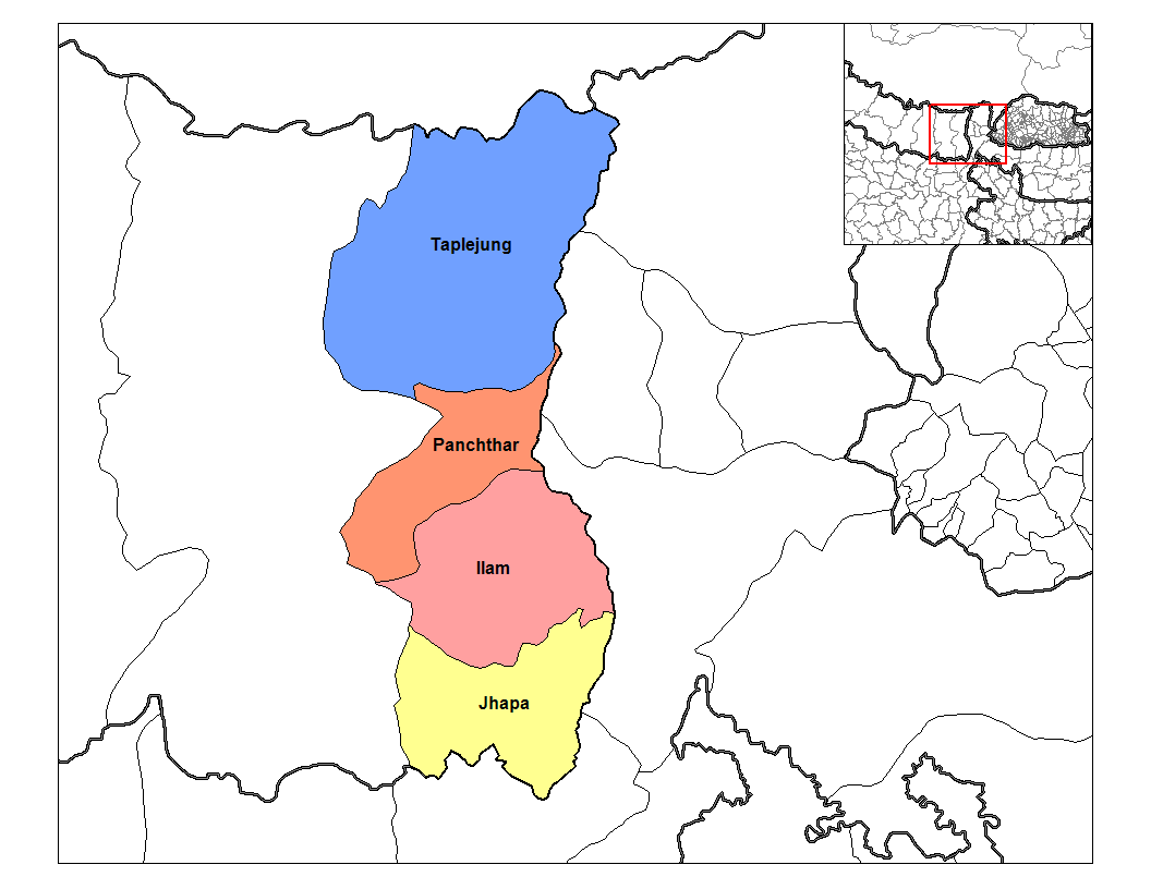
Taplejung District, a part of
Mechi Zone , is one of seventy-five districts ofNepal , alandlocked country ofSouth Asia . The district, withTaplejung as its district headquarters, covers an area of 3,646km² and has a population (2001 ) of 134,698.Taplejung is located in North Eastern
Nepal , theTamor river flows through the district and the area is famous for its proximity toKanchenjunga , the third highest mountain in the world. Taplejung has an airstrip with commercial flights toBiratnagar andKathmandu . A road has connected the district headquarters with the Tarai plains. Most of the population are involved in agriculture, and the vegetation zones range from sub-tropical, totemperate forests, alpine meadows and snow and ice.The name Taplejung is derived from the words "Taple" and "Jung", Taple was the medieval Limbu King who used to rule the area and "Jung" in Limbu language means Fort. Literally, Taplejung means Fort of the King Taple.
Taplejung is one of the most beautiful areas in eastern Nepal with spectacular landscape, Himalayan peak of heights above 7000 meters and a wide range of flora and fauna. Mt. Kanchanjunga (8586 m), the world's third largest peak lies in this region. Alpine grassland, rocky out crops, dense temperate, subtropical forests, and no river valleys make up the region. Taplejung occupies an area ranging from 670 meters to 8586 meters (Mt. Kanchanjunga) above sea level. One of the major attraction that lies in this area is the Pathibhara Devi temple. This secret region attracts tourists seeking spiritual fulfilment and blessings from the powerful Pathibhara Devi. Hindus as well as the Buddhists reach the temple for celebrations during special occasions. The trek to Pathibhara Devi (3794 m) combined with the natural and cultural experiences of the region make the visit a unique exhilarating experience.
Taplejung is famous for its holy temple Pathivara. It takes a day to reach the temple on foot from Taplejung Bazaar. The airport in Suketar can only accommodate aircraft Short Take-off and Landing (
STOL ). On the way to Pathivara we can find many species of rhododendron. Mostly we can find Red, White and light yellow. We can also view the scenery of MountKanchenjunga .Travel
For those wanting to travel Taplejung by motor roads there are two available options. The first one is from
Kathmandu toBirtamod (about 500 km which takes approximately 14 hours), and then from Birtamod to Taplejung Bajar (about 300 km -the roads are hilly and are pitched up to Phidim district town). The second option would be to travel fromKathmandu toDharan (about 450km) and from Dhran to Dhankuta, Hiley, Sindha, Basantapur. After Basantapur travellers will have to walk on foot. It might not be a good option but walking through the jungle of Gufaa is exciting.ee also
*
Zones of Nepal
*Kanchenjunga References
*
Wikimedia Foundation. 2010.