- Makwanpur District
-
Makwanpur
मकवानपुर— District — 
Country  Nepal
NepalRegion Central (Madhyamanchal) Zone Narayani Area - Total 2,426 km2 (936.7 sq mi) Population (2001) - Total 392,604 - Density 161.8/km2 (419.1/sq mi) Time zone NPT (UTC+5:45) Main language(s) Nepali Makwanpur District(Nepali: मकवानपुर जिल्ला
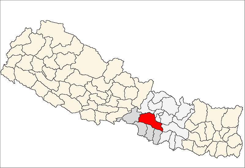
 Listen (help·info), a part of Narayani Zone, is one of the seventy-five districts of Nepal, a landlocked country of South Asia. The district, with Hetauda as its district headquarters, covers an area of 2,426 km² and has a population (2001) of 392,604. Bhimfedi market of the district was the traditional route to enter Kathmandu valley from the south.
Village Development Committees (VDCs)
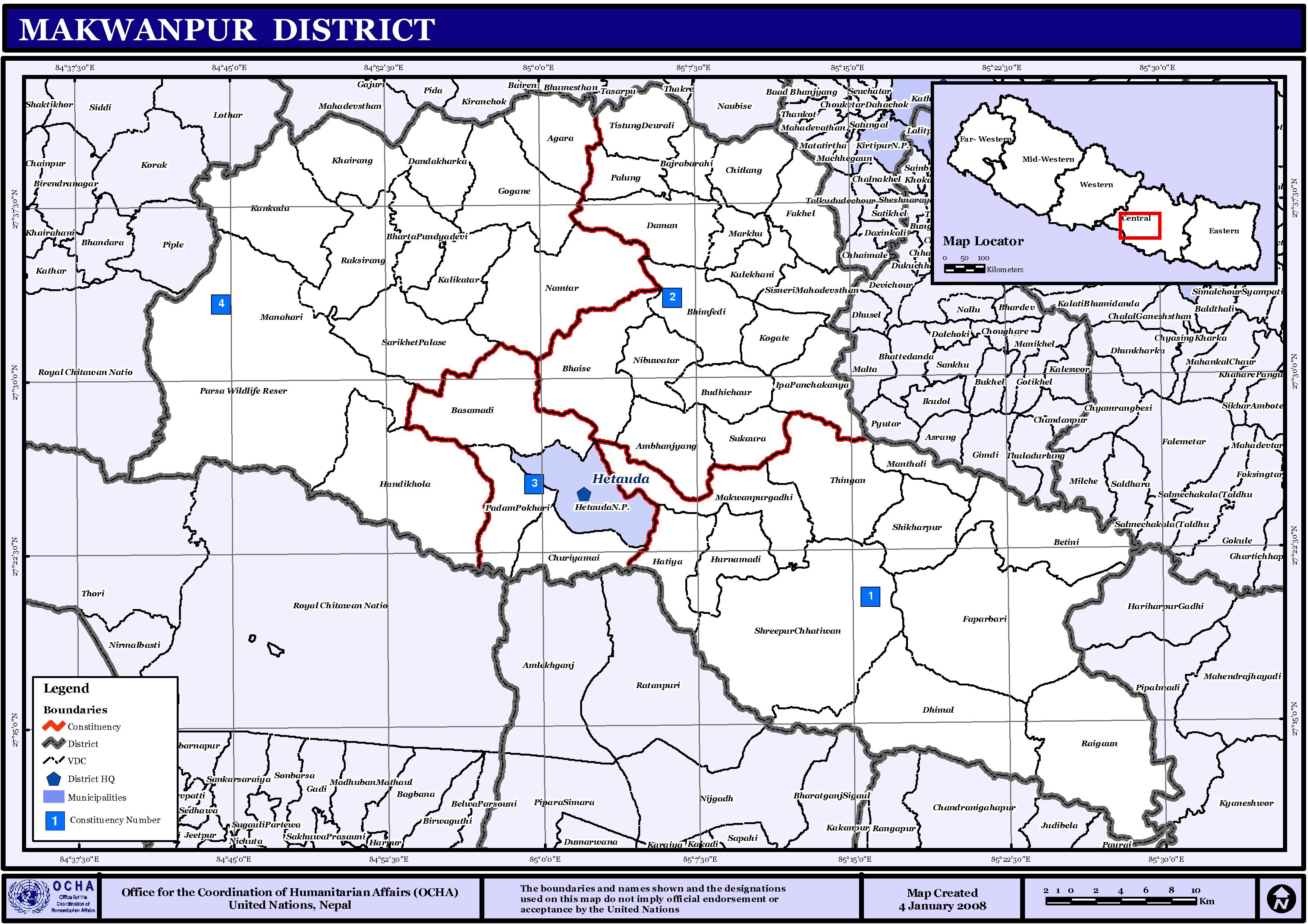
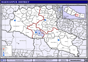 Map of the VDCs in Makwanpur District
- Agara
- Ambhanjyang
- Bajrabarahi
- Basamadi
- Betini
- Bhaise
- Bharta Pundyadevi
- Bhimfedi
- Budhichaur
- Chhatiwan
- Chitlang
- Churiyamai
- Daman
- Dandakharka
- Dhimal
- Fakhel
- Faparbadi
- Gogane
- Handikhola
- Hatiya
- Hetauda
- Hurnamadi
- Ipa Panchakanya
- Kalikatar
- Kankada
- Khairang
- Kogate
- Kulekhani
- Makwanpurgadhi
- Manahari
- Manthali
- Markhu
- Marta Punchedevi
- Namtar
- Nibuwatar
- Padam Pokhari
- Palung
- Raigaun
- Raksirang
- Sarikhet Palase
- Shikharpur
- Shreepur Chhatiwan
- Sisneri Mahadevsthan
- Sukaura
- Thingan
- Tistung Deurali
See also
References
- Districts of Nepal at statoids.com
Districts of Nepal Achham · Arghakhanchi · Baglung · Baitadi · Bajhang · Bajura · Banke · Bara · Bardiya · Bhaktapur · Bhojpur · Chitwan · Dadeldhura · Dailekh · Dang Deokhuri · Darchula · Dhading · Dhankuta · Dhanusa · Dolkha · Dolpa · Doti · Gorkha · Gulmi · Humla · Ilam · Jajarkot · Jhapa · Jumla · Kailali · Kalikot · Kanchanpur · Kapilvastu · Kaski · Kathmandu · Kavrepalanchok · Khotang · Lalitpur · Lamjung · Mahottari · Makwanpur · Manang · Morang · Mugu · Mustang · Myagdi · Nawalparasi · Nuwakot · Okhaldhunga · Palpa · Panchthar · Parbat · Parsa · Pyuthan · Ramechhap · Rasuwa · Rautahat · Rolpa · Rukum · Rupandehi · Salyan · Sankhuwasabha · Saptari · Sarlahi · Sindhuli · Sindhulpalchok · Siraha · Solukhumbu · Sunsari · Surkhet · Syangja · Tanahu · Taplejung · Terhathum · Udayapur

Coordinates: 27°25′N 85°02′E / 27.417°N 85.033°E
Categories:- Makwanpur District
- Nepal geography stubs

Wikimedia Foundation. 2010.