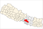
- Churiyamai
-
Churiyamai — Village development committee — Location in Nepal Coordinates: 27°22′N 85°02′E / 27.37°N 85.03°ECoordinates: 27°22′N 85°02′E / 27.37°N 85.03°E Country  Nepal
NepalZone Narayani Zone District Makwanpur District Population (1991) – Total 10,405 Time zone Nepal Time (UTC+5:45) Churiyamai is a village development committee in Makwanpur District in the Narayani Zone of southern Nepal. At the time of the 1991 Nepal census it had a population of 10,405 people living in 1843 individual households.[1] There is Churiyamai Secondary School in Ward no. 9. It has its own history. The principal of this school is Bishnu Pariyar.Mr Rajib Timalsina is Vice principal.< This VDC has Churiyamai Temple, goddes of Churiyamai. The drivers worship this Goddess heartly. The name of the VDC and School named by the name of Churiya hill. Churiya hill is the range of hills across the whole Nepal. This VDC has 12 schools and mostly 90% people from ethnic group lived in this VDC.
References
- ^ "Nepal Census 2001". Nepal's Village Development Committees. Digital Himalaya. http://www.digitalhimalaya.com/collections/nepalcensus/form.php?selection=1. Retrieved 9 December 2008.
Agara, Ambhanjyang, Bajrabarahi, Basamadi, Betini, Bhaise, Bharta Pundyadevi, Bhimfedi, Budhichaur, Chhatiwan, Chitlang, Churiyamai, Daman, Dandakharka, Dhimal, Fakhel, Faparbadi, Gogane, Handikhola, Hatiya, Hurnamadi, Ipa Panchakanya,
Kalikatar, Kankada, Khairang, Kogate, Kulekhani, Makwanpurgadhi, Manahari, Manthali, Markhu, Marta Punchedevi, Namtar, Nibuwatar, Padma Pokhari, Palung, Raigaun, Raksirang, Sarikhet Palase, Shikharpur, Shreepur Chhatiwan, Sisneri Mahadevsthan, Sukaura, Thingan, Tistung Deurali
At Churiyamai Secondary school Rajib Timalsina worked as Vice Principal from BS 2061 to BS 2066 Chaitra.Churiyamai Secondary School is one of the model school of Makawanpur District of Nepal. It has beautiful library and model classes.
Categories:- Populated places in Makwanpur District
- Narayani Zone geography stubs
Wikimedia Foundation. 2010.

