- Jhapa District
Infobox Nepal district
district = Jhapa District
area = 1,606
population = 688,109
pop_year = 2001
density =
caption =
region =
established =
languages =
website =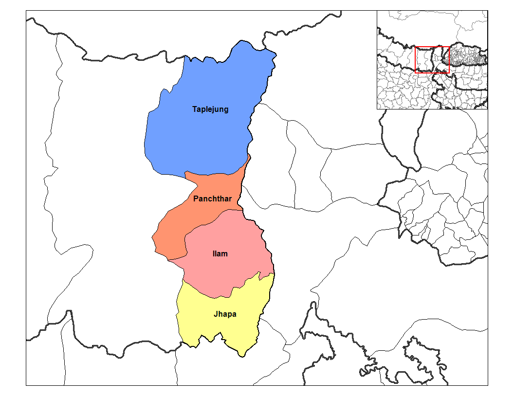
Jhapa District, a district of
Mechi Zone , is one of the seventy-fivedistricts of Nepal . The district, withChandragadhi as its district headquarters, covers an area of 1,606 km² and has a population (2001 ) of 688,109.Location
Jhapa is the easternmost district of Nepal and lies in the fertile
Terai plains . It bordersIlam district in the north,Morang district in the west, the Indian state ofBihar in the south and east, and the Indian state ofWest Bengal in the east.Administration
The district is divided into 47 Village Development Committees (VDCs) and three municipalities, namely
Budhabare in the north,Bhadrapur in the south,Mechinagar in the east andDamak in the west. Its major centers areChandragadhi , Bhadrapur,Birtamod ,Kakarbhitta ,Damak ,Dhulabari ,Budhabare ,Surunga ,Charali ,Baniyani ,Kechana ,Patharia ,Balubadi ,Gherabari ,Pathamari ,Prithvinagar ,Halddibari ,Maharanijhora ,Lakhanpur ,Gauradaha ,Topgachhi .Towns and villages
Anarmani Arjundhara Bahundangi Baigundhara Balubari Baniyani Bhadrapur N.P. Budhabare Chakchaki Chandragadhi Charpani Damak N.P. Dangibari Dhaijan Dharmpur Dhulabari Duhagadhi Garamani Gauradaha Gauriganj Ghailadubba Gherabari Golchhap Haldibari Jalthal Juropani Jyamirgadhi Kakadvidta Kechana Khajurgachhi Khudnabari Kohabara Korabari Kumarkhod Lakhanpur Mahabhara Maharanijhoda Maheshpur Mechinagar N.P. Panchganchi Pathabhari Pathariya Prithivinagar Rajghadh Sanischare Satasidham Shantinagar Sharanamati Shivaganj Surunga Taganduba (Jhapa) Topgachchi
Demography
Jhapa is home to many indigenous ethnic nationalities such as the
Rajbanshi ,Satar ,Meche ,Koche , Limbu,Dhimal ,andGangain . Other ethnic groups such as Rai,Dhangad ,Tamang ,Uraon , Magar,Gurung and many others came to Jhapa in the late 19th century, so did the Hill/mountain castes Bahun,Chhettri , andNewar .Jhapa is diverse and rich in culture and traditions due to the influences of its different tribes. All the tribes/ethnic groups have their own languages, customs and traditions, and they celebrate their festivals every year.
Climate and Geography
Jhapa receives 250 to 300 cm of rainfall a year, and mostly during the
monsoon season in the summer, and its hilly northern area receives more rainfall than the south. Its major rivers, like theMechi River ,Kankai Mai ,Ratuwa ,Biring ,Deuniya ,(Aduwa), (Bhuteni)(Dhangri ), Hadiya, andNinda ,Krishne Khola, Gauriya, Ramchandre etc provide water forirrigation . Due to itsalluvial soil best suited for agriculture, Jhapa has been the largest producer ofrice and is therefore known as the Grain Grocery of Nepal Fact|date=April 2007. Besides cereal crops like rice andwheat , it is also one of the largest producers ofjute ,tea ,betel nut ,rubber and other cash crops.Jhapa also has vast areas of forests, such as
Deonia ,Charali ,Charkose Jhaadi ,Hadiya ,Sukhani ,Jalthal , and others. It's name itself is derived from the Rajbanshi word "jhapa" meaning "canopy", which suggests that the area was a dense forest in the past. It was once such a dense and dangerous forest that it was called Kaalapaani and prisoners were sent here to die ofmalaria and other diseases in the jungle.Attractions and Sites
Jhapa also has several religious and historical sites of great importance like
Kankai Mai ,Kichakbadh ,Satasidham ,Arjundhara ,Chillagadh ,Biratpokhar , andKrishnathumki among others. It is believed thatPandu 's sonBhim had killedKichak in Kichakbadh (near Kechana in the south border) in the time of theMahabharata and a great festival is observed on that day every year. There is also the historical fort of Chandragadh which gave its name to Chandragadhi. Other sites too have their own religious and historical values. It is also the gateway toDarjeeling andSikkim and the rest of north-east India fromNepal .Development
Jhapa is one of the most developed districts of the country. Almost all the villages and towns are linked by roads. There are schools and colleges in many parts of the district. There is also an airport and a hospital in Chandragadhi. It has the highest literacy rate in the country after Kathmandu, Kaski and Chitwan districts.
Education
Jhapa has a good literacy rate of
66.93 [cite web | url = http://www.cbs.gov.np/] percentage which is highest in Nepal after the capital city Kathmandu. Lots of higher secondary school likeLittle Flower's English School ,Kankai Boarding School ,Emerald Academy , etc. have been providing quality education in Jhapa.Mechi Multiple Campus under the affiliation ofTribhuwan University is the oldest government college in Jhapa. Students from neighbouring districts also come here for higher education.Role in National Politics
It plays the main role in national politics.The Communist revolution was started from the Jhapa,which led to formation of one the most prominent party of nation CPN-UML. Many national political figures are from jhapa such as K.P Oli, K.P Sitaula, Chakra Bastola, C.P Mainali.Recently during JanaAndolan 2063(April Revolution)Jhapa played a significant role in the agitation against Royal takeover.Around 5 peoples were Killed by the Royal Army in Bhadrapur and many more deaths weren't disclosed.
Agriculture and Industry
Jhapa is also famous for
microcredit development. The Small Farmer Development Programme (SFDP) was the first rural and micro-financing program in Jhapa. The Agricultural Development Bank started this Small Farmer Development Programm in 1988. It started in a few VDCs and spread. After lifted many people out of poverty, the SFDP was handed over to the local people and the new institution was named Small Farmer Cooperative Ltd (SFCL). There are currently 13 SFCLs in Jhapa, each of which covers a single VDC.It is one of the major area for the Production of Tea and Rice. Budhubare situated below the Mahabhara range is the most fertile land of Nepal. Several large Tea Estate are also located in Jhapa.
Giri Bandhu Tea Estate , Tokla Tea Estate, Sattighatta Tea Estate are the Major ones.ee also
*
Zones of Nepal References
1. cite web |url=http://www.cbs.gov.np/ |title=Census 2001 |accessdate=2008-08-24 |work=Census |publisher=central bureau of statistics, Nepal |date=2001
*
Wikimedia Foundation. 2010.