- Baglung District
Infobox Nepal district
district = Arghakhanchi District
area = 1,784
population = 268,938
pop_year = 2001
density =
caption = Baglung is located in the south of Dhawalagiri Zone
region =
established =
languages =
website =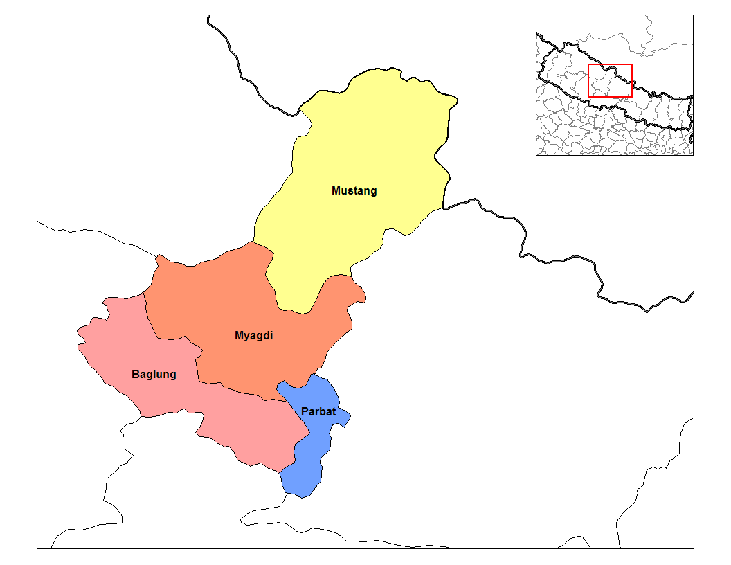
Baglung District, a part of
Dhawalagiri Zone , is one of the seventy-five districts ofNepal , alandlocked country ofSouth Asia . The district, withBaglung as its district headquarters, covers an area of 1,784 km² and has a population (2001 ) of 268,938.Baglung is surrounded by Parvat, Myagdi, Rukum, Ropla, Pyuthan and Gulmi districts. It looks like Nepal in shape. It has 59 Village Development Committees and one Municipality. It has many rivers and streams and so, many suspension bridges. Baglung is also known as the district of suspension bridges because of the large number of bridges. It is a hilly district, most of the population settled in the sides of the rivers. Fertile planes situated in the either sides of the rivers are used for farming. Headquarter of Baglung (Baglung Bazaar) is also situated in the bank of the holy river- Kaligandaki. Like Nepal, Baglung is also diverse in religion, culture, ethnicity, altitute, temperature etc. Hinduism and Buddhism are the major religions. Magar, Chhetri, Bramhan, Newar, Gurung, Chhantyal and Thakali are the main ethnic groups residing in Baglung. Highest temperature in the lowest altutude of baglung rises up to about 37.5 degree Celcius in summer and the lowest temperature at Dhorpatan falls up to about -15 degree celcius in Winter. Altitude of Baglung varies from about 650 meters at Kharbang to about 4,300 meters in Dhorpatan.
Baglung is rich in herbal medicine plants. Rice, corn, millet, wheat and potato are the major crops of baglung.There were many mines in use in Baglung in the past; Iron and Copper mines being the most prevalent. But they are not in use for long time because of the heedlessness of the government. There are numerous slate mines in use in Baglung. These slates are excellent for roofing.
Baglung Bazaar, Hatiya- Galkot, Kushmi Sera and Burtibang are the main trading centers of Baglung. Galkot, Kushmi Sera and Burtibang are connected with the district headquarter Baglung Bazaar by raw roads. Small part of Baglung is electrified by Nepal Electricity Authority and some other parts are electrified by small local hydroplants. Recently, telephone has been accessible in almost all villages of Baglung.
Baglung is considered to be one of the politically most conscious districts and it plays a significant role in the Nepali politics.
"Italic tex"'
Towns and villages
"
Adhikarichaur ,Amalachaur ,Amarbhumi ,Argal ,Arjewa ,Baglung ,Baskot ,Batakachaur ,Bhakunde ,Bhimgithe ,Bhimpokhara ,Bihunkot ,Binamare ,Boharagaun ,Bowang ,Bungadovan ,Burtiwang ,Chhisti ,Daga Tumdada , Damek, Darling, Devisthan,Dhamja ,Dhullu Gaidi ,Dhullubaskot ,Dudhilamati ,Gwalichaur ,Harichaur , Hatiya,Heela ,Hudgisheer ,Jabdi ,Jaljala , Kalika, (kundule)Kandebas ,Khungkhani ,Khunga ,Kusmishera ,Lekhani , Malika, Malma, Mulpani,Narayansthan ,Narethanti , Nisi,Paiyunthanthap ,Palakot ,Pandavkhani ,Paiyunpata ,Rajkut ,Ranasingkiteni ,Rangkhani ,Rayadanda , Resh,Righa , Salyan,Sarkuwa ,Singana ,Sisakhani ,Sukhaura ,Sunkhani , Taman, Tangram, Tara, [Tityang),(chappa)"
Wikimedia Foundation. 2010.