- Osaka Prefecture
-
Osaka Prefecture Japanese transcription(s) – Japanese 大阪府 – Rōmaji Ōsaka-fu 
Symbol of Osaka Prefecture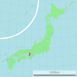
Coordinates: 34°41′11″N 135°31′12″E / 34.68639°N 135.52°ECoordinates: 34°41′11″N 135°31′12″E / 34.68639°N 135.52°E Country Japan Region Kansai Island Honshū Capital Osaka Government – Governor Tōru Hashimoto Area – Total 1,898.47 km2 (733 sq mi) Area rank 46th Population (August 1, 2011) – Total 8,862,030 – Rank 3rd – Density 4,668/km2 (12,090/sq mi) ISO 3166 code JP-27 Districts 5 Municipalities 43 Flower Japanese apricot (Prunus mume)
Primrose (Primula sieboldii)Tree Ginkgo tree (Ginkgo biloba) Bird Bull-headed shrike (Lanius bucephalus) Website pref.osaka.jp/en/ Osaka Prefecture (大阪府 Ōsaka-fu) is a prefecture located in the Kansai region on Honshū, the main island of Japan.[1] The capital is the city of Osaka. It is the center of Osaka-Kobe-Kyoto area.[2]
Contents
History
See also: Osaka#HistoryUntil the Meiji Restoration, the area of Osaka prefecture was known as Kawachi, Izumi and Settsu provinces.[3]
Osaka Prefecture was created in 1868, at the very beginning of the Meiji era.[4]
On September 1, 1956, the city of Osaka was promoted to a city designated by government ordinance and thereby divided into 24 wards.
In 2000, Fusae Ota became Japan's first female governor when she replaced Knock Yokoyama, who resigned after prosecution for sexual harassment.[5]
On April 1, 2006: the city of Sakai was promoted to a city designated by government ordinance and thereby divided into seven wards.
In 2008, Tōru Hashimoto, previously famous as a counselor on television, was elected at the age of 38 as the youngest governor in Japan.
Reform
In 2010, the Osaka Restoration Association was created with backing by Governor Tōru Hashimoto, attempting to reform Osaka Prefecture into Osaka Metropolis reducing affiliated organizations of Osaka Prefecture and the City of Osaka.
In the 2011 local elections the association was able to win the majority of the prefectural seats.
Geography
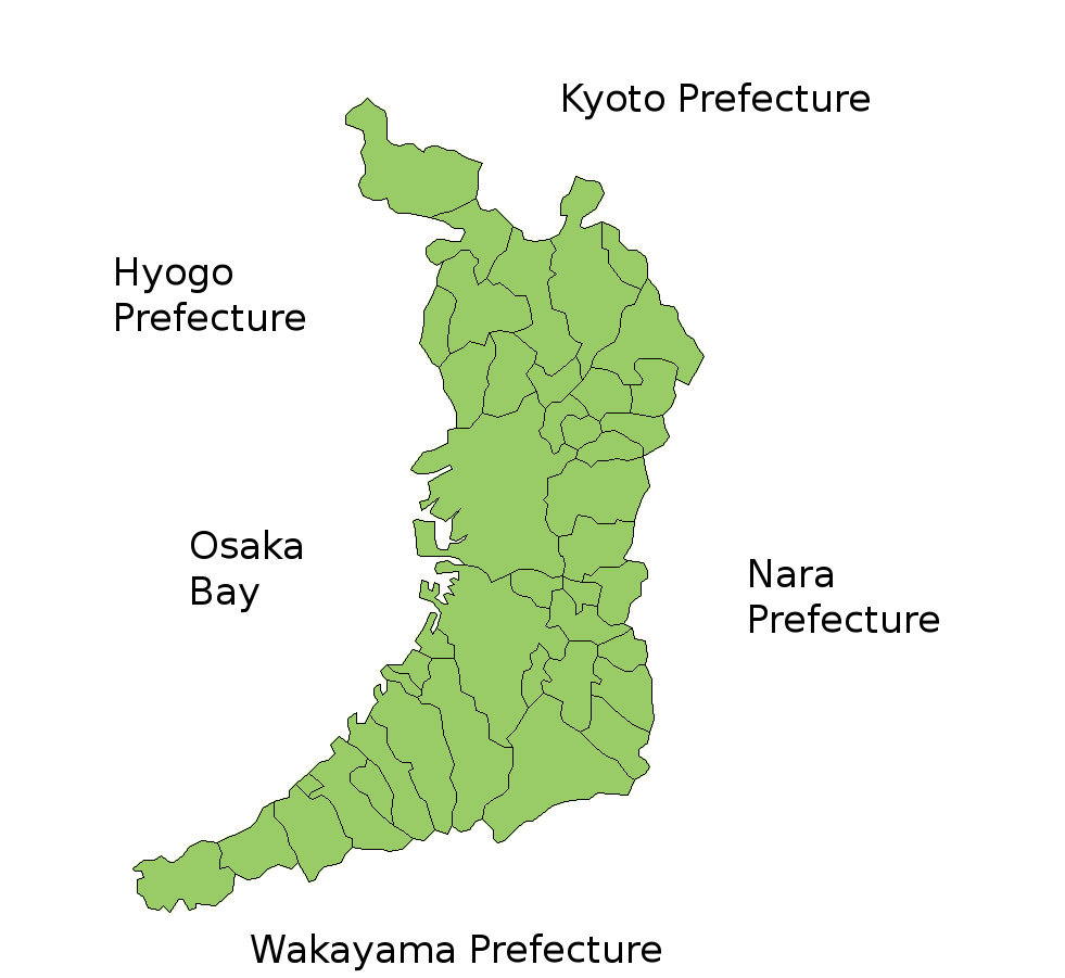
Osaka Prefecture neighbors the prefectures of Hyōgo and Kyoto in the north, Nara in the east and Wakayama in the south. The west is open to Osaka Bay. The Yodo and Yamato Rivers flow through the prefecture.
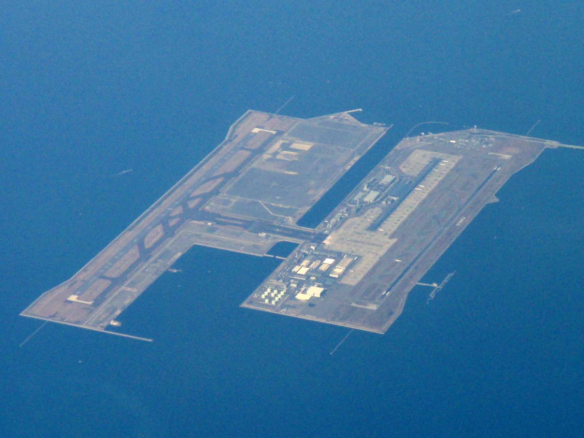
Prior to the construction of Kansai International Airport, Osaka was the smallest prefecture in Japan. The artificial island on which the airport was built added enough area to make it slightly larger than Kagawa Prefecture.[6][7]
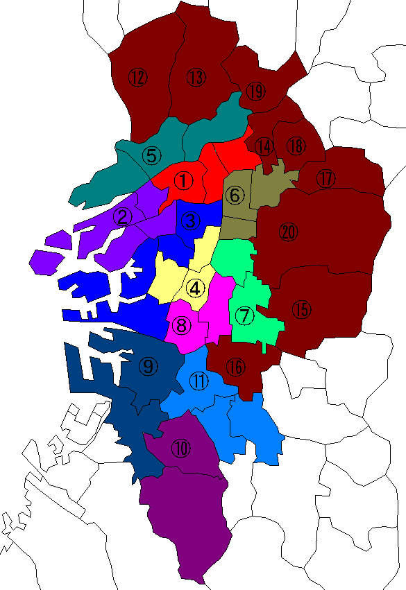
Cities
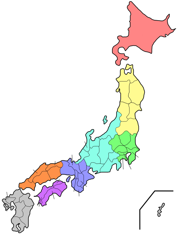
 Map of Osaka Prefecture.
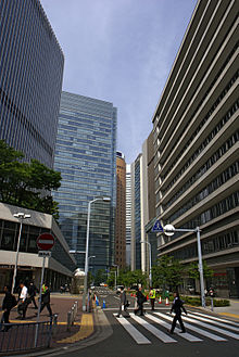
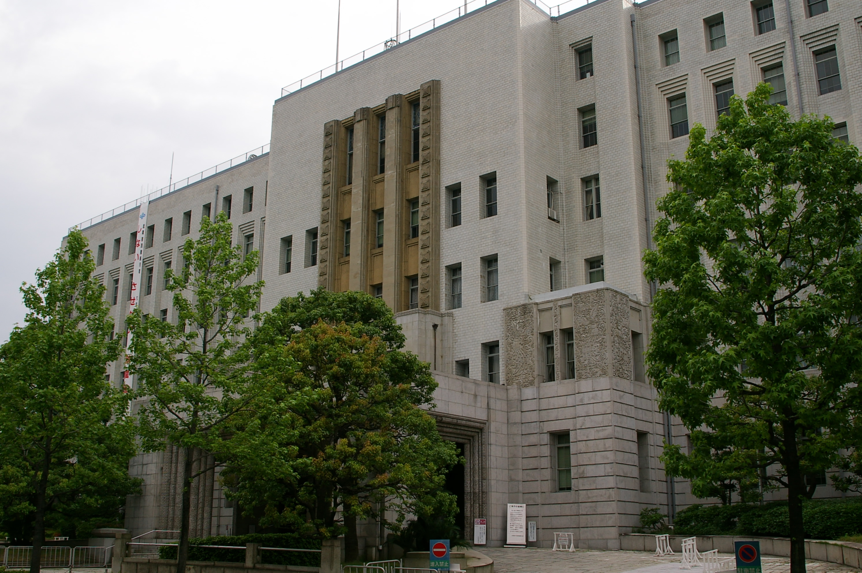
 Osaka Pref. Head Office
Thirty-three cities are located in Osaka Prefecture:
Towns and villages
These are the towns and villages in each district.
Mergers
Main article: List of mergers in Osaka PrefectureEconomy
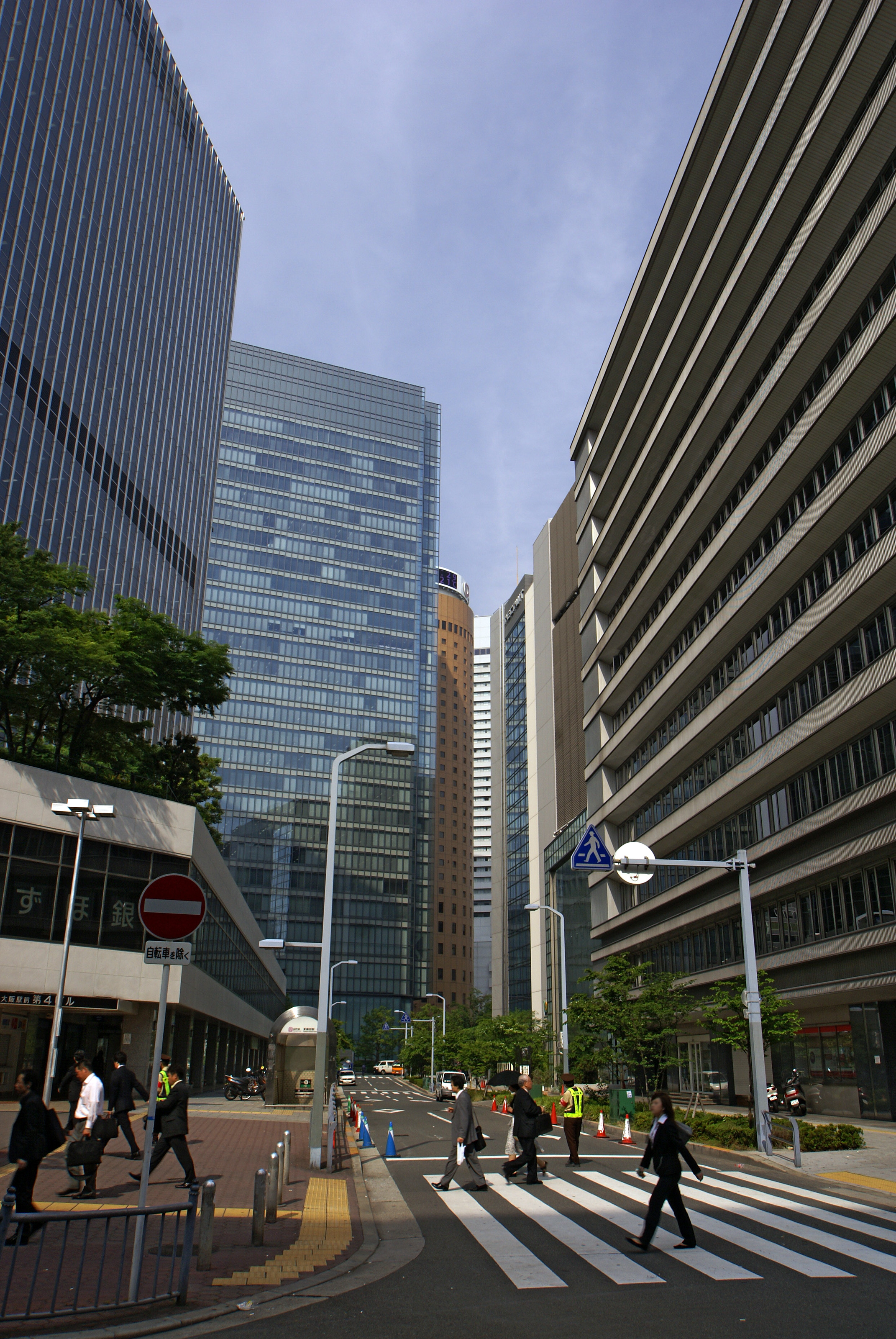
 Diamond district in Umeda
 Herbis ENT
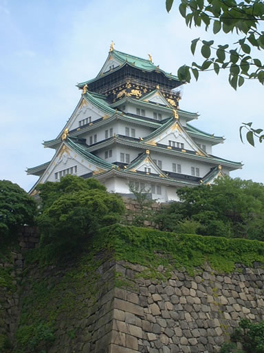
 Osaka castle Reproduction Tower
 Osaka Castle park and Osaka business park
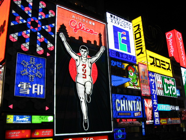
 Famous advertisement by Glico man in Dōtonbori (middle-left)
The gross prefecture product of Osaka for the fiscal year 2004 was ¥38.7 trillion, second after Tokyo with an increase of 0.9% from the previous year. This represented approximately 48% of the Kinki region. The per capita income was ¥3.0 million, seventh in the nation.[8] Commercial sales the same year was ¥60.1 trillion.[9]
Overshadowed by such globally renowned electronics giants as Panasonic and Sharp, the other side of Osaka's economy can be characterized by its Small and Medium Enterprises (SMEs) activities. The number of SMEs based in Osaka in 2006 was 330,737, accounting for 99.6% of the total number of businesses in the prefecture.[10] While this proportion is similar to other prefectures (the average nationwide was 99.7%), the manufactured output of the SMEs amounted to 65.4% of the total within the prefecture, a rate significantly higher than Tokyo's 55.5%, or Kanagawa's 38.4%.[11] One model from Osaka of serving the public interest and restimulting the regional economy combined with industry-education cooperation efforts is the Astro-Technology SOHLA,[12] with is struggling artificial satellite project.[13] Having originally started from a gathering of Higashiosaka based SMEs, Astro-Technology SOHLA, has not only grown into a Kansai region- wide group but has also won the support from the government, through technology and material support from Japan Aerospace Exploration Agency (JAXA),[14] and financial support from NEDO.[15][16]
The Osaka Securities Exchange, specializing in derivatives such as Nikkei 225 Futures, is based in Osaka.
There are many electrical, chemical,pharmaceutical, heavy industry, food, and housing companies in Osaka Prefecture.
Major companies
Main page: :Category:Companies based in Osaka PrefectureMajor factories and research institutes
Main articles: Hanshin Industrial Region and Kansai Science CityDemographics
According to the 2005 Population Census of Japan, Osaka prefecture has a population of 8,817,166, an increase of 12,085, or 0.14%, since the Census of year 2000.[17]
Culture
Museums
- National Museum of Ethnology, Japan [2]
- Open-Air Museum of Old Japanese Farm Houses (Hattori Ryokuchi Park)
- OSTEC (Osaka Science and Technology Center) Exhibition Hall
- Japan Folk Crafts Museum, Osaka [3]
Universities in Osaka Prefecture
- Kansai Medical University (Moriguchi, Osaka)
- Osaka University (Toyonaka and Suita)
- former Osaka University of Foreign Studies (Minoh)
- Osaka Kyoiku University (Kashiwara)
- Osaka City University (Osaka city)
- Osaka Prefecture University (Sakai)
- Kansai University (Suita, Takatsuki, Osaka city)
- Kinki University (Higashiosaka)
- Kansai Gaidai University (Hirakata) (Kansai University of Foreign Studies)
- Osaka International Educational University (Moriguchi)
- Osaka University of Health and Sport sciences (Kumatori)
- Osaka University of Commerce (Higashiosaka)
- Osaka University of Economic and Law (Higashiosaka)
- Osaka College of Music (Toyonaka)
- Osaka Electro Comnunication University (Neyagawa)
- Osaka Gakuin University (Suita)
- Otemon Gakuin University (Ibaraki)
- Hannan University (Matsubara)
- Setsunan University (Neyagawa)
- St. Andrew's University (Momoyama Gakuin University) (Izumi)
- Taisei Gakuin University (Mihara, Sakai)
Parks
- The Expo Commemoration Park (Suita) It was held Expo '70 here. About 260 ha.There is The Japanese garden, National Museum of Art, Osaka and an amusement park "Expoland".
- Hattori Ryokuchi Park (Toyonaka) About 150 ha.
- Nagai Park (Osaka city) About 66 ha. It is held The World Championships in Athletics games in 2007 at Nagai Stadium in this park.
- Osaka Castle Park (Osaka city) About 106 ha.
- Nakanoshima Park (Osaka city) - The Museum of Oriental Ceramics, public hall (1911, Renaissance Revival architecture), Osaka Prefectural Nakanoshima Library (1904, Baroque Revival architecture), and the city hall of Osaka city. 11 ha.
Transportation
Rail
- JR West
- Sanyo Shinkansen (Shin-Osaka Station)
- Osaka Loop Line
- Osaka Higashi Line
- Tokaido Main Line
- Gakkentoshi Line
- Yamatoji Line
- Hanwa Line
- JR Tozai Line
- JR Yumesaki Line
- Kansai Airport Line
- Hankyu
- Kyoto Line
- Senri Line
- Takarazuka Line
- Minoo Line
- Kobe Line
- Senboku Rapid Railway
- Mizuma Railway
- Kita-Osaka Kyuko Railway
People Mover
Road
Expressway
- Meishin Expressway
- Chugoku Expressway
- Hanshin Expressway
- Nishi-Meihan Expressway
- Second Keihan Road
- Hanwa Expressway
- Second Hanna Road
- Minami Hanna Road
National Highway
- Route 1
- Route 2
- Route 25
- Route 26
- Route 43
- Route 163
- Route 165
- Route 166
- Route 168
- Route 170
- Route 171
- Route 173
- Route 176
- Route 307
- Route 308
- Route 309
- Route 310
- Route 371
- Route 423
- Route 477
- Route 479
- Route 480
- Route 481
Airport
- Osaka International Airport - Domestic
- Kansai International Airport - International and Domestic
Sports
The sports teams listed below are based in Osaka.
Football (soccer)
- Gamba Osaka (Suita)
- Cerezo Osaka (Osaka city)
Baseball
- Orix Buffaloes (Osaka city)
- Hanshin Tigers (Nishinomiya, Hyōgo Prefecture)
Basketball
- Osaka Evessa (Osaka city)
- Panasonic Trians (Hirakata)
Volleyball
- Osaka Blazers Sakai (Sakai)
- Suntory Sunbirds (Osaka city)
- Panasonic Panthers (Hirakata)
Rugby union
Transportation
Osaka Prefecture has three airports (Kansai International Airport, Osaka International Airport, and Yao Airport).
For more information about the railroad system, see Category:Rail transport in Osaka Prefecture (Osaka mass transit ).
Education
Public elementary and junior high schools in the prefecture are operated by the municipalities. Public high schools are operated by the Osaka Prefectural Board of Education.
Friendship relationships
Osaka Prefecture has sister-city type relationships with these eight locations:[19]
 Shanghai in People's Republic of China
 East Java in Indonesia
 Val-d'Oise in France
 Queensland in Australia
 the Primorsky area of Russia
 California in the United States
 Lombardy in Italy
 Dubai in the United Arab Emirates
Prefectural symbols
The symbol of Osaka Prefecture, called the sennari byōtan or "thousand gourds," was originally the crest of Toyotomi Hideyoshi, the feudal lord of Osaka Castle.
Miscellanea
- Osaka and Akita are the only unlandlocked prefectures that do not have any natural islands.[citation needed]
- The first conveyor belt sushi originated in Higashiosaka in Osaka Prefecture.[20][unreliable source?]
Notes
- ^ Nussbaum, Louis-Frédéric. (2005). "Osaka-fu" in Japan Encyclopedia, p. 759 at Google Books; "Kansai" in p. 477 at Google Books.
- ^ Nussbaum, "Osaka" in p. 759 at Google Books.
- ^ Nussbaum, "Provinces and prefectures" in p. 780 at Google Books.
- ^ "大阪のあゆみ (History of Osaka)" (in Japanese). http://www.pref.osaka.jp/j_intro/ayumi/ayumi1.html. Retrieved 2007-03-12.The creation of Osaka prefecture took place slight earlier than many other prefectures, that had to wait for abolition of the han system in 1871.
- ^ Tolbert, Kathryn. "Election of First Female Governor Boosts Japan's Ruling Party", The Washington Post, February 8, 2000.
- ^ "平成10年全国都道府県市区町村の面積の公表について(Official announcement on the national territory and area of 1998, by prefectures, cities, districts, towns and villages)", Geographical Survey Institute, Government of Japan, January 29, 1999.
- ^ "コラム Vol.017 全国都道府県市区町村面積調 (Column: "National Area Investigation" vol.017)", Alps Mapping K.K., March 8, 2001.
- ^ "平成16年度の県民経済計算について (Prefectural Economy for the fiscal year 2004 based on 93SNA) Cabinet Office, Government of Japan" (in Japanese). Archived from the original on 2007-06-14. http://web.archive.org/web/20070614232333/http://www.esri.cao.go.jp/jp/sna/kenmin/h16/kenmin1.pdf. Retrieved 2007-03-13.
- ^ "大阪府民経済計算 (Osaka Prefectural Economy based on 93SNA) Osaka Prefectural Government" (in Japanese). Archived from the original on 2007-06-14. http://web.archive.org/web/20070614232402/http://www.pref.osaka.jp/aid/naniwa/naniwa2007/n2007-2-5.pdf. Retrieved 2007-03-13.
- ^ "2006 White Paper on Small and Medium Enterprises in Japan, Japan Small Business Research Institute (Japan)". http://www.chusho.meti.go.jp/pamflet/hakusyo/h18/download/2006hakusho_eng.pdf. Retrieved 2007-03-13.
- ^ "なにわの経済データ (The Naniwa Economy Data)" (in Japanese). Archived from the original on 2007-06-14. http://web.archive.org/web/20070614232332/http://www.pref.osaka.jp/aid/naniwa/naniwa2007/n2007-2-3.pdf. Retrieved 2007-03-13.
- ^ "Astro-Technology SOHLA" (in Japanese). http://www.sohla.com/index.php. Retrieved 2007-03-14.
- ^ "Japan Advertising Council". http://www.ad-c.or.jp/eng/index.html. Retrieved 2007-03-14. For details on the campaign featuring SOHLA, navigate through the Japanese page to the 2003 campaign listing, at entry "東大阪の人工衛星" (Higashiosaka's Satellite) [1]
- ^ ""Smaller firms build a satellite" City of Osaka, Chicago Office". http://www.osakacity.org/news/newsItem.aspx?news=244. Retrieved 2007-03-14.
- ^ The New Energy and Industrial Technology Development Organization
- ^ ""Study of PETSAT" NEDO, 2005" (in Japanese with English abstract). http://www.nedo.go.jp/kibanbu/saitaku/15h/houkokusho/16higasiosaka.pdf. Retrieved 2007-03-14.
- ^ "Table 1: 大阪府の人口の推移 ( Population Change of Osaka Prefecture)" (in Japanese). Osaka Prefectural Government. Archived from the original on 2007-01-05. http://web.archive.org/web/20070105142219/http://www.pref.osaka.jp/toukei/kokucho/gaiyou1.html. Retrieved 2007-03-13.
- ^ 財団法人 国際花と緑の博覧会記念協会:English:Expo'90 Foundation
- ^ Osaka's friendships regions/states and Overseas Offices
- ^ 回転寿司!元祖 廻る元禄寿司 !回転寿司の事始め!, retrieved March 14, 2007 (Japanese)
References
- Nussbaum, Louis-Frédéric and Käthe Roth. (2005). Japan encyclopedia. Cambridge: Harvard University Press. 10-ISBN 0-674-01753-6; 13-ISBN 978-0-674-01753-5; OCLC 58053128
External links
 Osaka Prefecture
Osaka (capital city) Wards 
Sakai Wards Other cities Minamikawachi District Mishima District Senboku District Sennan District Toyono District Regions and administrative divisions of  Japan
JapanRegions 
Prefectures Hokkaido Tōhoku Kantō Chūbu Kansai Chūgoku Shikoku Kyushu Categories:- Osaka Prefecture
- Visitor attractions in Osaka Prefecture
- Kansai region
- Prefectures of Japan


Wikimedia Foundation. 2010.