Wakayama Prefecture

Wakayama Prefecture

Infobox Prefecture Japan
Name = Wakayama
JapaneseName = 和歌山県
Rōmaji = Wakayama-ken
Symbol = PrefSymbol-Wakayama.png Capital = Wakayama
Region = Kansai
Island = Honshū
TotalArea = 4,725.67
AreaRank = 30th
PCWater = 0.04
PopDate = October 1, 2005
Population = 1,036,061
PopRank = 39th
Density = 219
Districts = 6
Municipalities = 30
ISOCode = JP-30
Flower = Ume blossom ("Prunus mume")
Tree = Ubame oak ("Quercus phillyraeoides")
Bird = Japanese white-eye (Zosterops japonica)


Website = [http://www.pref.wakayama.lg.jp/english/ www.wakayama.lg.jp/ english/]
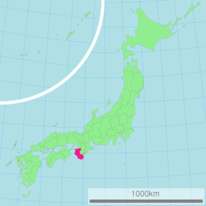
Governor = Yoshinobu Nisaka
nihongo|Wakayama Prefecture|和歌山県|Wakayama-ken is a prefecture of Japan located on the Kii Peninsula in the Kansai region on Honshū island. The capital is the city of Wakayama.

History

Geography

Cities

Nine cities are located in Wakayama Prefecture:
*Arida
*Gobō
*Hashimoto
*Iwade
*Kainan
*Kinokawa
*Shingū
*Tanabe
*Wakayama (capital)

Towns and villages

These are the towns and villages in each district:

Mergers

Economy

Wakayama supplies most of Japan with its high production of mikans (Mandarin Oranges) in October of every year.

Demographics

Culture

nihongo|Mount Kōya|高野山|Kōya-san in the Ito District is the headquarters of the Shingon sect of Japanese Buddhism. It is home to one of the first Japanese style buddhist temples in Japan and remains a site of pilgrimage and an increasingly popular tourist destination as people flock to see its ancient temples set amidst the towering cedar trees at the top of the mountain.

The Kumano Shrines are located on the southern tip of the prefecture.

Sister relationships

Wakayama Prefecture has friendship and sister relationships with five places outside Japan [ [http://www.pref.wakayama.lg.jp/prefg/022100/kokusaikouryu/yuko.html 友好・姉妹提携] Wakayama Prefecture official Web site retrieved May 16, 2008] . These are Shandong, People's Republic of China; Pyrénées-Orientales, France; Florida, United States; Sinaloa, Mexico; and Galicia, Spain.

Tourism

References

External links

* [http://www.pref.wakayama.lg.jp/english/ Official Wakayama Prefecture homepage]
* [http://wiwi.co.jp/kanko/world/english/ Wakayama Tourist Guide]
* [http://www.wakayama-nanki.jp/english/ Nanki Sightseeing Guide]


Wikimedia Foundation. 2010.

Игры ⚽ Нужно решить контрольную?

Look at other dictionaries:

  • Wakayama Prefecture Botanical Park — The Wakayama Prefecture Botanical Park (和歌山県植物公園緑花センター) is a park with botanical garden located at Higashi Sakamoto 672, Iwade, Wakayama, Japan. It is open daily except Tuesdays; an admission fee is charged.The park contains a large tropical… …   Wikipedia

  • List of mergers in Wakayama Prefecture — The following is a list of mergers that occurred in the 2000s in Wakayama Prefecture, Japan.(as of April 1, 2006)Mergers from April 1, 2004 to March 31, 2005*On October 1, 2004 the village of Minabegawa and the town of Minabe (both from Hidaka… …   Wikipedia

  • Prefecture de Wakayama — Préfecture de Wakayama Préfecture de Wakayama · 和歌山県 Wakayama ken Carte du Japon avec la Préfecture de Wakayama mise en évidence. Pays  Japon …   Wikipédia en Français

  • Préfecture de wakayama — · 和歌山県 Wakayama ken Carte du Japon avec la Préfecture de Wakayama mise en évidence. Pays  Japon …   Wikipédia en Français

  • Wakayama gubernatorial election, 1999 — Wakayama Prefecture held a gubernatorial election on November 1, 1999. Incumbent governor Isamu Nishiguchi was re elected. Election box begin | title=Gubernatorial election 1999: Wakayama Election box candidate party = LDP,DPJ,NKP,LP,SDP… …   Wikipedia

  • Wakayama gubernatorial election, 2006 — Wakayama Prefecture held a gubernatorial election on December 17, 2006. Election box begin | title=Gubernatorial election 2006: Wakayama Election box candidate party = LDP, Komeito candidate = Yoshinobu Nisaka votes = 195,713 percentage = change …   Wikipedia

  • Wakayama, Wakayama — Infobox City Japan Name= Wakayama JapaneseName= 和歌山市 Map Region= Kansai Prefecture= Wakayama Prefecture District= Area km2= 210.23 PopDate= 2007 Population= 373,655 Density km2= Coords= LatitudeDegrees= 34 LatitudeMinutes= 14 LatitudeSeconds=… …   Wikipedia

  • Wakayama — /wah kah yah mah/, n. a seaport on S Honshu, in S Japan. 401,462. * * * ▪ Japan       city, capital of Wakayama ken (prefecture), west central Honshu, Japan. It is situated in the northwestern part of the prefecture at the mouth of the Kino River …   Universalium

  • Wakayama Castle — Infobox Military Structure name = Wakayama Castle ja. 和歌山城 partof = location = Wakayama, Wakayama Prefecture, Japan coordinates = caption = The reconstructed concrete tenshu (keep) type = Hirayamashiro (hilltop castle) built = 1585 1586 builder …   Wikipedia

  • Wakayama University — Infobox University name = Wakayama University native name = latin name = motto = established = 1949 type = Public (National) endowment = staff = faculty = 510 president = Akira Oda provost = principal = rector = chancellor = vice chancellor =… …   Wikipedia

Share the article and excerpts

Direct link
Do a right-click on the link above
and select “Copy Link”