- National Register of Historic Places listings in Leflore County, Mississippi
-
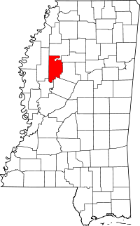 Location of Leflore County in Mississippi
This is a list of the National Register of Historic Places listings in Leflore County, Mississippi.
This is intended to be a complete list of the properties and districts on the National Register of Historic Places in Leflore County, Mississippi, United States. Latitude and longitude coordinates are provided for many National Register properties and districts; these locations may be seen together in a Google map.[1]
There are 36 properties and districts listed on the National Register in the county.
-
- This National Park Service list is complete through NPS recent listings posted November 10, 2011.[2]
Current listings
[3] Landmark name[4] Image Date listed Location City or Town Summary 1 Black Site November 21, 1978 Address Restricted Greenwood 2 Black Site January 11, 1991 Address Restricted Sidon 3 Boulevard Subdivision Historic District March 2, 1986 Roughly bounded by Jeff Davis Ave., Poplar St., President Ave., and Grand Boulevard
33°31′50″N 90°11′16″W / 33.53056°N 90.18778°WGreenwood 4 Building at 308 Lamar Street November 4, 1985 308 Lamar St.
33°31′11″N 90°10′40″W / 33.51972°N 90.17778°WGreenwood 5 Building at 312 George Street November 4, 1985 312 George St.
33°31′9″N 90°10′43″W / 33.51917°N 90.17861°WGreenwood 6 Building at 710 South Boulevard November 4, 1985 710 South Boulevard
33°30′48″N 90°11′12″W / 33.51333°N 90.18667°WGreenwood 7 Central Commercial and Railroad Historic District November 4, 1985 Roughly bounded by Washington, Main, and Lamar Sts., Ave. F, Wardaman and Johnson Sts., and Cotton and Fulton Sts.
33°31′2″N 90°10′43″W / 33.51722°N 90.17861°WGreenwood 8 Cotton Row Historic District May 15, 1980 Cotton, Front, Fulton, Howard, Main, and Market Sts.
33°31′14″N 90°10′59″W / 33.52056°N 90.18306°WGreenwood 9 Falls Site (22LF507) May 1, 1986 Address Restricted Minter City 10 First Methodist Church of Greenwood 
November 4, 1985 310 W. Washington St.
33°31′9″N 90°11′4″W / 33.51917°N 90.18444°WGreenwood 11 Fort Leflore April 4, 1979 North of Greenwood off Mississippi Highway 7
33°33′6″N 90°10′26″W / 33.55167°N 90.17389°WGreenwood 12 Fort Pemberton Site June 19, 1973 West of Greenwood off U.S. Route 49, E.
33°31′45″N 90°14′7″W / 33.52917°N 90.23528°WGreenwood 13 Four Corners Historic District February 14, 1985 Washington and Henderson Sts.
33°31′7″N 90°11′9″W / 33.51861°N 90.18583°WGreenwood 14 Greenwood High School 
November 4, 1985 400 Cotton St.
33°31′11″N 90°10′40″W / 33.51972°N 90.17778°WGreenwood 15 Greyhound Lines Station July 8, 2010 325 Main St.
33°31′10″N 90°10′52″W / 33.51944°N 90.18111°WGreenwood 16 Itta Bena Historic District September 30, 2009 Roughly bounded by Cemetery St. to the north, Lake Shore Dr. to the east, Lake Side St. to the south, and Dewey St. to the west
33°29′42.43″N 90°19′11.3″W / 33.4951194°N 90.319806°WItta Bena 17 Keesler Bridge November 16, 1988 Spans the Yazoo River at Fulton St.
33°31′18″N 90°11′3″W / 33.52167°N 90.18417°WGreenwood 18 Lane's Chapel Site May 4, 1976 Address Restricted Money 19 Marclare November 25, 1980 River Rd.
33°31′19″N 90°13′17″W / 33.52194°N 90.22139°WGreenwood 20 McLean Site (22LF513) April 6, 1988 Address Restricted Itta Bena 21 Murphey Site November 10, 1993 Address Restricted Itta Bena 22 Neill Archeological Site April 26, 1976 Address Restricted Whaley 23 Provine House April 8, 1980 319 Grand Boulevard
33°31′39″N 90°11′13″W / 33.5275°N 90.18694°WGreenwood 24 Rebecca Site January 11, 1991 Address Restricted Sidon 25 River Road and Western Downtown Residential Historic District March 2, 1986 Roughly bounded by River Rd., Dewey and Gillespie, Washington and Johnson, and 1st Sts.
33°31′4″N 90°11′20″W / 33.51778°N 90.18889°WGreenwood 26 Rosemary-Humphreys House November 4, 1985 1440 Grand Boulevard
33°32′20″N 90°11′33″W / 33.53889°N 90.1925°WGreenwood 27 Southworth House November 4, 1985 1108 Mississippi Ave.
33°30′34″N 90°11′13″W / 33.50944°N 90.18694°WGreenwood 28 STAR OF THE WEST 
May 21, 1975 West of Greenwood on the Tallahatchie River
33°31′54″N 90°13′59″W / 33.53167°N 90.23306°WGreenwood 29 Stratton Archeological Site July 28, 1999 Address Restricted Sidon 30 Sweethome Mound June 9, 1978 Address Restricted Wakeland 31 Wesley Memorial Methodist Episcopal November 4, 1985 800 Howard St.
33°30′49″N 90°10′52″W / 33.51361°N 90.18111°WGreenwood 32 Wesley Methodist Church Historic District April 8, 1999 Roughly bounded by Cotton, Howard, Palace, Weeks Lane, and W. Johnson
33°30′41″N 90°10′54″W / 33.51139°N 90.18167°WGreenwood 33 Whaley Archeological Site March 15, 1976 Address Restricted Whaley 34 W.M. Whittington House July 19, 1984 401 E. Market St.
33°31′18″N 90°10′40″W / 33.52167°N 90.17778°WGreenwood 35 Williams Landing and Eastern Downtown Residential Historic District March 2, 1986 Roughly bounded by Front, McLemore and Lamar, Market, and George Sts.
33°31′15″N 90°10′38″W / 33.52083°N 90.17722°WGreenwood 36 Wright House November 4, 1985 414 Fulton Ave.
33°31′2″N 90°10′59″W / 33.51722°N 90.18306°WGreenwood See also
- List of National Historic Landmarks in Mississippi
- National Register of Historic Places listings in Mississippi
References
- ^ The latitude and longitude information provided in this table was derived originally from the National Register Information System, which has been found to be fairly accurate for about 99% of listings. For about 1% of NRIS original coordinates, experience has shown that one or both coordinates are typos or otherwise extremely far off; some corrections may have been made. A more subtle problem causes many locations to be off by up to 150 yards, depending on location in the country: most NRIS coordinates were derived from tracing out latitude and longitudes off of USGS topographical quadrant maps created under the North American Datum of 1927, which differs from the current, highly accurate WGS84 GPS system used by Google maps. Chicago is about right, but NRIS longitudes in Washington are higher by about 4.5 seconds, and are lower by about 2.0 seconds in Maine. Latitudes differ by about 1.0 second in Florida. Some locations in this table may have been corrected to current GPS standards.
- ^ "National Register of Historic Places: Weekly List Actions". National Park Service, United States Department of the Interior. Retrieved on November 10, 2011.
- ^ Numbers represent an ordering by significant words. Various colorings, defined here, differentiate National Historic Landmark sites and National Register of Historic Places Districts from other NRHP buildings, structures, sites or objects.
- ^ "National Register Information System". National Register of Historic Places. National Park Service. 2009-03-13. http://nrhp.focus.nps.gov/natreg/docs/All_Data.html.
U.S. National Register of Historic Places Topics Lists by states Alabama • Alaska • Arizona • Arkansas • California • Colorado • Connecticut • Delaware • Florida • Georgia • Hawaii • Idaho • Illinois • Indiana • Iowa • Kansas • Kentucky • Louisiana • Maine • Maryland • Massachusetts • Michigan • Minnesota • Mississippi • Missouri • Montana • Nebraska • Nevada • New Hampshire • New Jersey • New Mexico • New York • North Carolina • North Dakota • Ohio • Oklahoma • Oregon • Pennsylvania • Rhode Island • South Carolina • South Dakota • Tennessee • Texas • Utah • Vermont • Virginia • Washington • West Virginia • Wisconsin • WyomingLists by territories Lists by associated states Other Municipalities and communities of Leflore County, Mississippi Cities 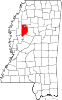
Towns Morgan City | Schlater | Sidon
Unincorporated
communitiesBerclair | Browning | McNutt | Minter City | Money | Rising Sun | Ruby | Shellmound | Sunnyside | Swiftown | Quito
Ghost town Categories:- Leflore County, Mississippi
- National Register of Historic Places in Mississippi by county
- Buildings and structures in Leflore County, Mississippi
-


Wikimedia Foundation. 2010.