- National Register of Historic Places listings in Atoka County, Oklahoma
-
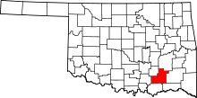 Location of Atoka County in Oklahoma
This is a list of the National Register of Historic Places listings in Atoka County, Oklahoma.
This is intended to be a complete list of the properties on the National Register of Historic Places in Atoka County, Oklahoma, United States. The locations of National Register properties for which the latitude and longitude coordinates are included below, may be seen in a Google map.[1]
There are 15 properties listed on the National Register in the county. Another 4 properties were once listed but have since been removed.
-
- This National Park Service list is complete through NPS recent listings posted November 10, 2011.[2]
Current listings
[3] Landmark name [4] Image Date listed Location City or town Summary 1 Atoka Armory September 8, 1988 Ohio and C Sts.
34°23′17″N 96°07′22″W / 34.388056°N 96.122778°WAtoka 2 Isaac Billy Homestead and Family Cemetery April 17, 1980 Northeast of Daisy
34°32′45″N 95°41′44″W / 34.545833°N 95.695556°WDaisy 3 Boggy Depot Site April 19, 1972 14 miles southwest of Atoka
34°19′13″N 96°18′51″W / 34.320278°N 96.314167°WAtoka 4 First Methodist Church Building June 30, 1980 105 W. 1st St.
34°23′06″N 96°07′40″W / 34.385°N 96.127778°WAtoka 5 First Oil Well in Oklahoma April 13, 1972 4 miles northeast of Wapanucka
34°24′06″N 96°22′25″W / 34.401667°N 96.373611°WWapanucka 6 First Presbyterian Church September 6, 2007 212 E. 1st St.
34°23′02″N 96°07′35″W / 34.383889°N 96.126389°WAtoka 7 Indian Citizen Building October 4, 1979 115 N. Ohio Ave.
34°23′08″N 96°07′28″W / 34.385556°N 96.124444°WAtoka 8 Capt. Charles LeFlore House June 13, 1972 0.5 miles north of Limestone Gap on U.S. Route 69
34°36′17″N 95°58′33″W / 34.604722°N 95.975833°WLimestone Gap 9 Masonic Temple September 8, 1980 301 Court St.
34°23′07″N 96°07′29″W / 34.385278°N 96.124722°WAtoka 10 Bo McAlister Site April 21, 1978 Address Restricted Wapanucka An archaeological site 11 Middle Boggy Battlefield Site and Confederate Cemetery April 19, 1972 1 mile north of Atoka
34°23′55″N 96°06′58″W / 34.398611°N 96.116111°WAtoka 12 Old Atoka State Bank August 29, 1980 Court and Ohio Sts.
34°23′06″N 96°07′29″W / 34.385°N 96.124722°WAtoka 13 Pioneer Club June 27, 1980 1st and Mississippi Sts.
34°23′04″N 96°07′42″W / 34.384444°N 96.128333°WAtoka 14 Joe Ralls House June 27, 1980 303 S. Pennsylvania St.
34°22′58″N 96°07′32″W / 34.382778°N 96.125556°WAtoka 15 Waddell's Station Site April 13, 1972 About 3 miles southwest of Wesley
34°34′01″N 95°56′02″W / 34.566944°N 95.933889°WWesley Former listings
Landmark name Image Dates Location City or Town Summary 1 Atoka Community Building December 29, 2005 (delisted) Atoka 2 Old Atoka County Courthouse December 29, 2005 (delisted) Atoka 3 Captain James S. Standley House December 29, 2005 (delisted) Atoka 4 Zweigel Hardware Store Building December 29, 2005 (delisted) Atoka See also
- List of National Historic Landmarks in Oklahoma
- National Register of Historic Places listings in Oklahoma
References
- ^ The latitude and longitude information provided in this table was derived originally from the National Register Information System, which has been found to be fairly accurate for about 99% of listings. For about 1% of NRIS original coordinates, experience has shown that one or both coordinates are typos or otherwise extremely far off; some corrections may have been made. A more subtle problem causes many locations to be off by up to 150 yards, depending on location in the country: most NRIS coordinates were derived from tracing out latitude and longitudes off of USGS topographical quadrant maps created under North American Datum of 1927, which differs from the current, highly accurate GPS system used by Google maps. Chicago is about right, but NRIS longitudes in Washington are higher by about 4.5 seconds, and are lower by about 2.0 seconds in Maine. Latitudes differ by about 1.0 second in Florida. Some locations in this table may have been corrected to current GPS standards.
- ^ "National Register of Historic Places: Weekly List Actions". National Park Service, United States Department of the Interior. Retrieved on November 10, 2011.
- ^ Numbers represent an ordering by significant words. Various colorings, defined here, differentiate National Historic Landmark sites and National Register of Historic Places Districts from other NRHP buildings, structures, sites or objects.
- ^ "National Register Information System". National Register of Historic Places. National Park Service. . http://nrhp.focus.nps.gov/natreg/docs/All_Data.html.
U.S. National Register of Historic Places Topics Lists by states Alabama • Alaska • Arizona • Arkansas • California • Colorado • Connecticut • Delaware • Florida • Georgia • Hawaii • Idaho • Illinois • Indiana • Iowa • Kansas • Kentucky • Louisiana • Maine • Maryland • Massachusetts • Michigan • Minnesota • Mississippi • Missouri • Montana • Nebraska • Nevada • New Hampshire • New Jersey • New Mexico • New York • North Carolina • North Dakota • Ohio • Oklahoma • Oregon • Pennsylvania • Rhode Island • South Carolina • South Dakota • Tennessee • Texas • Utah • Vermont • Virginia • Washington • West Virginia • Wisconsin • WyomingLists by territories Lists by associated states Other  Category:National Register of Historic Places •
  Portal:National Register of Historic Places
National Register of Historic Places in Atoka County, Oklahoma Atoka Atoka Armory · First Methodist Church Building · First Presbyterian Church · Indian Citizen Building · Masonic Temple · Old Atoka State Bank · Pioneer Club · Joe Ralls House · Boggy Depot Site · Middle Boggy Battlefield Site & Confederate Cemetery

Daisy Isaac Billy Homestead & Family Cemetery
Limestone Gap Captain Charles LeFlore House
Wapanucka First Oil Well in Oklahoma · Bo McAlister Site
Wesley See also: National Register of Historic Places listings in Atoka County, Oklahoma and List of National Historic Landmarks in Oklahoma Categories:- Atoka County, Oklahoma
- National Register of Historic Places in Oklahoma by county
- Buildings and structures in Atoka County, Oklahoma
-

Wikimedia Foundation. 2010.