- Schlater, Mississippi
Infobox Settlement
official_name = Schlater, Mississippi
settlement_type =Town
nickname =
motto =
imagesize =
image_caption =
image_
imagesize =
image_caption =
image_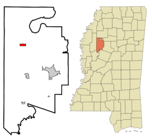
mapsize = 250px
map_caption = Location of Schlater, Mississippi
mapsize1 =
map_caption1 =subdivision_type = Country
subdivision_name =United States
subdivision_type1 = State
subdivision_name1 =Mississippi
subdivision_type2 = County
subdivision_name2 = Leflore
government_footnotes =
government_type = Mayor and Board of Alderman
leader_title =
leader_name =
leader_title1 =
leader_name1 =
established_title =
established_date =unit_pref = Imperial
area_footnotes =area_magnitude =
area_total_km2 = 3.0
area_land_km2 = 3.0
area_water_km2 = 0.0
area_total_sq_mi = 1.2
area_land_sq_mi = 1.2
area_water_sq_mi = 0.0population_as_of = 2000
population_footnotes =
population_total = 388
population_density_km2 = 128.5
population_density_sq_mi = 332.8timezone = Central (CST)
utc_offset = -6
timezone_DST = CDT
utc_offset_DST = -5
elevation_footnotes =
elevation_m = 39
elevation_ft = 128
latd = 33 |latm = 38 |lats = 25 |latNS = N
longd = 90 |longm = 20 |longs = 50 |longEW = Wpostal_code_type =
ZIP code
postal_code = 38952
area_code = 662
blank_name = FIPS code
blank_info = 28-66080
blank1_name = GNIS feature ID
blank1_info = 0677454
website =
footnotes =Schlater is a town in Leflore County,
Mississippi ,United States . The population was 388 at the 2000 census. It is part of theGreenwood, Mississippi Micropolitan Statistical Area.Geography
Schlater is located at coor dms|33|38|25|N|90|20|50|W|city (33.640156, -90.347246)GR|1.
According to the
United States Census Bureau , the town has a total area of 1.2square mile s (3.0km² ), all of it land.Demographics
As of the
census GR|2 of 2000, there were 388 people, 141 households, and 105 families residing in the town. Thepopulation density was 332.8 people per square mile (128.0/km²). There were 150 housing units at an average density of 128.7/sq mi (49.5/km²). The racial makeup of the town was 38.92% White, 60.57% African American and 0.52% Asian.There were 141 households out of which 29.8% had children under the age of 18 living with them, 44.7% were married couples living together, 22.7% had a female householder with no husband present, and 25.5% were non-families. 24.8% of all households were made up of individuals and 11.3% had someone living alone who was 65 years of age or older. The average household size was 2.75 and the average family size was 3.29.
In the town the population was spread out with 32.2% under the age of 18, 9.3% from 18 to 24, 25.5% from 25 to 44, 20.1% from 45 to 64, and 12.9% who were 65 years of age or older. The median age was 34 years. For every 100 females there were 86.5 males. For every 100 females age 18 and over, there were 81.4 males.
The median income for a household in the town was $23,816, and the median income for a family was $25,000. Males had a median income of $21,667 versus $13,571 for females. The
per capita income for the town was $10,022. About 34.9% of families and 44.3% of the population were below thepoverty line , including 65.0% of those under age 18 and 14.3% of those age 65 or over.Education
The Town of Schlater is served by the
Leflore County School District .References
External links
Wikimedia Foundation. 2010.