- National Register of Historic Places listings in Jasper County, Missouri
-
This is a list of properties and historic districts in Jasper County, Missouri, that are listed on the National Register of Historic Places. .
Contents: Counties in Missouri A–B · C · D–I · J–K · L–N · O–St. · St. Louis · Ste.–Z -
- This National Park Service list is complete through NPS recent listings posted November 10, 2011.[1]
Current listings
[2] Landmark name Image Date listed Location City or town Summary 1 66 Drive-In 
April 2, 2003 17231 Old 66 Boulevard
37°10′24″N 94°22′06″W / 37.173333°N 94.368333°WCarthage 2 Carthage Courthouse Square Historic District May 15, 1980 Roughly bounded by E. Central Ave., S. Maple, Lincoln, and W. 5th Sts.
37°10′36″N 94°18′37″W / 37.176667°N 94.310278°WCarthage 3 Carthage South Historic District May 6, 1982 City limits of Carthage
37°10′08″N 94°18′38″W / 37.168889°N 94.310556°WCarthage 4 Cassill Place Historic District 
January 2, 1986 Roughly the first half-block of W. Central east of Blanche St.
37°10′44″N 94°19′13″W / 37.178889°N 94.320278°WCarthage 5 Colonial Apartments 
August 14, 2001 406 Walnut St.
37°10′29″N 94°18′51″W / 37.174722°N 94.314167°WCarthage 6 Elks Club Lodge No. 501 
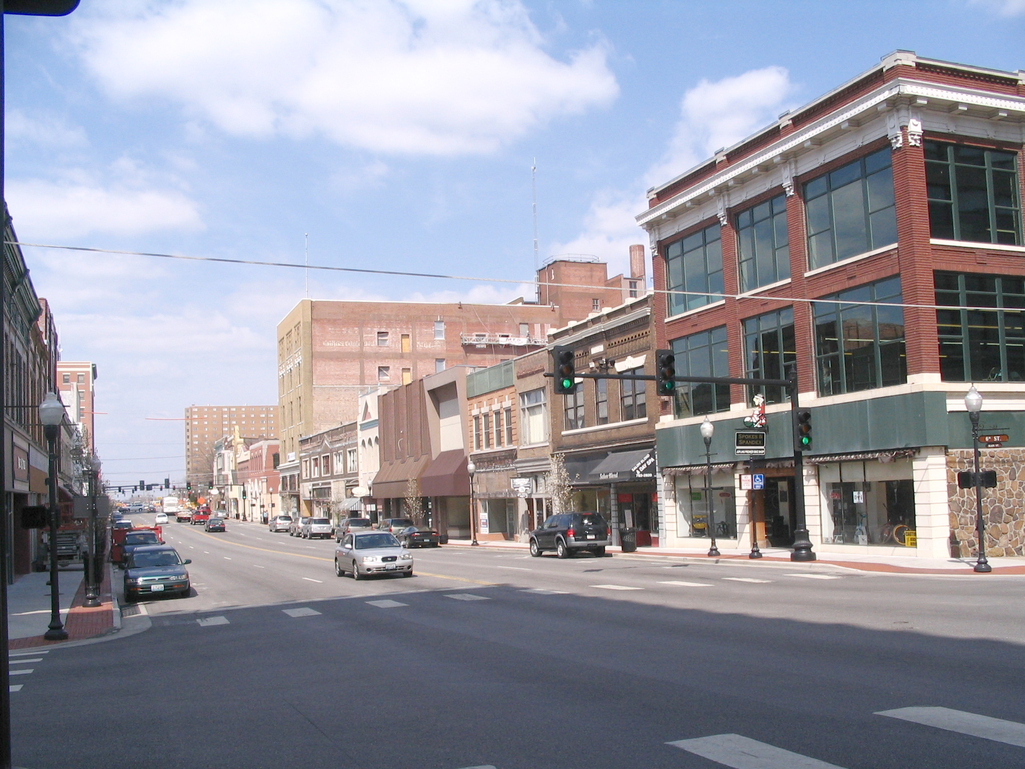
June 3, 1985 318-320 W. 4th St.
37°05′15″N 94°30′58″W / 37.0875°N 94.516111°WJoplin 7 Fifth and Main Historic District 
July 5, 2006 501-513 S. Main St., 502-508 Virginia St.
37°05′19″N 94°30′48″W / 37.088611°N 94.513333°WJoplin 8 Fox Theater 
July 30, 1990 415 S. Main St.
37°05′18″N 94°30′51″W / 37.088333°N 94.514167°WJoplin 9 Gentry Apartments 
August 8, 2006 318 S. Wall St.
37°05′23″N 94°30′57″W / 37.089722°N 94.515833°WJoplin 10 Inter-State Grocer Company Building 
October 24, 2008 1027-1035 S. Main St.
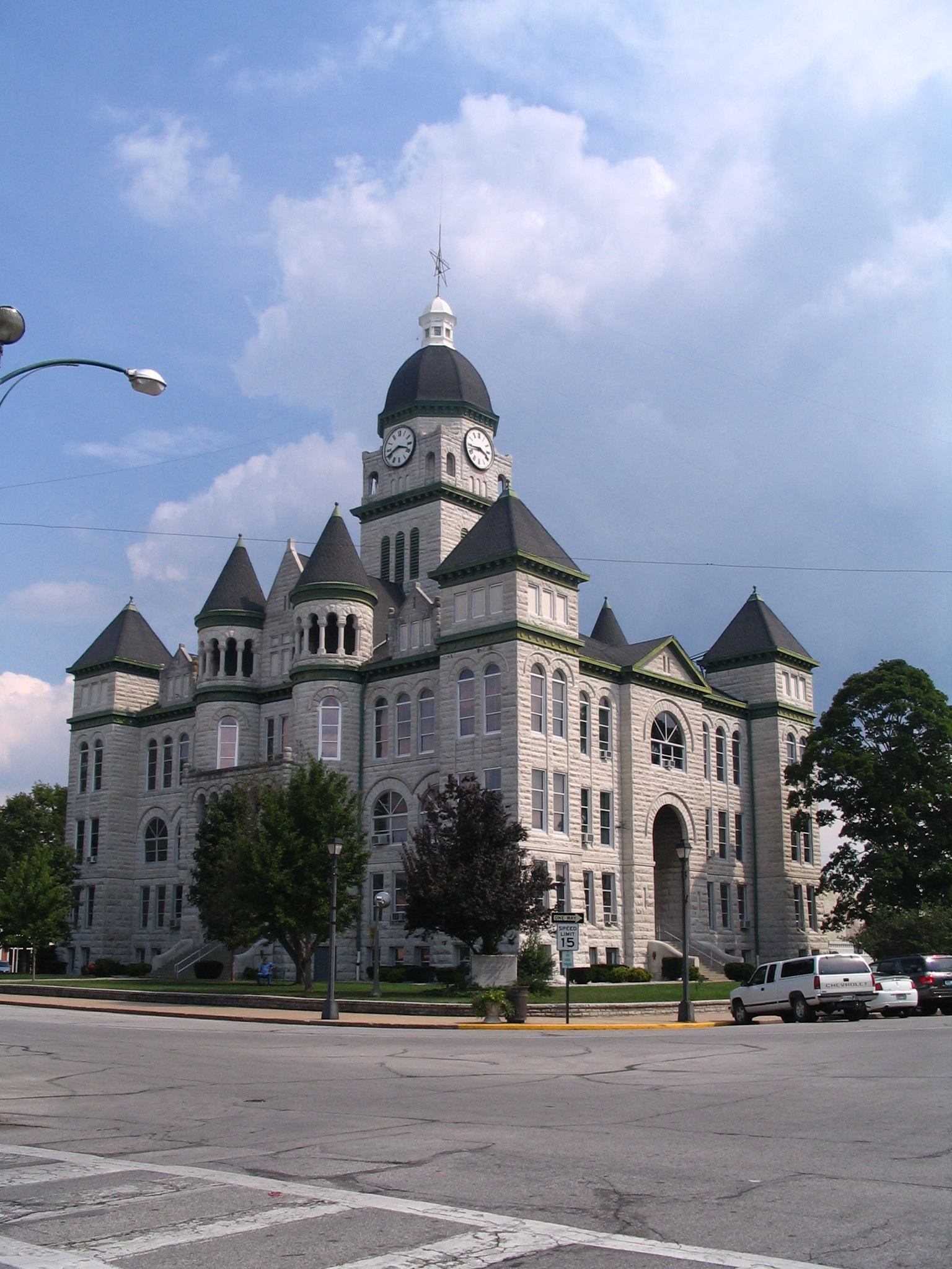
37°04′45″N 94°30′48″W / 37.079167°N 94.513333°WJoplin 11 Jasper County Courthouse 
February 8, 1973 Courthouse Sq.
37°10′45″N 94°18′37″W / 37.179167°N 94.310278°WCarthage 12 Joplin and Wall Avenues Historic District October 12, 2010 Portions of S. Joplin and Wall Aves., W. First, Second, Third Sts.
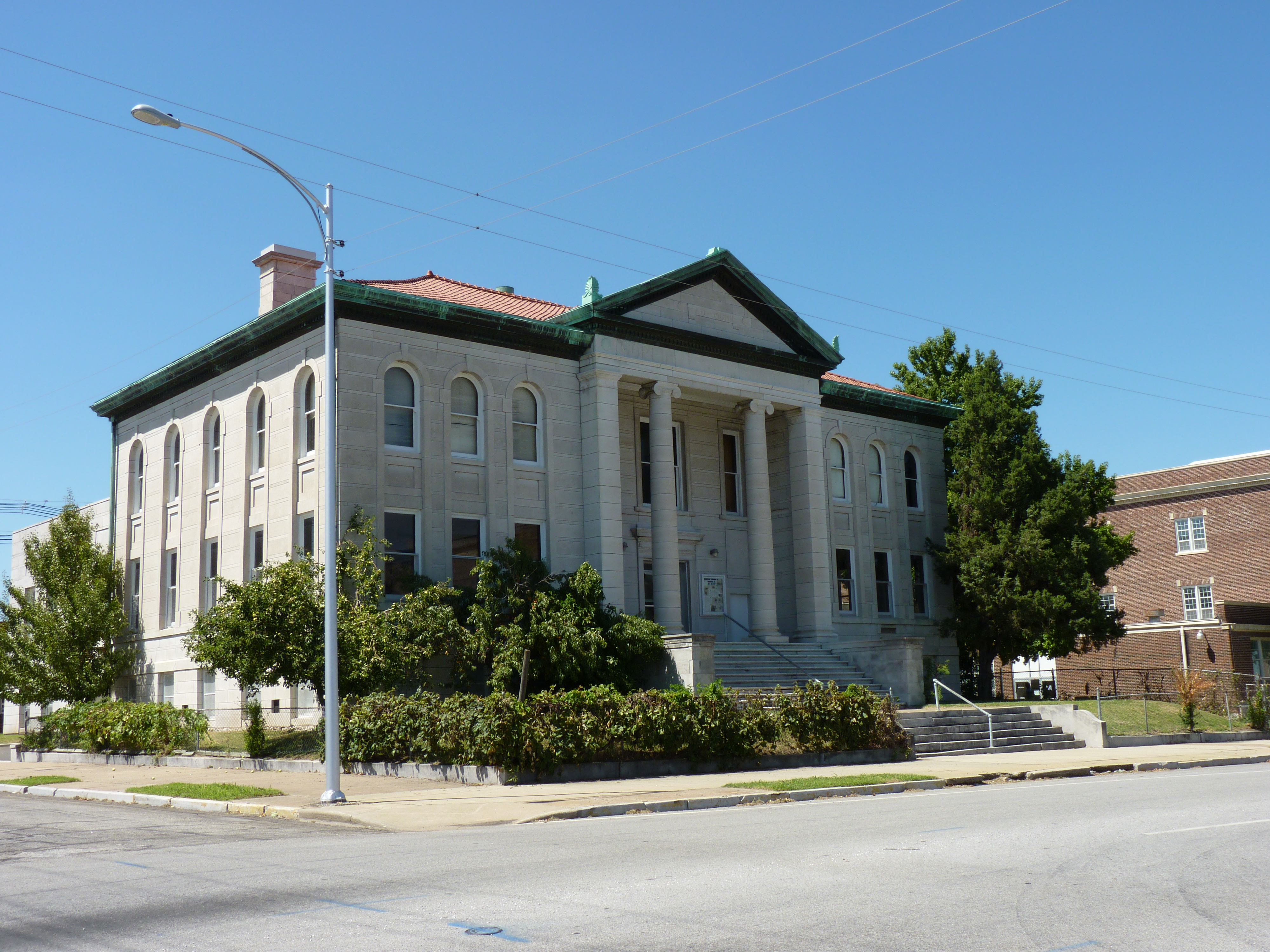
37°05′23″N 94°30′53″W / 37.089722°N 94.514722°WJoplin Historic Resources of Joplin, Missouri MPS 13 Joplin Carnegie Library 
July 10, 1979 9th and Wall Sts.
37°04′55″N 94°30′57″W / 37.081944°N 94.515833°WJoplin 14 Joplin Connor Hotel 
February 28, 1973 324 Main St.
37°05′17″N 94°30′49″W / 37.088056°N 94.513611°WJoplin Demolished.[3] 15 Joplin Downtown Historic District 
July 16, 2008 S. Main St., roughly between E. 4th and E. 6th Sts.
37°05′12″N 94°30′48″W / 37.086667°N 94.513333°WJoplin 16 Joplin Supply Company 
July 3, 2007 228 S. Joplin Ave.
37°05′20″N 94°30′52″W / 37.088889°N 94.514444°WJoplin 17 Joplin Union Depot 
March 14, 1973 Broadway and Main St.
37°05′30″N 94°30′42″W / 37.091667°N 94.511667°WJoplin 18 Main and Eighth Streets Historic District April 15, 2011 Portions of the 800 and 900 block of S. Main St.
37°04′53″N 94°30′49″W / 37.081389°N 94.513611°WJoplin Historic Resources of Joplin, Missouri MPS 19 Middle West Hotel 
September 16, 1982 1 S. Main St.
37°08′46″N 94°27′45″W / 37.146111°N 94.4625°WWebb City 20 Newman Brothers Building 
July 23, 1990 602-608 S. Main St.
37°05′07″N 94°30′45″W / 37.085278°N 94.5125°WJoplin 21 Olivia Apartments 
June 20, 2008 320 Moffet Ave.
37°05′19″N 94°31′08″W / 37.088611°N 94.518889°WJoplin 22 Phelps Country Estate 
August 29, 1983 RR 1, Newcastle Rd. just west of CR100
37°15′00″N 94°14′10″W / 37.25°N 94.236111°WCarthage 23 Rains Brothers Building 
July 19, 1990 906-908 S. Main St.
37°04′52″N 94°30′44″W / 37.081111°N 94.512222°WJoplin 24 Ridgway Apartments 
August 8, 2006 402 S. Byers Ave. and 404 S. Byers Ave.
37°05′22″N 94°31′05″W / 37.089444°N 94.518056°WJoplin 25 St. Louis and San Francisco Railroad Building 
October 22, 2002 605 Main St.
37°05′09″N 94°30′47″W / 37.085833°N 94.513056°WJoplin 26 St. Peter the Apostle Catholic Church and Rectory 
June 28, 1991 812 Pearl St.
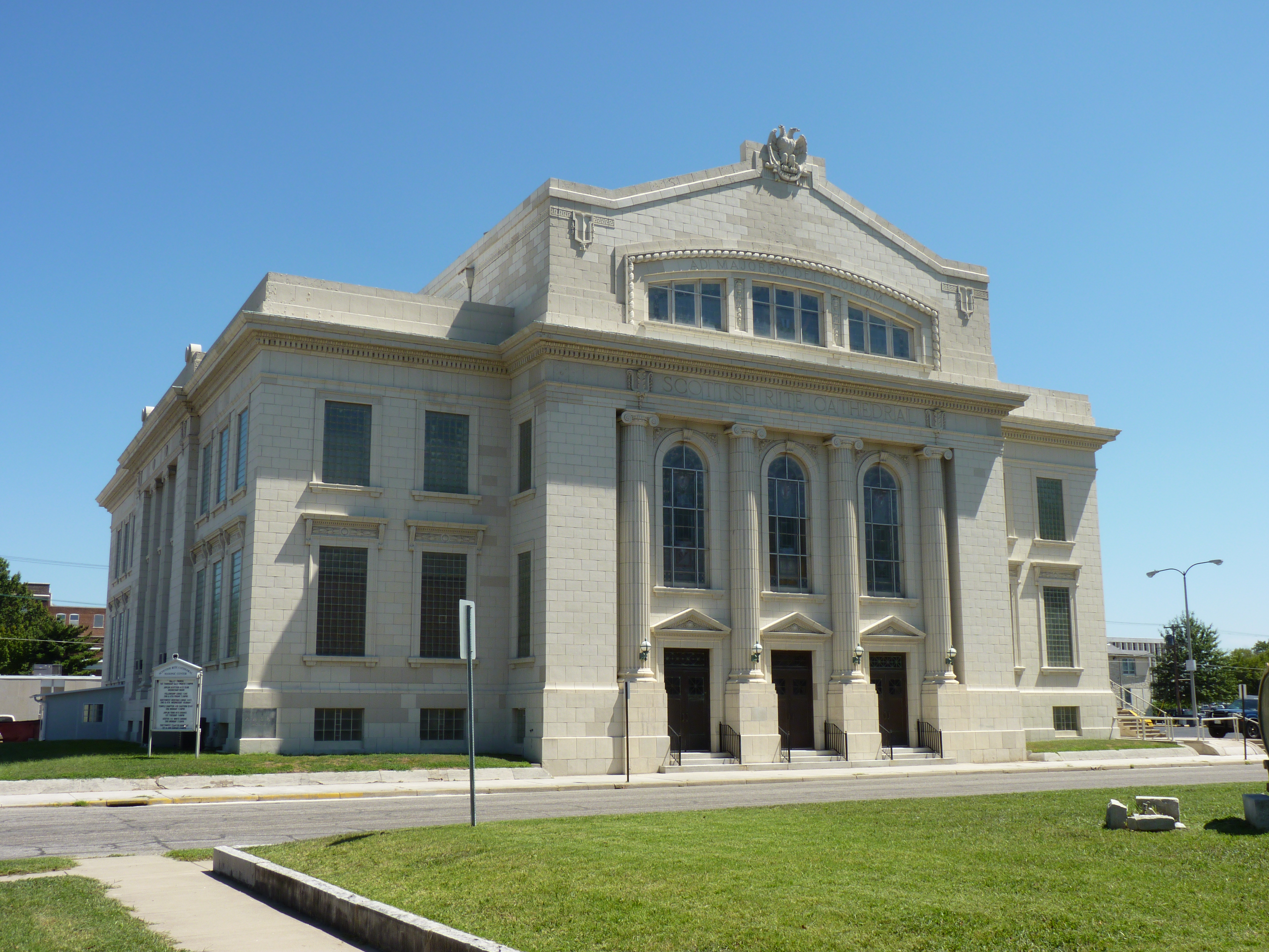
37°04′58″N 94°31′01″W / 37.082778°N 94.516944°WJoplin 27 Scottish Rite Cathedral 
June 21, 1990 505 Byers Ave.
37°05′11″N 94°31′02″W / 37.086389°N 94.517222°WJoplin 28 South Main Street Historic District October 12, 2010 West side S. Main St., between W. First and W. Second Sts.
37°05′24″N 94°30′48″W / 37.09°N 94.513333°WJoplin Historic Resources of Joplin, Missouri MPS References
- ^ "National Register of Historic Places: Weekly List Actions". National Park Service, United States Department of the Interior. Retrieved on November 10, 2011.
- ^ Numbers represent an ordering by significant words. Various colorings, defined here, differentiate National Historic Landmark sites and National Register of Historic Places Districts from other NRHP buildings, structures, sites or objects.
- ^ http://www.dnr.mo.gov/shpo/Jasper.htm
Municipalities and communities of Jasper County, Missouri County seat: Carthage Cities 
Villages Airport Drive | Avilla | Brooklyn Heights | Carytown | Duquesne | Fidelity
Unincorporated
communitiesDudenville‡ | Kendricktown | Maxville | Scotland
Footnotes ‡This populated place also has portions in an adjacent county or counties
U.S. National Register of Historic Places Topics Lists by states Alabama • Alaska • Arizona • Arkansas • California • Colorado • Connecticut • Delaware • Florida • Georgia • Hawaii • Idaho • Illinois • Indiana • Iowa • Kansas • Kentucky • Louisiana • Maine • Maryland • Massachusetts • Michigan • Minnesota • Mississippi • Missouri • Montana • Nebraska • Nevada • New Hampshire • New Jersey • New Mexico • New York • North Carolina • North Dakota • Ohio • Oklahoma • Oregon • Pennsylvania • Rhode Island • South Carolina • South Dakota • Tennessee • Texas • Utah • Vermont • Virginia • Washington • West Virginia • Wisconsin • WyomingLists by territories Lists by associated states Other  Category:National Register of Historic Places •
  Portal:National Register of Historic PlacesCategories:
- Jasper County, Missouri
- National Register of Historic Places in Missouri
-


Wikimedia Foundation. 2010.