- National Register of Historic Places listings in Day County, South Dakota
-
 Location of Day County in South Dakota
This is a list of the National Register of Historic Places listings in Day County, South Dakota.
This is intended to be a complete list of the properties and districts on the National Register of Historic Places in Day County, South Dakota, United States. The locations of National Register properties and districts for which the latitude and longitude coordinates are included below, may be seen in a Google map.[1]
There are 10 properties and districts listed on the National Register in the county.
-
- This National Park Service list is complete through NPS recent listings posted November 10, 2011.[2]
Current listings
[3] Landmark name [4] Image Date listed Location City or town Summary 1 Charles A. Barber Farmstead February 8, 1988 0.25 miles west of Lily; also 0.5 miles west of Lily, approximately 5 miles west of Highway 25
45°10′56″N 97°41′32″W / 45.182222°N 97.692222°WLily Second set of boundaries represents a boundary increase 2 Lars J. Fiksdal House March 23, 1995 619 W. 1st St.
45°19′55″N 97°31′20″W / 45.331944°N 97.522222°WWebster 3 First National Bank Building June 22, 2005 611 Main St.
45°20′01″N 97°31′13″W / 45.333611°N 97.520278°WWebster 4 William Havens House January 31, 1985 915 E. 1st St.
45°19′36″N 97°31′07″W / 45.326667°N 97.518611°WWebster 5 Anton and Mary Agnes Karpen House February 19, 2008 818 1st St., W.
45°20′09″N 97°31′16″W / 45.335833°N 97.521111°WWebster 6 Roslyn Auditorium February 9, 2001 510 Main
45°29′48″N 97°29′28″W / 45.496667°N 97.491111°WRoslyn 7 Waddel Mansion June 3, 1994 605 W. 5th St.
45°19′53″N 97°30′44″W / 45.331389°N 97.512222°WWebster 8 Waldorf Hotel September 13, 1979 Main St.
45°24′43″N 97°54′13″W / 45.411944°N 97.903611°WAndover 9 John and Kittie Williams House February 19, 2008 1009 Main St.
45°20′15″N 97°31′14″W / 45.3375°N 97.520556°WWebster 10 Zoar Norwegian Lutheran Church October 25, 1990 7 miles east and 5 miles north of Grenville
45°32′36″N 97°14′20″W / 45.543333°N 97.238889°WGrenville See also
- List of National Historic Landmarks in South Dakota
- National Register of Historic Places listings in South Dakota
References
- ^ The latitude and longitude information provided in this table was derived originally from the National Register Information System, which has been found to be fairly accurate for about 99% of listings. For about 1% of NRIS original coordinates, experience has shown that one or both coordinates are typos or otherwise extremely far off; some corrections may have been made. A more subtle problem causes many locations to be off by up to 150 yards, depending on location in the country: most NRIS coordinates were derived from tracing out latitude and longitudes off of USGS topographical quadrant maps created under the North American Datum of 1927, which differs from the current, highly accurate WGS84 GPS system used by Google maps. Chicago is about right, but NRIS longitudes in Washington are higher by about 4.5 seconds, and are lower by about 2.0 seconds in Maine. Latitudes differ by about 1.0 second in Florida. Some locations in this table may have been corrected to current GPS standards.
- ^ "National Register of Historic Places: Weekly List Actions". National Park Service, United States Department of the Interior. Retrieved on November 10, 2011.
- ^ Numbers represent an ordering by significant words. Various colorings, defined here, differentiate National Historic Landmark sites and National Register of Historic Places Districts from other NRHP buildings, structures, sites or objects.
- ^ "National Register Information System". National Register of Historic Places. National Park Service. . http://nrhp.focus.nps.gov/natreg/docs/All_Data.html.
U.S. National Register of Historic Places Topics Lists by states Alabama • Alaska • Arizona • Arkansas • California • Colorado • Connecticut • Delaware • Florida • Georgia • Hawaii • Idaho • Illinois • Indiana • Iowa • Kansas • Kentucky • Louisiana • Maine • Maryland • Massachusetts • Michigan • Minnesota • Mississippi • Missouri • Montana • Nebraska • Nevada • New Hampshire • New Jersey • New Mexico • New York • North Carolina • North Dakota • Ohio • Oklahoma • Oregon • Pennsylvania • Rhode Island • South Carolina • South Dakota • Tennessee • Texas • Utah • Vermont • Virginia • Washington • West Virginia • Wisconsin • WyomingLists by territories Lists by associated states Other Municipalities and communities of Day County, South Dakota Cities 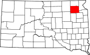
Towns Indian reservation Footnotes ‡This populated place also has portions in an adjacent county or counties
Categories:- Day County, South Dakota
- National Register of Historic Places in South Dakota by county
- Buildings and structures in Day County, South Dakota
-

Wikimedia Foundation. 2010.