- Roslyn, South Dakota
Infobox Settlement
official_name = Roslyn, South Dakota
other_name =
native_name =
nickname =
settlement_type =Town
motto =
imagesize =
image_caption =
flag_size =
image_
seal_size =
image_shield =
shield_size =
image_blank_emblem =
blank_emblem_type =
blank_emblem_size =
imagesize =
image_caption =
flag_size =
image_
seal_size =
image_shield =
shield_size =
image_blank_emblem =
blank_emblem_type =
blank_emblem_size =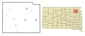
mapsize = 250px
map_caption = Location in Day County and the state ofSouth Dakota
mapsize1 =
map_caption1 =
image_dot_
dot_mapsize =
dot_map_caption =
dot_x =
dot_y =
pushpin_
pushpin_label_position =
pushpin_map_caption =
pushpin_mapsize =
subdivision_type = Country
subdivision_name =United States
subdivision_type1 = State
subdivision_name1 =South Dakota
subdivision_type2 = County
subdivision_name2 = Day
subdivision_type3 =
subdivision_name3 =
subdivision_type4 =
subdivision_name4 =
government_footnotes =
government_type =
leader_title =
leader_name =
leader_title1 =
leader_name1 =
leader_title2 =
leader_name2 =
leader_title3 =
leader_name3 =
leader_title4 =
leader_name4 =
established_title =
established_date =
established_title2 =
established_date2 =
established_title3 =
established_date3 =
area_magnitude =
unit_pref = Imperial
area_footnotes =
area_total_km2 = 0.5
area_land_km2 = 0.5
area_water_km2 = 0
area_total_sq_mi = 0.2
area_land_sq_mi = 0.2
area_water_sq_mi = 0
area_water_percent =
area_urban_km2 =
area_urban_sq_mi =
area_metro_km2 =
area_metro_sq_mi =
area_blank1_title =
area_blank1_km2 =
area_blank1_sq_mi =
population_as_of = 2000
population_footnotes =
population_note =
population_total = 225
population_density_km2 = 450
population_density_sq_mi = 1125
population_metro =
population_density_metro_km2 =
population_density_metro_sq_mi =
population_urban =
population_density_urban_km2 =
population_density_urban_sq_mi =
population_blank1_title =
population_blank1 =
population_density_blank1_km2 =
population_density_blank1_sq_mi =
timezone = Central (CST)
utc_offset = -6
timezone_DST = CDT
utc_offset_DST = -5
latd = 45 |latm = 29 |lats = 47 |latNS = N
longd = 97 |longm = 29 |longs = 27 |longEW = W
elevation_footnotes =
elevation_m = 568
elevation_ft = 1864
postal_code_type =ZIP code
postal_code = 57261
area_code = 605
blank_name = FIPS code
blank_info = 46-56380GR|2
blank1_name = GNIS feature ID
blank1_info = 1257490GR|3
website =
footnotes =Roslyn is a town in Day County,
South Dakota ,United States . The population was 225 at the 2000 census.Geography
Roslyn is located at coor dms|45|29|47|N|97|29|27|W|city (45.496323, -97.490960)GR|1.
According to the
United States Census Bureau , the town has a total area of 0.2square mile s (0.5km² ), all of it land.Roslyn has been assigned the
ZIP code 57261 and theFIPS place code 56380.Attractions
Roslyn is home to the International Vinegar Museum. [http://www.vinegarman.com/Museum1.shtml] [http://www.roadsideamerica.com/tip/2582]
History
“Roslyn received its name from Old Roslyn, which was a post office and trading point established in 1882. H.H. Russell, the first postmaster, took the name Roslyn from his native city in Scotland,” [Roslyn Diamond Jubilee, p. 1] although a Norwegian name would have been more appropriate as most of the European settlers in the area were from Norway.
“In 1914, the
Soo Line Railroad (Fairmount and Veblen Railway ) was being built in the area. In order to secure the line for the community, settlers adjoining the proposed line raised $60,000. The coming of the railroad led to the selection of a new town site. On August 17, 1914, the New Roslyn was plotted and Main Street was established.” [Roslyn Diamond Jubilee, p. 1] Old Roslyn was eventually abandoned.Demographics
As of the
census GR|2 of 2000, there were 225 people, 93 households, and 50 families residing in the town. Thepopulation density was 1,128.5 people per square mile (434.4/km²). There were 109 housing units at an average density of 546.7/sq mi (210.4/km²). The racial makeup of the town was 97.78% White, 1.78% African American and 0.44% Native American.There were 93 households out of which 26.9% had children under the age of 18 living with them, 43.0% were married couples living together, 9.7% had a female householder with no husband present, and 46.2% were non-families. 40.9% of all households were made up of individuals and 29.0% had someone living alone who was 65 years of age or older. The average household size was 2.05 and the average family size was 2.82.
In the town the population was spread out with 19.1% under the age of 18, 6.7% from 18 to 24, 14.7% from 25 to 44, 20.0% from 45 to 64, and 39.6% who were 65 years of age or older. The median age was 51 years. For every 100 females there were 77.2 males. For every 100 females age 18 and over, there were 75.0 males.
The median income for a household in the town was $19,375, and the median income for a family was $24,375. Males had a median income of $30,625 versus $18,438 for females. The
per capita income for the town was $11,527. About 14.0% of families and 18.4% of the population were below thepoverty line , including 26.5% of those under the age of eighteen and 18.3% of those sixty five or over.Notable natives
*
Myron Floren - Accordionist on "The Lawrence Welk Show "References
External links
Wikimedia Foundation. 2010.