- Musgrove Mill State Historic Site
-
Musgrove's Mill Historic Battle Site
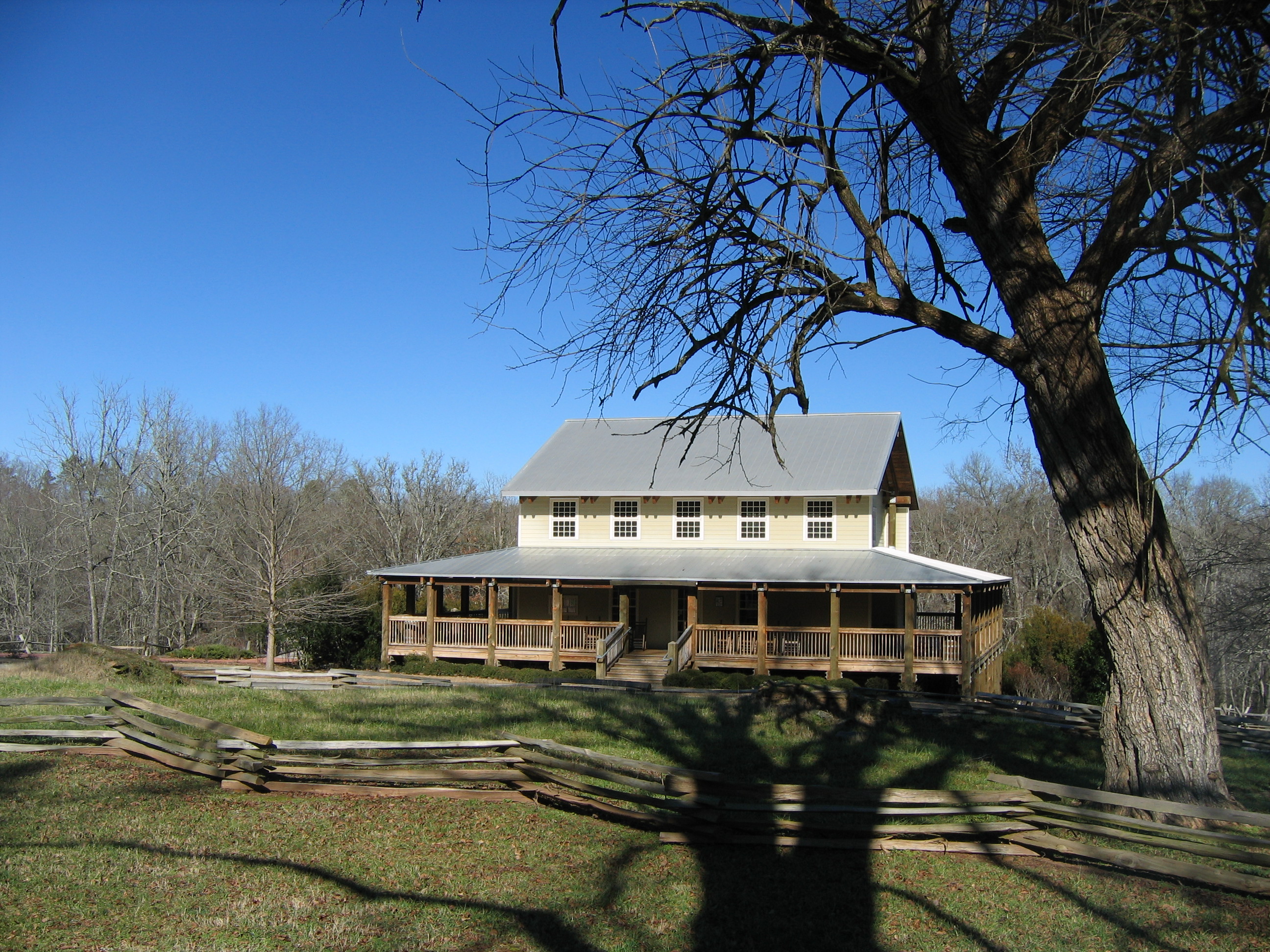
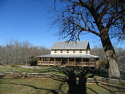 Visitors Center, Musgrove Mill State Historic Site
Nearest city: Cross Anchor, South Carolina Coordinates: 34°35′36.76″N 81°51′8.92″W / 34.5935444°N 81.8524778°WCoordinates: 34°35′36.76″N 81°51′8.92″W / 34.5935444°N 81.8524778°W Built: 1780 Governing body: State NRHP Reference#: 75001708
[1]Added to NRHP: March 4, 1975 Musgrove Mill State Historic Site was the site of the Battle of Musgrove Mill, an action in the American Revolution, which occurred on August 19, 1780 near the Enoree River, on what (in the 21st century) is the border between Spartanburg, Laurens and Union Counties in South Carolina, approximately seven miles from Interstate 26.
In the August 1780, a group of 200 Patriot militiamen attempted to strike what they thought was an equal number of Loyalists camped near a ford on the Enoree River. The Loyalists, however, had recently been joined by 300 more, two hundred of them provincial regulars from the British post at Ninety Six, South Carolina. Once discovered, the Patriots were unable to either retreat or make a frontal assault. Instead they took up a position behind logs and brush on a nearby ridge and lured the Loyalists into attacking them. A fierce fight ensued and turned into a near rout for the Loyalists. Nevertheless, when the Patriot militia learned that American forces had been defeated three days before at the Battle of Camden, they also retreated.[2]
North Carolina Patriot militia leader Col. Isaac Shelby (campaigning to Musgrove Mill from the area of present day northeast Tennessee) fought at the Battle of Musgrove Mill with a small force of Overmountain Men.[3] After the battle, Shelby and his Overmountain Men returned over the Appalachia Mountains to the Sycamore Shoals (located at present day Elizabethton, Tennessee). Shelby was one of the Patriot officers mustering weeks later at Sycamore Shoals on September 25, 1780 in advance of the early October 7, 1780 Battle of Kings Mountain.
The Musgrove Mill battle site was listed on the U.S. National Register of Historic Places in 1975.[1][4] The park includes a visitor center with interpretive exhibits, a memorial to the legendary Mary Musgrove (featured in a popular early 19th-century novel), two marked trails, a picnic area, a fishing pond, a canoe launch, and a small waterfall.[5]
References
- ^ a b "National Register Information System". National Register of Historic Places. National Park Service. 2007-01-23. http://nrhp.focus.nps.gov/natreg/docs/All_Data.html.
- ^ John Buchanan, The Road to Guilford Courthouse: The American Revolution in the Carolinas (New York: John Wiley & Sons, 1997), 176-80; Walter Edgar, Partisans and Redcoats: The Southern Conflict That Turned the Tide of the American Revolution (New York: HarperCollins, 2001), 114-15.
- ^ National Register of Historic Places Inventory - Nomination Form, 1975.
- ^ A National Register of Historic Places Inventory-Nomination document should be available upon request from the National Park Service for this site, but it appears not to be available on-line from the NPS Focus search site. An online version should also be available from the South Carolina Department of Archives and History.
- ^ Park website. Substantial waterfalls are unusual in this part of the state.
External links
- Musgrove Mill State Historic Site website
- National Register Properties in South Carolina, South Carolina Department of Archives and History, includes 9 photographs of the park and battle site.
U.S. National Register of Historic Places Topics Lists by states Alabama • Alaska • Arizona • Arkansas • California • Colorado • Connecticut • Delaware • Florida • Georgia • Hawaii • Idaho • Illinois • Indiana • Iowa • Kansas • Kentucky • Louisiana • Maine • Maryland • Massachusetts • Michigan • Minnesota • Mississippi • Missouri • Montana • Nebraska • Nevada • New Hampshire • New Jersey • New Mexico • New York • North Carolina • North Dakota • Ohio • Oklahoma • Oregon • Pennsylvania • Rhode Island • South Carolina • South Dakota • Tennessee • Texas • Utah • Vermont • Virginia • Washington • West Virginia • Wisconsin • WyomingLists by territories Lists by associated states Other Piedmont Andrew Jackson · Baker Creek · Calhoun Falls · Chester · Croft · Dreher Island · Hamilton Branch · Hickory Knob · Kings Mountain · Landsford Canal · Lake Greenwood · Musgrove Mill · Rose Hill Plantation · Sadlers CreekSandhills Aiken State · Barnwell · Cheraw · Goodale · H. Cooper Black Jr. · Lake Wateree · Lee · Poinsett · Redcliffe Plantation · Santee · SesquicentennialCoastal Plain Charles Towne Landing · Colleton · Colonial Dorchester · Edisto Beach · Fort Frederick · Givhans Ferry · Hampton Plantation · Huntington Beach · Hunting Island · Lake Warren · Little Pee Dee · Myrtle Beach · Rivers Bridge · Woods BayFederal Charles Pinckney National Historic Site • Fort Sumter National Monument • Ninety Six National Historic SiteNational TrailsCape Romain • Carolina Sandhills • Ernest F. Hollings ACE Basin • Pinckney Island • Santee • Savannah • Tybee • WaccamawACE Basin • North Inlet-Winyah BayCape Romain • Congaree • Ellicott Rock • Hell Hole Bay • Little Wambaw Swamp • Wambaw Creek • Wambaw Swamp
State Andrew Jackson • Baker Creek • Barnwell • Caesars Head • Cheraw • Chester • Colleton • Devils Fork • Edisto Beach • Givhans Ferry • Goodale • Hickory Knob • Hunting Island • Huntington Beach • Jones Gap • Kings Mountain • Lake Warren • Landsford Canal • Lee • Little Pee Dee • Myrtle Beach • Oconee • Paris Mountain • Poinsett • Santee • Sesquicentennial • Table RockCharles Towne Landing • Colonial Dorchester • Hampton Plantation • Musgrove Mill • Oconee Station • Redcliffe Plantation • Rivers Bridge • Rose Hill PlantationAiken State Natural Area • Calhoun Falls State Recreation Area • Croft State Natural Area • Dreher Island State Recreation Area • Hamilton Branch State Recreation Area • Keowee-Toxaway State Natural Area • Lake Greenwood State Recreation Area • Lake Hartwell State Recreation Area • Lake Wateree State Recreation Area • Lee State Natural Area • Sadlers Creek State Recreation Area • Woods Bay State Natural AreaHarbison • Manchester • Poe Creek • Sand Hills • Wee TeeWildlife Management AreasBear Island Wildlife Management Area • Belfast Wildlife Management Area • Bonneau Ferry Wildlife Management Area • Campbell's Crossroads Wildlife Management Area • Crackerneck Wildlife Preserve • Donnelley Wildlife Management Area • Draper Wildlife Management Area • Edisto River Wildlife Management Area • Fant's Grove Wildlife Management Area • Gray Court Wildlife Management Area • Hickory Top Wildlife Management Area • James Ross Wildlife Reservation • Jim Timmerman Natural Resources Area • Keowee Wildlife Management Area • Mason Wildlife Preserve • McBee Wildlife Management Area • McConnells Tract Wildlife Management • Palachucola Wildlife Management Area • Pee Dee Wildlife Management Area • Samworth Wildlife Management Area • Santee-Delta Wildlife Management Area • Thurmond Wildlife Management Area • Turkey Creek Wildlife Management Area • Turtle Island Wildlife Management Area • Webb Wildlife Center/Preserve • Woodbury Wildlife Management Area • Worth Mountain Wildlife Management AreaCategories:- National Register of Historic Places in South Carolina
- American Revolutionary War sites
- Museums in Spartanburg County, South Carolina
- American Revolutionary War museums in South Carolina
- Protected areas of Spartanburg County, South Carolina
- South Carolina state parks
Wikimedia Foundation. 2010.