- Congaree National Park
-
Congaree National Park Location Richland County, South Carolina, USA Nearest city Columbia, South Carolina Coordinates 33°47′0″N 80°47′0″W / 33.783333°N 80.783333°WCoordinates: 33°47′0″N 80°47′0″W / 33.783333°N 80.783333°W Area 21,867.02 acres (88.4927 km2)
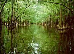
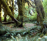
21,116.91 acres (85.4571 km2) federalEstablished November 10, 2003 Visitors 134,045 (in 2006) Governing body National Park Service Congaree National Park preserves the largest tract of old growth bottomland hardwood forest left in the United States. Located in South Carolina, the 26,546-acre (89 km2) national park received that designation in 2003 as the culmination of a grassroots campaign which had started in 1969. The lush trees growing in this floodplain forest are some of the tallest in the Eastern U.S., forming one of the highest temperate deciduous forest canopies remaining in the world. The Congaree River flows through the park. 15,000 acres (60.70 km2) or about 57 percent of the park is designated wilderness area.
Contents
Park history
In 1969, the Sierra Club launched a grassroots campaign to save this area of old growth forest from private landowners interested in relatively high timber prices. The result of this campaign was the establishment by Congress of Congaree Swamp National Monument on October 18, 1976. The national monument became an International Biosphere Reserve on June 30, 1983. Over two-thirds of the national monument was designated a wilderness area on October 24, 1988, and it became an Important Bird Area on July 26, 2001. Congress redesignated the monument Congaree National Park on November 10, 2003 and simultaneously expanded its authorized boundary by approximately 4,576 acres (18.52 km2). As of August 2011, approximately 26,020 acres (105.3 km2) of the park are in Federal ownership.
Environment
The park preserves a significant part of the Middle Atlantic coastal forests ecoregion.[1]
Amenities and attractions
In addition to being a designated Wilderness Area, an International Biosphere Reserve, a Globally Important Bird Area and a National Natural Landmark, Congaree National Park features primitive campsites and offers hiking, canoeing, kayaking, and bird watching. Bald cypress is a common tree in the park. Large animals possibly seen in the park include bobcats, deer, feral pigs, feral dogs, coyotes, and turkeys. Its waters contain interesting creatures like amphibians, turtles, snakes, alligators, and many types of fish, including bowfin, largemouth bass, panfish, and catfish. Primitive and backcountry camping is available. Some of the hiking trails include the Bluff Trail (0.7 mi), Weston Lake Loop Trail (4.6 mi), Oakridge Trail (7.5 mi), and King Snake Trail (11.1 mi) where hikers may spot deer, raccoon, opossum, and even bobcat tracks. The National Park Service rangers have current trail conditions which can be found in the Harry Hampton Visitor’s Center. Along with hiking trails, the park also has a 20-mile (32 km) marked canoe trail on Cedar Creek.
Most visitors to the park walk along the Boardwalk Loop, an elevated 2.4-mile (3.9 km) walkway through the swampy environment that protects delicate fungi and plant life at ground level. Canoe rides through the swamp are conducted for free every Saturday and Sunday. Congaree boasts both the tallest (169ft, 51.4m) and largest (42 cubic meters) Loblolly Pines (Pinus taeda) alive today.
The Harry Hampton Visitor Center features exhibits about the natural history of the park, and the efforts to protect the swamp.
Documentary
In 2008, South Carolina Educational Television (SCETV) began shooting a documentary on the history of the Congaree National Park titled Roots in the River: The Story of Congaree National Park. The story features interviews with people involved in the movement that eventually led to the area's U.S. National Monument status, and observes the role the park plays in the surrounding community of the Lower Richland County area of South Carolina. The program was scheduled to air on the SCETV network in September 2009.
References
- ^ Olson, D. M, E. Dinerstein, et al (2001). "Terrestrial Ecoregions of the World: A New Map of Life on Earth". BioScience 51 (11): 933–938. doi:10.1641/0006-3568(2001)051[0933:TEOTWA]2.0.CO;2. http://gis.wwfus.org/wildfinder/.
- The National Parks: Index 2001–2003. Washington: U.S. Department of the Interior.
- http://www.scetv.org/index.php/press/release/etv_to_broadcast_new_carolina_stories_documentary_roots_in_the_river
External links
- Official site: Congaree National Park
- Friends of Congaree Swamp
- Wilderness.net page on the park
- Panoramic photo of the exhibits in the Harry Hampton Visitor Center
- Article about the Congaree Swamp and efforts to protect it
- Congaree National Park Hiking
National parks of the United States Acadia • American Samoa • Arches • Badlands • Big Bend • Biscayne • Black Canyon of the Gunnison • Bryce Canyon • Canyonlands • Capitol Reef • Carlsbad Caverns • Channel Islands • Congaree • Crater Lake • Cuyahoga Valley • Death Valley • Denali • Dry Tortugas • Everglades • Gates of the Arctic • Glacier • Glacier Bay • Grand Canyon • Grand Teton • Great Basin • Great Sand Dunes • Great Smoky Mountains • Guadalupe Mountains • Haleakalā • Hawaiʻi Volcanoes • Hot Springs • Isle Royale • Joshua Tree • Katmai • Kenai Fjords • Kings Canyon • Kobuk Valley • Lake Clark • Lassen Volcanic • Mammoth Cave • Mesa Verde • Mount Rainier • North Cascades • Olympic • Petrified Forest • Redwood • Rocky Mountain • Saguaro • Sequoia • Shenandoah • Theodore Roosevelt • Virgin Islands • Voyageurs • Wind Cave • Wrangell-St. Elias • Yellowstone • Yosemite • ZionFederal Congaree National ParkCharles Pinckney National Historic Site • Fort Sumter National Monument • Ninety Six National Historic SiteNational TrailsCape Romain • Carolina Sandhills • Ernest F. Hollings ACE Basin • Pinckney Island • Santee • Savannah • Tybee • WaccamawCape Romain • Congaree • Ellicott Rock • Hell Hole Bay • Little Wambaw Swamp • Wambaw Creek • Wambaw Swamp
State Andrew Jackson • Baker Creek • Barnwell • Caesars Head • Cheraw • Chester • Colleton • Devils Fork • Edisto Beach • Givhans Ferry • Goodale • Hickory Knob • Hunting Island • Huntington Beach • Jones Gap • Kings Mountain • Lake Warren • Landsford Canal • Lee • Little Pee Dee • Myrtle Beach • Oconee • Paris Mountain • Poinsett • Santee • Sesquicentennial • Table RockCharles Towne Landing • Colonial Dorchester • Hampton Plantation • Musgrove Mill • Oconee Station • Redcliffe Plantation • Rivers Bridge • Rose Hill PlantationAiken State Natural Area • Calhoun Falls State Recreation Area • Croft State Natural Area • Dreher Island State Recreation Area • Hamilton Branch State Recreation Area • Keowee-Toxaway State Natural Area • Lake Greenwood State Recreation Area • Lake Hartwell State Recreation Area • Lake Wateree State Recreation Area • Lee State Natural Area • Sadlers Creek State Recreation Area • Woods Bay State Natural AreaHarbison • Manchester • Poe Creek • Sand Hills • Wee TeeWildlife Management AreasBear Island Wildlife Management Area • Belfast Wildlife Management Area • Bonneau Ferry Wildlife Management Area • Campbell's Crossroads Wildlife Management Area • Crackerneck Wildlife Preserve • Donnelley Wildlife Management Area • Draper Wildlife Management Area • Edisto River Wildlife Management Area • Fant's Grove Wildlife Management Area • Gray Court Wildlife Management Area • Hickory Top Wildlife Management Area • James Ross Wildlife Reservation • Jim Timmerman Natural Resources Area • Keowee Wildlife Management Area • Mason Wildlife Preserve • McBee Wildlife Management Area • McConnells Tract Wildlife Management • Palachucola Wildlife Management Area • Pee Dee Wildlife Management Area • Samworth Wildlife Management Area • Santee-Delta Wildlife Management Area • Thurmond Wildlife Management Area • Turkey Creek Wildlife Management Area • Turtle Island Wildlife Management Area • Webb Wildlife Center/Preserve • Woodbury Wildlife Management Area • Worth Mountain Wildlife Management AreaCategories:- IUCN Category Ib
- Parks in South Carolina
- National parks in South Carolina
- Old growth forests
- Protected areas of Richland County, South Carolina
- Swamps of South Carolina
- Wilderness Areas of South Carolina
- Wetlands of South Carolina
- Museums in Richland County, South Carolina
- Natural history museums in South Carolina
- Protected areas established in 2003
- Biosphere reserves of the United States
- Forests of South Carolina
Wikimedia Foundation. 2010.


