- Devils Fork State Park
-
Devils Fork State Park 
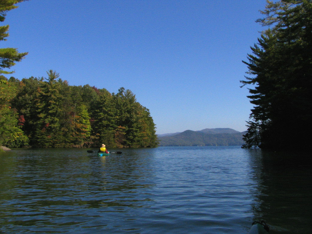
Lake Jocassee in Devils Fork State ParkNearest city Salem, South Carolina Coordinates 34°57′10.5″N 82°56′51.5″W / 34.952917°N 82.947639°WCoordinates: 34°57′10.5″N 82°56′51.5″W / 34.952917°N 82.947639°W Area 622 acres (2.5 km2) Created 1990 Camp sites Regular campgrounds, primitive boat-in, and RV sites are available Hiking trails 2 Other information Boating, fishing, many species of fish, including rainbow trout.[1] Devils Fork State Park is in northwestern South Carolina on the eastern edge of the Sumter National Forest at the edge of 7,500-acre (30 km2) Lake Jocassee. It is located three miles (5 km) off of SC 11, the Cherokee Scenic Highway, near tiny Salem, South Carolina.
The park offers hiking, camping (including several paddle-in primitive sites), canoeing and kayaking. The park is well-known for rainbow and brown trout, as well as largemouth, smallmouth, and white bass, crappie, bream and catfish. The park has accommodations for scuba divers, including a walk-in ramp; thirty foot visibility is common, and due to the lake's recent creation, roads, houses, signs and other marks of human habitation can be seen on the lake bottom.
The 622-acre (2.5 km2) park was created in 1990. The park has many small waterfalls that feed lake Jocassee, and is home to the Oconee Bell, a wildflower indigenous to North and South Carolina that grows throughout the park; more than 90 percent of the world population of these delicate white and pink flowers are found in the park.
References
External links
- Official website
- Devils Fork State Park Pictures & Map
- Pet Friendly Lodging near Devils Fork State Park
Piedmont Andrew Jackson · Baker Creek · Calhoun Falls · Chester · Croft · Dreher Island · Hamilton Branch · Hickory Knob · Kings Mountain · Landsford Canal · Lake Greenwood · Musgrove Mill · Rose Hill Plantation · Sadlers CreekSandhills Aiken State · Barnwell · Cheraw · Goodale · H. Cooper Black Jr. · Lake Wateree · Lee · Poinsett · Redcliffe Plantation · Santee · SesquicentennialCoastal Plain Charles Towne Landing · Colleton · Colonial Dorchester · Edisto Beach · Fort Frederick · Givhans Ferry · Hampton Plantation · Huntington Beach · Hunting Island · Lake Warren · Little Pee Dee · Myrtle Beach · Rivers Bridge · Woods BayFederal Charles Pinckney National Historic Site • Fort Sumter National Monument • Ninety Six National Historic SiteNational TrailsCape Romain • Carolina Sandhills • Ernest F. Hollings ACE Basin • Pinckney Island • Santee • Savannah • Tybee • WaccamawACE Basin • North Inlet-Winyah BayCape Romain • Congaree • Ellicott Rock • Hell Hole Bay • Little Wambaw Swamp • Wambaw Creek • Wambaw Swamp
State Andrew Jackson • Baker Creek • Barnwell • Caesars Head • Cheraw • Chester • Colleton • Devils Fork • Edisto Beach • Givhans Ferry • Goodale • Hickory Knob • Hunting Island • Huntington Beach • Jones Gap • Kings Mountain • Lake Warren • Landsford Canal • Lee • Little Pee Dee • Myrtle Beach • Oconee • Paris Mountain • Poinsett • Santee • Sesquicentennial • Table RockCharles Towne Landing • Colonial Dorchester • Hampton Plantation • Musgrove Mill • Oconee Station • Redcliffe Plantation • Rivers Bridge • Rose Hill PlantationAiken State Natural Area • Calhoun Falls State Recreation Area • Croft State Natural Area • Dreher Island State Recreation Area • Hamilton Branch State Recreation Area • Keowee-Toxaway State Natural Area • Lake Greenwood State Recreation Area • Lake Hartwell State Recreation Area • Lake Wateree State Recreation Area • Lee State Natural Area • Sadlers Creek State Recreation Area • Woods Bay State Natural AreaHarbison • Manchester • Poe Creek • Sand Hills • Wee TeeWildlife Management AreasBear Island Wildlife Management Area • Belfast Wildlife Management Area • Bonneau Ferry Wildlife Management Area • Campbell's Crossroads Wildlife Management Area • Crackerneck Wildlife Preserve • Donnelley Wildlife Management Area • Draper Wildlife Management Area • Edisto River Wildlife Management Area • Fant's Grove Wildlife Management Area • Gray Court Wildlife Management Area • Hickory Top Wildlife Management Area • James Ross Wildlife Reservation • Jim Timmerman Natural Resources Area • Keowee Wildlife Management Area • Mason Wildlife Preserve • McBee Wildlife Management Area • McConnells Tract Wildlife Management • Palachucola Wildlife Management Area • Pee Dee Wildlife Management Area • Samworth Wildlife Management Area • Santee-Delta Wildlife Management Area • Thurmond Wildlife Management Area • Turkey Creek Wildlife Management Area • Turtle Island Wildlife Management Area • Webb Wildlife Center/Preserve • Woodbury Wildlife Management Area • Worth Mountain Wildlife Management AreaCategories:- South Carolina state parks
- Protected areas of Oconee County, South Carolina
Wikimedia Foundation. 2010.